Where You'll Run Into Wet Roads Friday Morning
Special Stories
1 Nov 2018 3:22 PM
Before you step out the door and get your 'Happy Friday' going, we want to let you know the trouble spots in terms of weather. These will be areas that can expect ongoing rain showers and wet roadways.
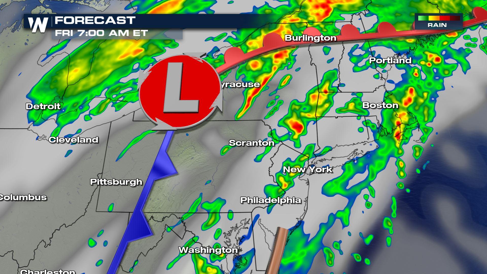
Let's take you to the Northeast first where the rain will be mainly east of I-81 by Friday morning.
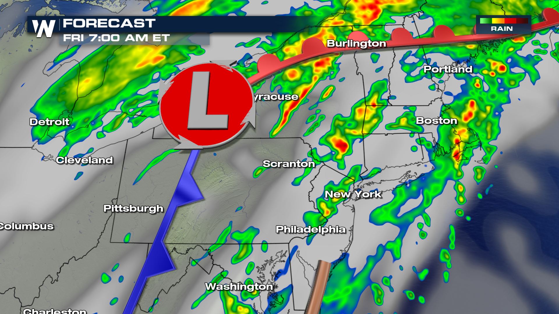 The forecast image around 7 a.m. ET Friday, November 2 where yellows and reds show the heaviest rain.
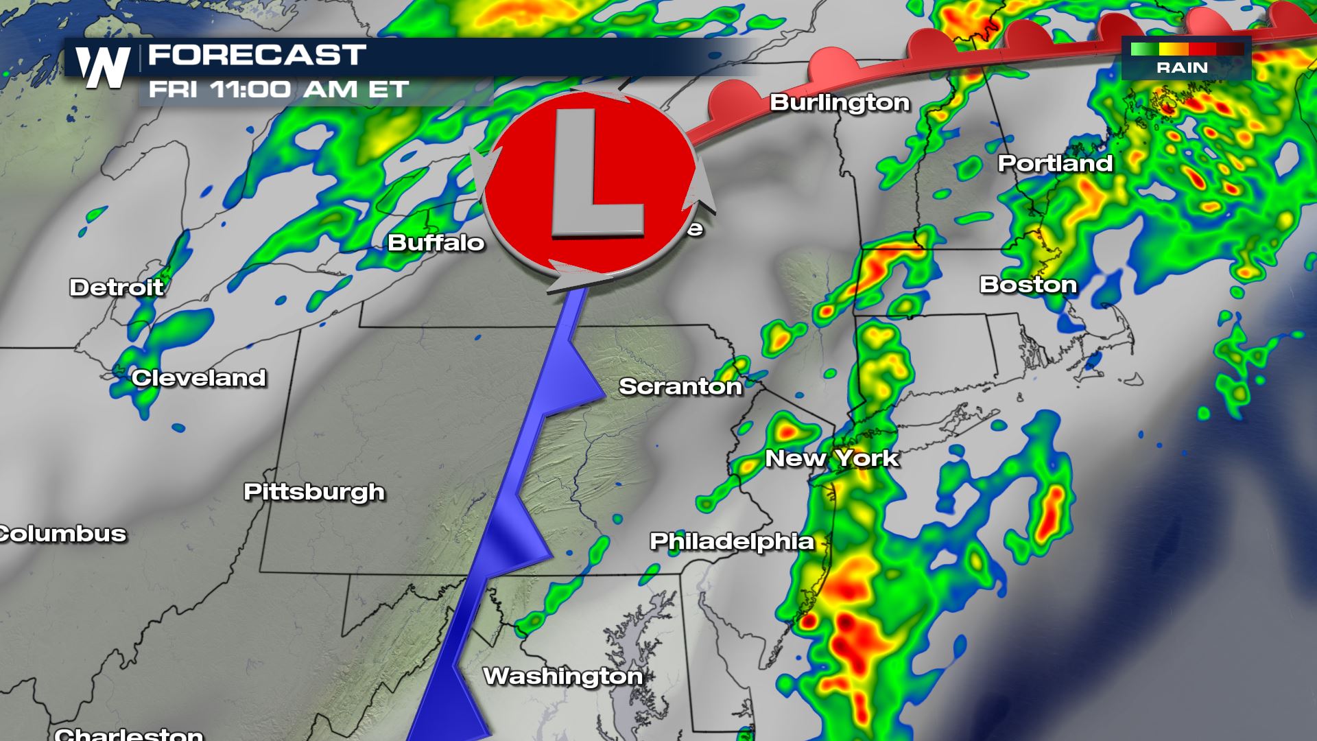 The forecast image around 11 a.m. ET Friday, November 2 where yellows and reds show the heaviest rain.
The temperatures should be warm enough to support all rain, instead of a wintry mix or snow. Still, pockets of heavy rain is expected to impact parts of Interstate 87 and 91 in New York and through New England respectively. Check traffic and road conditions, as well as weather conditions before you step out the door.
To the Southeast we go!
The forecast image around 11 a.m. ET Friday, November 2 where yellows and reds show the heaviest rain.
The temperatures should be warm enough to support all rain, instead of a wintry mix or snow. Still, pockets of heavy rain is expected to impact parts of Interstate 87 and 91 in New York and through New England respectively. Check traffic and road conditions, as well as weather conditions before you step out the door.
To the Southeast we go!
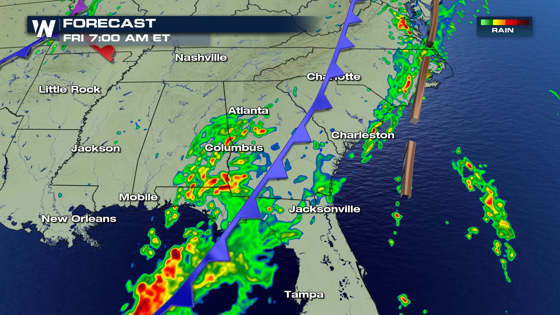 The forecast image around 7 a.m. ET Friday, November 2 where yellows and reds show the heaviest rain.
 The forecast image around 11 a.m. ET Friday, November 2 where yellows and reds show the heaviest rain.
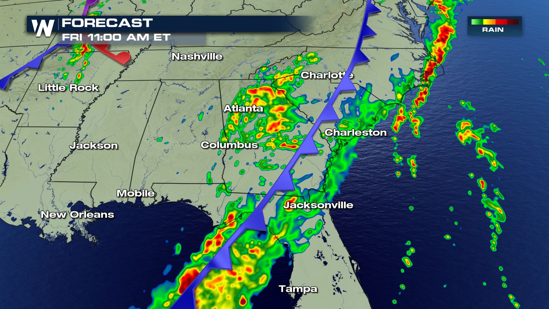
Here, ongoing rain will impact parts of Interstates 10 and 75 throughout Florida and Georgia.We are nearing peak foliage in the Southeast and any leaves on the ground will make things especially slippery when the rain falls.
Also, with this long-stretching weather system from Florida to Maine we could experience travel delays at the major airports. Check your flight before you get to the airport!
Make sure you stay with us here at WeatherNation for all updates on our top stories!
For WeatherNation, Meteorologist Steve Glazier
The forecast image around 11 a.m. ET Friday, November 2 where yellows and reds show the heaviest rain.
Here, ongoing rain will impact parts of Interstates 10 and 75 throughout Florida and Georgia.We are nearing peak foliage in the Southeast and any leaves on the ground will make things especially slippery when the rain falls.
Also, with this long-stretching weather system from Florida to Maine we could experience travel delays at the major airports. Check your flight before you get to the airport!
Make sure you stay with us here at WeatherNation for all updates on our top stories!
For WeatherNation, Meteorologist Steve Glazier
The forecast image around 7 a.m. ET Friday, November 2 where yellows and reds show the heaviest rain.
The forecast image around 11 a.m. ET Friday, November 2 where yellows and reds show the heaviest rain.
The temperatures should be warm enough to support all rain, instead of a wintry mix or snow. Still, pockets of heavy rain is expected to impact parts of Interstate 87 and 91 in New York and through New England respectively. Check traffic and road conditions, as well as weather conditions before you step out the door.
To the Southeast we go!
The forecast image around 7 a.m. ET Friday, November 2 where yellows and reds show the heaviest rain.
The forecast image around 11 a.m. ET Friday, November 2 where yellows and reds show the heaviest rain.
Here, ongoing rain will impact parts of Interstates 10 and 75 throughout Florida and Georgia.We are nearing peak foliage in the Southeast and any leaves on the ground will make things especially slippery when the rain falls.
Also, with this long-stretching weather system from Florida to Maine we could experience travel delays at the major airports. Check your flight before you get to the airport!
Make sure you stay with us here at WeatherNation for all updates on our top stories!
For WeatherNation, Meteorologist Steve GlazierAll Weather News
More

More Storms for the East Through Monday
A low-pressure system that moved through the
3 Aug 2026 12:20 PM


After Reaching Category 5, Genevieve Weakens in the Pacific
PacificGenevieve formed last Friday south of
3 Aug 2026 12:30 AM

Flooding, Severe Storms Target the Midwest Again
After an active week of storms across the nor
1 Aug 2026 1:40 AM

Flooding Risk Increases as Heavy Rain Targets the Tri-State Area
Tuesday, heavy rainfall moved across the Nort
30 Jul 2026 12:25 AM