Wildfires, High Fire Danger Continue in the West
Top Stories
29 Jun 2018 10:59 PM
Many western states continue to battle wildfires as the weather is still providing vulnerable conditions.
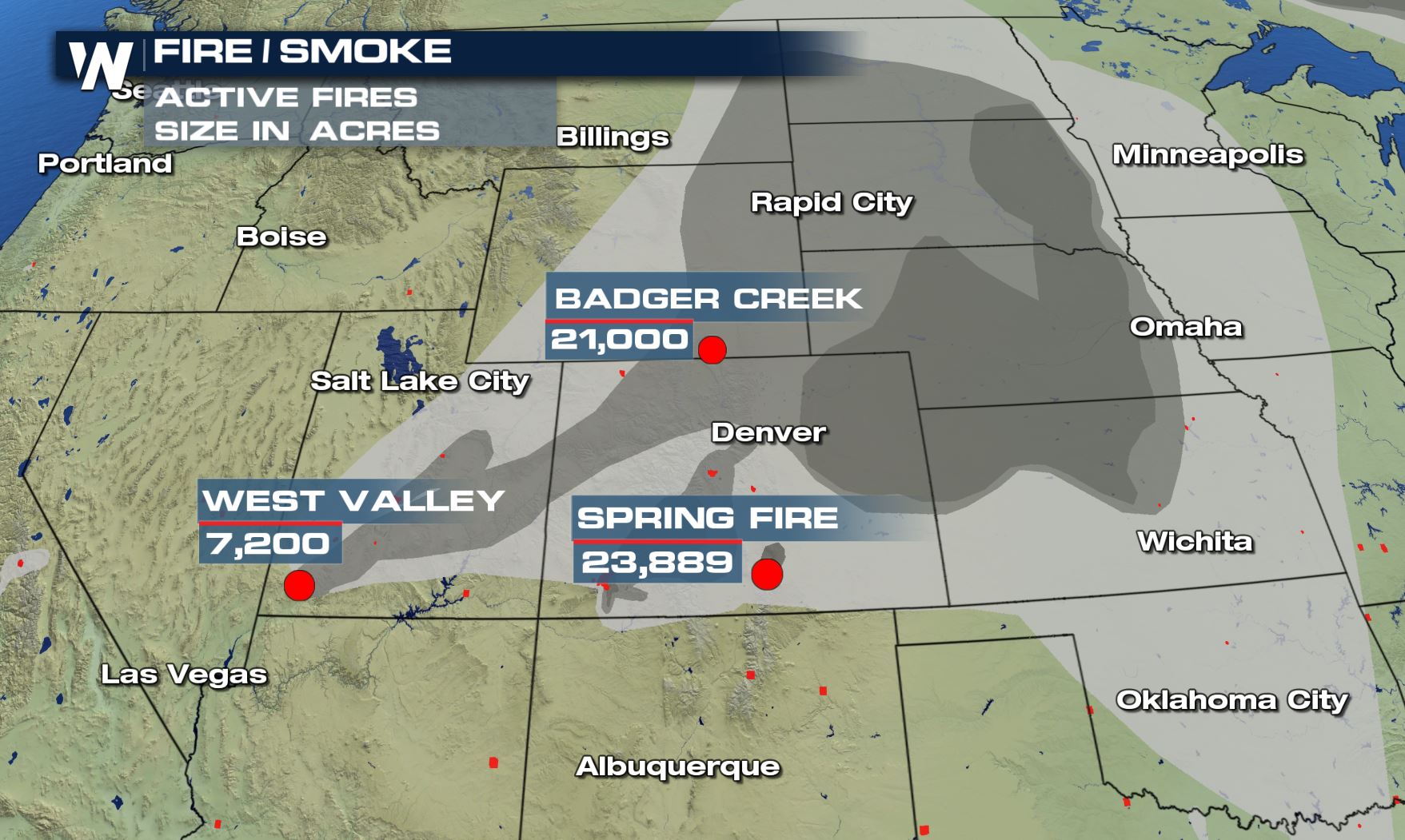 Some of the wildfires (red) with smoke plumes (gray) as of late Friday evening, June 29.
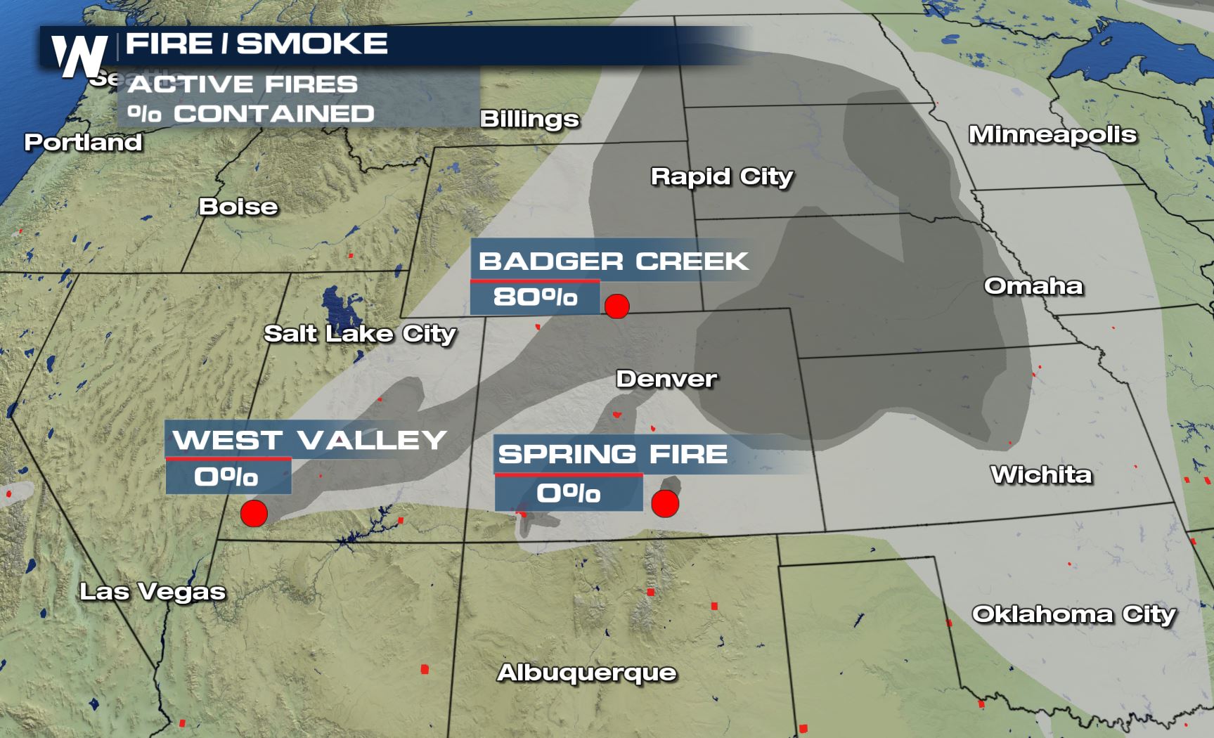
Notably the Spring Fire in southern Colorado quickly doubled in size from Thursday to Friday. The size of the fire is in acres above. Below, you'll find the percentage of containment for each.
Some of the wildfires (red) with smoke plumes (gray) as of late Friday evening, June 29.
Notably the Spring Fire in southern Colorado quickly doubled in size from Thursday to Friday. The size of the fire is in acres above. Below, you'll find the percentage of containment for each.
 Some of the wildfires (red) with smoke plumes (gray) as of late Friday evening, June 29.
Smoke and haze can be seen from many miles away. Mid and upper-level winds are bringing the smoke and haze from the fires and pushing it east/northeast. This may lead to poor air quality as well as more oranges and reds of hue in the sky.
Some of the wildfires (red) with smoke plumes (gray) as of late Friday evening, June 29.
Smoke and haze can be seen from many miles away. Mid and upper-level winds are bringing the smoke and haze from the fires and pushing it east/northeast. This may lead to poor air quality as well as more oranges and reds of hue in the sky.
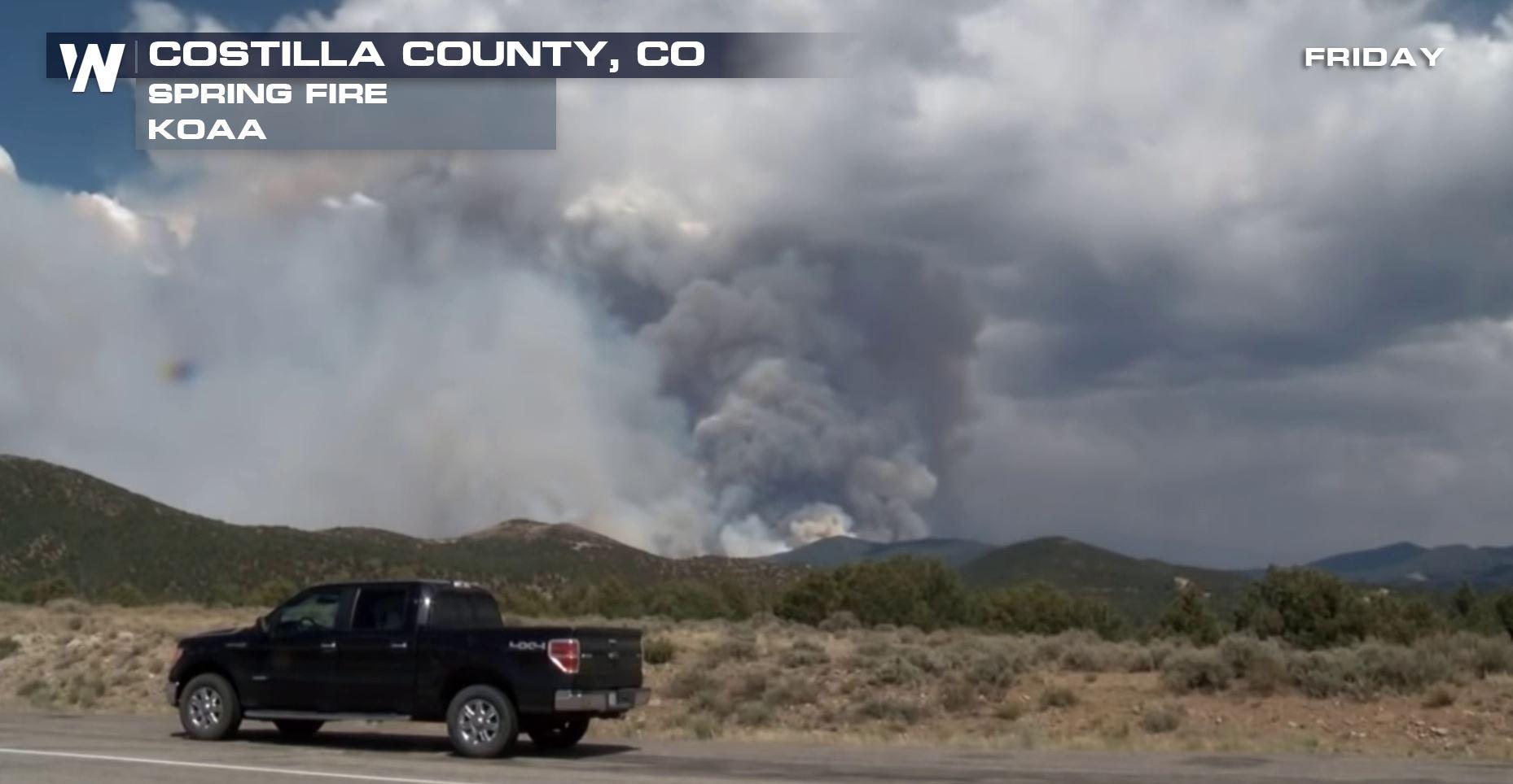
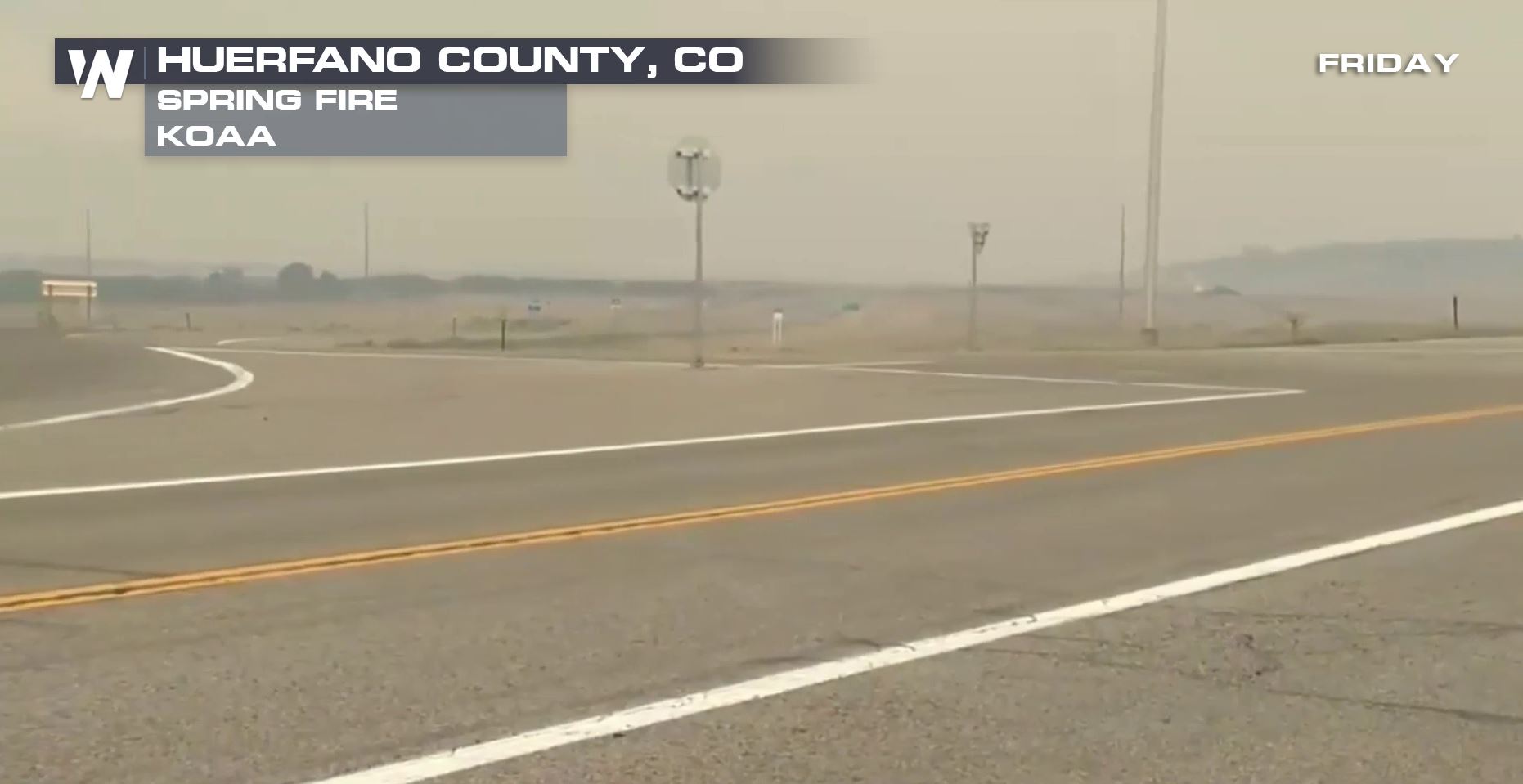 Spring Fire courtesy our news partners at KOAA-TV.
The weather conditions will generally stay hot and dry for much of the West. Some relief comes to eastern Colorado and New Mexico Saturday, Sunday, and Monday. However not a lot of additional rainfall is forecast for much of the West. That means the fire danger will likely stay elevated in the coming days.
Spring Fire courtesy our news partners at KOAA-TV.
The weather conditions will generally stay hot and dry for much of the West. Some relief comes to eastern Colorado and New Mexico Saturday, Sunday, and Monday. However not a lot of additional rainfall is forecast for much of the West. That means the fire danger will likely stay elevated in the coming days.
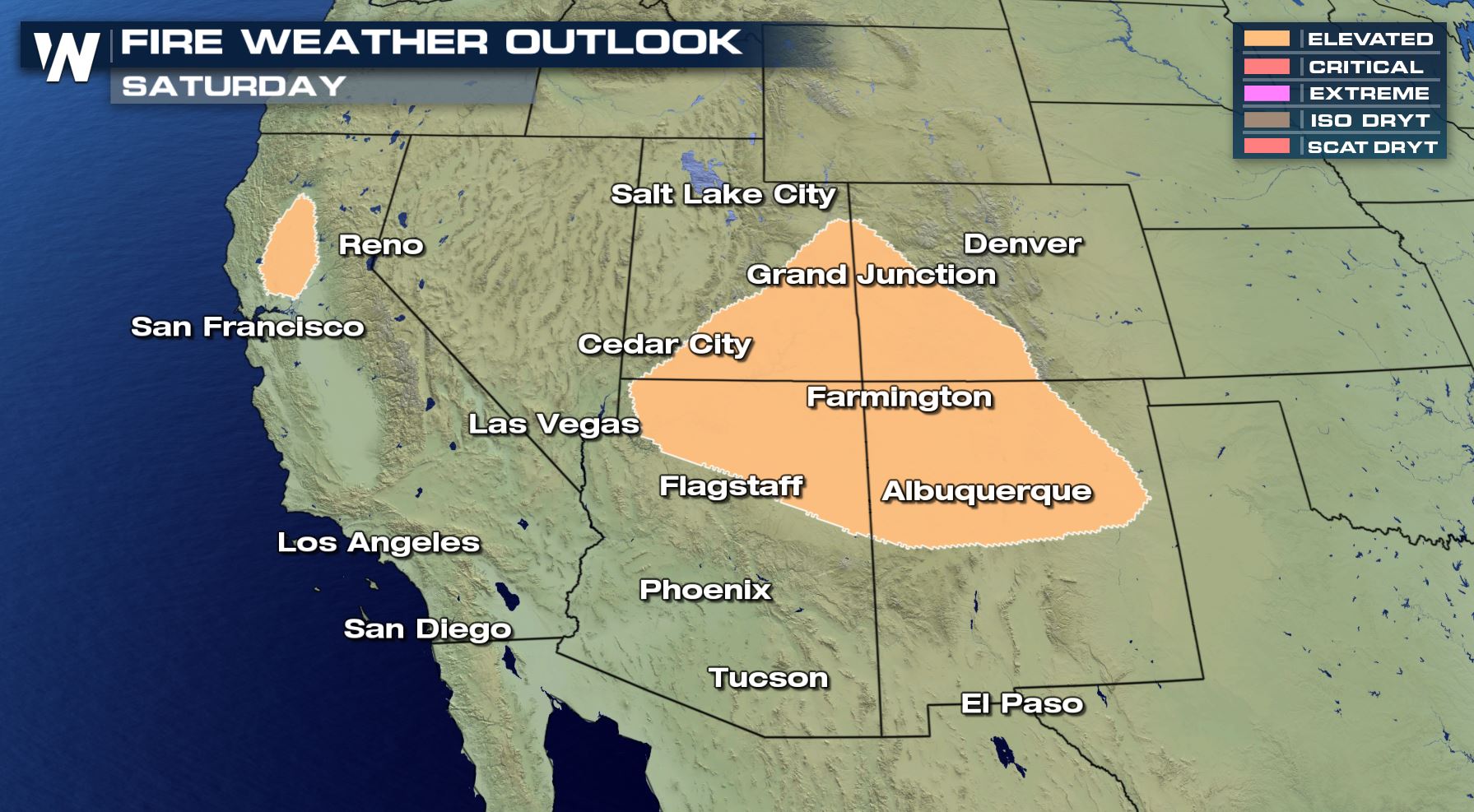 The fire weather outlook for Saturday, June 30 where shaded areas have an elevated risk of wildfire behavior.
Check in with local emergency managers, officials, or fire departments for evacuation orders. Since conditions can change so rapidly, we're not listing them here within this story at this time.
The fire weather outlook for Saturday, June 30 where shaded areas have an elevated risk of wildfire behavior.
Check in with local emergency managers, officials, or fire departments for evacuation orders. Since conditions can change so rapidly, we're not listing them here within this story at this time.
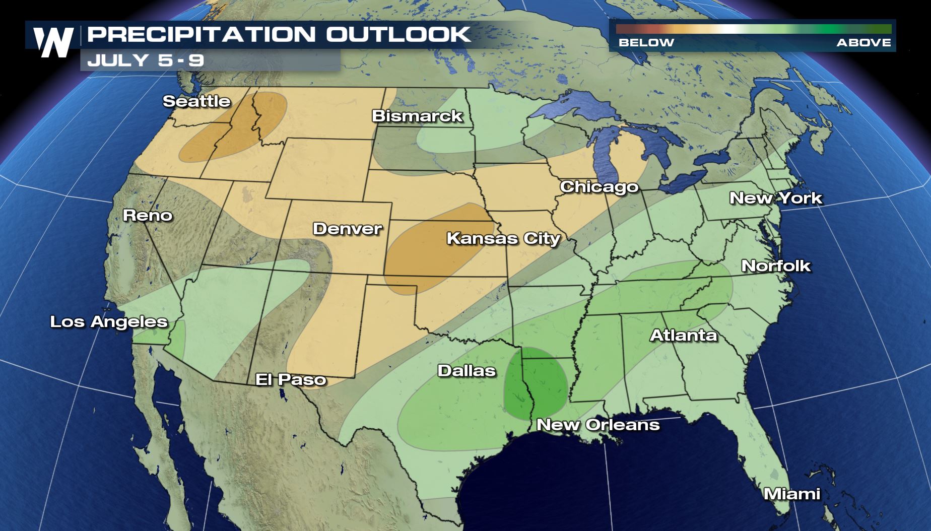 The precipitation outlook for Thursday, July 5 to Monday, July 9 where browns show a higher chance of drier than average conditions.
The recent dry weather and high fire risk has caused the cancellation of many firework displays. Check local burn bans for your county before setting off fireworks this holiday weekend!
For WeatherNation, Meteorologist Steve Glazier
The precipitation outlook for Thursday, July 5 to Monday, July 9 where browns show a higher chance of drier than average conditions.
The recent dry weather and high fire risk has caused the cancellation of many firework displays. Check local burn bans for your county before setting off fireworks this holiday weekend!
For WeatherNation, Meteorologist Steve Glazier
Some of the wildfires (red) with smoke plumes (gray) as of late Friday evening, June 29.
Notably the Spring Fire in southern Colorado quickly doubled in size from Thursday to Friday. The size of the fire is in acres above. Below, you'll find the percentage of containment for each.
Some of the wildfires (red) with smoke plumes (gray) as of late Friday evening, June 29.
Smoke and haze can be seen from many miles away. Mid and upper-level winds are bringing the smoke and haze from the fires and pushing it east/northeast. This may lead to poor air quality as well as more oranges and reds of hue in the sky.
Spring Fire courtesy our news partners at KOAA-TV.
The weather conditions will generally stay hot and dry for much of the West. Some relief comes to eastern Colorado and New Mexico Saturday, Sunday, and Monday. However not a lot of additional rainfall is forecast for much of the West. That means the fire danger will likely stay elevated in the coming days.
The fire weather outlook for Saturday, June 30 where shaded areas have an elevated risk of wildfire behavior.
Check in with local emergency managers, officials, or fire departments for evacuation orders. Since conditions can change so rapidly, we're not listing them here within this story at this time.
The precipitation outlook for Thursday, July 5 to Monday, July 9 where browns show a higher chance of drier than average conditions.
The recent dry weather and high fire risk has caused the cancellation of many firework displays. Check local burn bans for your county before setting off fireworks this holiday weekend!
For WeatherNation, Meteorologist Steve GlazierAll Weather News
More
More Storms for the East Through Monday
A low-pressure system that moved through the
3 Aug 2026 12:20 PM


After Reaching Category 5, Genevieve Weakens in the Pacific
PacificGenevieve formed last Friday south of
3 Aug 2026 12:30 AM

Flooding, Severe Storms Target the Midwest Again
After an active week of storms across the nor
1 Aug 2026 1:40 AM

Flooding Risk Increases as Heavy Rain Targets the Tri-State Area
Tuesday, heavy rainfall moved across the Nort
30 Jul 2026 12:25 AM

Severe Weather: Energy From the Midwest Now in the Southeast
UPPER MIDWEST - Through Monday, dangerous tor
29 Jul 2026 10:30 PM