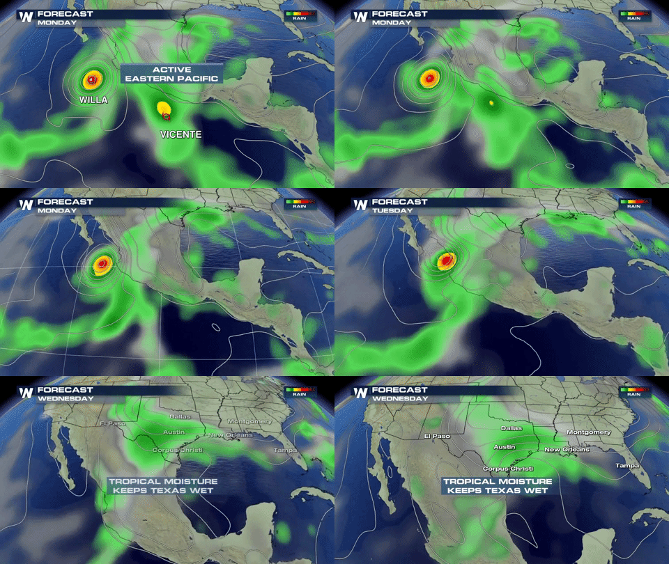
Willa Now a Category 5 Hurricane
Special Stories
22 Oct 2018 9:16 AM
Hurricane Willa strengthened to a Category 5 hurricane Monday morning.
https://www.facebook.com/WeatherNation/videos/283345342510839/
Willa, located in the Eastern Pacific, had max winds at 160 miles per hour.
The storm is scheduled to make landfall in Mexico late Tuesday.
Willa is the 10th storm to reach major hurricane status this year in the eastern Pacific Ocean.
Forecasters at the National Hurricane Center expect tropical storm conditions to impact Mexico by Tuesday morning and hurricane conditions by Tuesday night. A dangerous storm surge with large, destructive waves are possible Tuesday as well. Rip currents and large swells will impact beach communities. Heavy rainfall will cause life-threatening flash flooding and landslides. Rain of 5 to 10 inches with localized amounts up to 15 inches will fall across portions of the states of Jalisco, Nayarit, and Sinaloa. Farther inland, the Mexican states of Zacateca, Durango, Chihuahua, and Coahuila will experience rainfall totals of 2 to 4 inches (locally up to 6 inches).
The remnants of Hurricane Willa will cross the Mexican Plateau and reach Texas and the Southern Plains of the United States by midweek. While hurricane and tropical storm conditions are not likely, heavy rain and flooding will pose a threat.
 Continue to check back with WeatherNation for the latest on this storm.
 Continue to check back with WeatherNation for the latest on this storm.
All Weather News
More