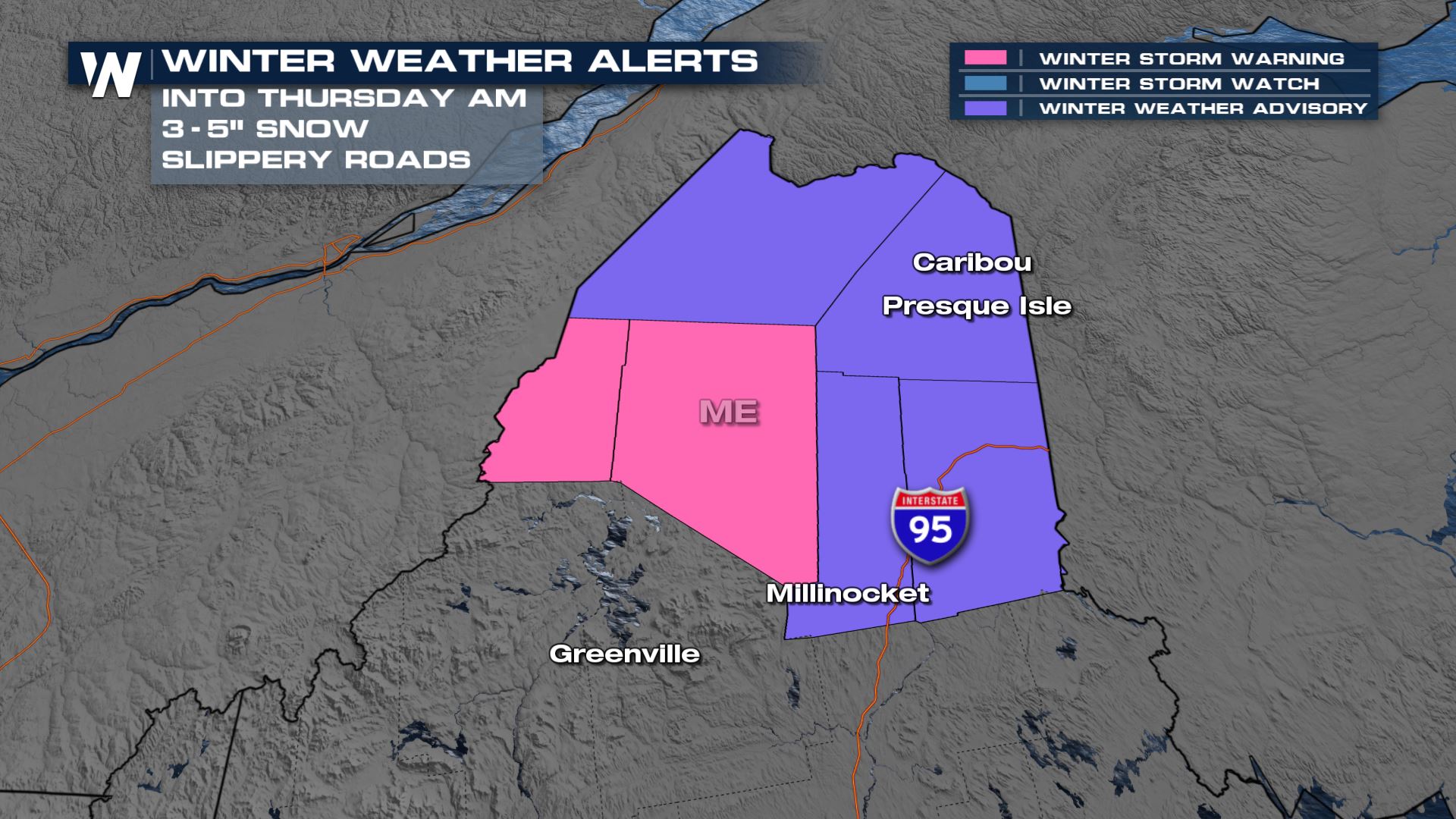
Winter Weather Alerts Continue for Maine

Special Stories
24 Feb 2021 2:30 PM
A fast moving storm system moving through the Upper Midwest has brought a wave of snow and gusty winds. 3" to 5" are possible in the areas under winter weather alerts cross parts of Maine into Thursday morning.
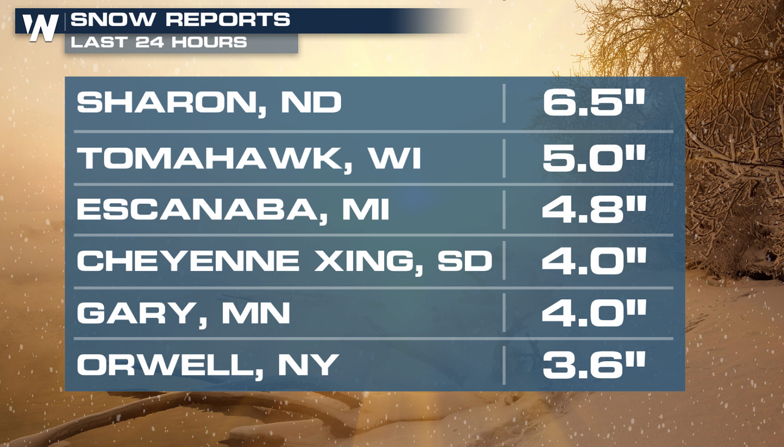
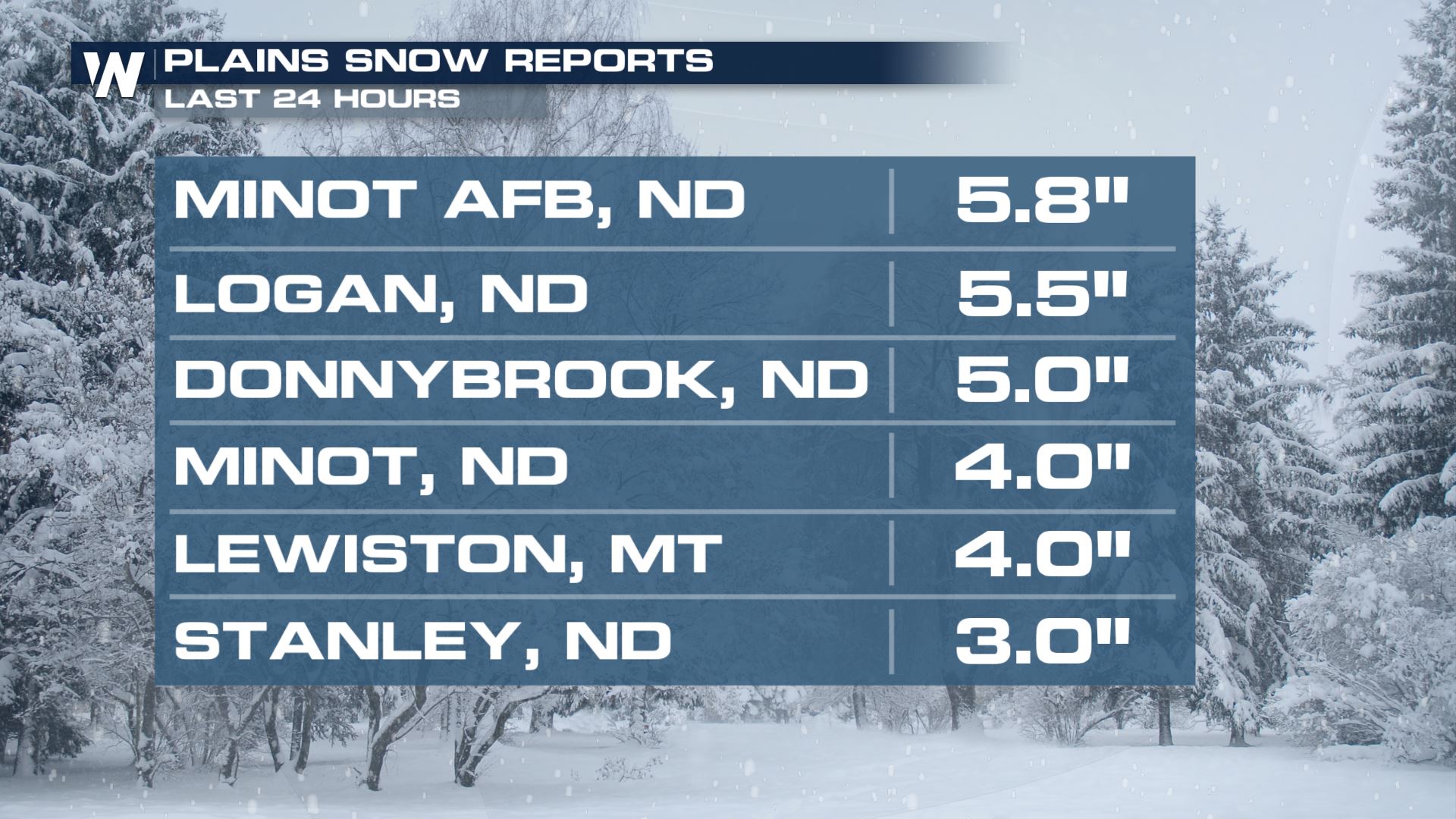
 The clipper-type low pressure center will continue its trek eastward into Thursday. Upwards of nearly 1/2 a foot of snow has already fallen in from parts of North Dakota to Wisconsin.
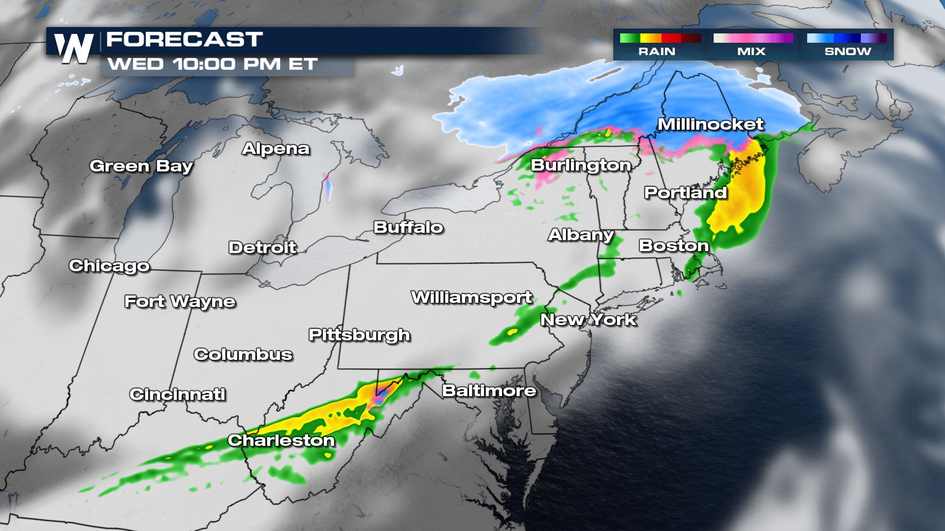
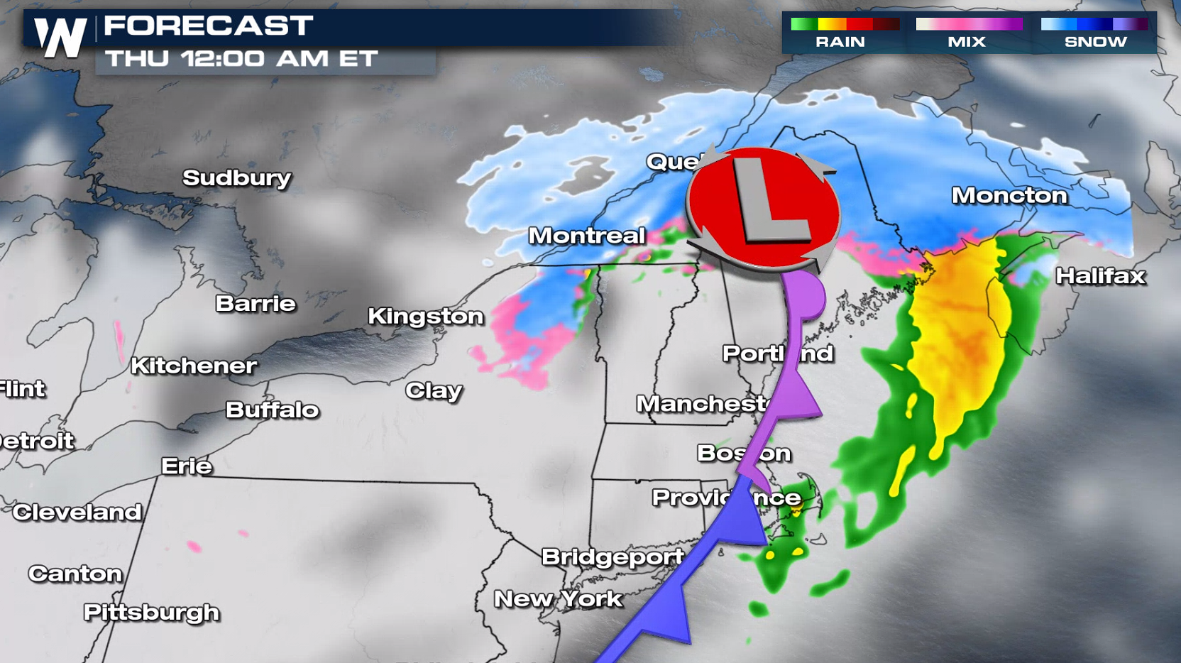
 Along the trailing cold front, a few areas in the Northeast could see quick bursts of snow that may quickly accumulate into Wednesday evening.
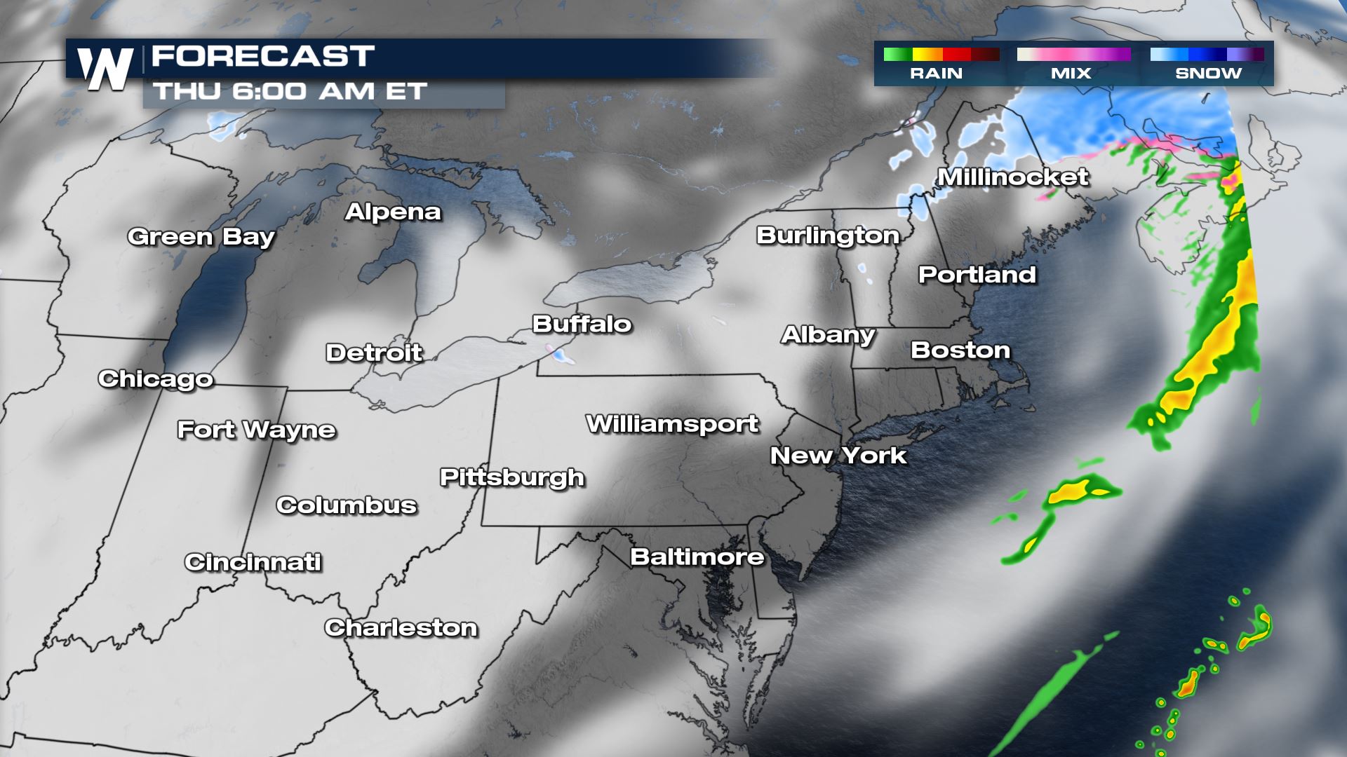
 Snow will continue to fall across the far northest into early Thursday morning. Heavy snow is possible and will accumulate quickly. Due to the fast moving nature of this system, snowfall will come to an end by midday Thursday.
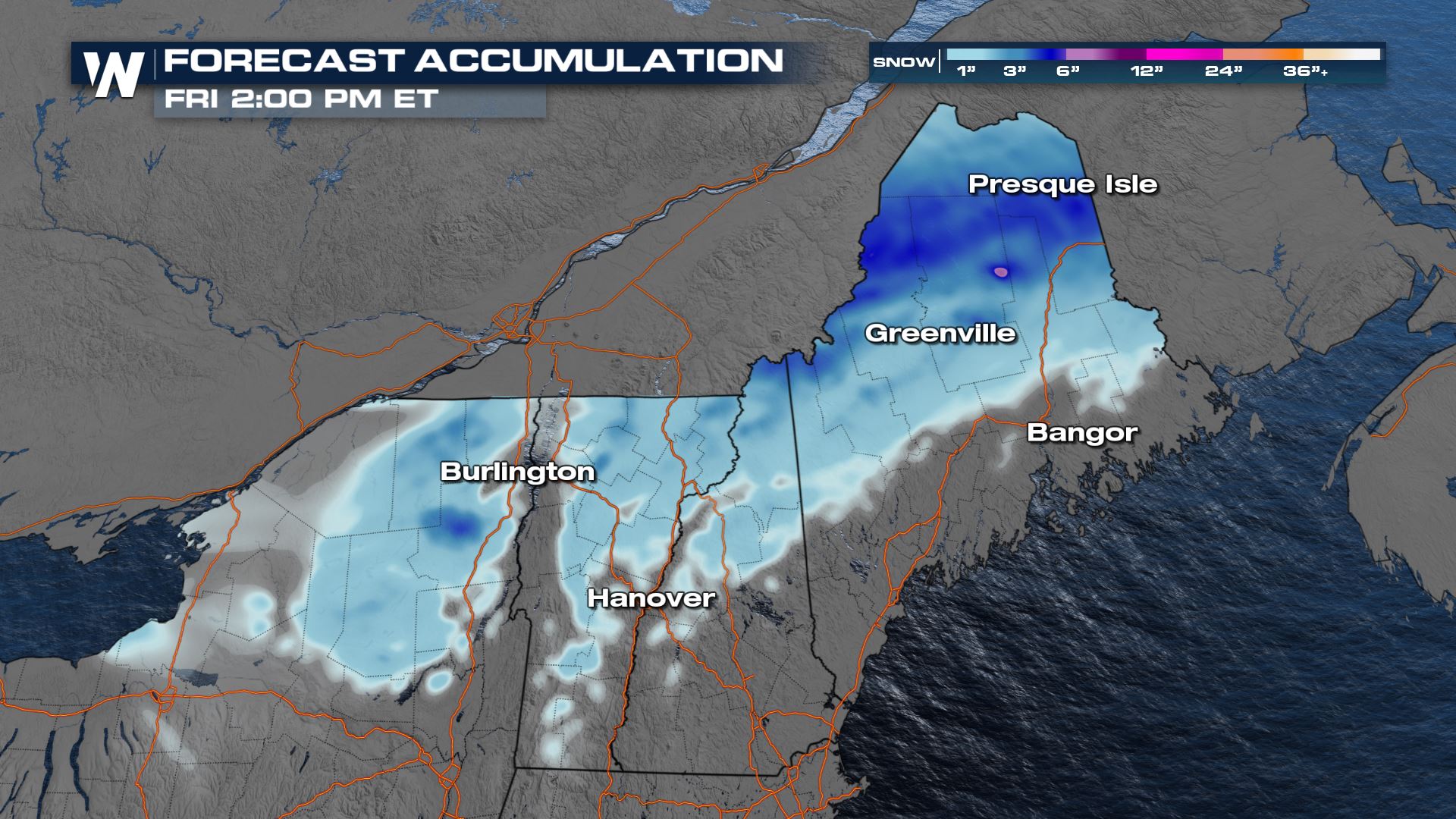
 Additional snowfall totals will reach 2" to 5" for parts of Upstate New York to Northern Maine. Isolated amounts to 6" may occur.
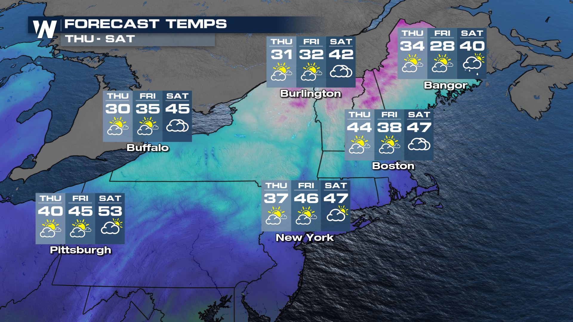
 Although the front will bring cooler air across the region for Thursday, by Saturday many places will rebound with daytime highs back again into the 40s and 50s.
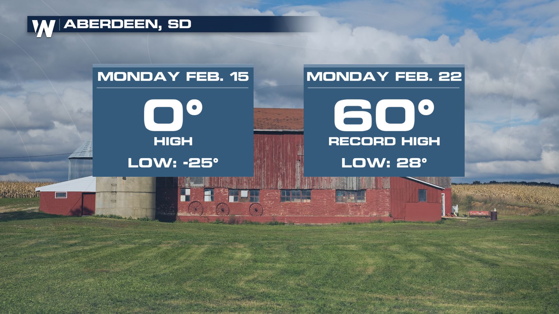
 One last interesting facet with this storm. After weeks of frigid arctic air, downslope winds brought in much warmer conditions and gave Aberdeen, SD quite a span of temperatures to be experienced just over the course of a week!
 WeatherNation will keep you updated on-air and online. Check back with us for the latest information and forecasts.
The clipper-type low pressure center will continue its trek eastward into Thursday. Upwards of nearly 1/2 a foot of snow has already fallen in from parts of North Dakota to Wisconsin.
Along the trailing cold front, a few areas in the Northeast could see quick bursts of snow that may quickly accumulate into Wednesday evening.
Snow will continue to fall across the far northest into early Thursday morning. Heavy snow is possible and will accumulate quickly. Due to the fast moving nature of this system, snowfall will come to an end by midday Thursday.
Additional snowfall totals will reach 2" to 5" for parts of Upstate New York to Northern Maine. Isolated amounts to 6" may occur.
Although the front will bring cooler air across the region for Thursday, by Saturday many places will rebound with daytime highs back again into the 40s and 50s.
One last interesting facet with this storm. After weeks of frigid arctic air, downslope winds brought in much warmer conditions and gave Aberdeen, SD quite a span of temperatures to be experienced just over the course of a week!
WeatherNation will keep you updated on-air and online. Check back with us for the latest information and forecasts.All Weather News
More

East Gears Up for Stormy, Wet Weekend
A low pressure system crashing through the Mi
1 Aug 2026 9:15 PM


Flooding, Severe Storms Target the Midwest Again
After an active week of storms across the nor
1 Aug 2026 1:40 AM

After Reaching Category 5, Genevieve Weakens in the Pacific
PacificFausto is now a post-tropical cyclone.
31 Jul 2026 1:30 AM

Flooding Risk Increases as Heavy Rain Targets the Tri-State Area
Tuesday, heavy rainfall moved across the Nort
30 Jul 2026 12:25 AM

Severe Weather: Energy From the Midwest Now in the Southeast
UPPER MIDWEST - Through Monday, dangerous tor
29 Jul 2026 10:30 PM