Winter Weather Returns to New England
Special Stories
16 Apr 2021 3:20 AM
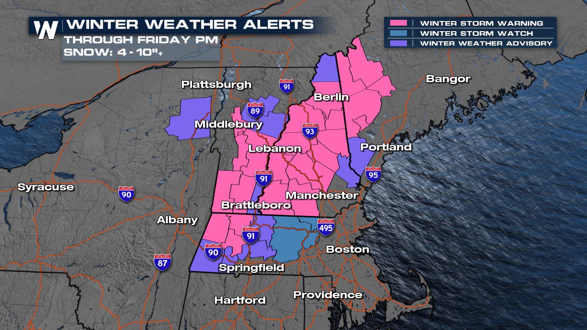
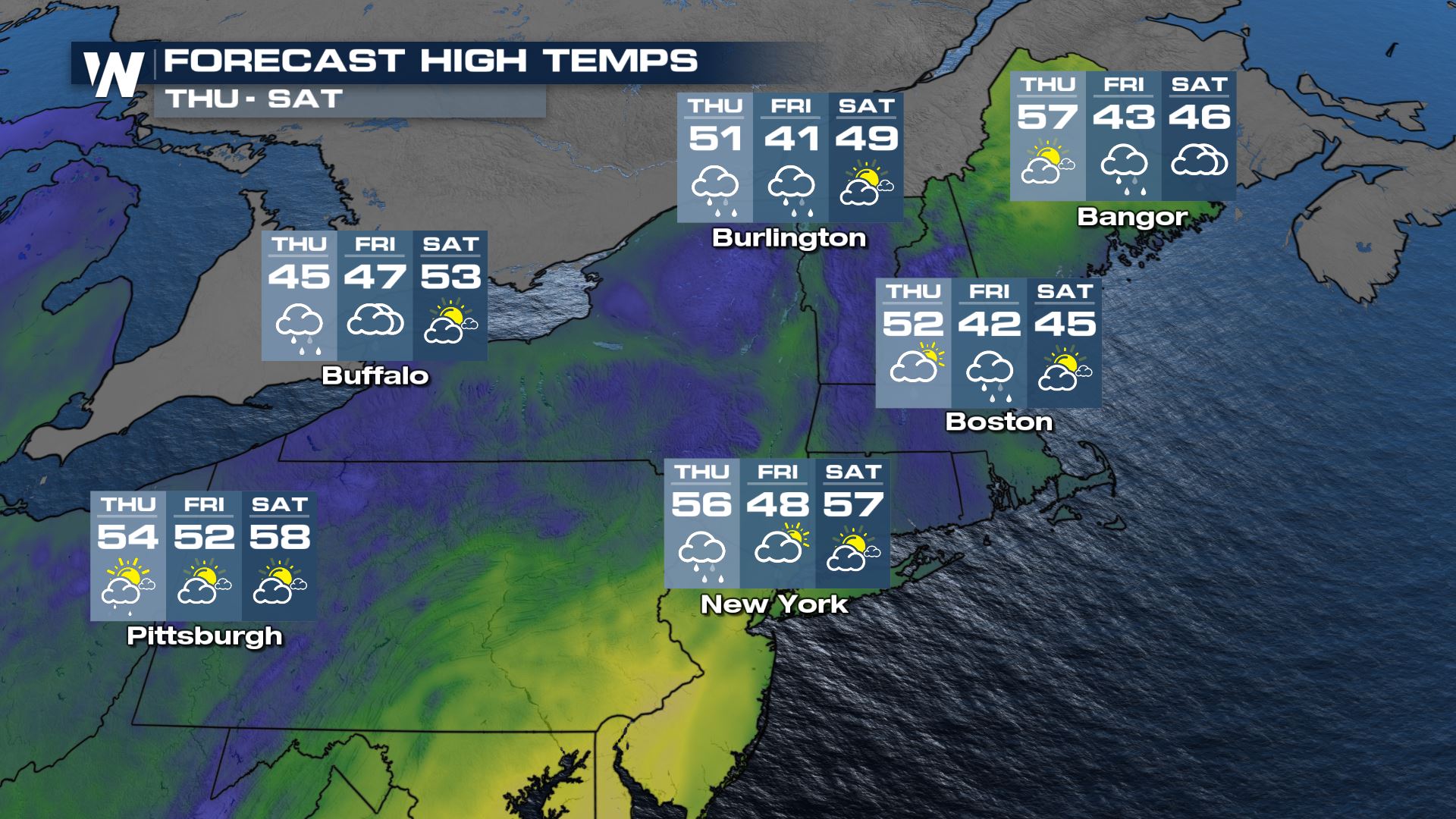
Spring may have started nearly 30 days ago, but we're about to go right back in to winter in the Northeast United States! Winter Storm Watches have been upgraded to warnings and advisories for parts of New England for Thursday night to Friday, April 15-16th.
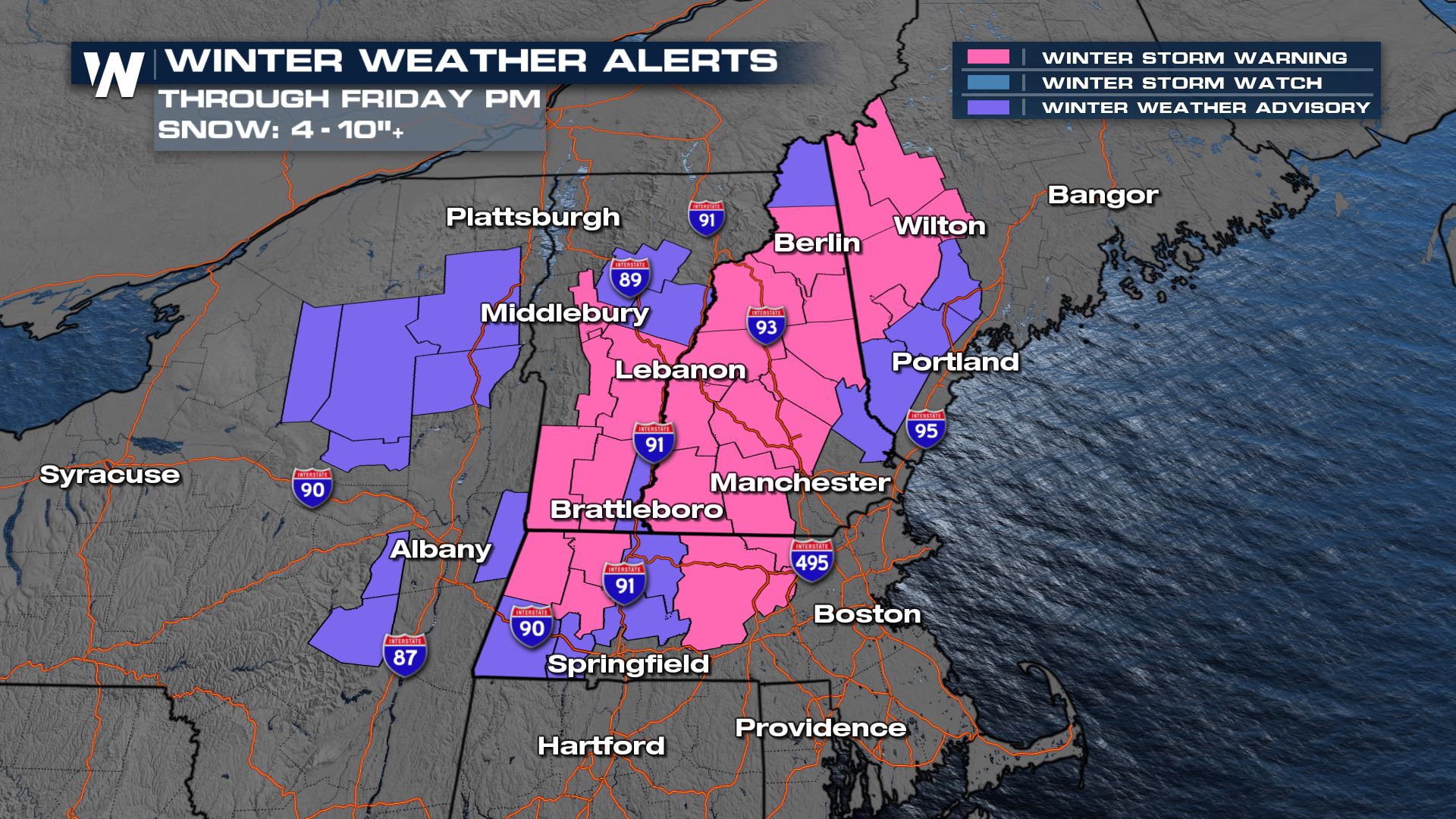 Areas impacted include the Green Mountains of Vermont, the Berkshire Mountains of Massachusetts, the White Mountains of New Hampshire, and the Blue Mountains of Maine. There is a potential of getting 6 inches of snow (or more) at elevations of 1,000 feet or higher. This will lead to slippery roads and power outages. Higher elevations could see up to a foot or more.
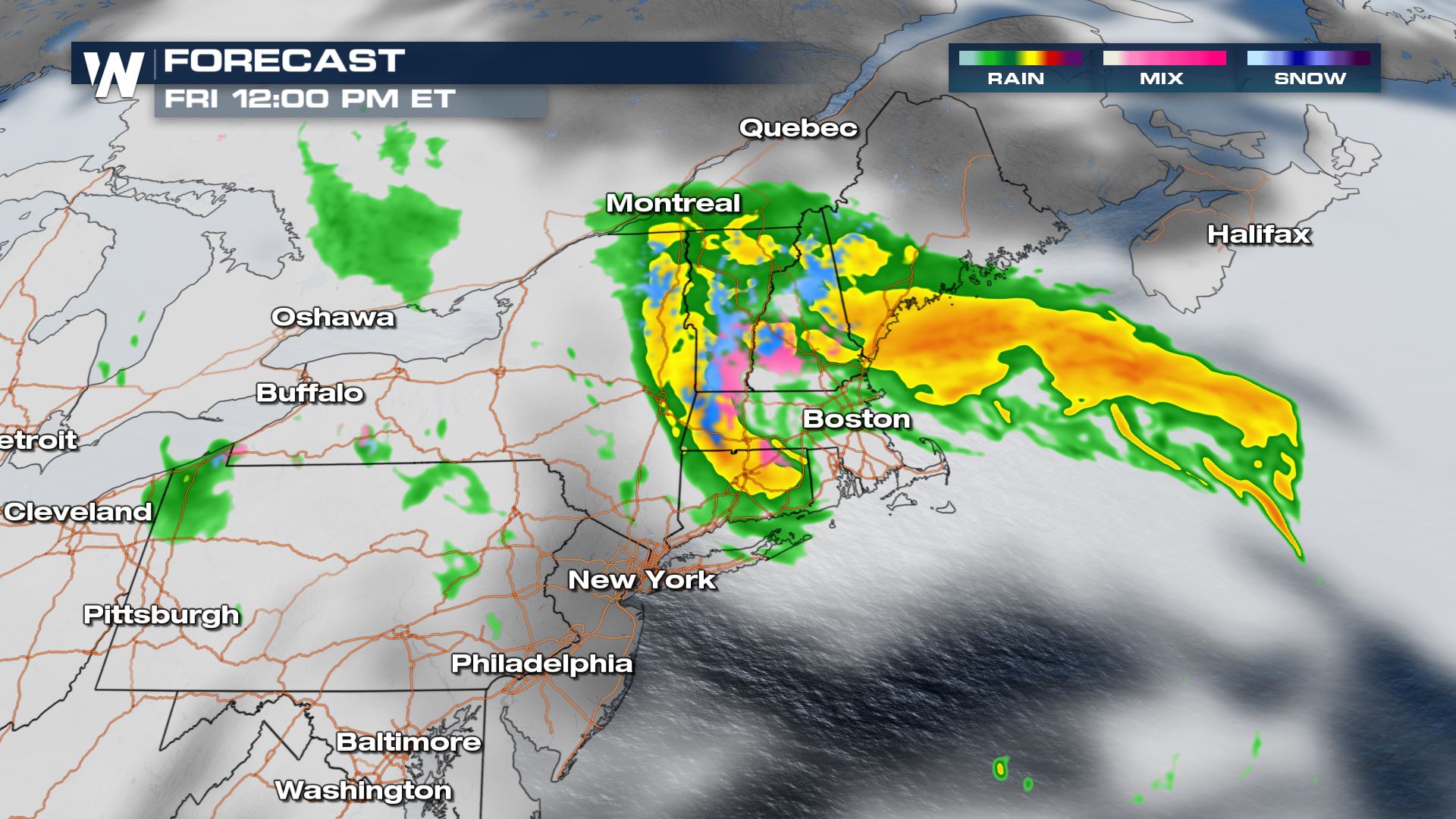
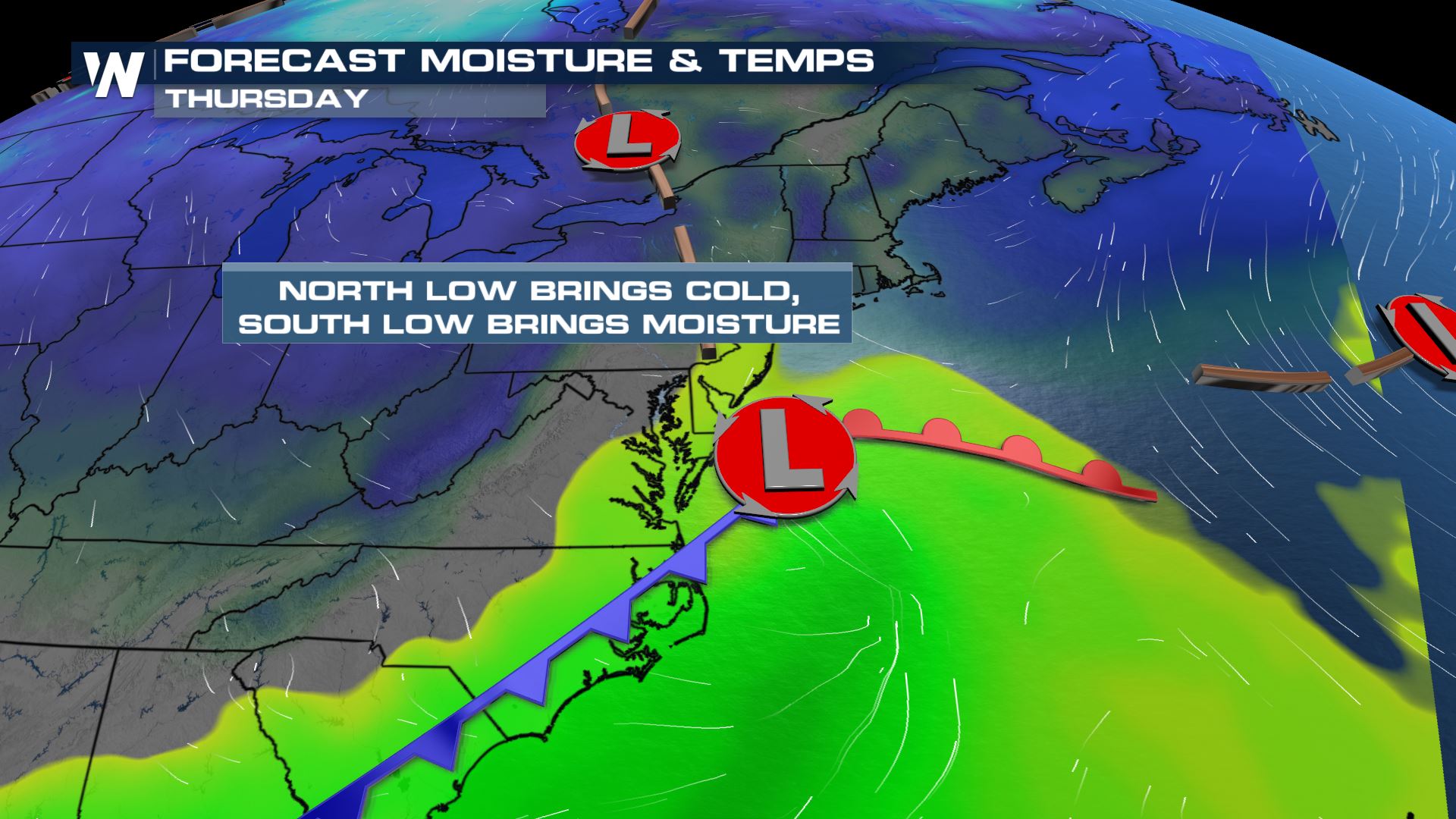 By Thursday night, the developing low pressure off the coast of New Jersey and New York will get stronger, pulling in additional cold air and changing rain to snow. Overnight Thursday into Friday more rain will change to snow and the wind will start to get breezy at times.
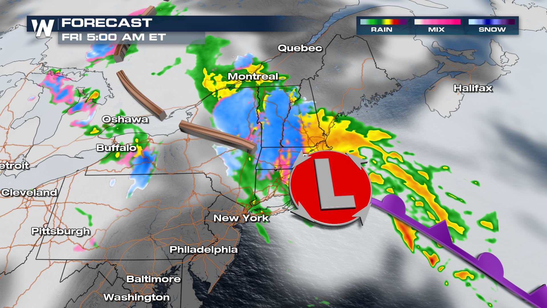 By Friday morning, snow showers will be blowing across upstate New York and New England's mountains with fresh blankets of snowfall across each corresponding state.
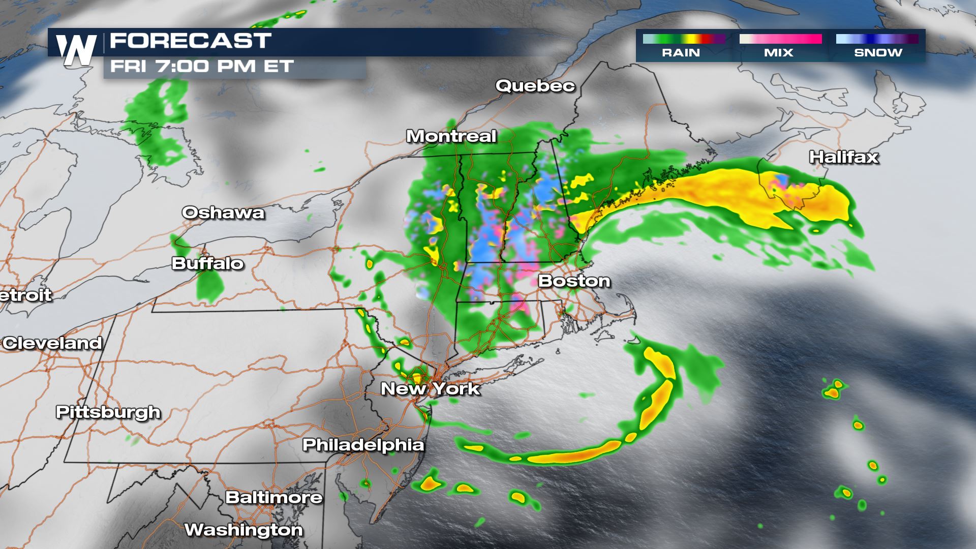
 Snow showers could change back over to rain showers during the daylight hours Friday, but the higher elevations above 1,500 feet will likely stay all snow Friday.
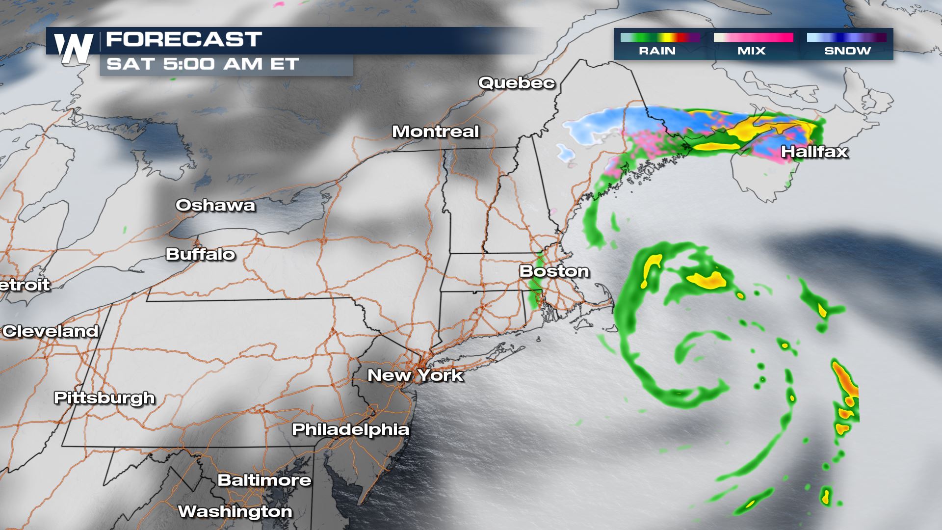 Friday night the storm system will pull away from New England putting an end to the wintry mix, but allow cold temperatures to settle in by Saturday morning.
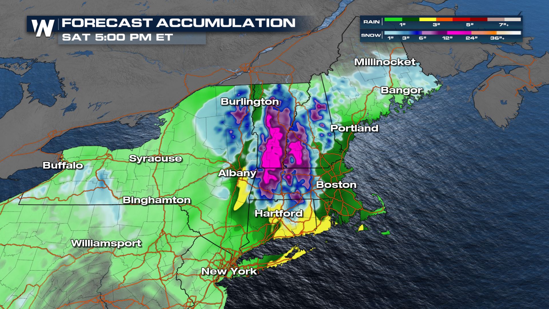 In all, accumulation will be quite heavy. Lower elevations will get 1 to 2 inches of rainfall while the higher elevations receive 6" of snow or more. Elevations above 1,500 feet will get the heaviest snow, while locations below 1,000 feet will likely stay all rain. This will be a heavy, wet snow accumulation. Power outages will be possible and plan on some slippery conditions on the roads that go over the higher mountains.
Temperatures will be a driving factor in precipitation types. Snow levels will shift through the day and ground temperatures will allow for melting.
In all, accumulation will be quite heavy. Lower elevations will get 1 to 2 inches of rainfall while the higher elevations receive 6" of snow or more. Elevations above 1,500 feet will get the heaviest snow, while locations below 1,000 feet will likely stay all rain. This will be a heavy, wet snow accumulation. Power outages will be possible and plan on some slippery conditions on the roads that go over the higher mountains.
Temperatures will be a driving factor in precipitation types. Snow levels will shift through the day and ground temperatures will allow for melting.
Areas impacted include the Green Mountains of Vermont, the Berkshire Mountains of Massachusetts, the White Mountains of New Hampshire, and the Blue Mountains of Maine. There is a potential of getting 6 inches of snow (or more) at elevations of 1,000 feet or higher. This will lead to slippery roads and power outages. Higher elevations could see up to a foot or more.
By Thursday night, the developing low pressure off the coast of New Jersey and New York will get stronger, pulling in additional cold air and changing rain to snow. Overnight Thursday into Friday more rain will change to snow and the wind will start to get breezy at times.
By Friday morning, snow showers will be blowing across upstate New York and New England's mountains with fresh blankets of snowfall across each corresponding state.
Snow showers could change back over to rain showers during the daylight hours Friday, but the higher elevations above 1,500 feet will likely stay all snow Friday.
Friday night the storm system will pull away from New England putting an end to the wintry mix, but allow cold temperatures to settle in by Saturday morning.
In all, accumulation will be quite heavy. Lower elevations will get 1 to 2 inches of rainfall while the higher elevations receive 6" of snow or more. Elevations above 1,500 feet will get the heaviest snow, while locations below 1,000 feet will likely stay all rain. This will be a heavy, wet snow accumulation. Power outages will be possible and plan on some slippery conditions on the roads that go over the higher mountains.
Temperatures will be a driving factor in precipitation types. Snow levels will shift through the day and ground temperatures will allow for melting.
All Weather News
More
Fronts Continue To Spark Severe Weather Across the Plains
A cold front that brought record lows to the
18 Jul 2025 10:40 PM

Extreme Heat Impacts for the East Coast & South
Extreme heat continues to impact several area
18 Jul 2025 10:05 PM

Flooding Threat Remains Elevated in the East
A cold front pushing through the Eastern Seab
18 Jul 2025 9:10 PM

EF-2 Firenado from the Deer Creek Fire in Utah
A fire tornado was spotted near La Sal, Utah
18 Jul 2025 7:30 AM

Tropical System Brings Flood Risk to the Central Gulf
Time has run out for notable tropical develop
18 Jul 2025 3:05 AM

Heavy Rain, Flooding Threat Returns to Florida
Keep the rain boots handy in Florida - heavy
13 Jul 2025 12:50 PM

Severe Storm Risk Pushes into the Great Lakes, Ohio Valley
Friday was another busy day with severe weath
12 Jul 2025 8:00 PM