Winter Weather Alerts for the Northwest
Special Stories
31 Oct 2018 11:05 AM
FORECAST
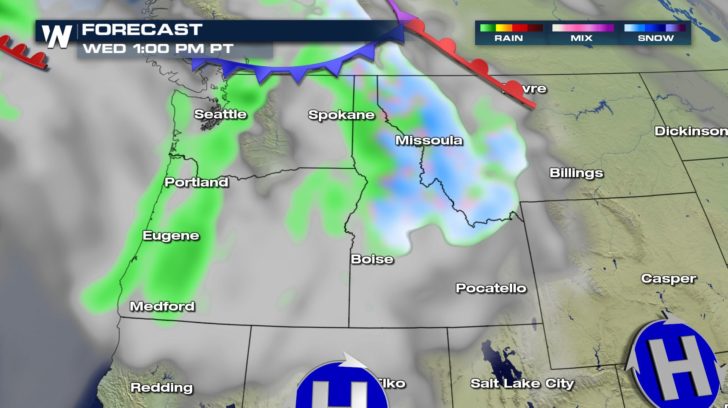
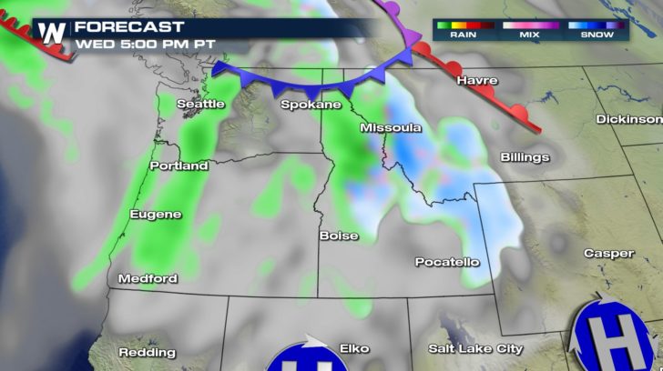
 Snow started up early this morning and will continue all day long becoming more widespread as we move into the afternoon. Snow showers could become heavy at times and will last into tomorrow morning. Another system moving in from the north will bring in more snow for northwestern portions of Montana on Thursday. Remember to take it slow on commutes!
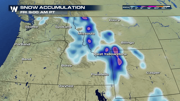
WINTER ALERTS AND SNOW ACCUMULATION
Snow started up early this morning and will continue all day long becoming more widespread as we move into the afternoon. Snow showers could become heavy at times and will last into tomorrow morning. Another system moving in from the north will bring in more snow for northwestern portions of Montana on Thursday. Remember to take it slow on commutes!
WINTER ALERTS AND SNOW ACCUMULATION
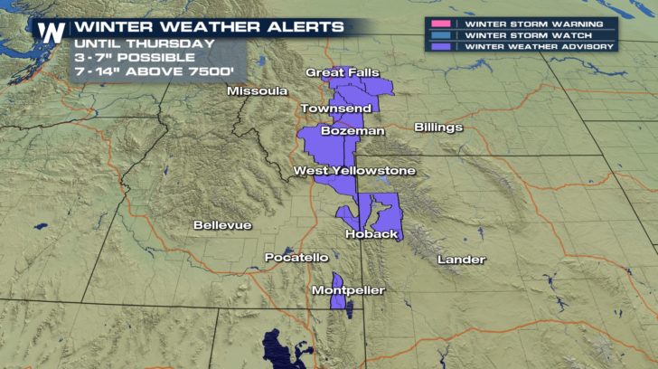
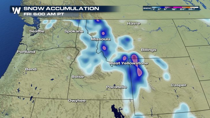 Winter weather advisories are in effect until Thursday morning. Many cities should expect to see 3 to 7 inches of snow just over the next 24 hours with higher elevations receiving over a foot of snow!
A LOOK AHEAD
Winter weather advisories are in effect until Thursday morning. Many cities should expect to see 3 to 7 inches of snow just over the next 24 hours with higher elevations receiving over a foot of snow!
A LOOK AHEAD
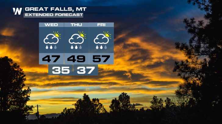
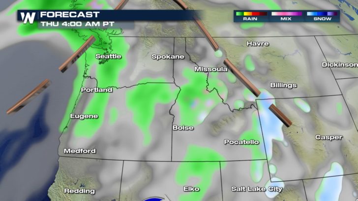
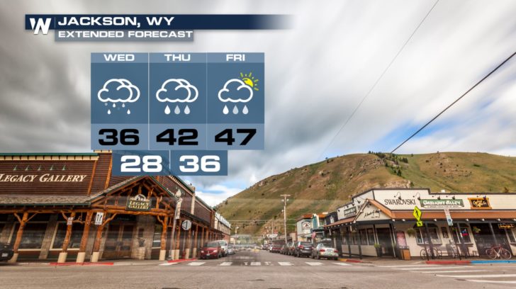 Cold temperatures and precipitation in the forecast for Montana and Wyoming over the next few days. Rain during the day will most likely transition to snow for the nighttime hours.
Snow started up early this morning and will continue all day long becoming more widespread as we move into the afternoon. Snow showers could become heavy at times and will last into tomorrow morning. Another system moving in from the north will bring in more snow for northwestern portions of Montana on Thursday. Remember to take it slow on commutes!
WINTER ALERTS AND SNOW ACCUMULATION
Winter weather advisories are in effect until Thursday morning. Many cities should expect to see 3 to 7 inches of snow just over the next 24 hours with higher elevations receiving over a foot of snow!
A LOOK AHEAD
Cold temperatures and precipitation in the forecast for Montana and Wyoming over the next few days. Rain during the day will most likely transition to snow for the nighttime hours.All Weather News
More


More Storms for the East Sunday and Monday
A low-pressure system crashing through the Mi
2 Aug 2026 2:20 AM

After Reaching Category 5, Genevieve Weakens in the Pacific
PacificGenevieve formed on last Friday south
2 Aug 2026 1:30 AM

Flooding, Severe Storms Target the Midwest Again
After an active week of storms across the nor
1 Aug 2026 1:40 AM

Flooding Risk Increases as Heavy Rain Targets the Tri-State Area
Tuesday, heavy rainfall moved across the Nort
30 Jul 2026 12:25 AM

Severe Weather: Energy From the Midwest Now in the Southeast
UPPER MIDWEST - Through Monday, dangerous tor
29 Jul 2026 10:30 PM