Wintry Weather from the Rockies to New England
Special Stories
5 Feb 2018 4:05 PM
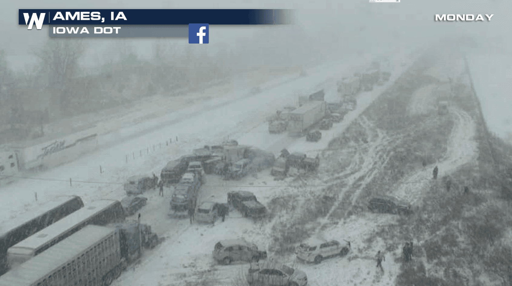
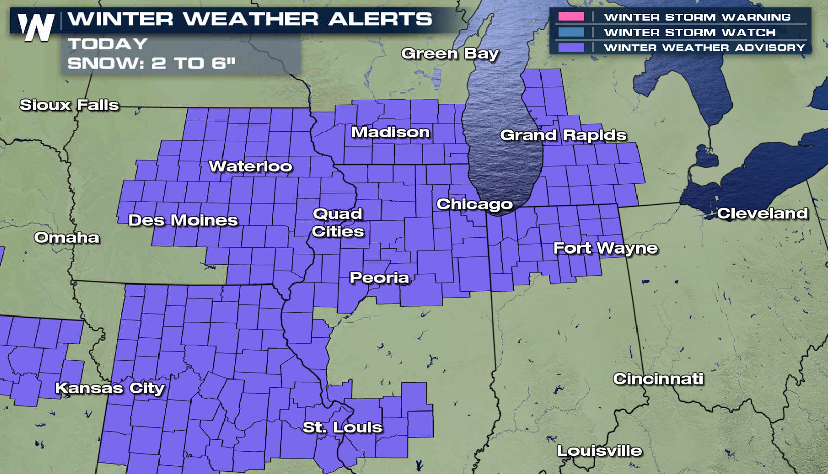
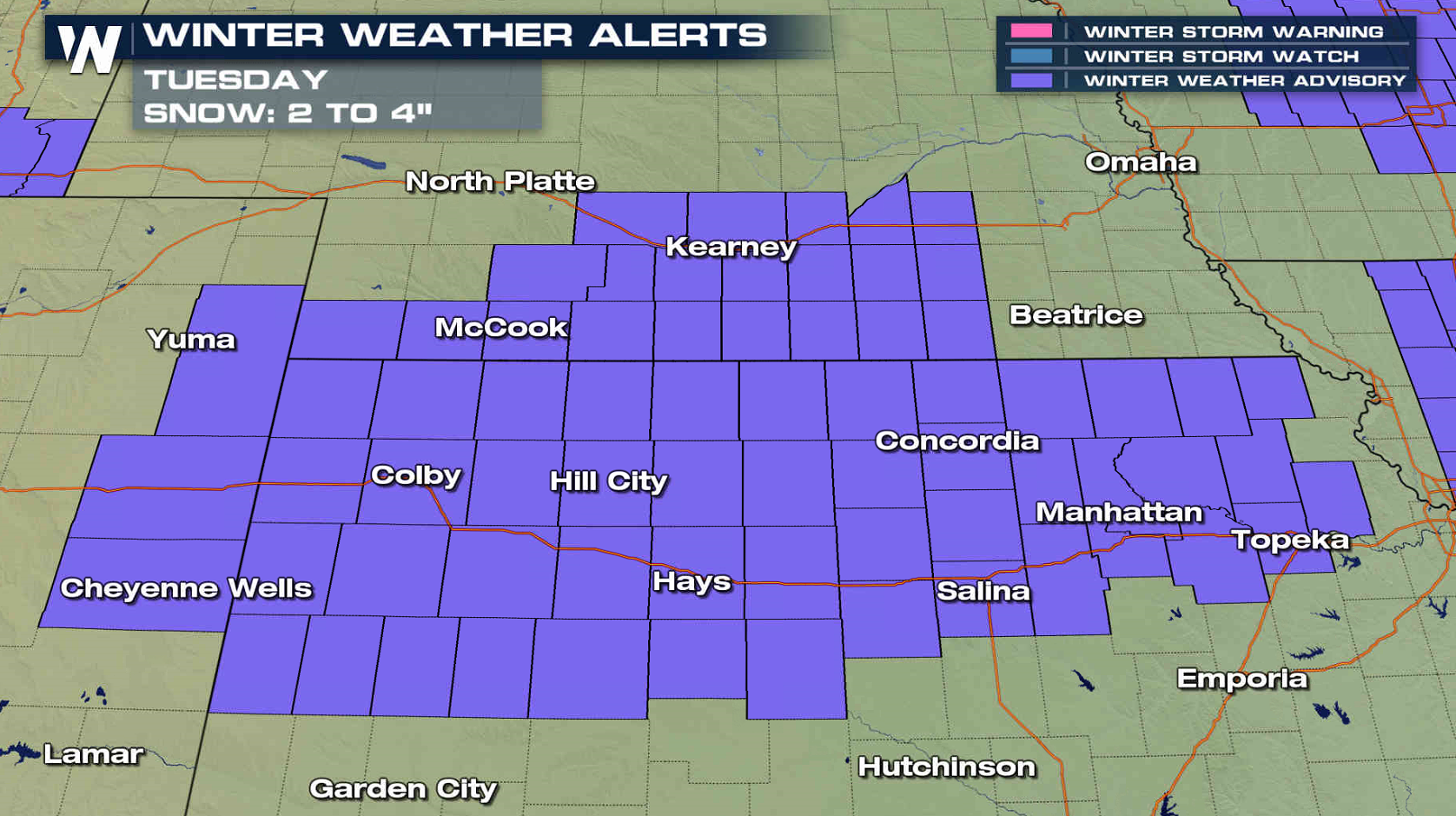
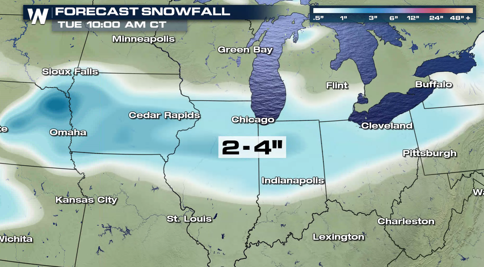
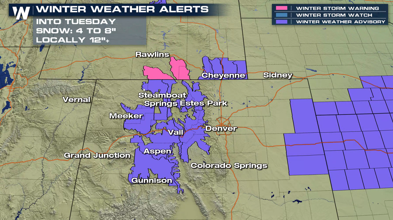
Several storm systems along an active Jet Stream are creating snow and ice over the northern tier of the nation. Up to 6" of snow is possible in the Midwest and Great Lakes through this evening, with a few inches into the Central Plains Tuesday as Winter Weather Advisories remain in effect.
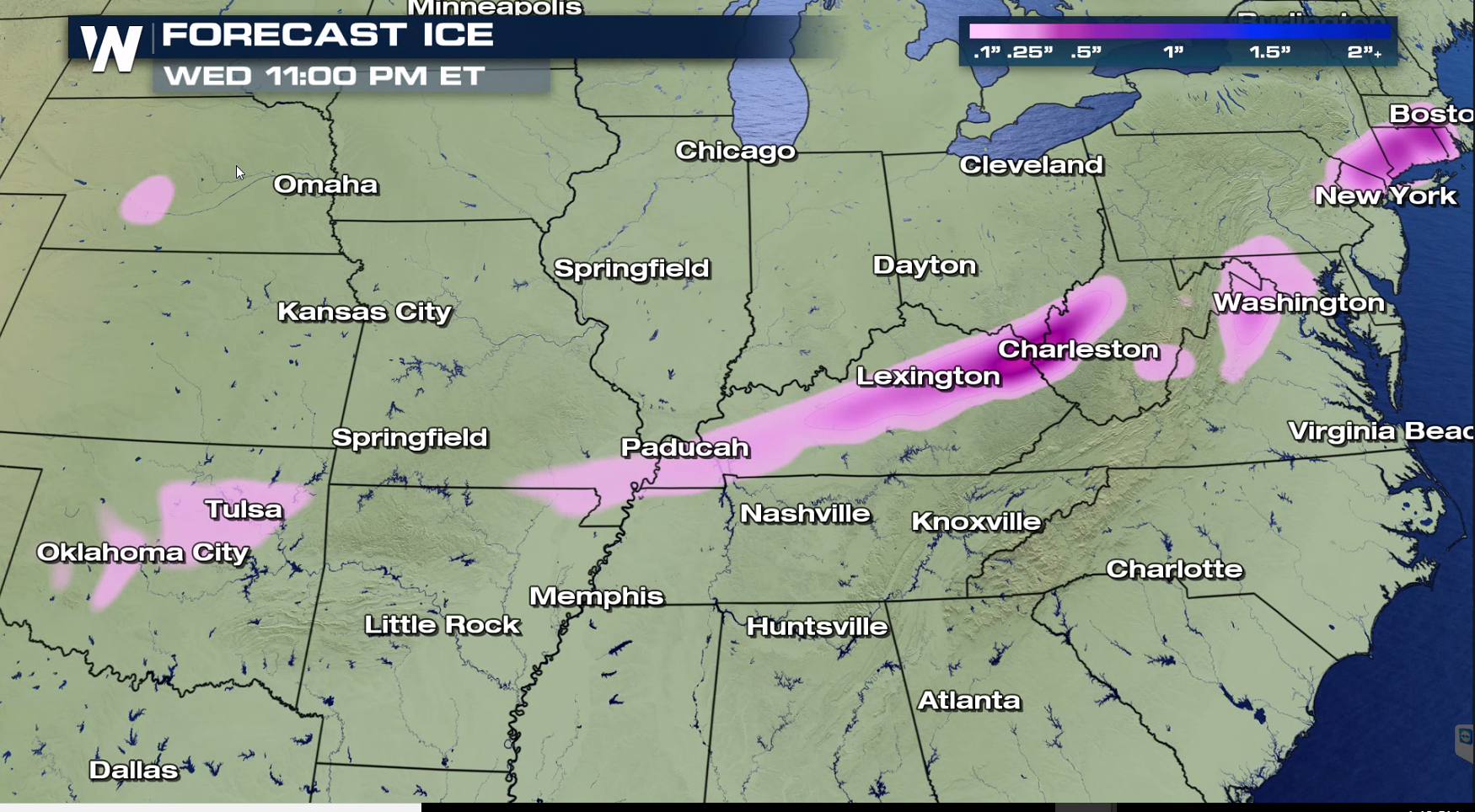
 Most areas will see snow, but some sleet and freezing rain may form along and ahead of a front. This will add to the travel headaches from the Plains into the Northeast.
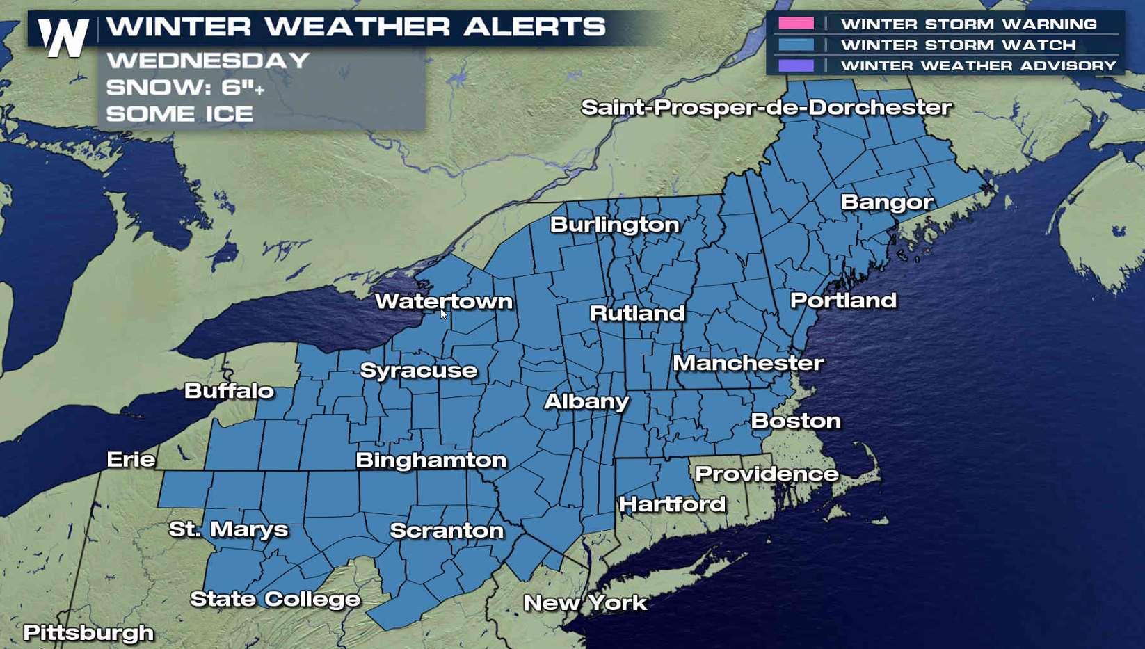
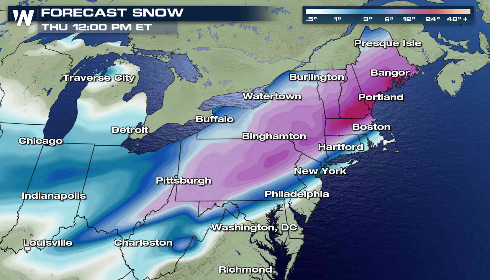
 Winter Storm Watches have been issued for Wednesday from Maine to Pennsylvania. Parts of New England could see up to a foot of snow.
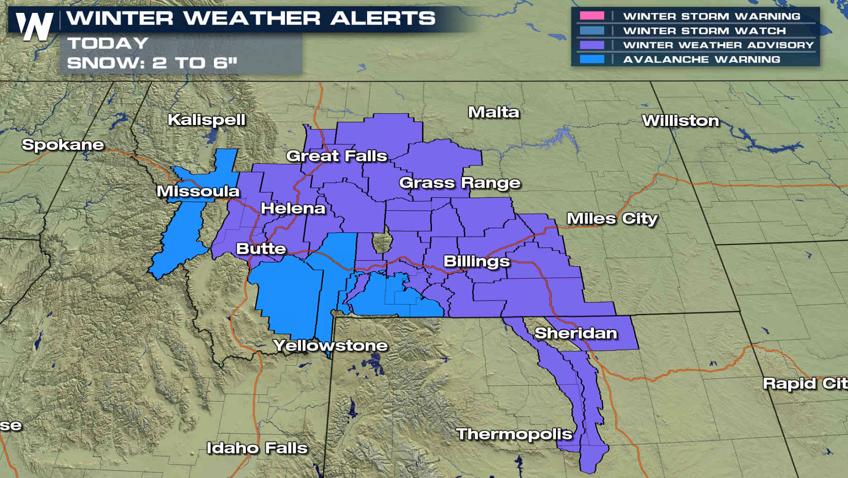
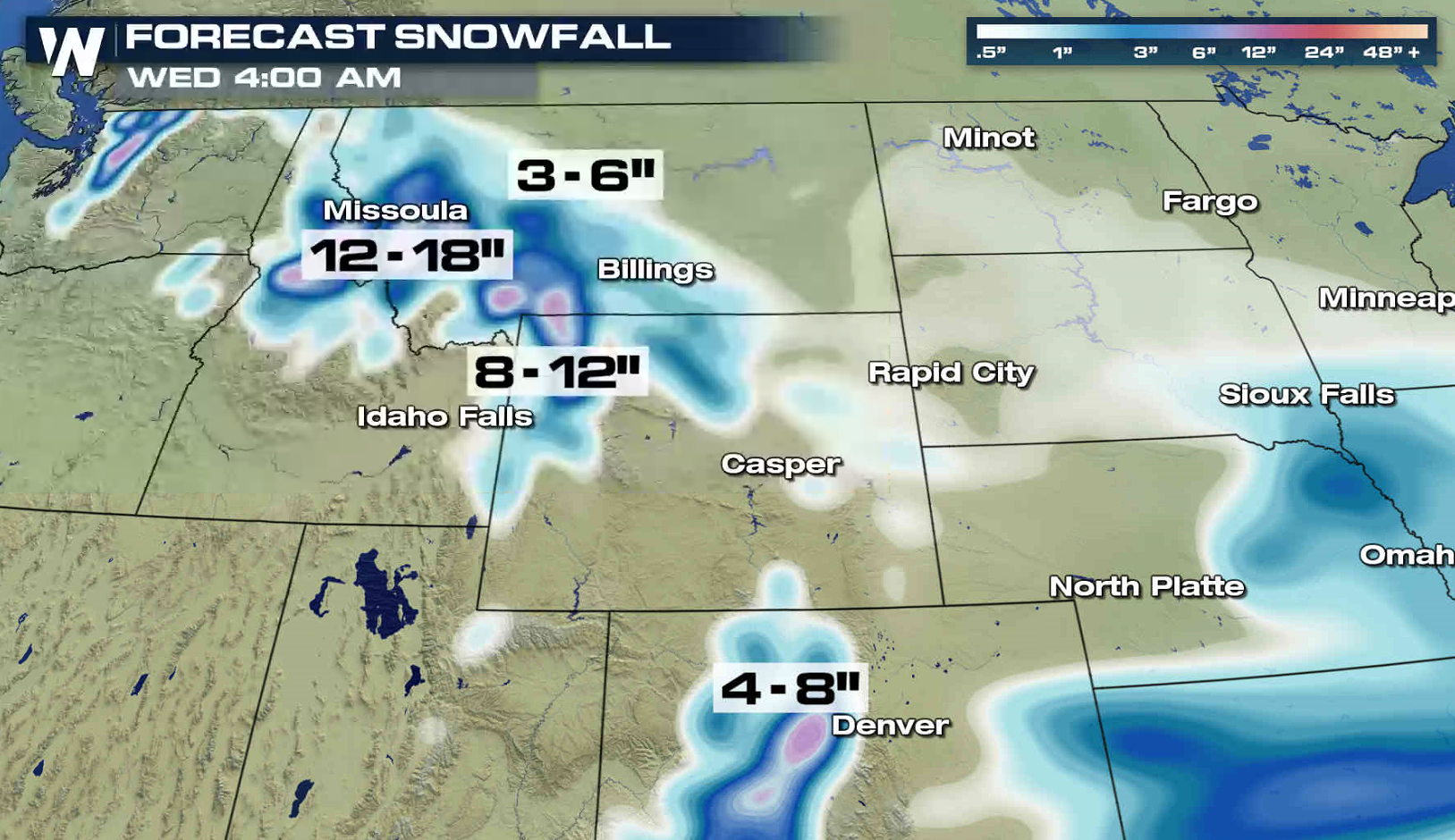
 Snow continues across the West, although will gradually diminish into Tuesday. The highest mountain peaks may see nearly 2 feet of snow.
 For WeatherNation: Meteorologist Mace Michaels
Most areas will see snow, but some sleet and freezing rain may form along and ahead of a front. This will add to the travel headaches from the Plains into the Northeast.
Winter Storm Watches have been issued for Wednesday from Maine to Pennsylvania. Parts of New England could see up to a foot of snow.
Snow continues across the West, although will gradually diminish into Tuesday. The highest mountain peaks may see nearly 2 feet of snow.
For WeatherNation: Meteorologist Mace MichaelsAll Weather News
More

More Storms for the East Through Monday
A low-pressure system that moved through the
3 Aug 2026 12:20 PM


After Reaching Category 5, Genevieve Weakens in the Pacific
PacificGenevieve formed last Friday south of
3 Aug 2026 12:30 AM

Flooding, Severe Storms Target the Midwest Again
After an active week of storms across the nor
1 Aug 2026 1:40 AM

Flooding Risk Increases as Heavy Rain Targets the Tri-State Area
Tuesday, heavy rainfall moved across the Nort
30 Jul 2026 12:25 AM