Your Christmas Forecast!

Special Stories
24 Dec 2018 8:38 AM
TEMPERATURE FORECAST
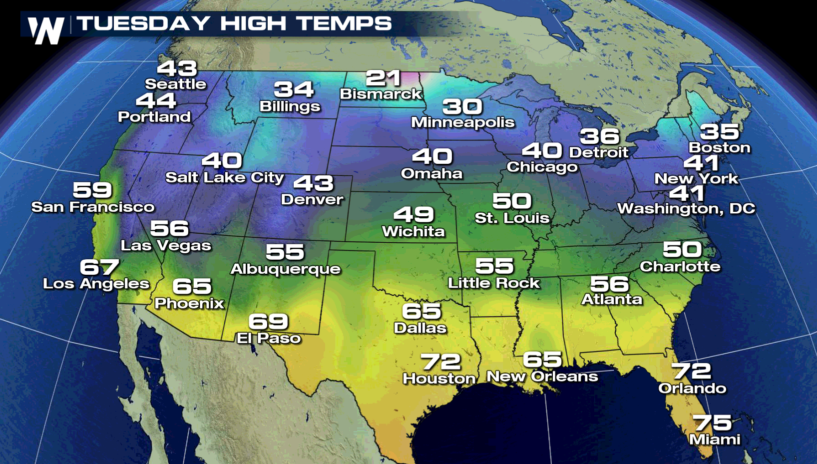 Tranquil weather is expected across the nation with most temperatures at or above normal as Santa arrives on Tuesday. The northern half of the country will be in the 30s and 40s while the southern half of the country will experience temperatures ranging from the 50s to the 70s!
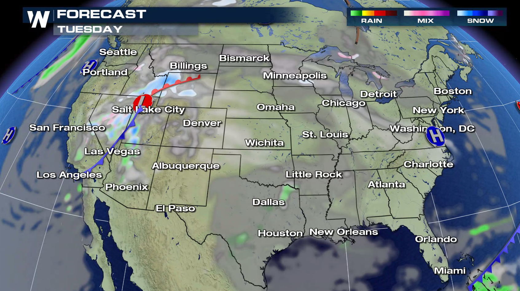
 Travel problems for Christmas are expected to be minimal, with some slowdowns in the West as a low pressure center moves near the Wasatch.
NORTHEAST
Travel problems for Christmas are expected to be minimal, with some slowdowns in the West as a low pressure center moves near the Wasatch.
NORTHEAST
 The northeast will stay on the quiet side throughout Christmas day. Despite a few isolated snow and rain showers and some added cloud cover, much of the northeast will stay dry all day long.
SOUTHEAST
The northeast will stay on the quiet side throughout Christmas day. Despite a few isolated snow and rain showers and some added cloud cover, much of the northeast will stay dry all day long.
SOUTHEAST
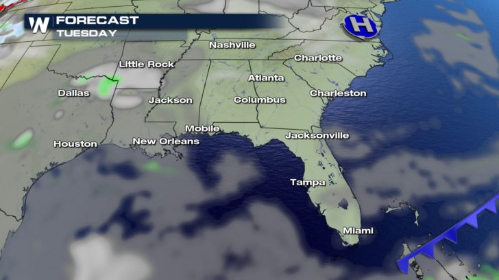 The southeast will also stay on the quiet side. Many cities will see plenty of sunshine throughout the day. Rain showers will start to pop up for Texas during the afternoon and will become more widespread as we near the end of Tuesday.
NORTHWEST
The southeast will also stay on the quiet side. Many cities will see plenty of sunshine throughout the day. Rain showers will start to pop up for Texas during the afternoon and will become more widespread as we near the end of Tuesday.
NORTHWEST
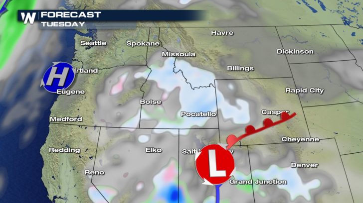 Widespread snow showers are in the forecast for the northwest from Idaho to Wyoming. A high pressure system will briefly move through the region bringing in a short period of dry weather near the coast, so many cities will get a little drop of sunshine during the day. Another cold front moving in on Wednesday will bring the heavy rain and snow back for the second half of the week.
SOUTHWEST
Widespread snow showers are in the forecast for the northwest from Idaho to Wyoming. A high pressure system will briefly move through the region bringing in a short period of dry weather near the coast, so many cities will get a little drop of sunshine during the day. Another cold front moving in on Wednesday will bring the heavy rain and snow back for the second half of the week.
SOUTHWEST
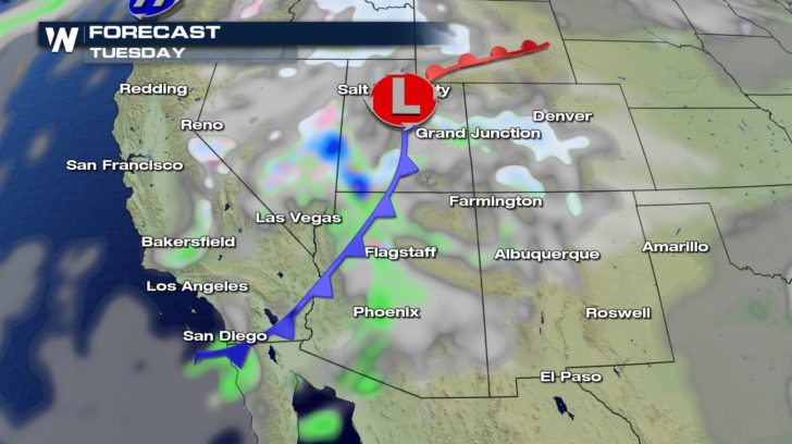 A low pressure system moving in from the northwest will bring in some heavy rain and snow showers for the southwest. These showers will be lingering all day long, moving into New Mexico and Texas as we get into the second half of of the day. The snow will last into our Wednesday for New Mexico and Colorado, as well.
Tranquil weather is expected across the nation with most temperatures at or above normal as Santa arrives on Tuesday. The northern half of the country will be in the 30s and 40s while the southern half of the country will experience temperatures ranging from the 50s to the 70s!
Travel problems for Christmas are expected to be minimal, with some slowdowns in the West as a low pressure center moves near the Wasatch.
NORTHEAST
The northeast will stay on the quiet side throughout Christmas day. Despite a few isolated snow and rain showers and some added cloud cover, much of the northeast will stay dry all day long.
SOUTHEAST
The southeast will also stay on the quiet side. Many cities will see plenty of sunshine throughout the day. Rain showers will start to pop up for Texas during the afternoon and will become more widespread as we near the end of Tuesday.
NORTHWEST
Widespread snow showers are in the forecast for the northwest from Idaho to Wyoming. A high pressure system will briefly move through the region bringing in a short period of dry weather near the coast, so many cities will get a little drop of sunshine during the day. Another cold front moving in on Wednesday will bring the heavy rain and snow back for the second half of the week.
SOUTHWEST
A low pressure system moving in from the northwest will bring in some heavy rain and snow showers for the southwest. These showers will be lingering all day long, moving into New Mexico and Texas as we get into the second half of of the day. The snow will last into our Wednesday for New Mexico and Colorado, as well.All Weather News
More
East Gears Up for Stormy, Wet Weekend
A low pressure system crashing through the Mi
1 Aug 2026 11:35 AM


Flooding, Severe Storms Target the Midwest Again
After an active week of storms across the nor
1 Aug 2026 1:40 AM


After Reaching Category 5, Genevieve Weakens in the Pacific
PacificFausto is now a post-tropical cyclone.
31 Jul 2026 1:30 AM

Flooding Risk Increases as Heavy Rain Targets the Tri-State Area
Tuesday, heavy rainfall moved across the Nort
30 Jul 2026 12:25 AM

Severe Weather: Energy From the Midwest Now in the Southeast
UPPER MIDWEST - Through Monday, dangerous tor
29 Jul 2026 10:30 PM