Your Extended Severe Weather Forecast
Special Stories
4 Nov 2018 11:23 AM
 An abundant amount of moisture moving in from the gulf will help fuel thunderstorms for the next several days.
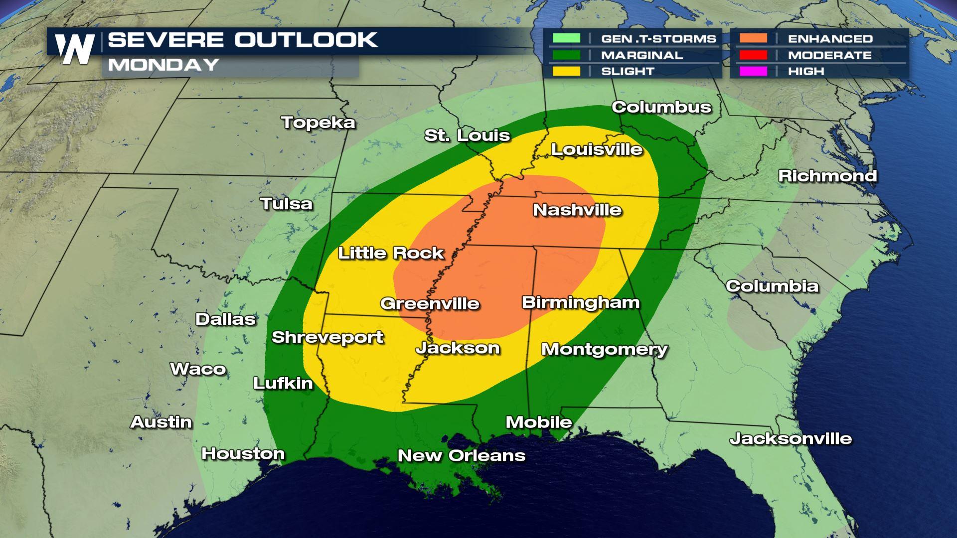
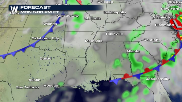
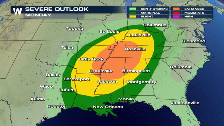 On Monday, the severe weather outlook shows an enhanced region of severe weather ranging from Kentucky to Louisiana. This means numerous severe thunderstorms could be possible within this area. Damaging winds and hail could also be seen within some of these storms.
 On top of the damaging winds and hail risk, there will also be a tornado risk for the day on Monday. The wind shear will change in direction with height. This means winds at the surface will be flowing in a different direction from the winds in the upper atmosphere which, in turn, could produce rotation. This could lead to a tornado threat.
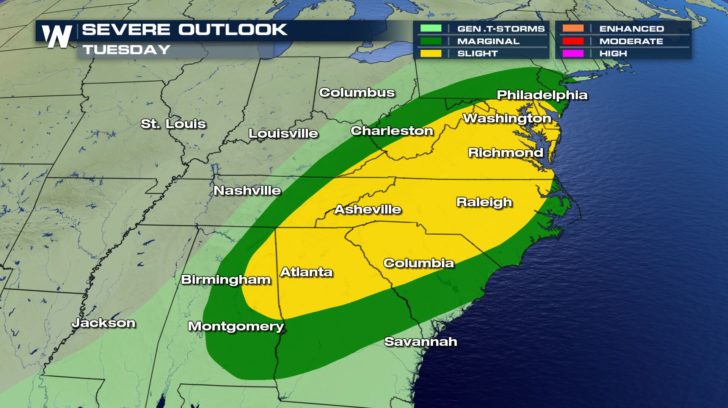 The severe weather threat does not stop on Monday. As the front shifts more towards the east, the severe weather threat exists for our Tuesday, as well. From New Jersey to Alabama, severe thunderstorms will be a big possibility.
FORECAST
The severe weather threat does not stop on Monday. As the front shifts more towards the east, the severe weather threat exists for our Tuesday, as well. From New Jersey to Alabama, severe thunderstorms will be a big possibility.
FORECAST
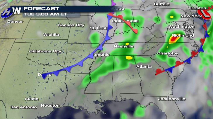
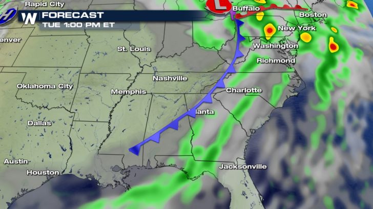 The rain and severe weather threat for the eastern half of the United States will continue until early Wednesday morning.
All Weather News
More
Severe Storms Target the Midwest This Weekend
Extreme heat will be a big story this week ac
26 Jul 2026 2:15 AM

Heat Wave Grips Central, Western U.S.
Are you over the summer heat yet? The heat al
26 Jul 2026 2:05 AM

Tropics: Fausto Heads to Hawaii; Genevieve Will Become a Major Hurricane
Atlantic BasinBertha has dissipated after mov
26 Jul 2026 2:00 AM


Southeast Flood Risk Lingers Near Stalled Front
A stalled boundary over the Southeast will ke
25 Jul 2026 10:55 AM

Another Round of Storms Targets the Northeast
Tuesday brought severe weather again across p
23 Jul 2026 1:15 AM

Another Round of Severe Weather for the Upper Midwest and Great Lakes
The upper-level low train continues to keep t
21 Jul 2026 1:45 AM