Rain and Snow Continue for the Northeast

Back-to-back low pressure systems have kept the Northeast soggy the last few days. Pesky rain and snow will linger for New England this weekend, while other areas see brief clearing before the next system arrives.
Snowfall
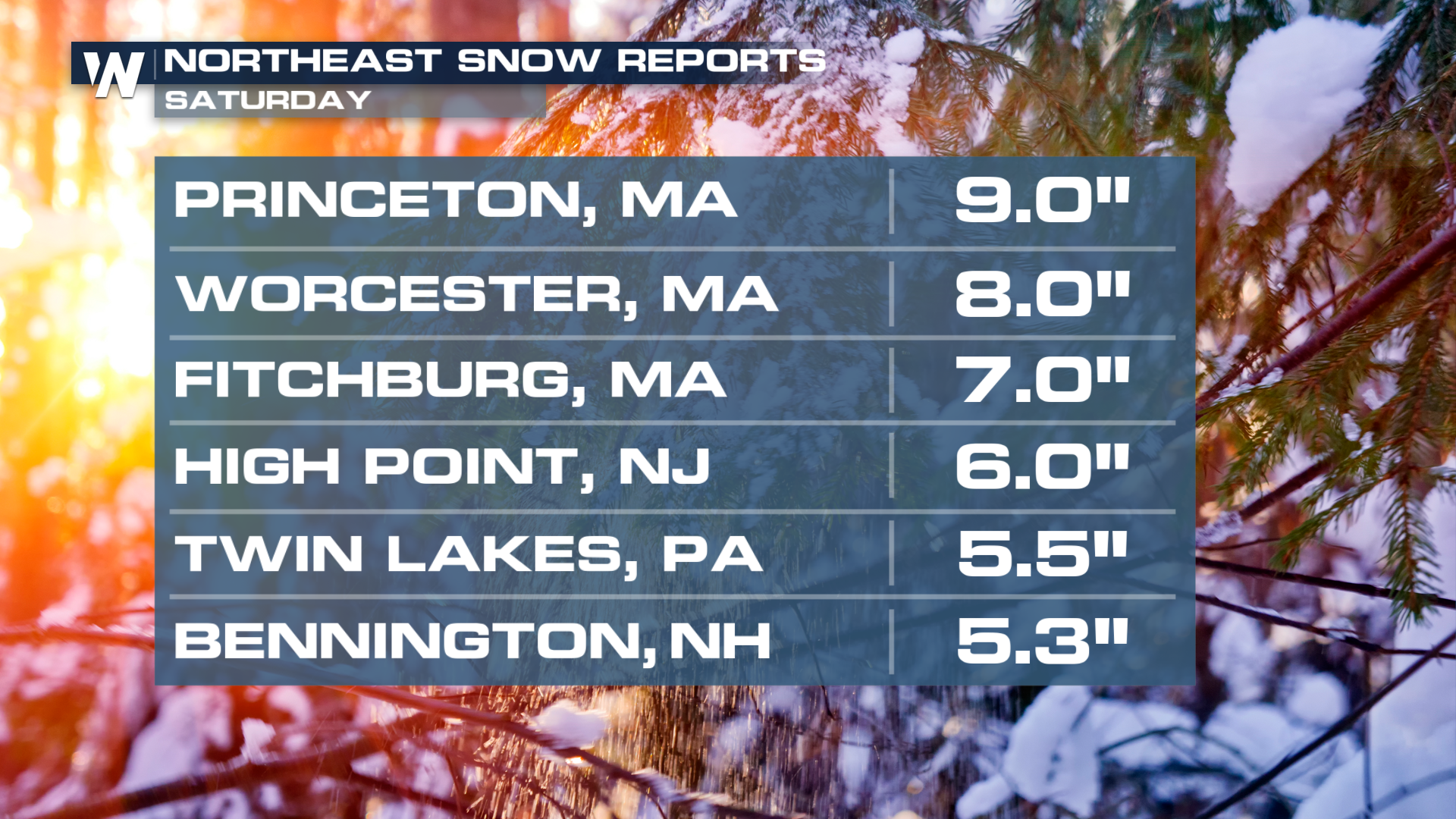 A round of light snow fell with the first system Friday morning, while heavier snow came down to start Saturday! Areas from Boston to northern New Jersey have seen the white stuff, up to 9 inches in Massachusetts.
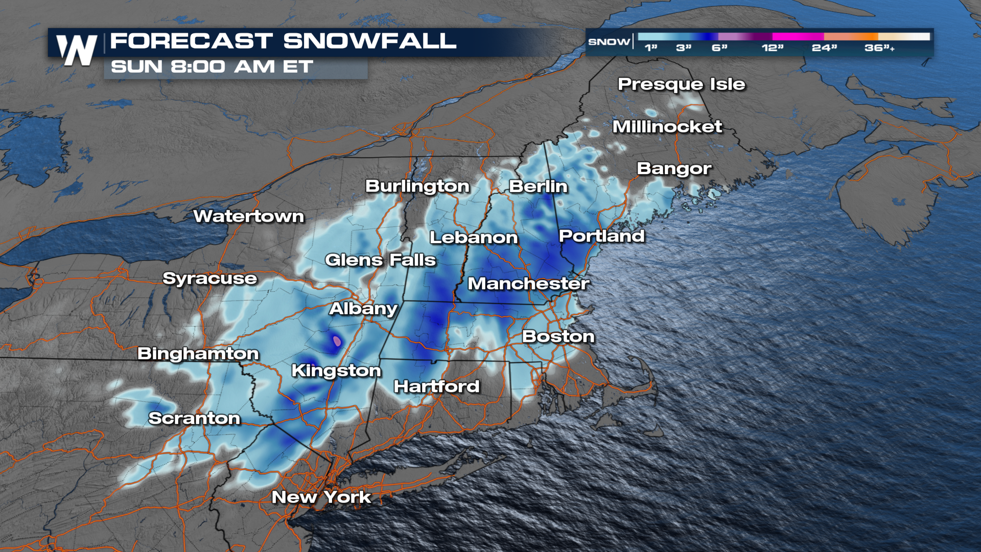
The storm will not be in a hurry to exit the coast, as it will linger into Sunday, with persistent showers likely across parts of Boston and surrounding areas. Weekend plans could be a washout, especially for those hoping to enjoy springtime activities outdoors. 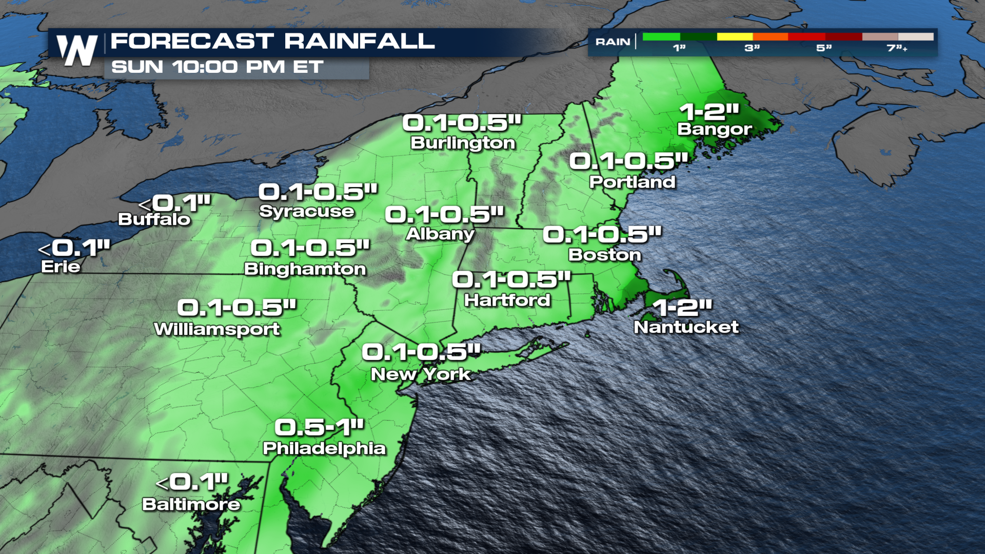 There will be more snowfall across the northern extent of the Northeast through Sunday. Snowfall totals could reach over 6 inches in some areas. Cities such as Buffalo, Manchester, and Burlington, Vermont, typically see their last average snowfall around mid-April. Some winter alerts are in effect for the snow!
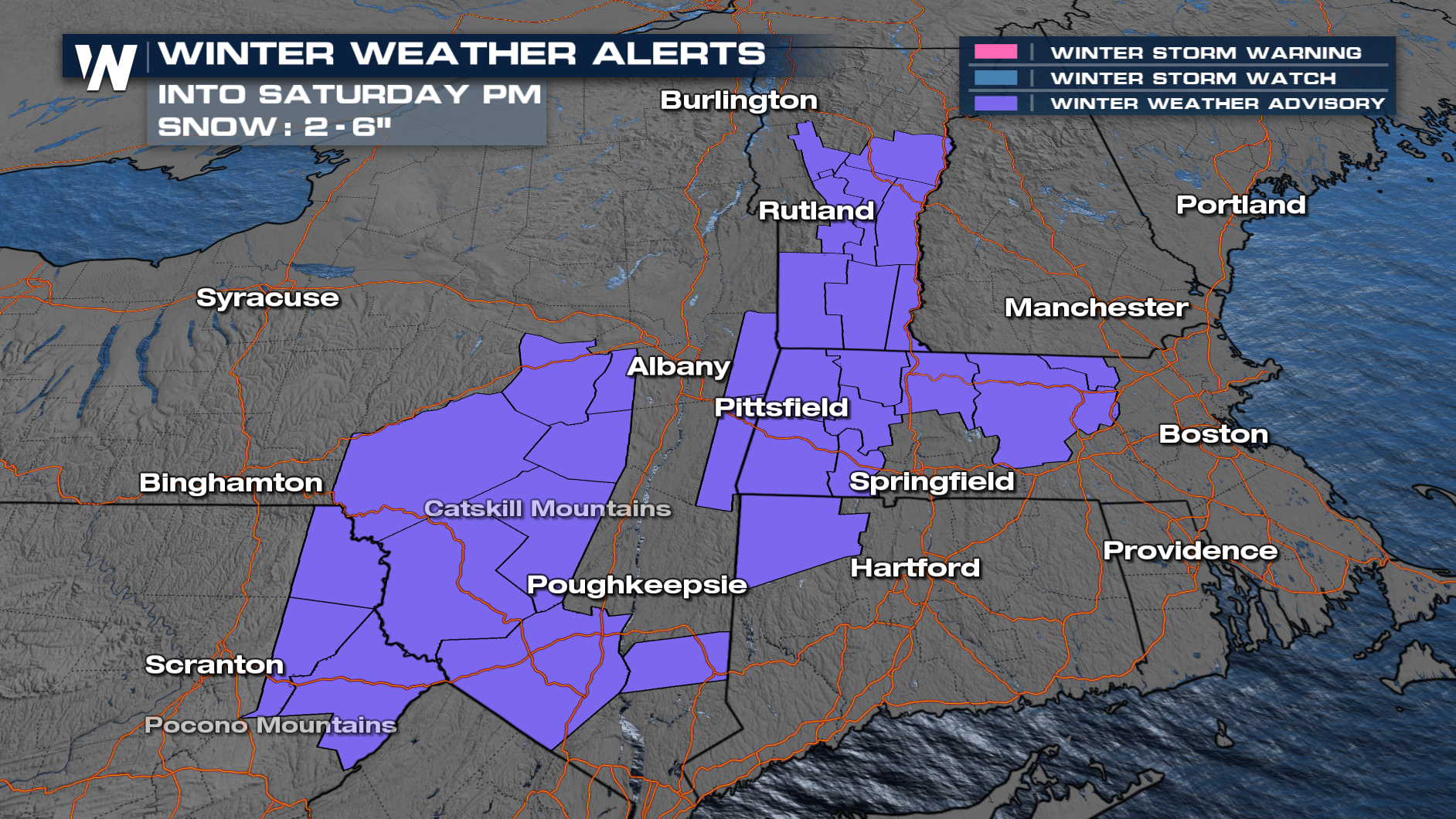
 Hoping for mild April warmth to balance out the rain? Think again. Temperatures will dip, making it feel more like late winter than early spring. Chilly air wrapping in behind the system will keep things damp and dreary, at least through the first half of the weekend.
 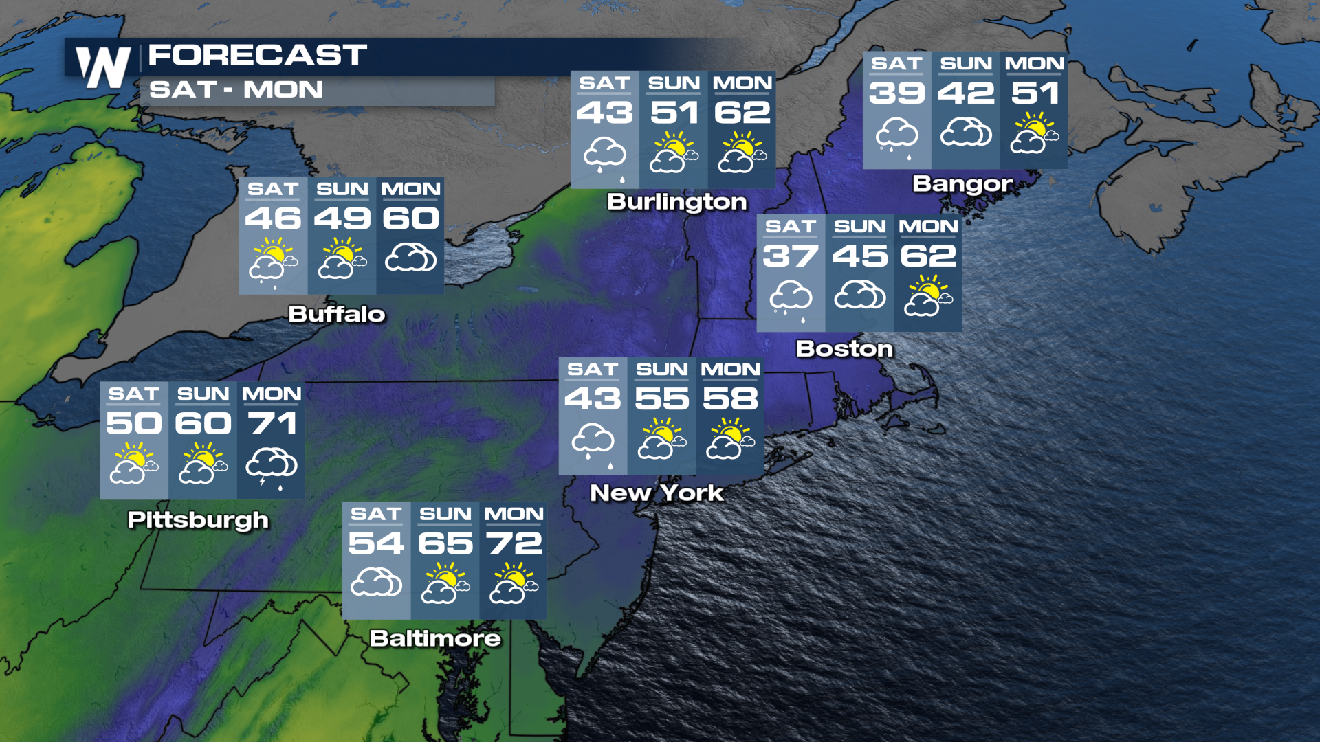 Bottom line? Keep the umbrellas close and the warm layers ready. This system may not be severe, but it’s certainly enough to disrupt the second half of your week—and your weekend plans.
Stay tuned for more details on when spring returns.


