Severe Storms Target the Midwest Again Saturday

The Midwest has been hammered by severe weather this week, including multiple tornadoes and a derecho! Another round of storms is expected Saturday, with high-end severe weather potential, including several strong tornadoes. Saturday's storms have already produced some very large hail across parts of the Central Plains.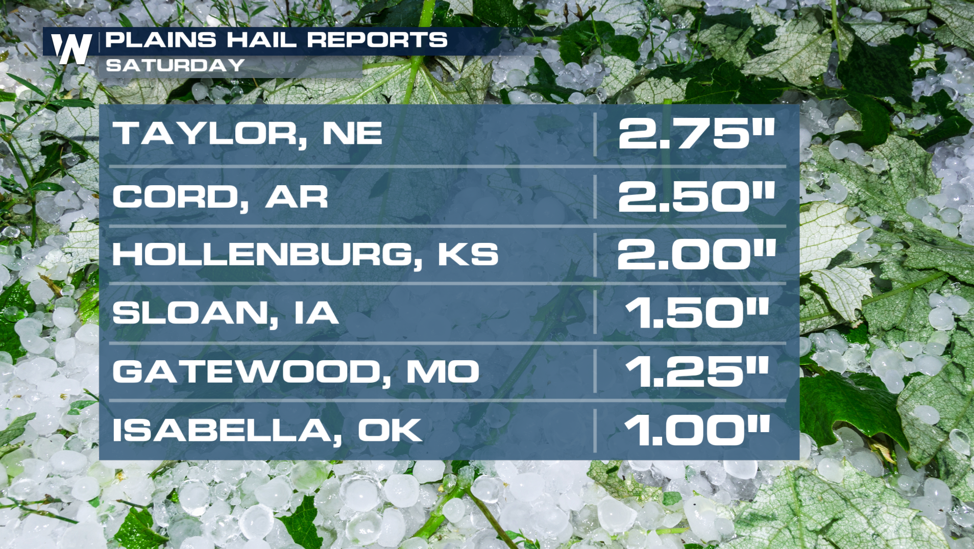
A low pressure system moving through the Great Plains will tap into plentiful warmth and moisture, with high-end energy giving the potential for massive hail and hurricane force wind gusts.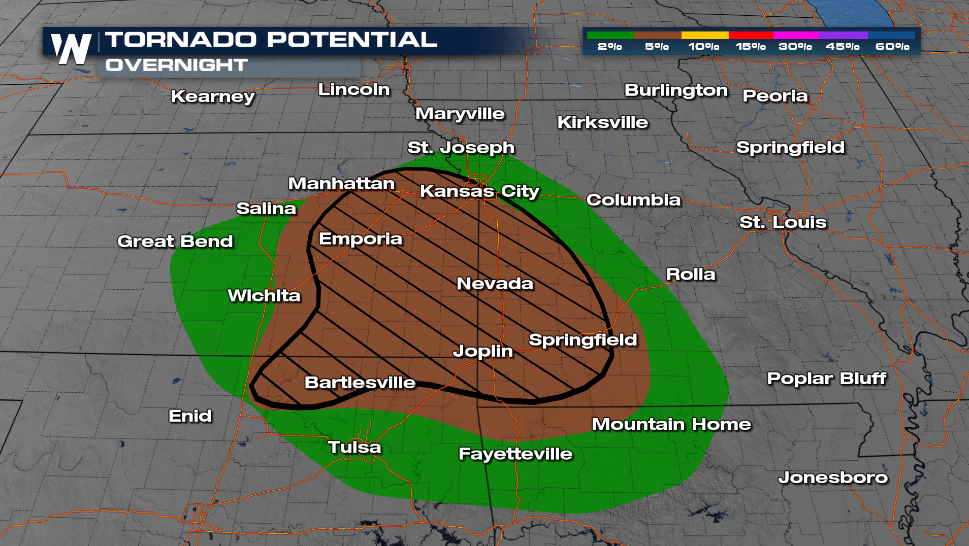
Wind and hail threats are expected to be the most widespread hazards and could be significant (below), but several tornadoes are also possible, including an intense tornado or two (hatched region above).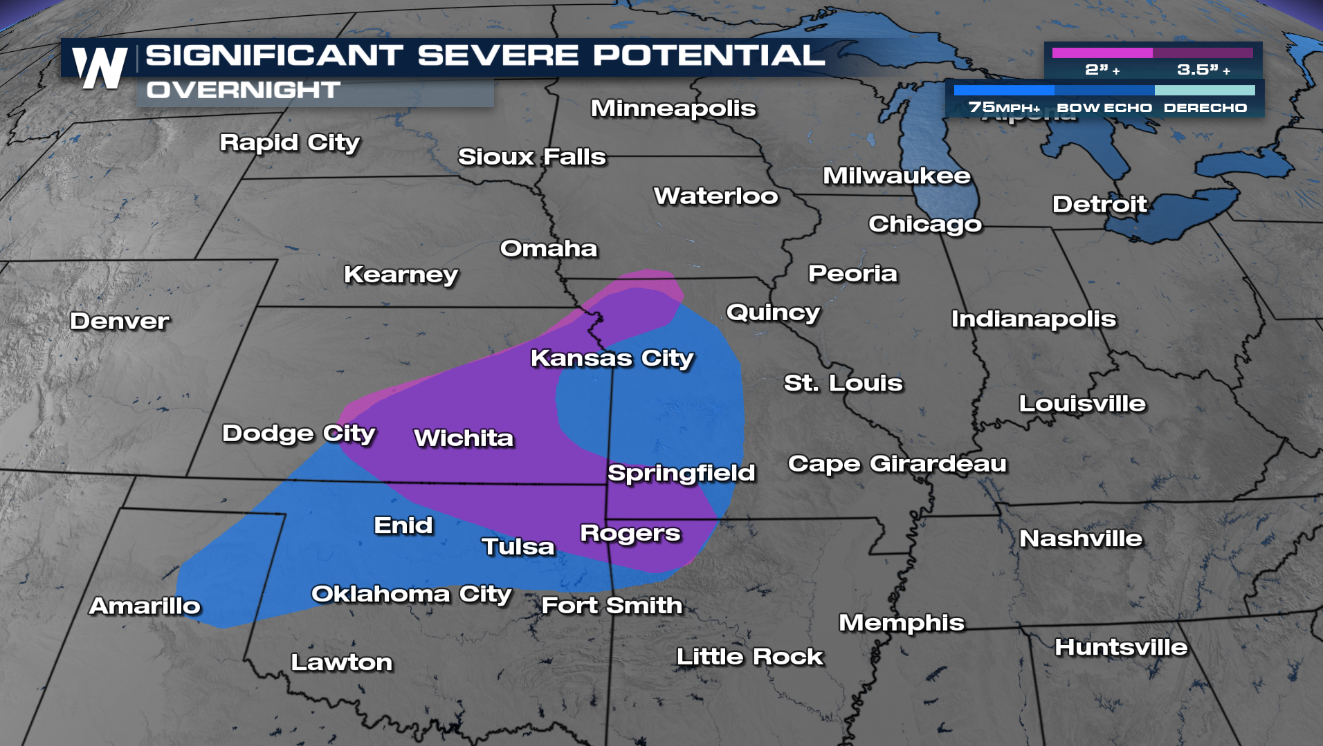
As storms pushed into the Kansas City metro, winds did gusts up to 70-80 mph and a confirmed tornado touchdown north of Kansas City. For the rest of the night, the strong squall line pushes further southward into Kansas and Missouri producing more reports of winds and hail.
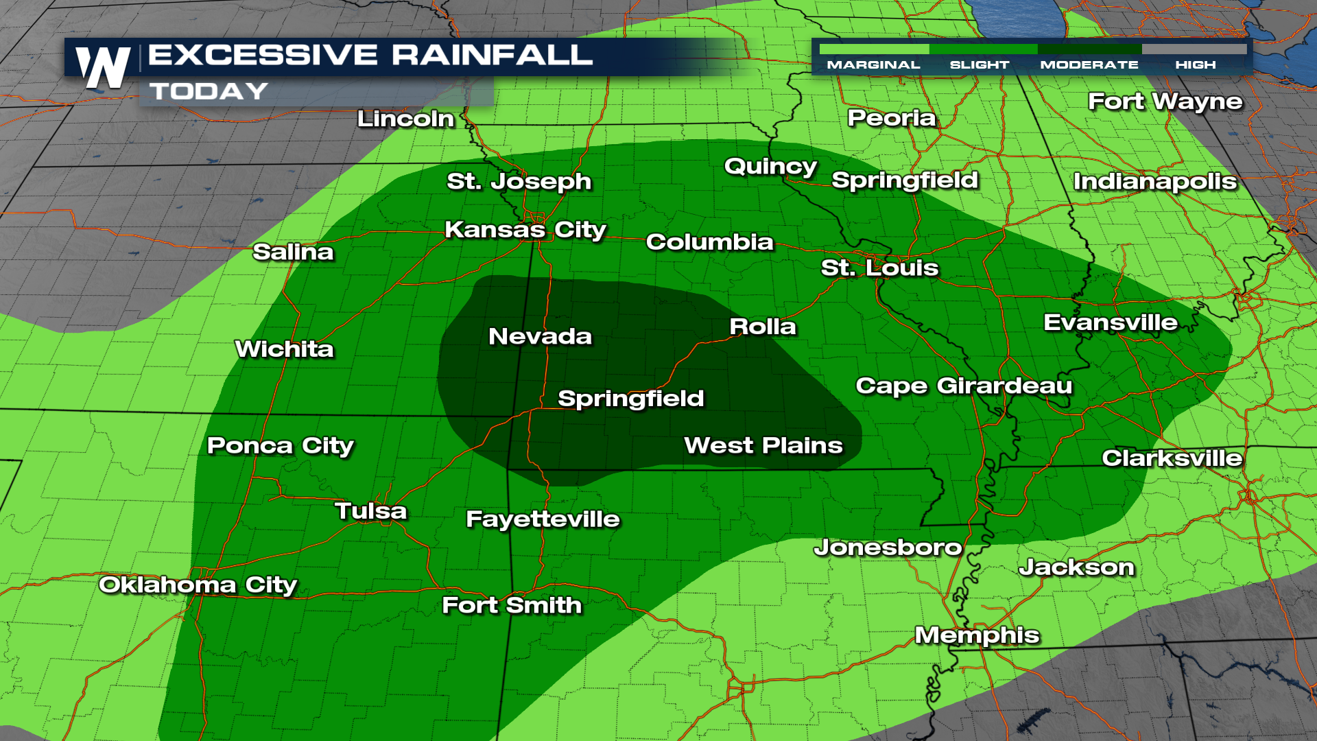
Flood Threat
Intense precipitation rates are expected in Saturdays storms, producing rainfall rates of 1-2" per hour. Soils in these areas are already saturated from storms earlier in the week, which will allow for flooding to develop more quickly.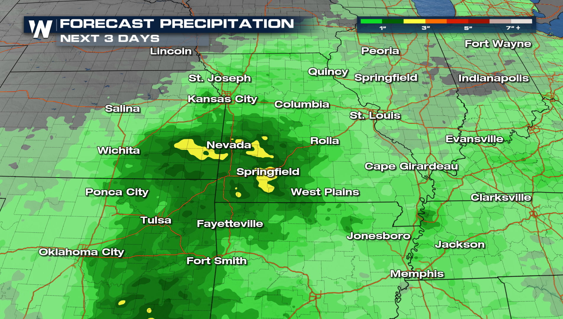
The WPC has issued a MODERATE (level 3 out of 4) excessive rainfall outlook for parts of Missouri and Kansas, meaning numerous flash flood incidents are expected. Flash flooding could be significant in these areas, meaning water could be high enough to enter homes and businesses.