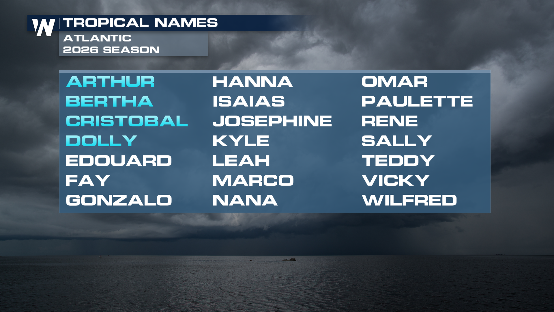
BREAKING: Dolly Forms in the Atlantic

Tropical Storm Dolly has formed in the Atlantic. Former Invest 96-L was able to create a clearly defined center of circulation Thursday morning with robust convection. The two primary global forecast models agree on it moving through the MDR (main development region of the Atlantic) into the weekend. It will likely stay around tropical storm strength for much of its life cycle. Though the waters of the Atlantic are warm, there is a considerable amount of shear working against Dolly's strengthening. It will likely move through the Northern Lesser Antilles, Virgin Islands and Puerto Rico.
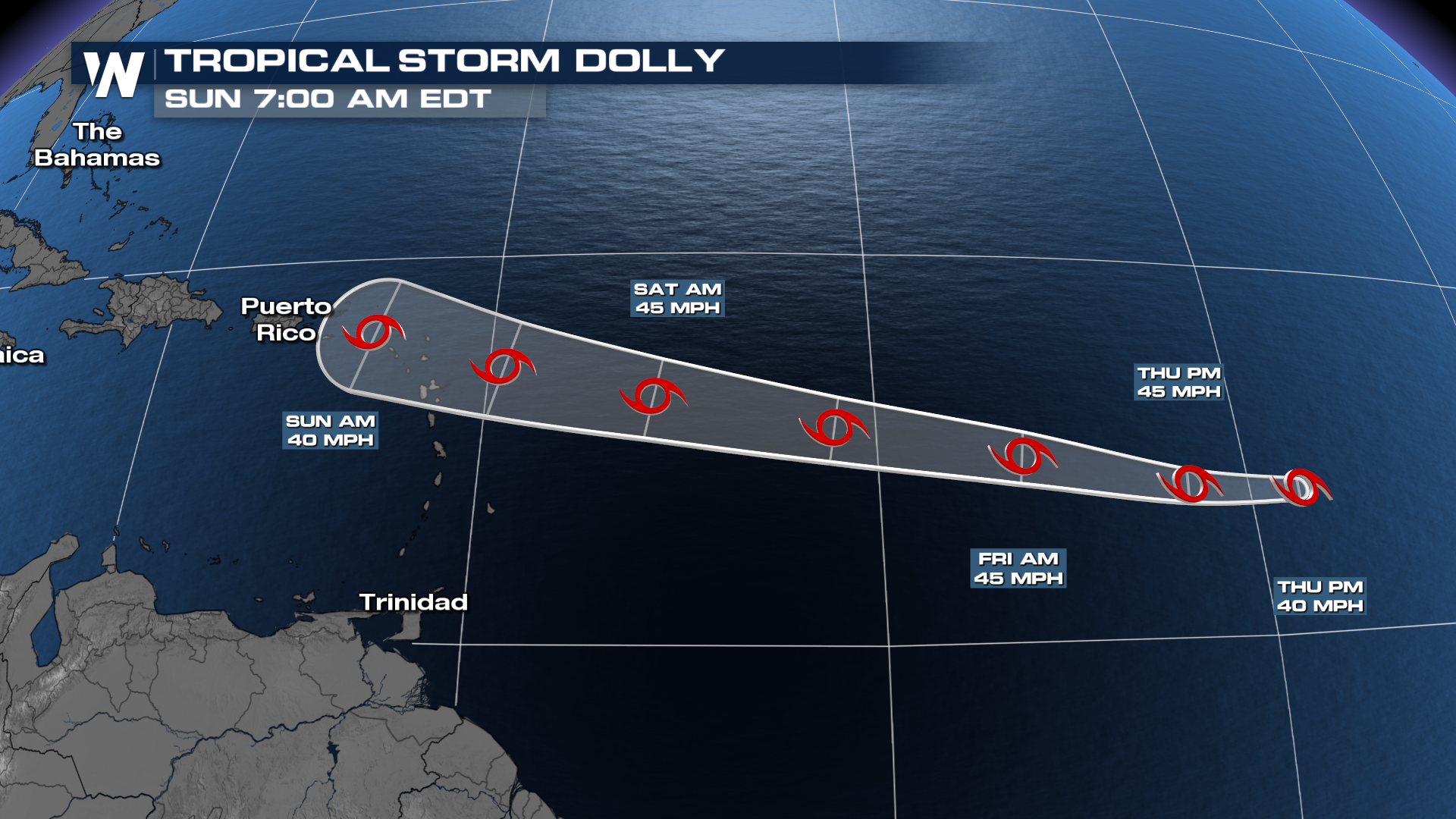
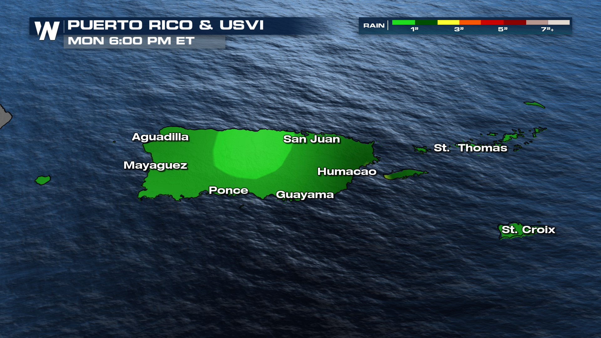
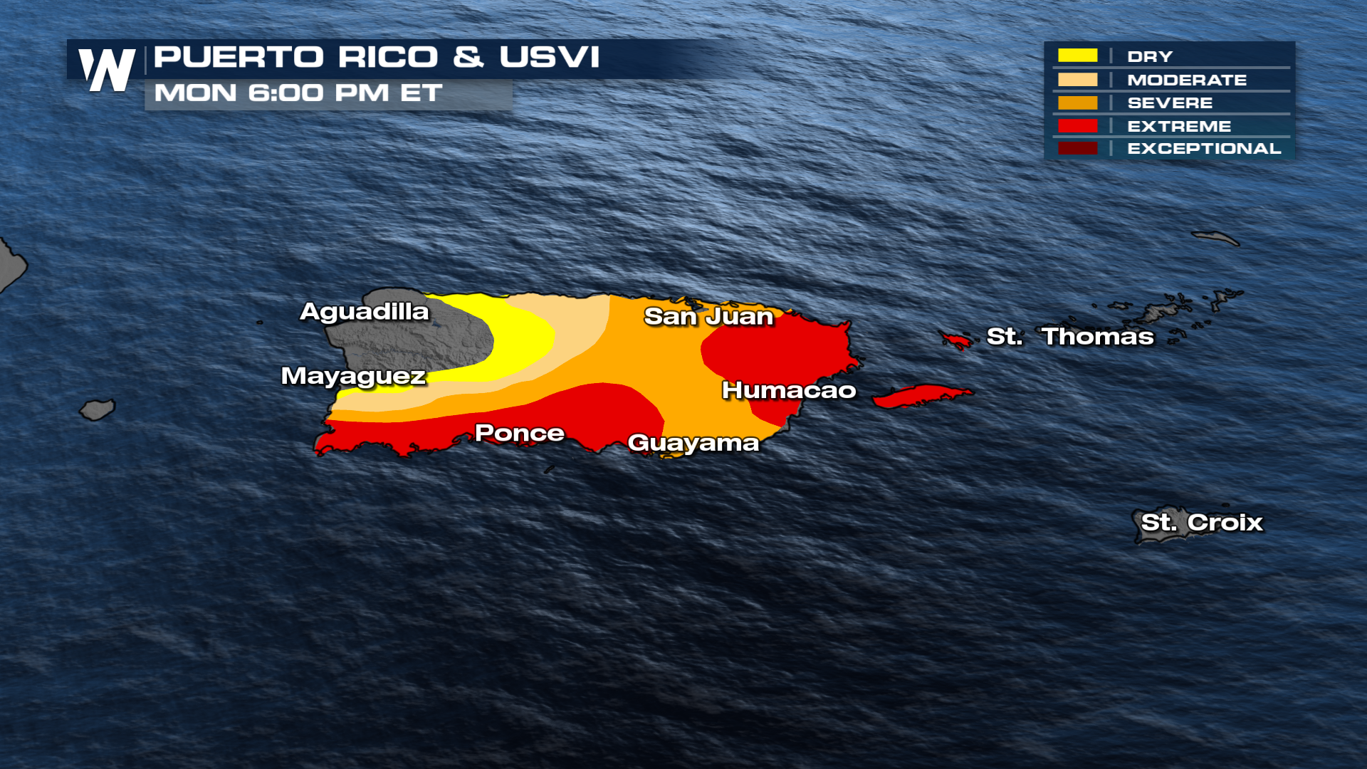
Puerto Rico has seen dire drought conditions and is in desperate need of rain. Hopefully, we can see some decent rainfall out of Dolly for them, without the strong, damaging winds. Still, with dry ground and hilly terrain, flash flooding will be a threat. Interests in the Lesser Antilles, Virgin Islands and Puerto Rico should stay updated on the forecast in the coming days.
 El Niño has been smothering tropical waves in the Atlantic this summer, with three named storms to date but only 16% of average cyclone energy! This doesn't mean the rest of the season will be just as quiet, however, as 66% of all hurricane activity in the Atlantic occurs between August 20th and October 10th. The climatological peak of Atlantic Hurricane Season is September 10.