Blizzards & Ice Storms In The Western U.S.

Power outages are mountain across the state of Oregon as heavy freezing rain and snow accumulate. A combination of Arctic air and an atmospheric river is producing heavy, wintry accumulation all the way down to sea level elevation!
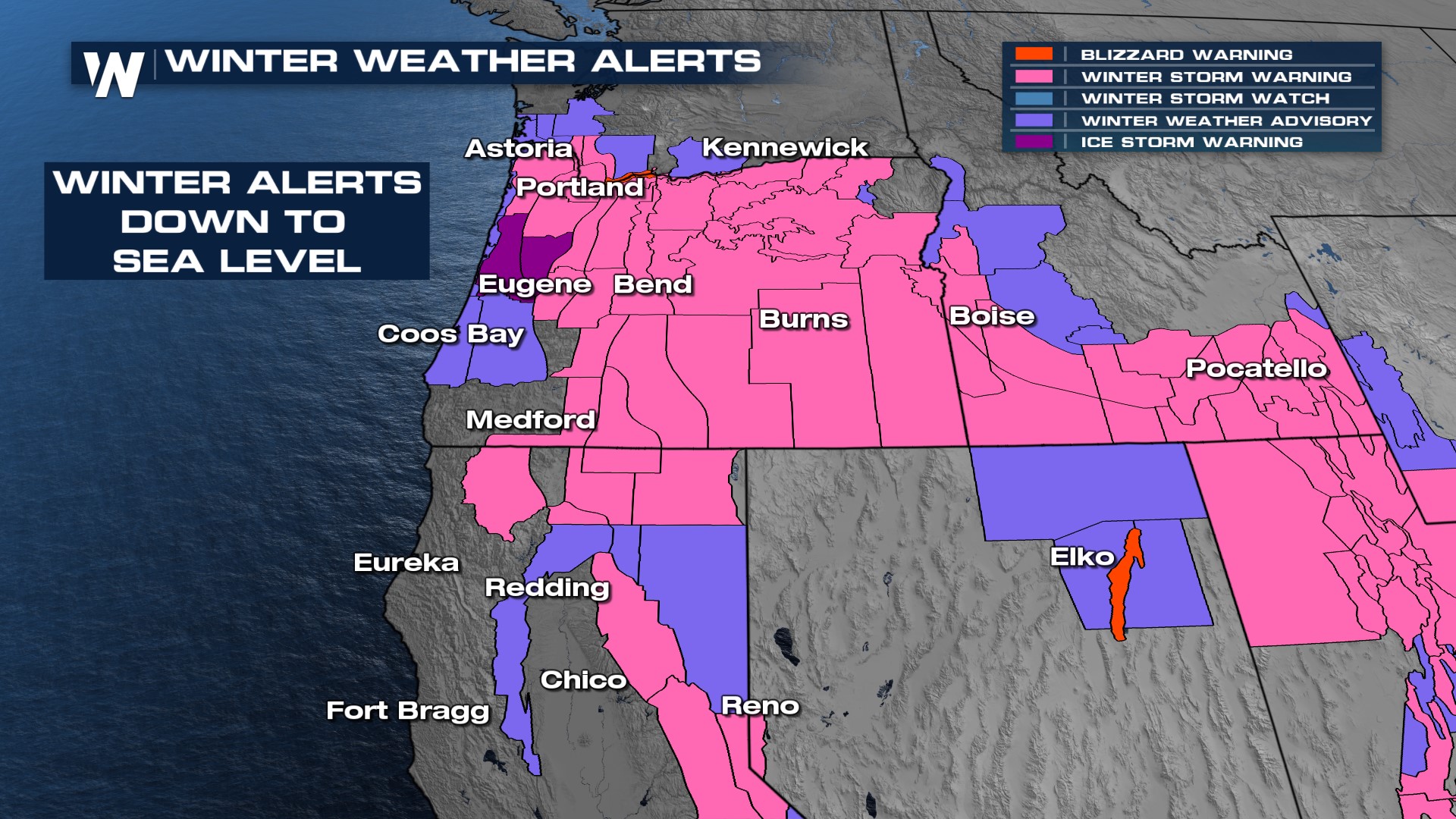 Yes ice can pile up across Oregon, but it takes a certain weather setup. We're in that setup now. Cold, Arctic air has invaded the west and drained down the Columbia River Valley into the Willamette Valley. As a result, cold surface temperatures are allowing for ice to accumulate south of Portland, Oregon and in/around Eugene, OR. This will make travel impossible and create widespread power outages that could last for an extended period of time.
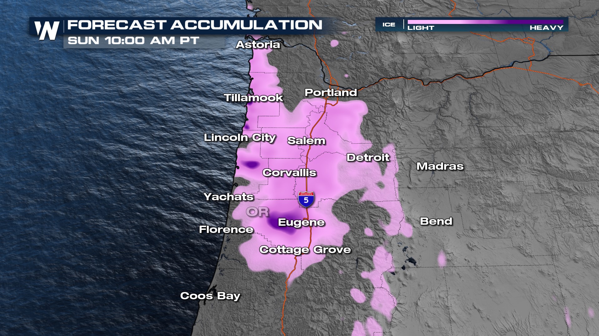 This is all associated with an atmospheric river that will push across the Great Basin and into the Four Corners. Expect lots of wind, whiteout conditions, falling temperatures, and true winter conditions to continue this holiday weekend. The immediate shoreline and West coast will dry out and clear up on Sunday, however it won't be until Monday that the precipitation will end in the Four Corners.
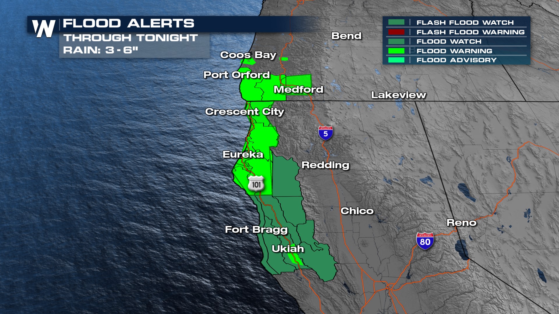
Heavy rain will also be possible along the immediate coastline with 3-5" of rainfall. This will likely cause localized flood concerns for coastal communities. Flood alerts are in effect from coastal Oregon south to Ukiah outside of San Francisco.
 This weather system could close roadways and make road travel impossible across parts of the West. Plan appropriately if you're going to be venturing out!


