Storms With Hail & Tornado Threat Continue for the Front Range

We have seen a rinse-and-repeat pattern as of late along the Front Range with daily strong to severe storms. Hail has been a big player, with hailstones as big as baseballs and teacups reported Saturday across Colorado.
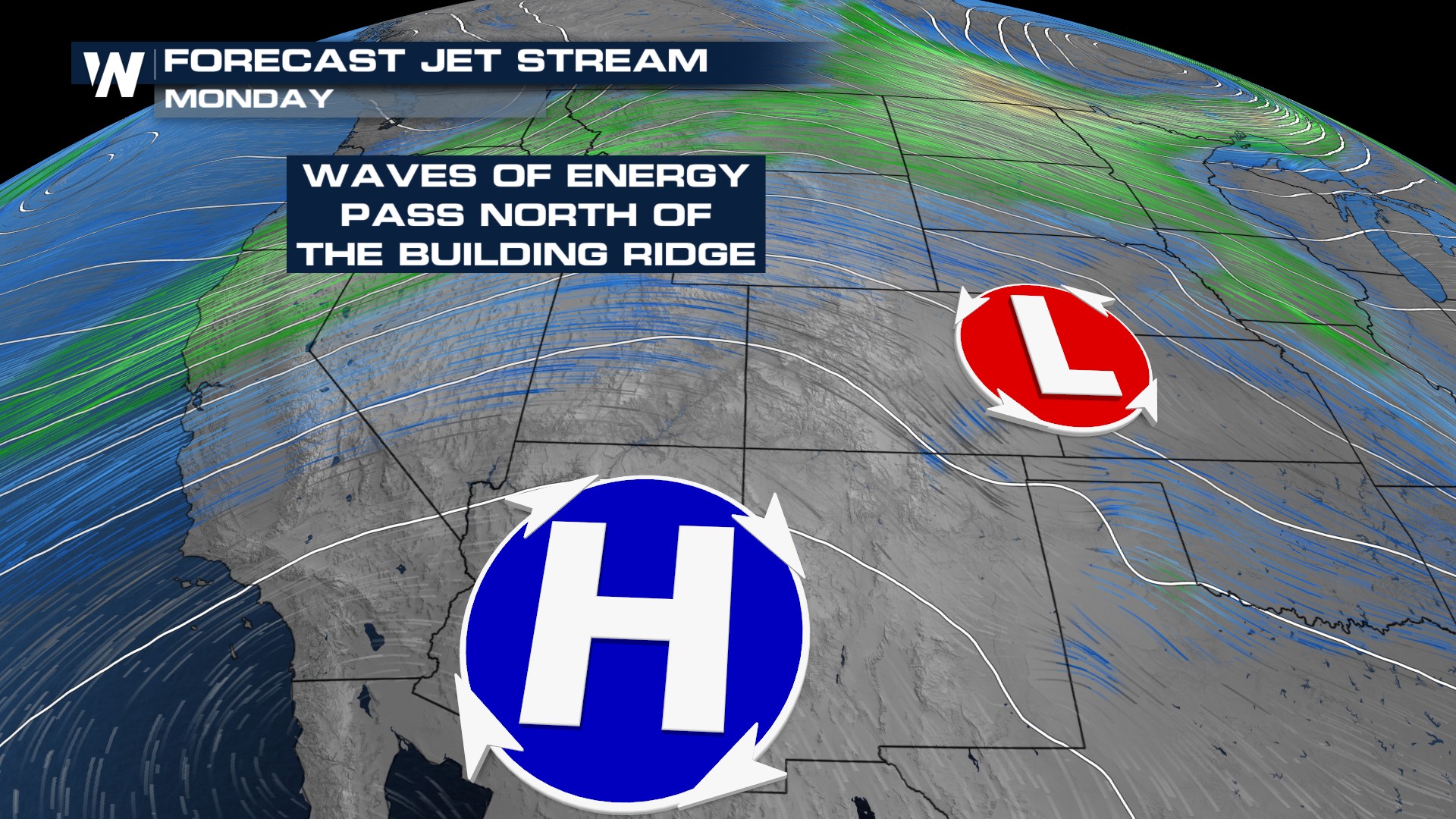 Jet stream energy will linger over the Colorado Rockies Saturday night before weakening Sunday. This will reduce the coverage of storms before a quickly moving low-pressure system increases the risk again on Monday.
TONIGHT
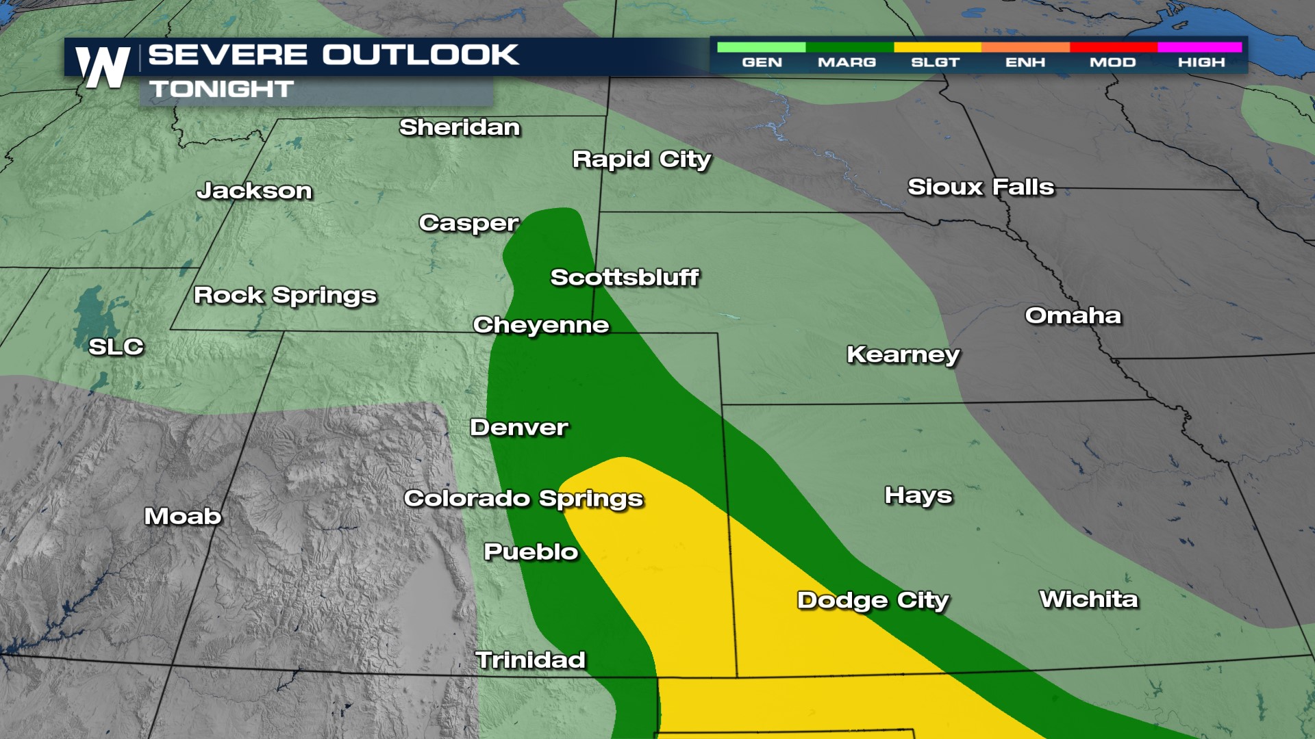
This evening, an elevated risk for hail and damaging wind is expected, though a tornado or two will still be possible. We also have the potential for damaging hail east of I-25 in southern Colorado.
Monday
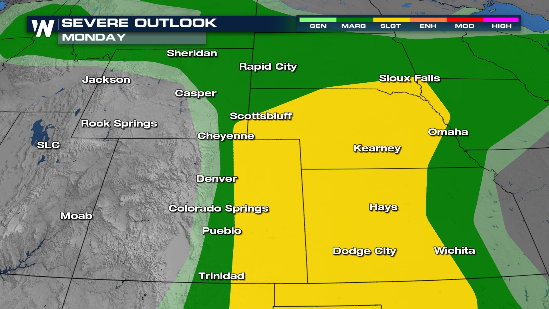
Strong storms will increase in coverage on Monday once again as a low-pressure system moves off the Rockies. The I-25 corridor could see isolated severe storms, but they are more likely farther east into the Plains.
Forecast
Storms continue overnight, moving into Kansas continuing the severe threat. Sunday will be a much drier day with fewer storms, but there is still enough energy for a rogue severe storm or two in the afternoon. Monday looks more active east of I-25, primarily in the afternoon.
To stay up-to-date with the Central and Western regional forecasts, tune in at :30 and :50 after the hour!


