Lingering Storms & Flash Flooding on the East Coast

A slow-moving cold front remains the focus for strong storms today from the Mid-Atlantic and into the Northeast. Damaging winds will be the primary risk, but an isolated waterspout over the Atlantic waters can't be ruled out. A Marginal Risk of severe storms has been issued from the Storm Prediction Center this evening through early Wednesday morning. This means a risk for isolated severe storms will be there, but not everyone will see a severe storm.
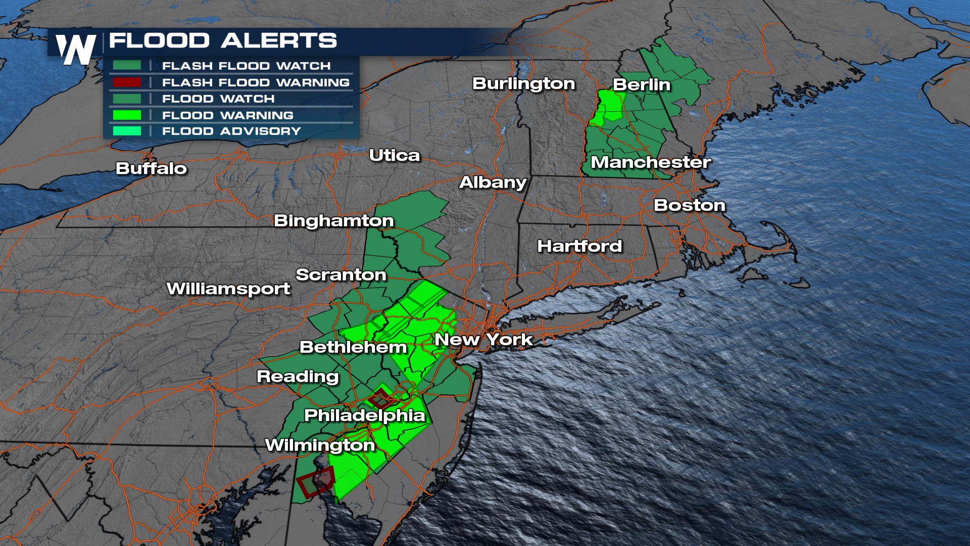
Saturated grounds with all the heavy rain will also contribute to a risk of flash flooding. The highest threat for flooding will be across eastern Pennsylvania and western New Jersey where there is a flood watch in effect, but there are also flood watches in northern New England.
 Stay with WeatherNation for the latest updates on the storms throughout the day!


