Great Lakes Severe Threat Overnight

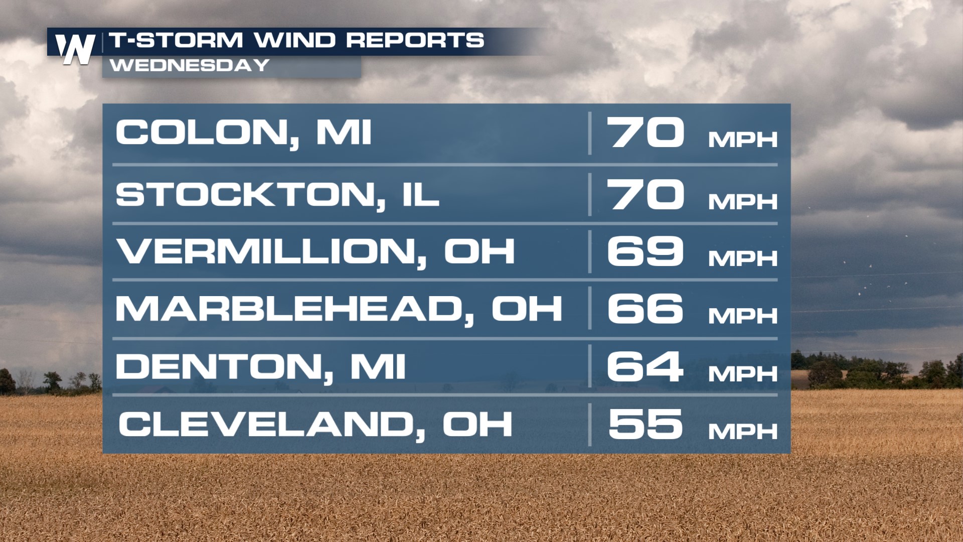
A couple rounds of thunderstorms rumbled through the Great Lakes on Wednesday with additional strong to severe thunderstorms shifting east of Lake Erie expected overnight. Gusty winds, hail, and even an isolated tornado will remain possible. Some of our strongest winds got up to 70 mph in some spots.
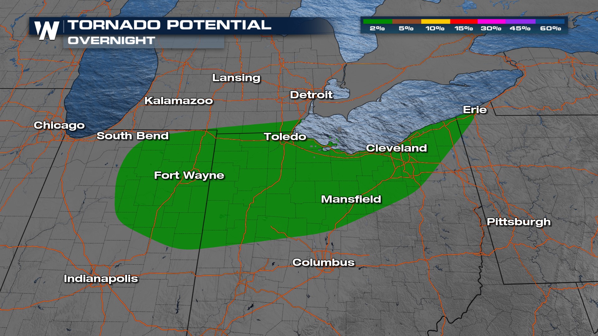
The Storm Prediction Center maintains a SLIGHT (level 2 out of 5) risk for some folks along the eastern shores of Lake Erie as additional thunderstorms are expected to move through. This includes a more isolated tornado threat overnight, but it is non-zero so be sure to have multiple ways of receiving severe weather alerts.

Strong and severe thunderstorms have been moving across the Great Lakes region and will continue to do so overnight. Check in on family and friends in these areas and make sure they are weather aware of what could be on the way. It's also a good idea to have multiple ways to get alerts as these severe storms pass through.
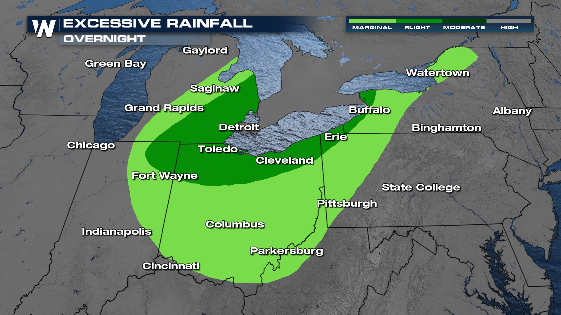
The Weather Prediction Center has kept a SLIGHT risk for flash flooding across Great Lakes cities including Detroit, Toledo, and Buffalo. Watch out for flooded roadways and never drive through them. "Turn around, don't drown." We say it a lot on WeatherNation, but there is a reason why!

The latest severe weather forecast can be found in your Central Regional Forecast, always :30 past the hour.


