Severe Threat Slices South Yet Again
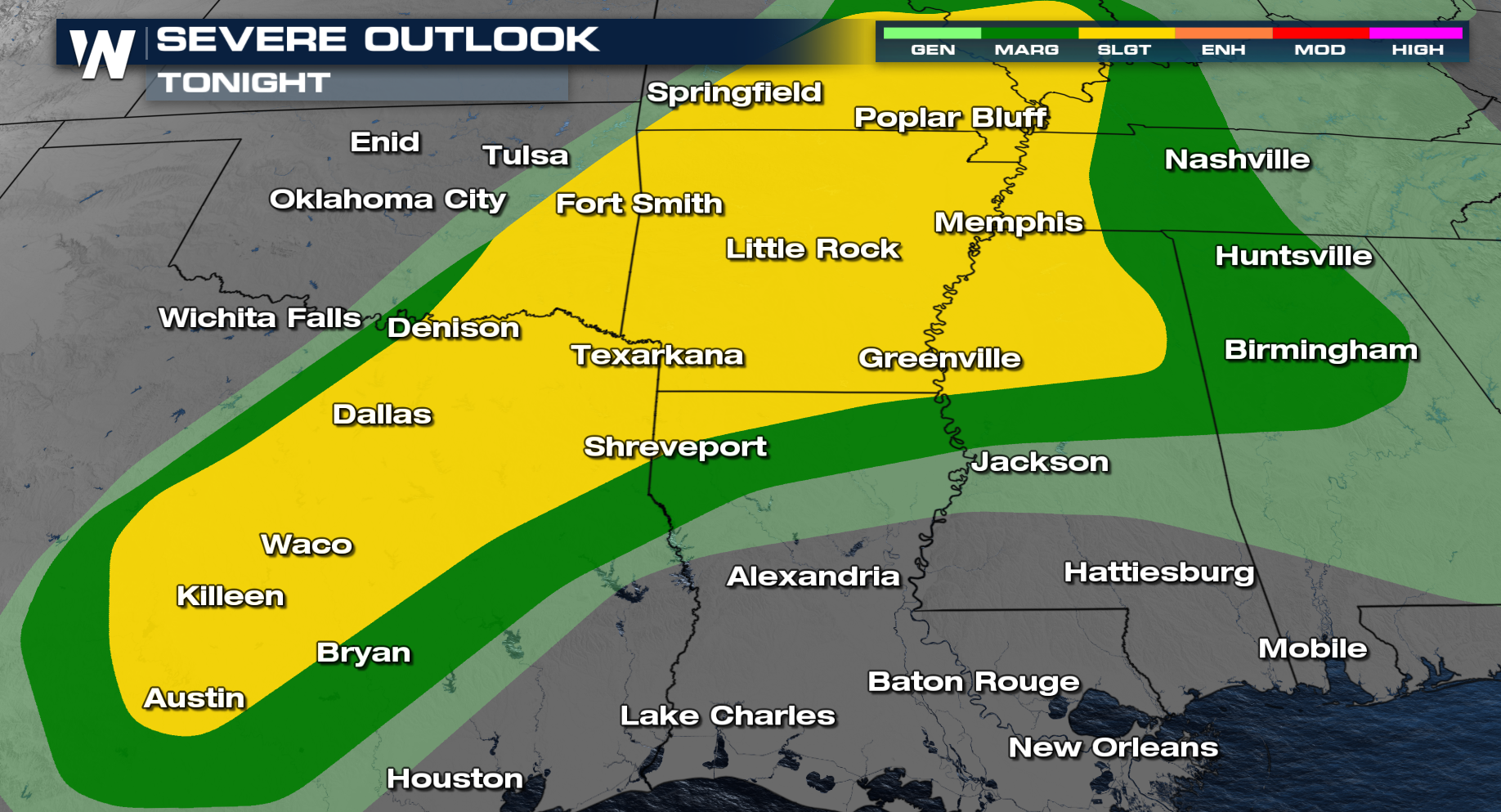
The severe threat continues again Friday night in the storm-weary South. On Wednesday, a confirmed tornado touchdown in Temple, Texas, along Interstate 35 between Dallas and Austin. NWS Fort Worth gave this tornado a preliminary rating of EF-2 as the survey continued. Thursday, tornado warnings that were confirmed west of Altus, OK, and east of Waco, TX did some damage with slow storm movement. We will be awaiting storm surveys from these storms.
Tonight, we will see more thunderstorms firing up along a stalled boundary draped across the South. Thunderstorms tonight already produced a softball report of 4.00" in diameter in Arkansas. You would think since we have lost the best heating of the day storms would quickly die off. Tonight is not the case as plenty of energy, heat, and humidity continues for storms to maintain their strength even towards daybreak on Saturday.

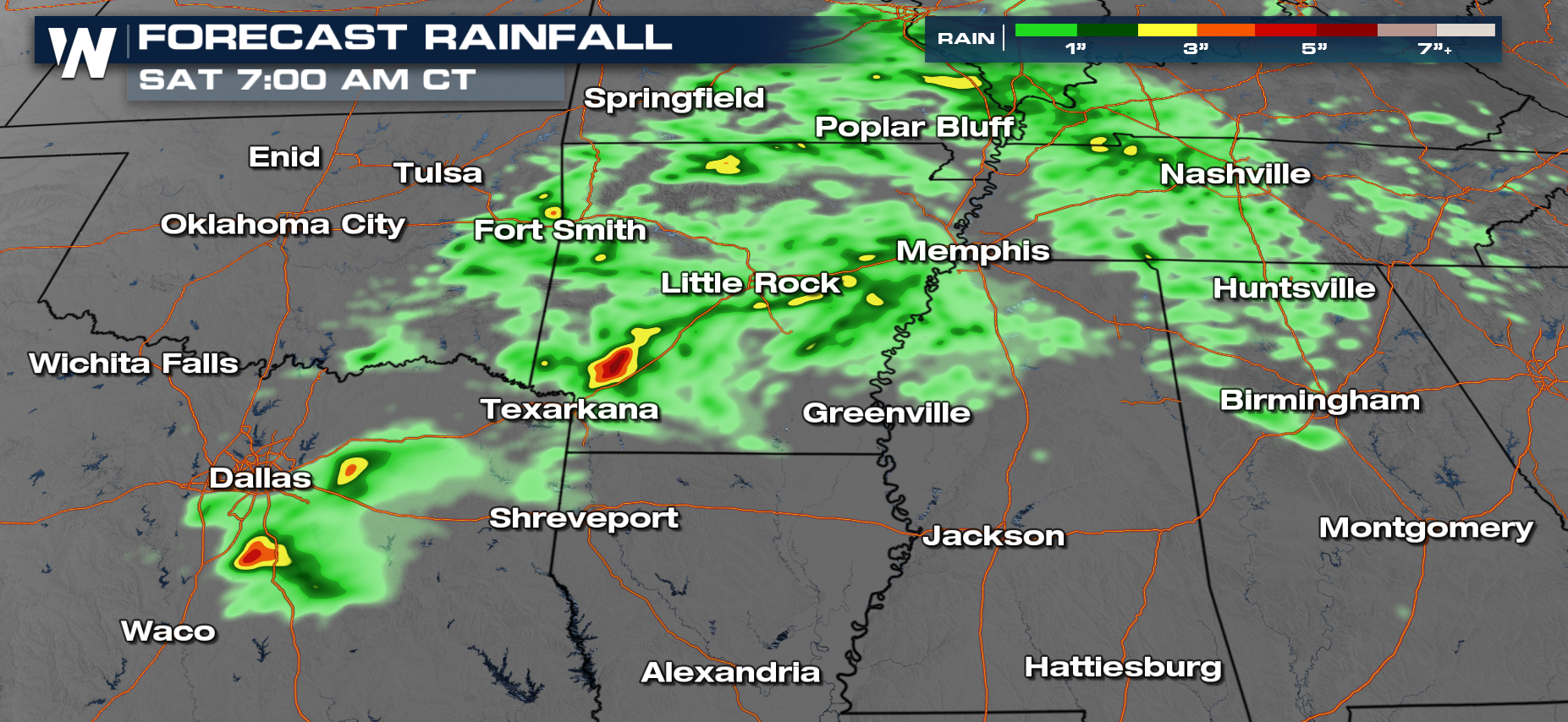
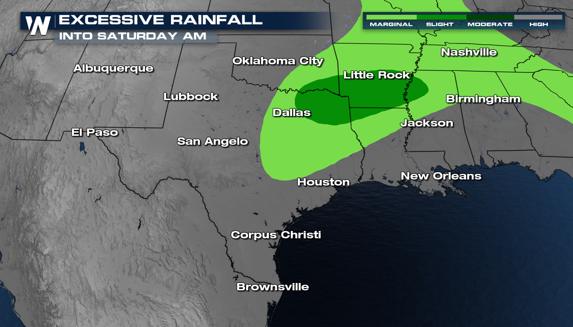
Areas of heavy rain will also be possible. Parts of Texas and Arkansas could see some isolated flash flooding.


Continue to stay with us here at WeatherNation as we bring you the very latest regarding this developing situation!