Severe Threat from St. Louis to West Texas

news image
Top Stories
6 Sep 2023 10:40 AM

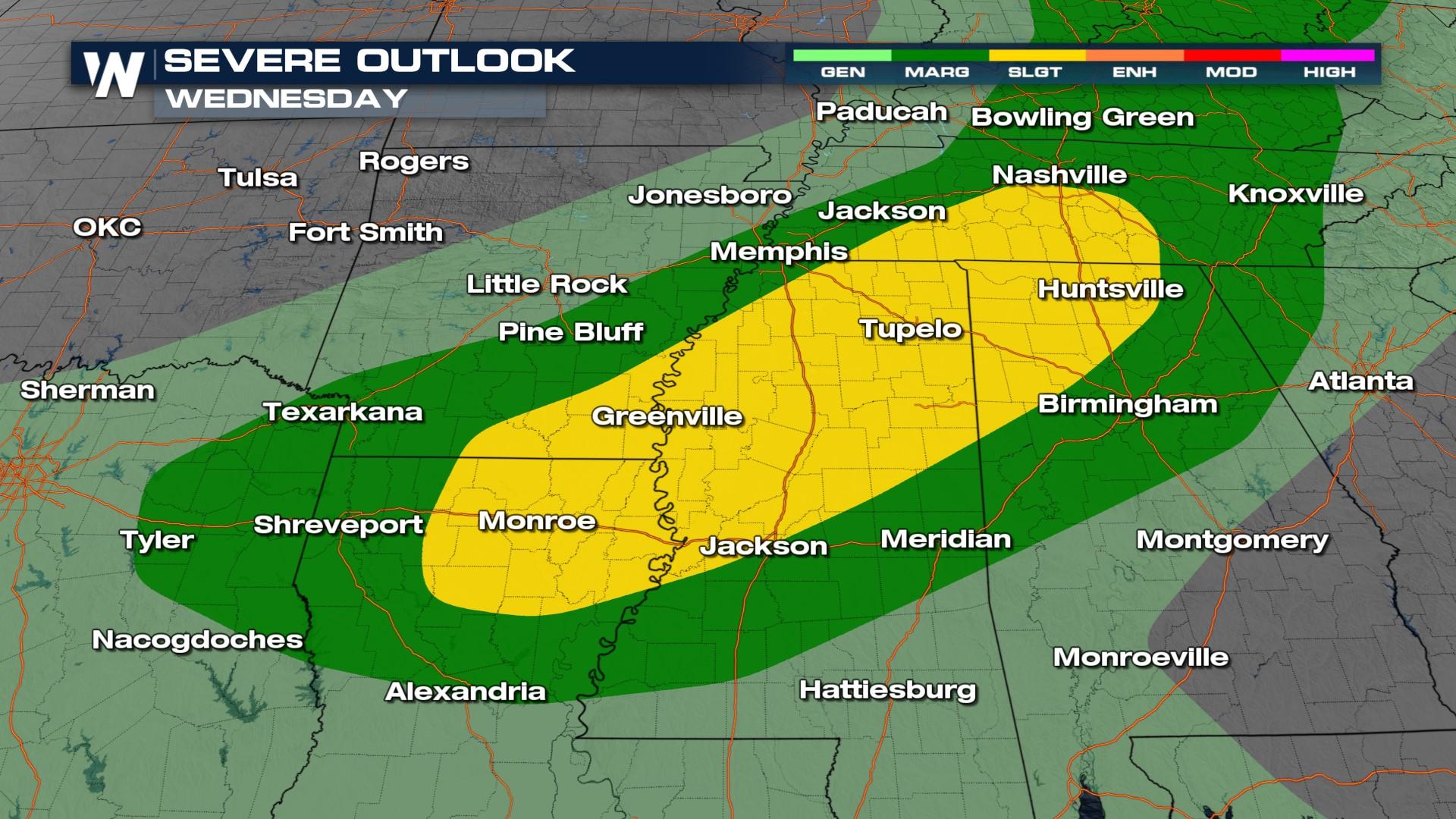
Storms produced large hail and damaging winds from Missouri through Texas on Tuesday. The front acting to trigger those storms is heading south with more sever weather possible Wednesday from from the Tennessee River Valley to East Texas (above). Our primary threat will be for damaging winds once again Wednesday afternoon and evening.

Storms look most active in the afternoon with peak daytime heating, but Thursday night and Friday morning could see storms continue overnight closer to I-10 on Thursday and with another complex of storms in Arkansas.

The severe threat continues again on Thursday, back into Arkansas with wind and hail possible once again as another frontal boundary arrives in the region. Storms will be likely through central and southern MS/AL but they will be sub-severe.

All Weather News
More
Historic Snow Leaves Slick Roads into Monday

Historic Snow Leaves Slick Roads into Monday

While the snow has ended, the slippery travel

2 Feb 2026 11:20 PM
Feeling More Like Summer Out West

Feeling More Like Summer Out West

Record high temperatures were shattered to st

2 Feb 2026 11:00 PM
Customers Still Remain Without Power

Customers Still Remain Without Power

While it has now been about a week since a ma

2 Feb 2026 10:20 PM
Gulf-Effect Snow Possible This Weekend

Gulf-Effect Snow Possible This Weekend

You've been warned, iguanas. We've had glanci

1 Feb 2026 6:00 PM
Rain Finally Makes a Return to the Northwest

Rain Finally Makes a Return to the Northwest

More precipitation is in the forecast across

1 Feb 2026 11:00 AM
Lake-Effect Snow Continues, Shifts Toward Chicago This Weekend

Lake-Effect Snow Continues, Shifts Toward Chicago This Weekend

Persistent bursts of cold air have continued

31 Jan 2026 3:00 AM
Thousands Without Power as another Systems Brews

Thousands Without Power as another Systems Brews

ABOVE - Up to one inch of ice accumulated acr

29 Jan 2026 12:30 PM