A Look at the Severe Weather Forecast to Start This Week
Special Stories
20 Aug 2018 10:26 AM
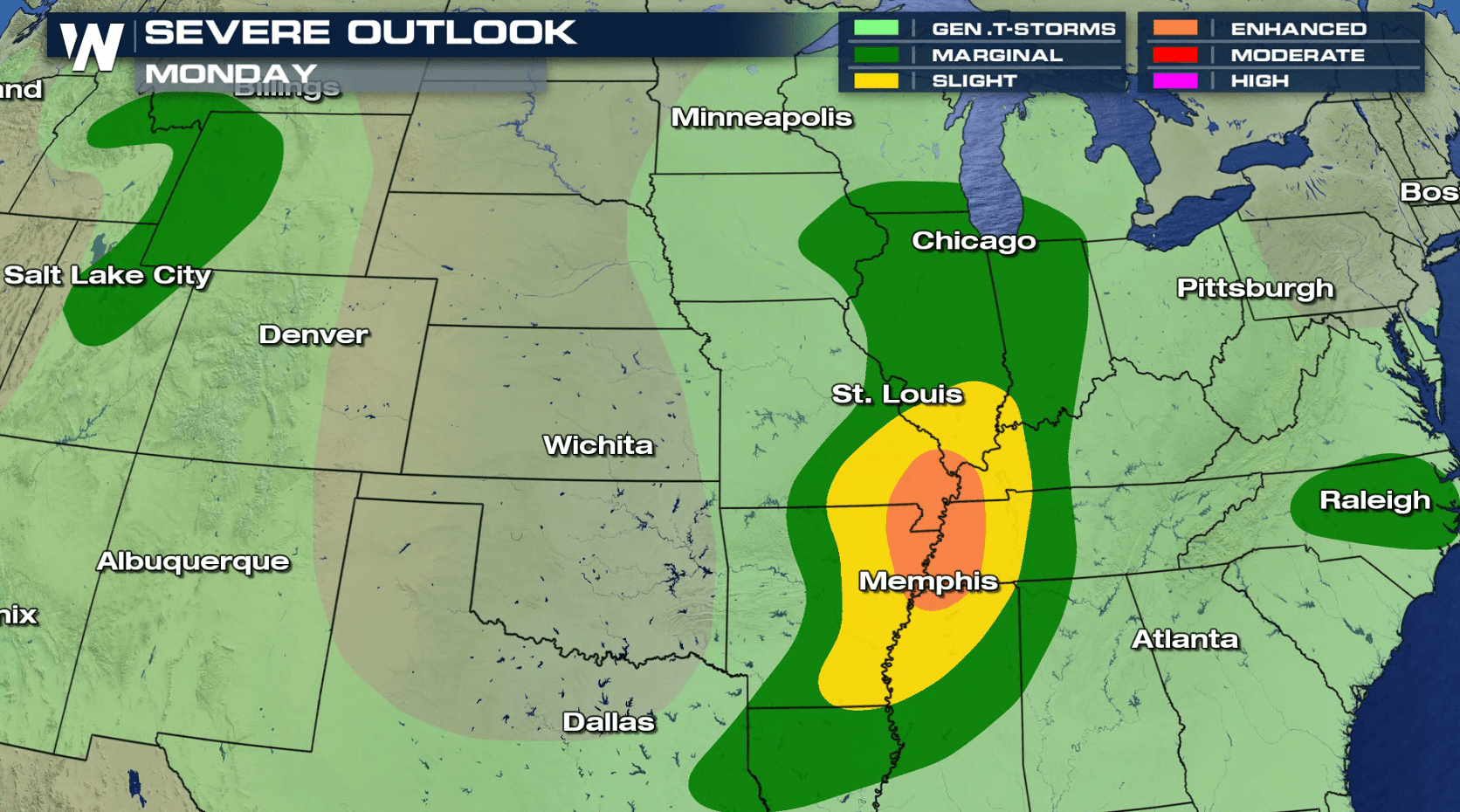
After a quiet week last week, a more active pattern for severe thunderstorms is likely this week. For today (Monday), there is a risk for severe thunderstorms in the southern Great Lakes southward along the Mississippi River. Smaller risk areas are located in the Northwest and Middle Atlantic. Strong wind gusts and large hail are the biggest threats, with a low risk for a tornado.
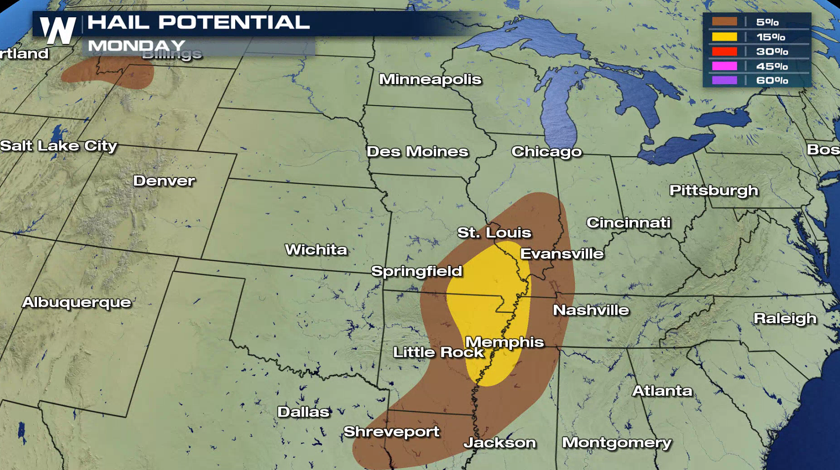
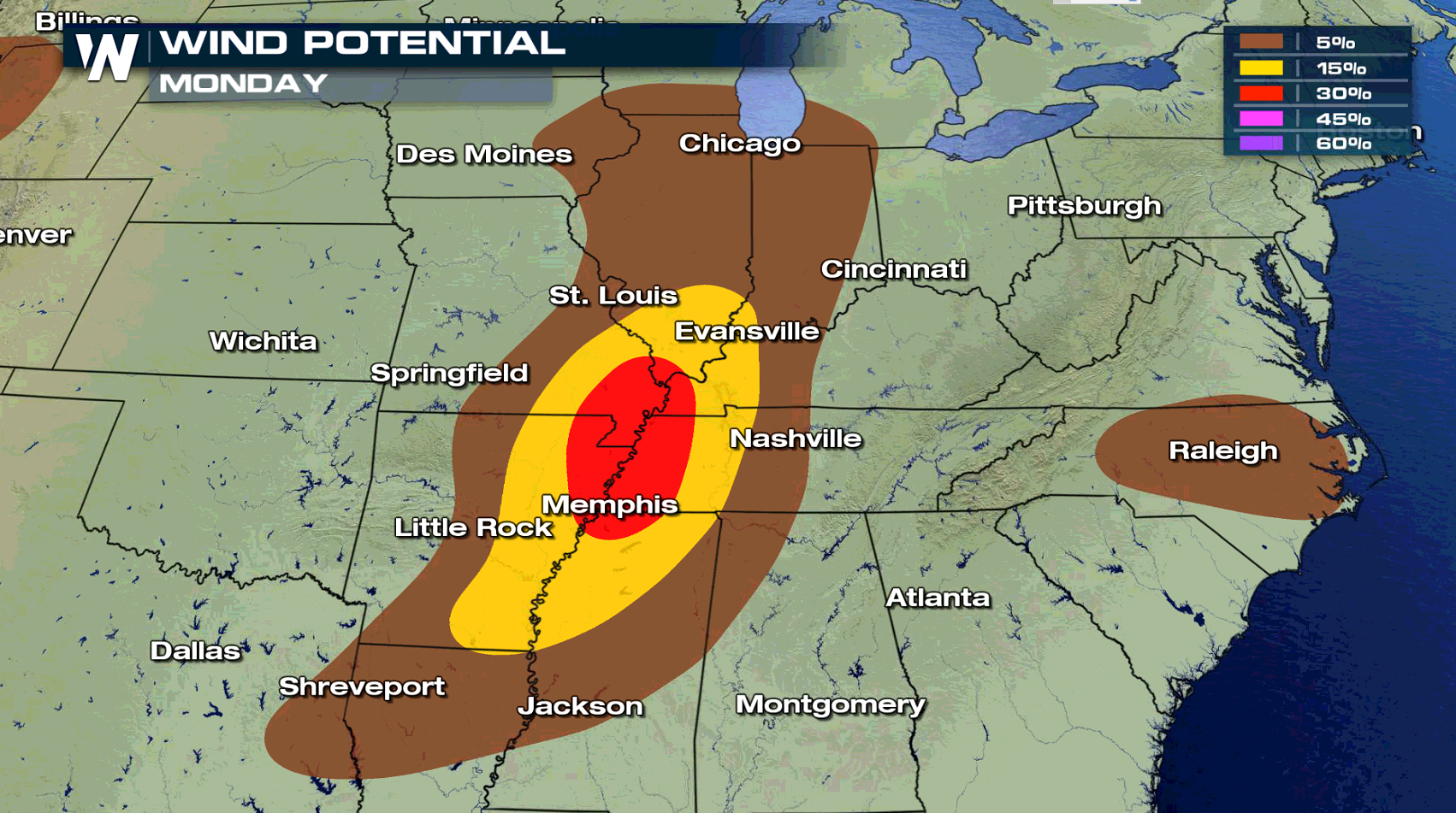
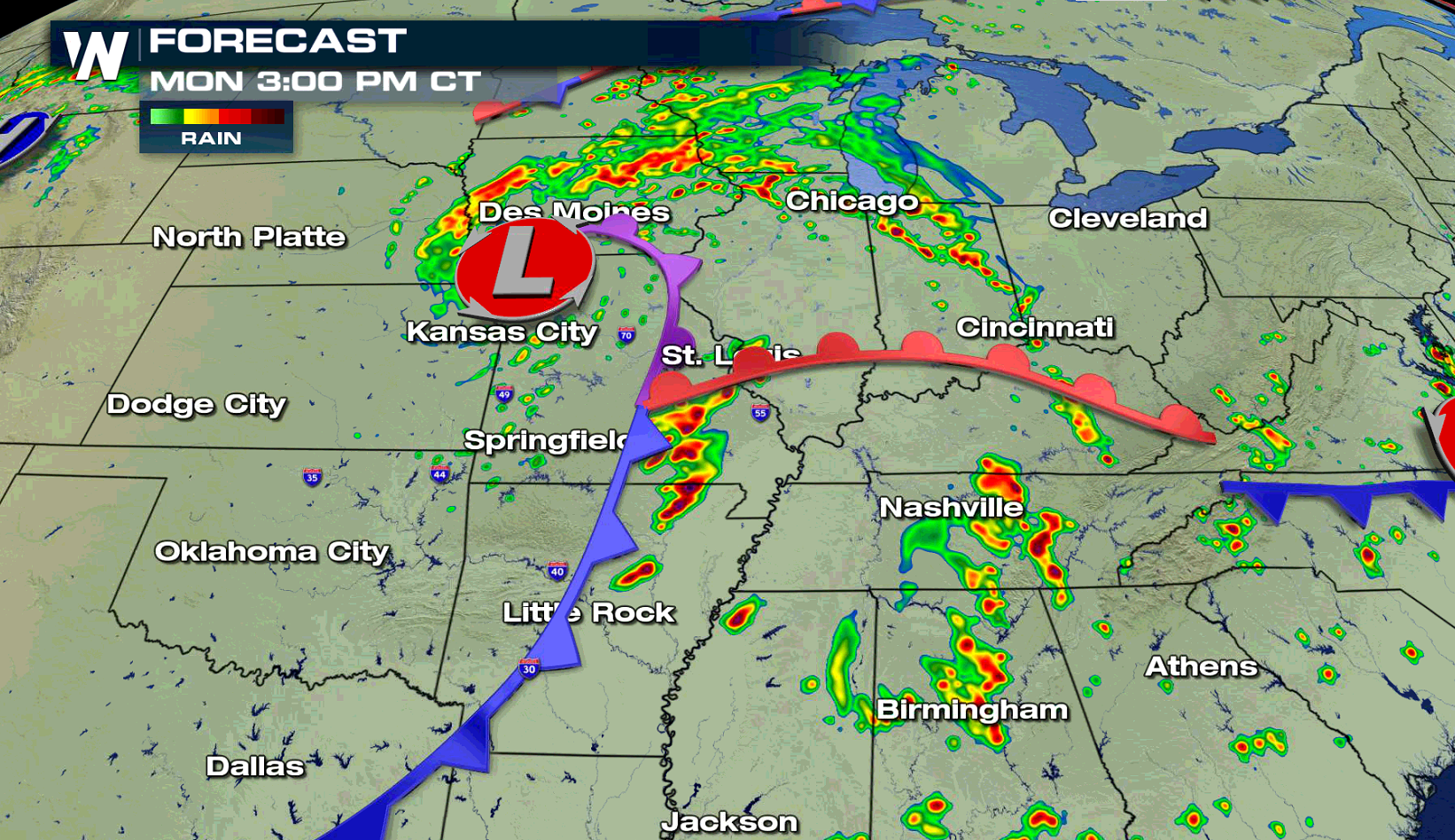
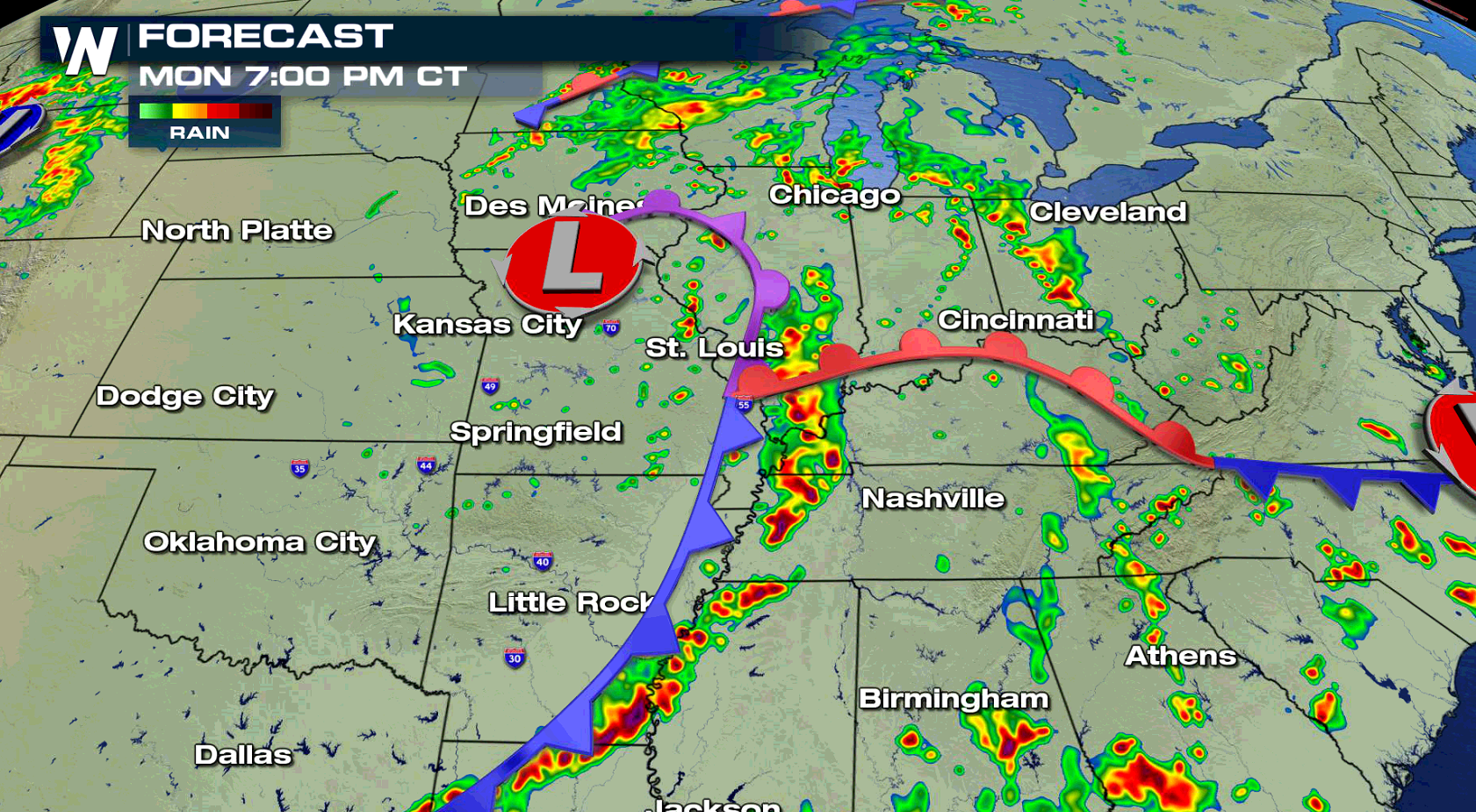
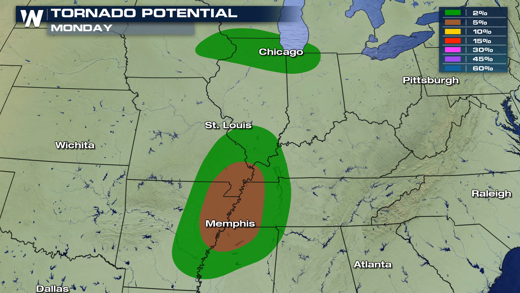 Severe thunderstorms are likely near a low pressure center and along a cold front. Areas from the central Plains into the Mississippi Valley will be the most active. Development will be in the late afternoon, with storms continuing into the evening.
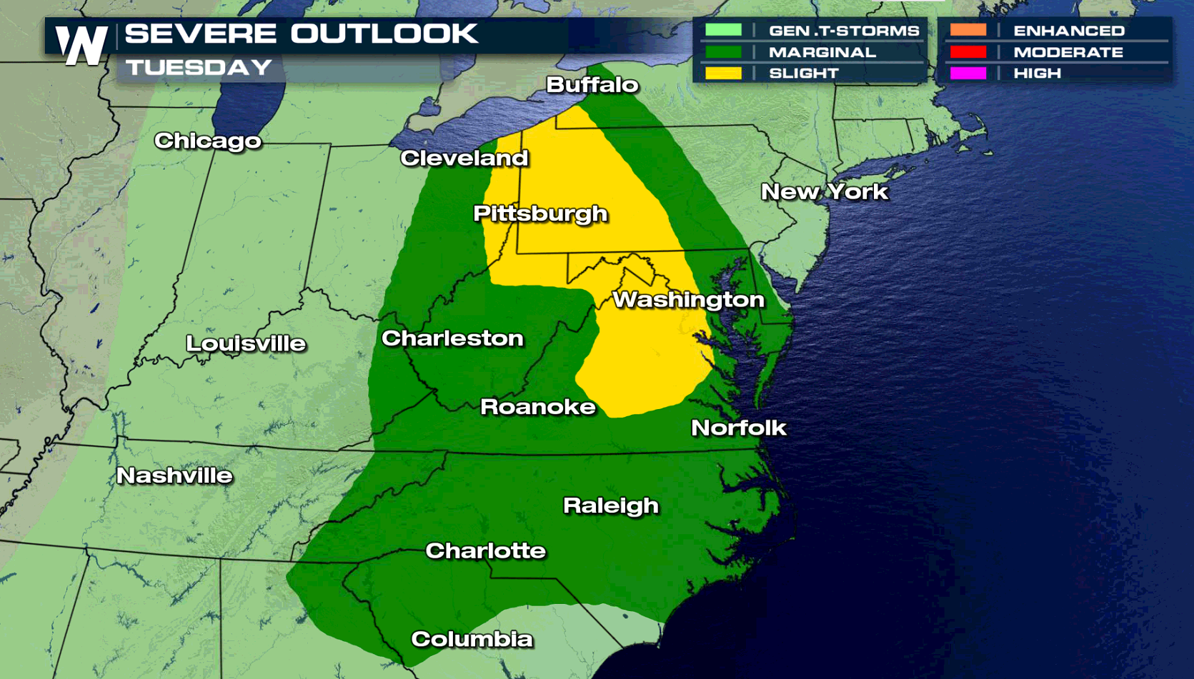
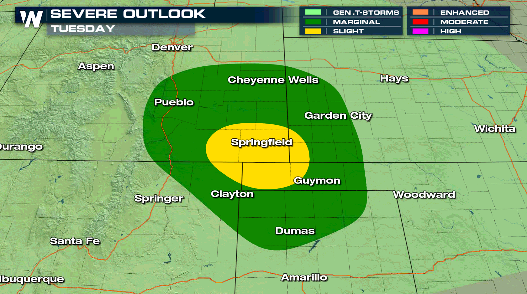
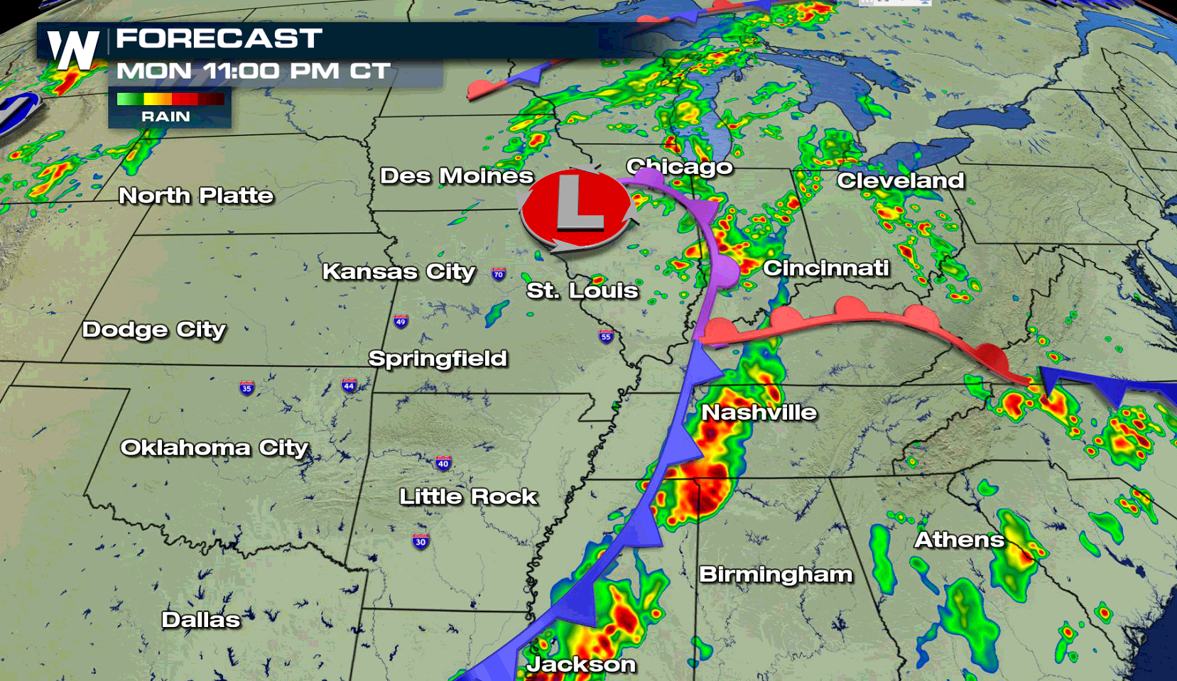 As the storm system shifts to the east, the severe weather threat moves to the eastern Great Lakes southward to Chesapeake Bay. A small area in the southern Plains may also see severe thunderstorms on Tuesday.
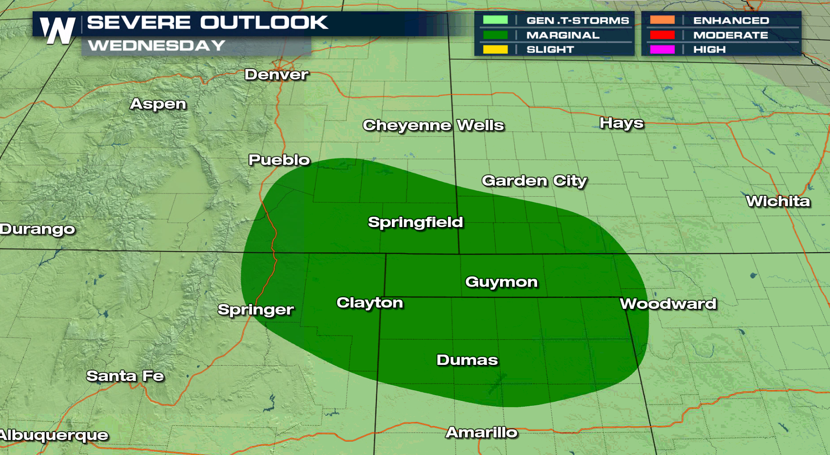
 On Wednesday, there is a lesser chance for severe storms in the southern Plains, but a storm system moving into the northern Plains may produce severe weather Thursday.
 For WeatherNation: Meteorologist Mace Michaels
Severe thunderstorms are likely near a low pressure center and along a cold front. Areas from the central Plains into the Mississippi Valley will be the most active. Development will be in the late afternoon, with storms continuing into the evening.
As the storm system shifts to the east, the severe weather threat moves to the eastern Great Lakes southward to Chesapeake Bay. A small area in the southern Plains may also see severe thunderstorms on Tuesday.
On Wednesday, there is a lesser chance for severe storms in the southern Plains, but a storm system moving into the northern Plains may produce severe weather Thursday.
For WeatherNation: Meteorologist Mace MichaelsAll Weather News
More
Wildfire Outbreak in the Pacific Northwest
Conditions have been incredibly dry out west.
2 Aug 2026 1:30 PM

After Reaching Category 5, Genevieve Weakens in the Pacific
PacificGenevieve formed on last Friday south
2 Aug 2026 1:25 PM

More Storms for the East Sunday and Monday
A low-pressure system crashing through the Mi
2 Aug 2026 1:25 PM


Flooding, Severe Storms Target the Midwest Again
After an active week of storms across the nor
1 Aug 2026 1:40 AM

Flooding Risk Increases as Heavy Rain Targets the Tri-State Area
Tuesday, heavy rainfall moved across the Nort
30 Jul 2026 12:25 AM

Severe Weather: Energy From the Midwest Now in the Southeast
UPPER MIDWEST - Through Monday, dangerous tor
29 Jul 2026 10:30 PM