Chantal Weakens After Making Landfall Sunday Morning

Top Stories
7 Jul 2025 4:50 PM
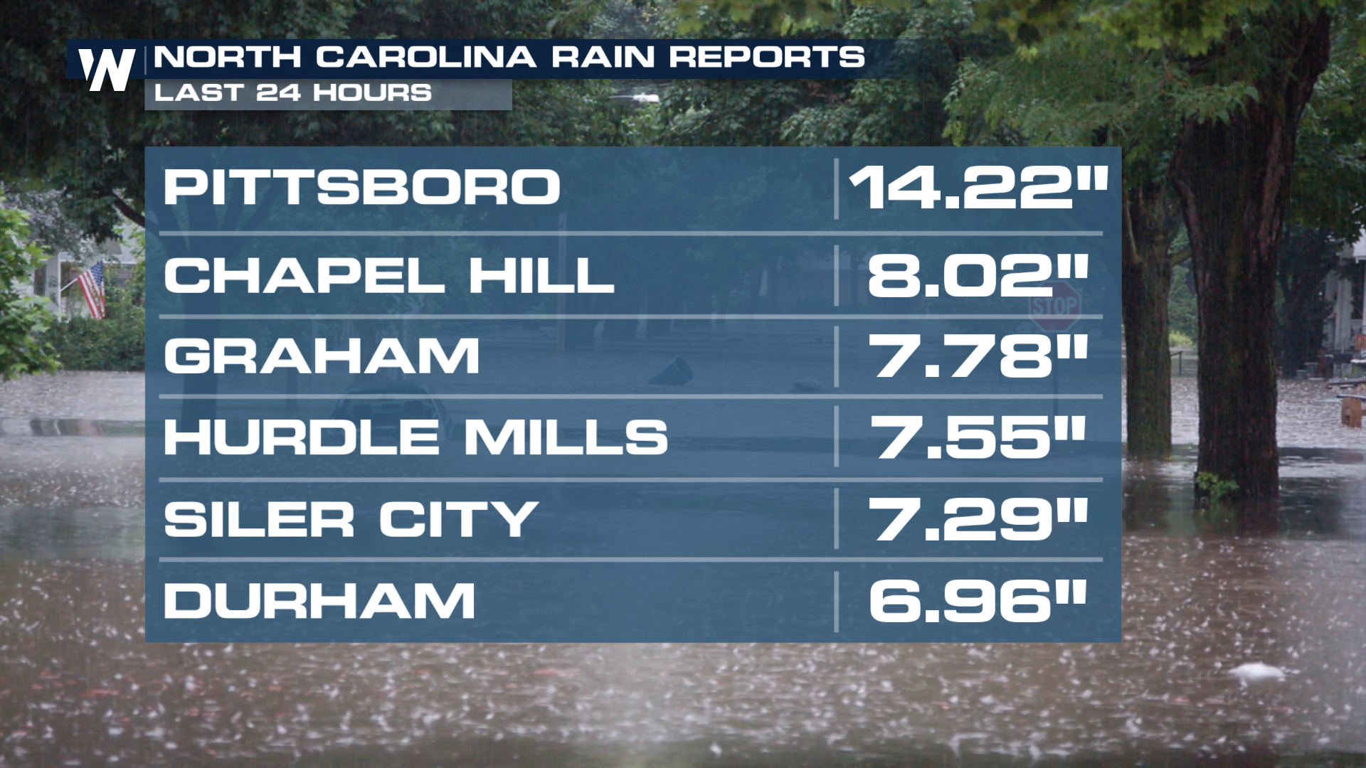
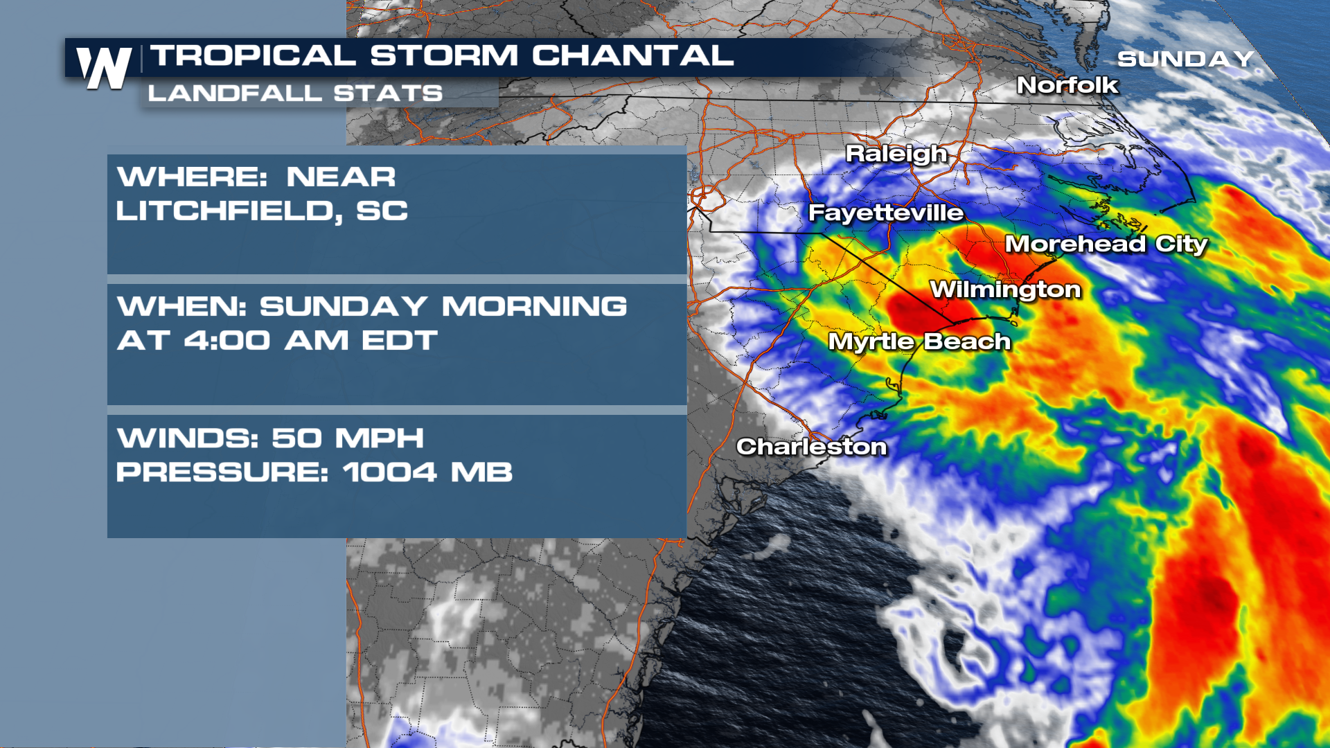
Tropical Storm Chantal formed Saturday morning and made landfall early Sunday morning with sustained winds of 50 mph. Winds have knocked down some palm fronds and lead to a foot or two of storm surge so far. Chantal turned into an inland flooding threat, especially in North Carolina.
Forecast
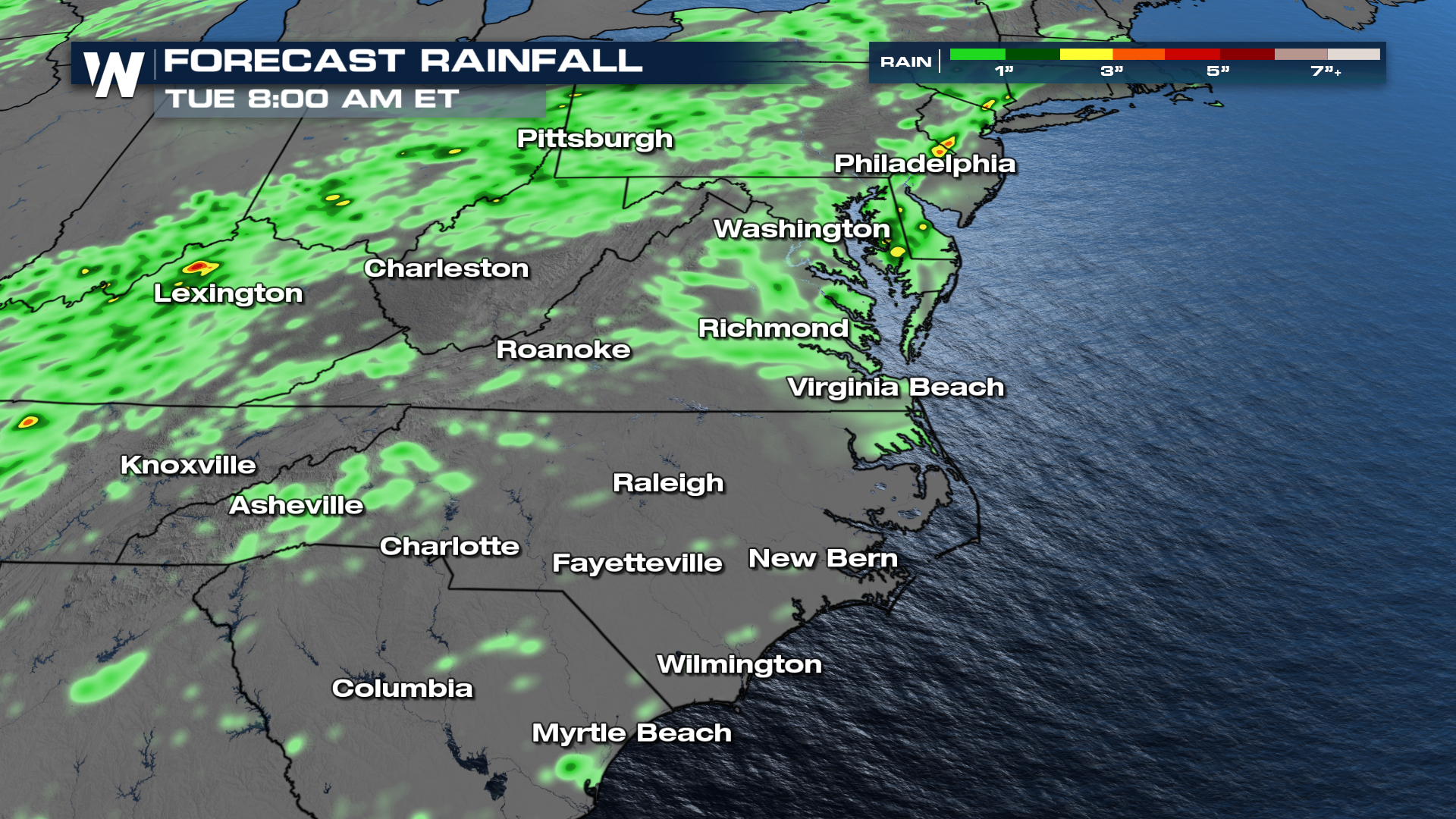
The remnants of Chantal will continue to move Northeast and eventually get picked-up by an inbound cold front and carried back out to sea. Until that happens, efficient rainfall could produce some localized areas of flooding Monday.
A narrow band of heavy rain accumulation is possible through Tuesday morning.
Catch more details on the southeast during your Southeastern Regional Forecast, :10 past the hour on WeatherNation.
All Weather News
More
Tropics: Fausto Heads towards Hawaii; Genevieve Cat 4 Hurricane
PacificHurricane Fausto continues to track we
27 Jul 2026 11:00 PM

Severe Storms Target the Midwest to the Northeast
UPPER MIDWEST - Dangerous tornadoes have alre
27 Jul 2026 10:20 PM


Southeast Flood Risk Lingers Near Stalled Front
A stalled boundary over the Southeast will ke
25 Jul 2026 10:55 AM

Another Round of Storms Targets the Northeast
Tuesday brought severe weather again across p
23 Jul 2026 1:15 AM

Another Round of Severe Weather for the Upper Midwest and Great Lakes
The upper-level low train continues to keep t
21 Jul 2026 1:45 AM