After a Brief Break, Severe Storm Chances Return
Special Stories
12 Jun 2019 5:15 AM
After a fairly quiet start to the week across the United States for severe storms, a chance for severe weather will return again today (Wednesday) through the end of the week. A low pressure system and associated cold front has been dipping southward through the Dakotas. As this system tracks southeast, we will see an isolated chance for storms returning to the Plains.
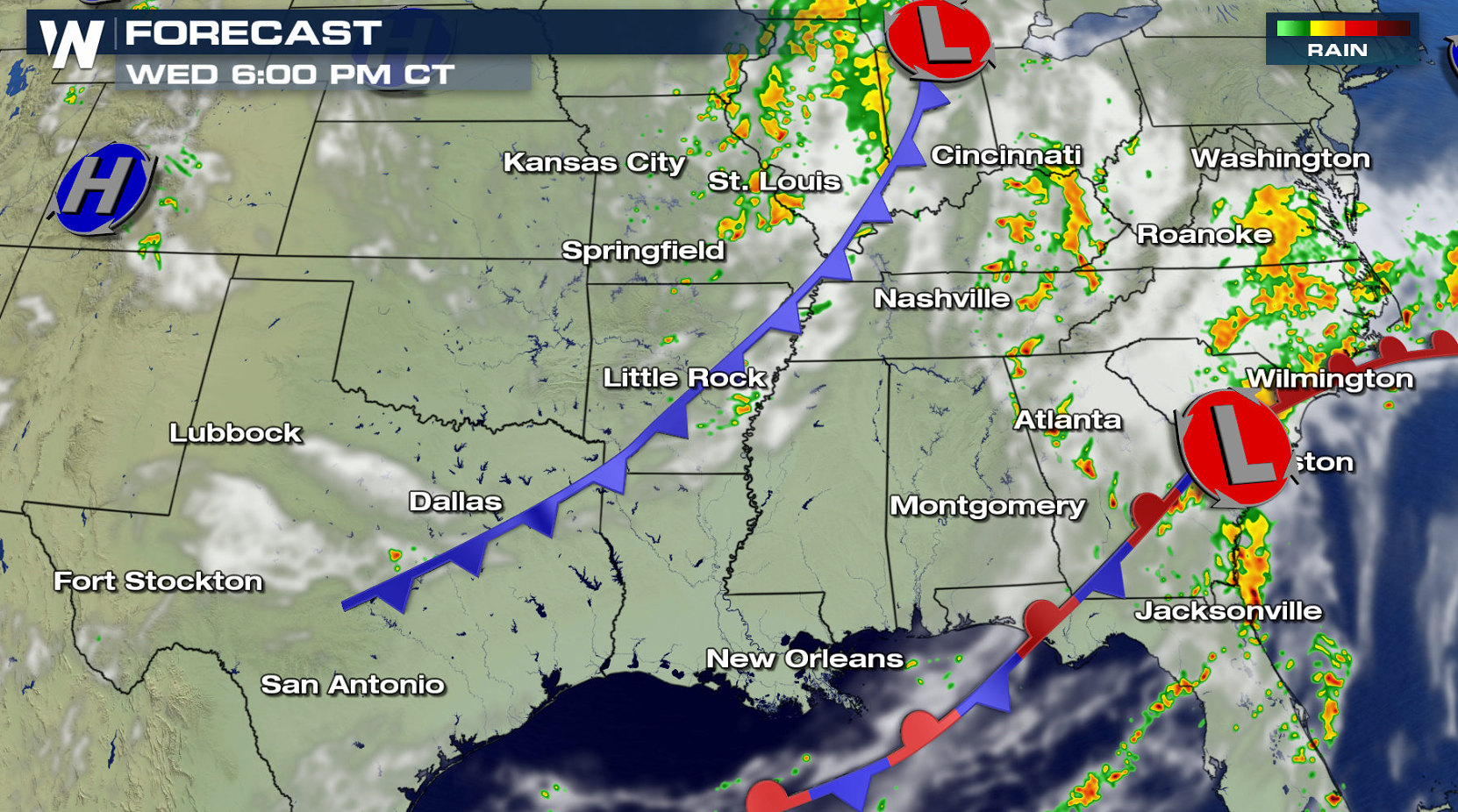
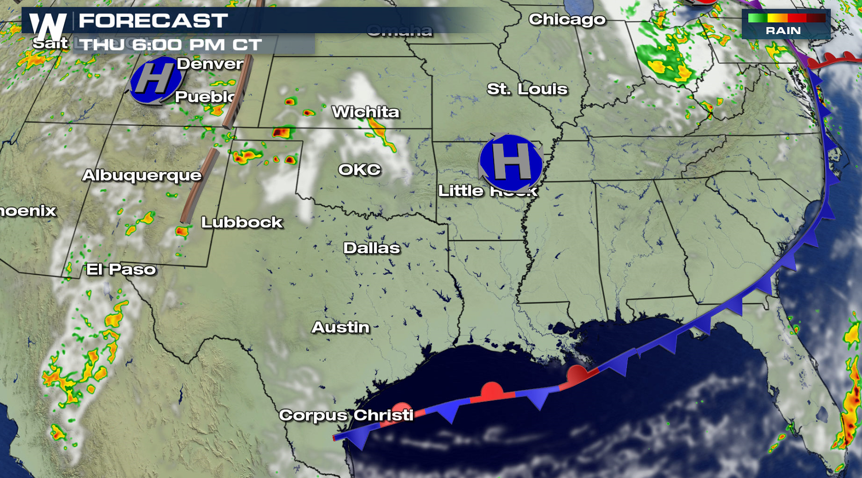
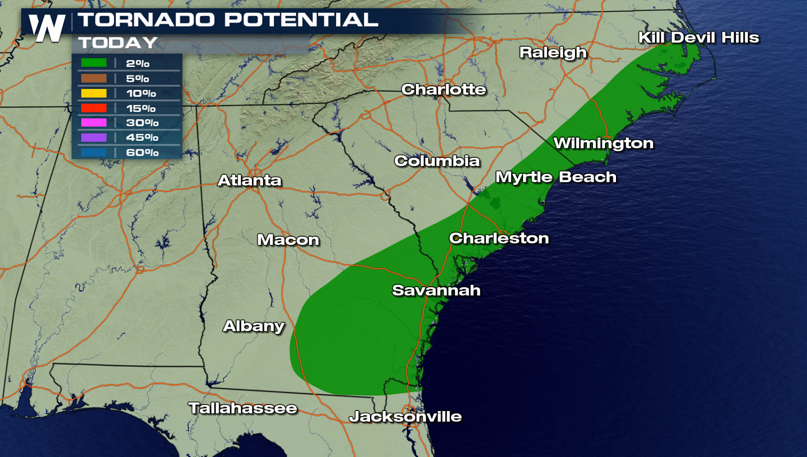
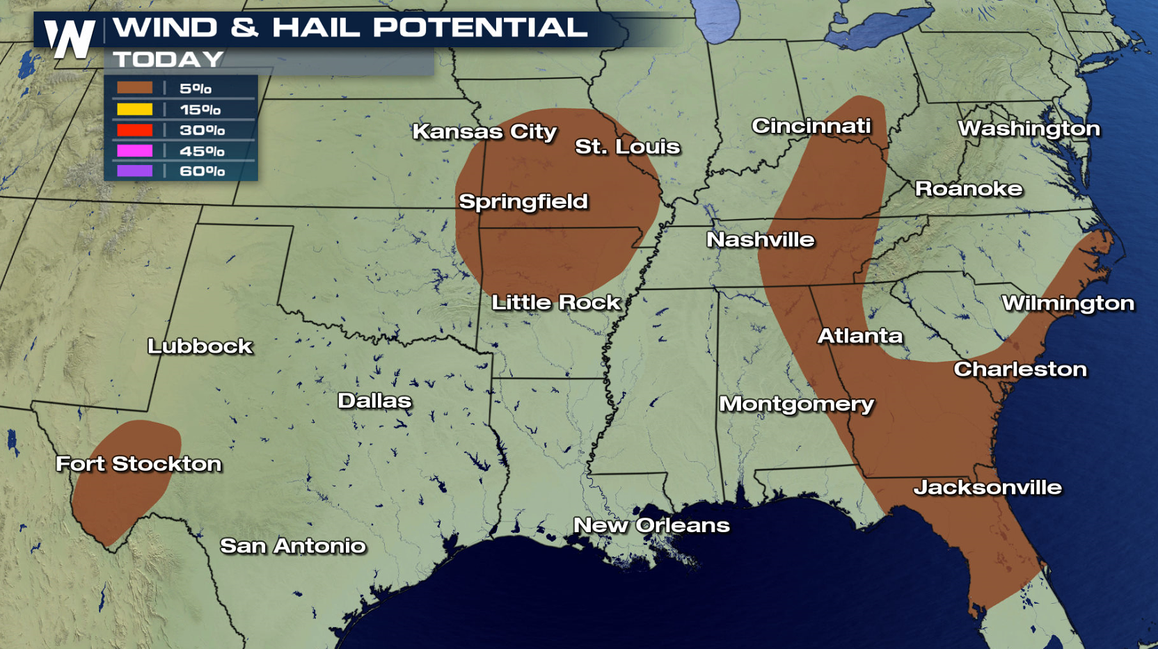
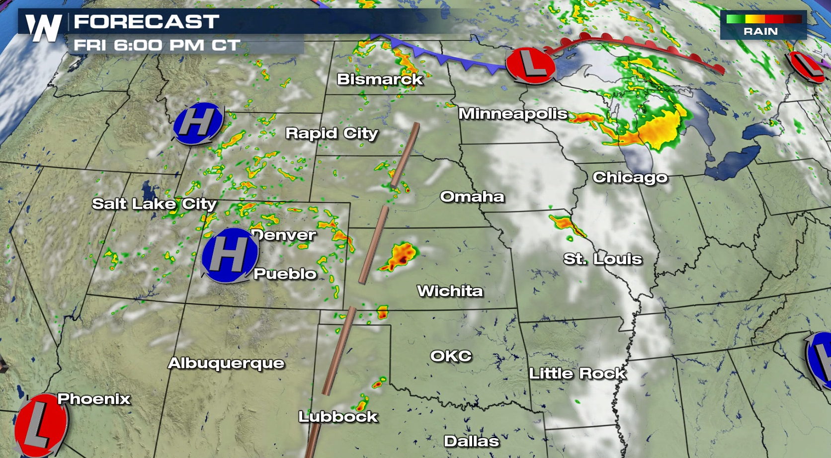 The threat for severe weather includes several marginal risk areas from the Southeast to the central and southern Plains. Isolated tornadoes are possible along the coasts of Georgia, North Carolina and South Carolina. Large hail and damaging wind gusts are a concern throughout all of the marginal risk areas.
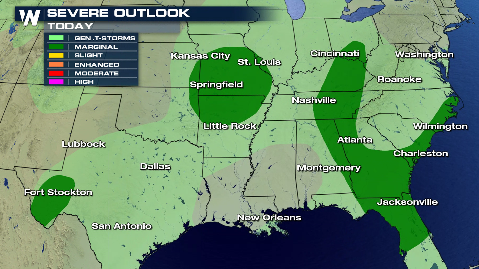
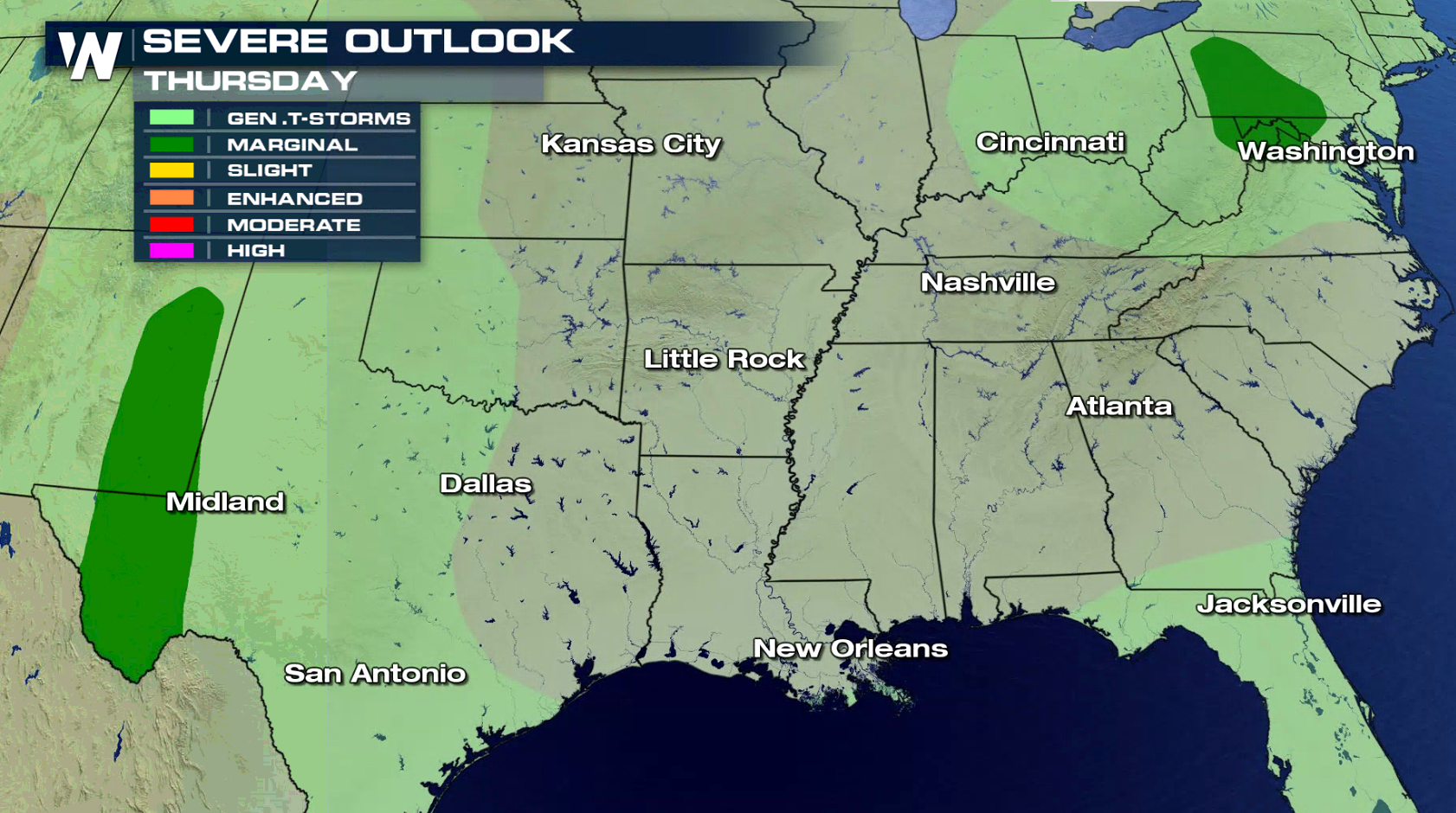
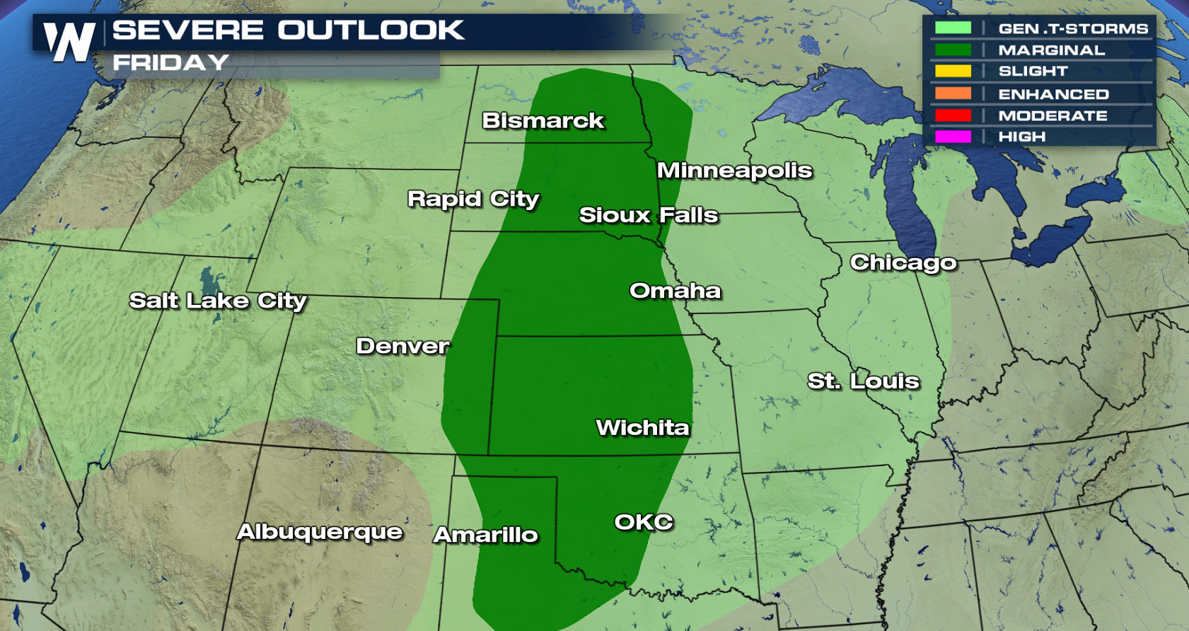
 On Thursday, the threat for severe weather will be isolated, confined to the Middle Atlantic and the Rio Grande of Texas and eastern New Mexico. Most of the Great Plains are included in a marginal severe weather risk for Friday.
 As always, stick with WeatherNation online and on-air for continued updates. We will make sure you are prepared for any severe weather that may head your way.
-Meteorologist Viki Knapp


 The threat for severe weather includes several marginal risk areas from the Southeast to the central and southern Plains. Isolated tornadoes are possible along the coasts of Georgia, North Carolina and South Carolina. Large hail and damaging wind gusts are a concern throughout all of the marginal risk areas.


 On Thursday, the threat for severe weather will be isolated, confined to the Middle Atlantic and the Rio Grande of Texas and eastern New Mexico. Most of the Great Plains are included in a marginal severe weather risk for Friday.

 As always, stick with WeatherNation online and on-air for continued updates. We will make sure you are prepared for any severe weather that may head your way.
-Meteorologist Viki Knapp
As always, stick with WeatherNation online and on-air for continued updates. We will make sure you are prepared for any severe weather that may head your way.
-Meteorologist Viki KnappAll Weather News
More