Northeast in for Some Heavy Rain

WHAT TO EXPECT
The Northeast is forecast to get a lot of rain going into the midweek. This will likely leave very few spots WITHOUT seeing rain into the next few days.
TIMING:
Rain will move along the frontal boundary as this frontal boundary and its associated low-pressure system move through. Areas of rain will stick around with this system through Thursday morning. On Thursday afternoon and evening, a low-pressure system will lift from the south, bringing more rounds of rain. There can be some localized heavy rain as these systems move through.
By Saturday, almost all of the Northeast and Ohio Valley is expected to see rain in some form or fashion. Higher totals could potentially up to 2" across Kentucky, Virginia, and even the New England area!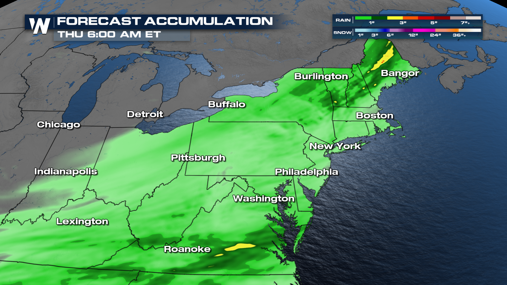
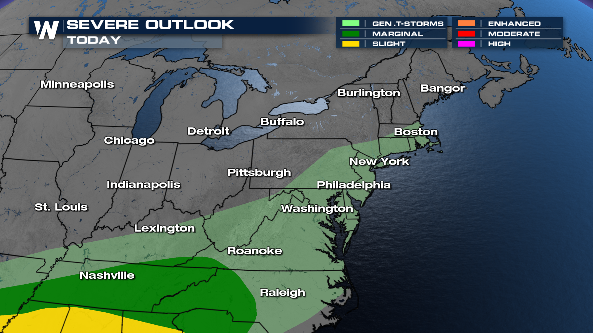
While not under a severe weather threat, the Storm Prediction Center (SPC) has issued a warning for thunderstorm activity across the Ohio Valley and Mid-Atlantic!
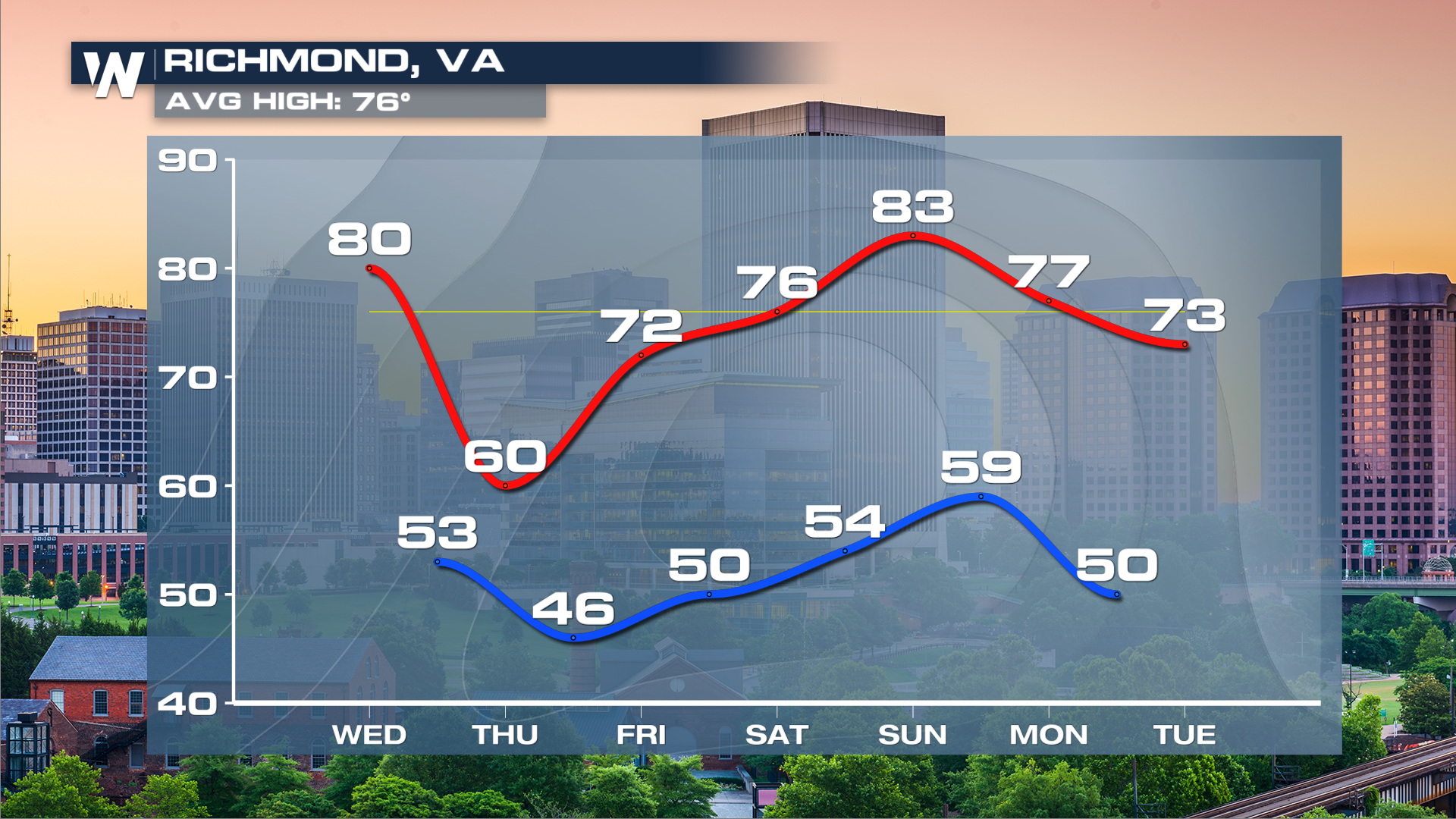
With this active pattern in store, cloud cover and cooler air will likely drop temperatures on Thursday, but pick back up on Saturday and Sunday.
Make sure to stay tuned to WeatherNation at :10 past the hour for your Northeast regional breakdown!


