More Heavy Rain in the Northeast Today

Within in the last week we have seen tremendous rainfall in the Northeast, causing widespread damage and sadly deaths too. Soils remain saturated in these areas; unfortunately, there is more heavy rainfall in the forecast. Some cities that have seen minor flooding in the past week will now prepare for additional impacts.
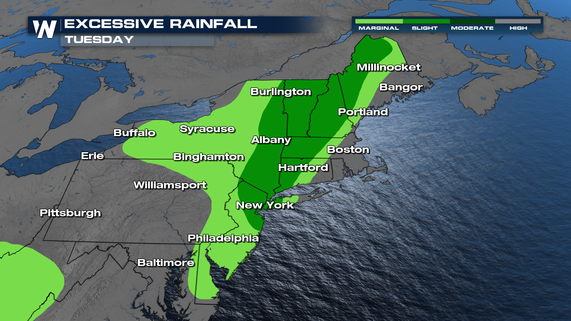
 Rain will pick up throughout the day today as a line of showers and storms will push from west to east throughout the day with extremely heavy rainfall possible once again. A level 2 out of 4 Excessive Rainfall risk is in place for the Northeast through Tuesday.
 Below is the latest on the timing of showers and isolated storms expected to move across the area.
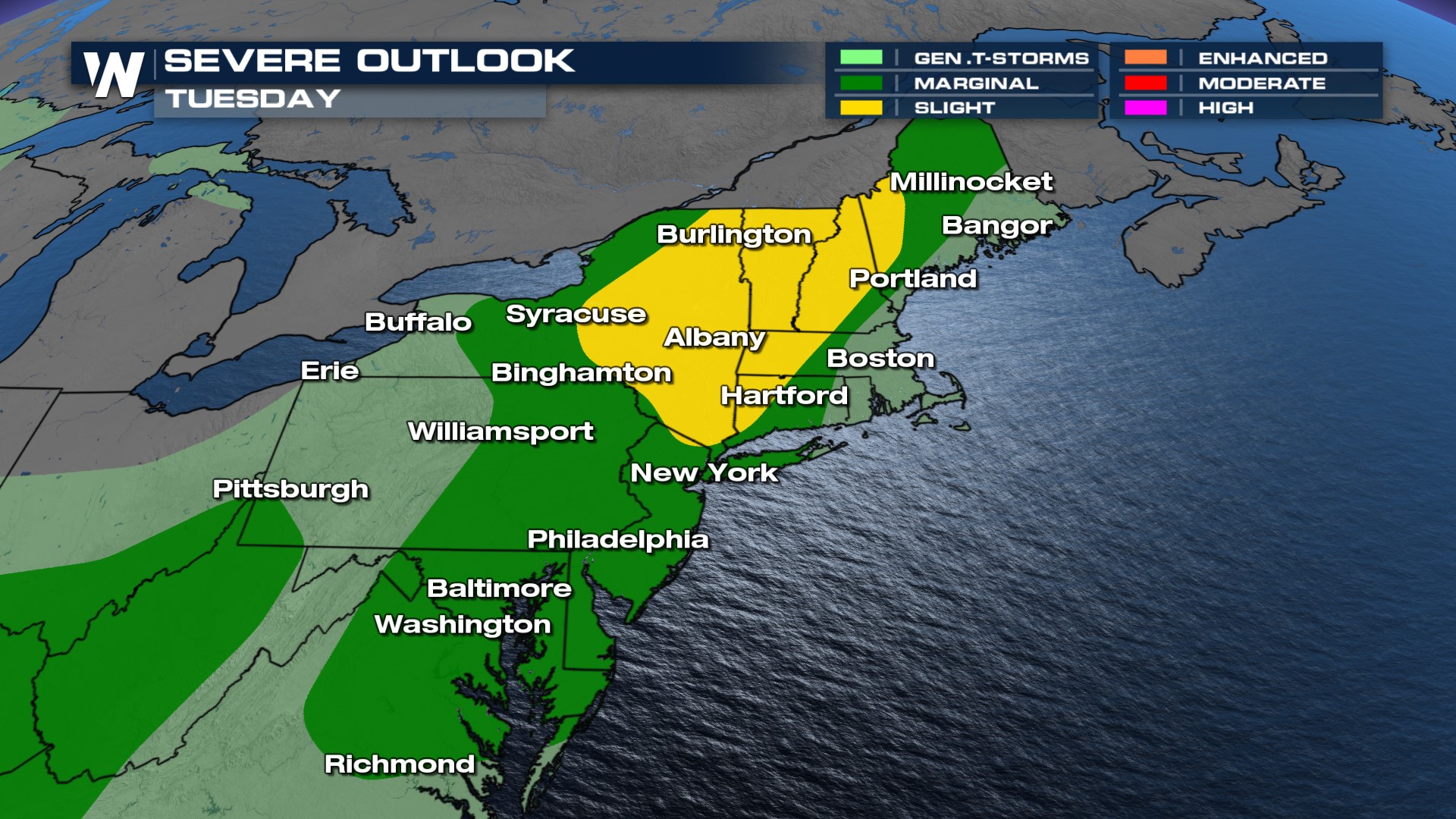
Though most will see sub-severe storms, a few stronger cells are possible. A SLIGHT (level 2 out of 5) severe weather risk is in place for northern New England (VT, NH, ME) with the MARGINAL risk from Maine to Virginia as wind is the primary concern.
 The Weather Prediction Center has highlighted the threat of heavy rainfall on Tuesday, so flood alerts could be reissued. Rainfall totals don't look to be as intense compared to last week, but even a quarter inch of fresh rain could overwhelm soils. Remember, turn around, don't drown. Many roads have buckled or washed away in recent rainfall events.
 Stay with WeatherNation for the latest on the severe weather in the Northeast and catch the Eastern Regional Forecast at :10 past the hour.


