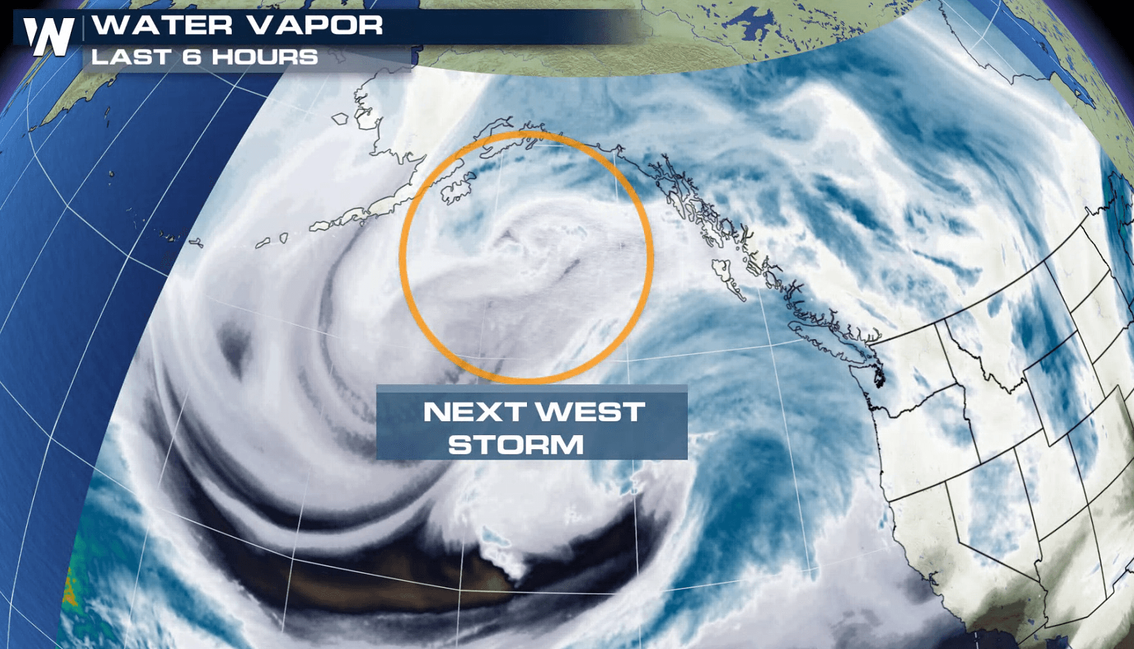
Another System Ready to Move into the West
Special Stories
22 Jan 2018 5:03 PM
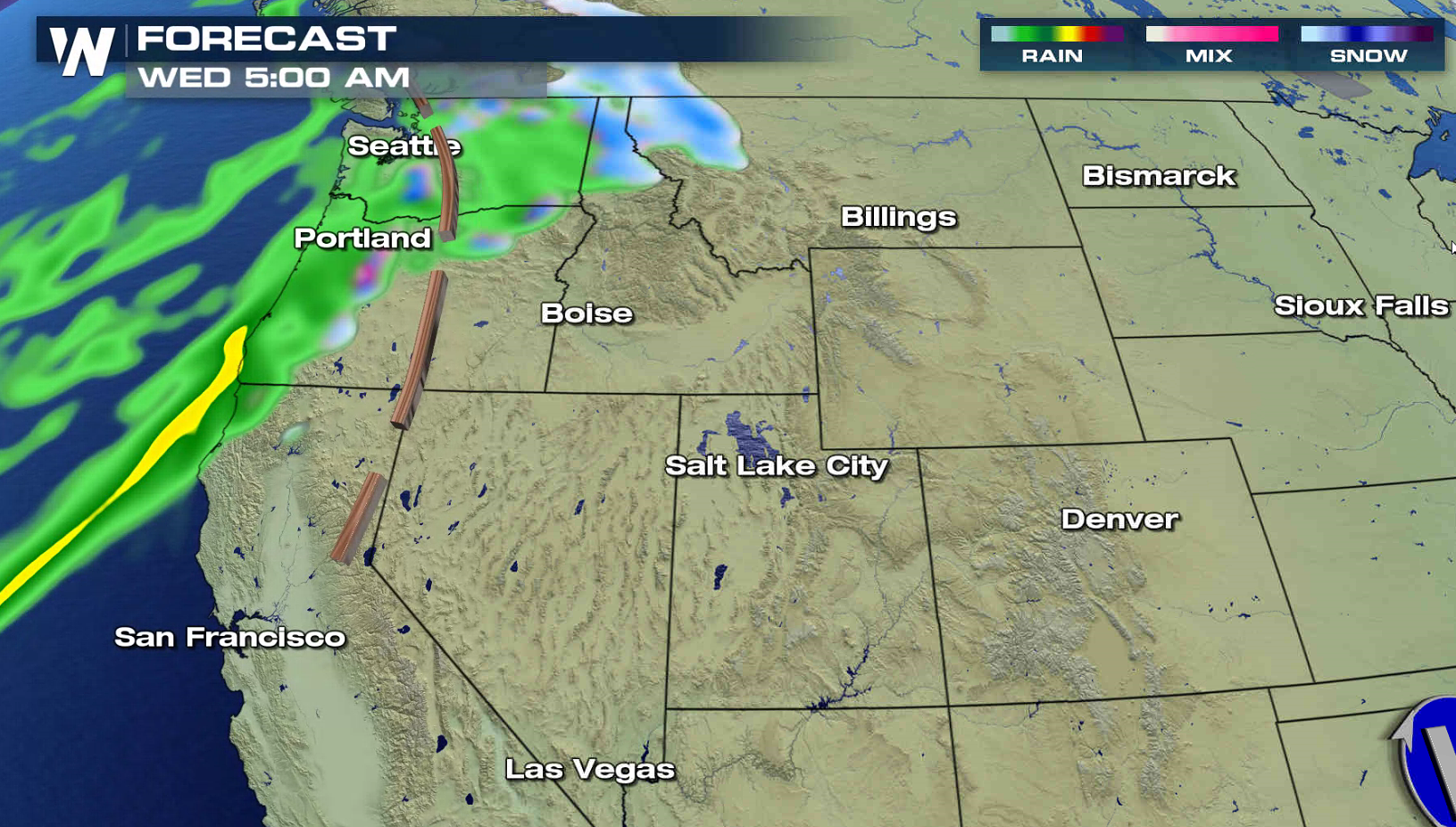
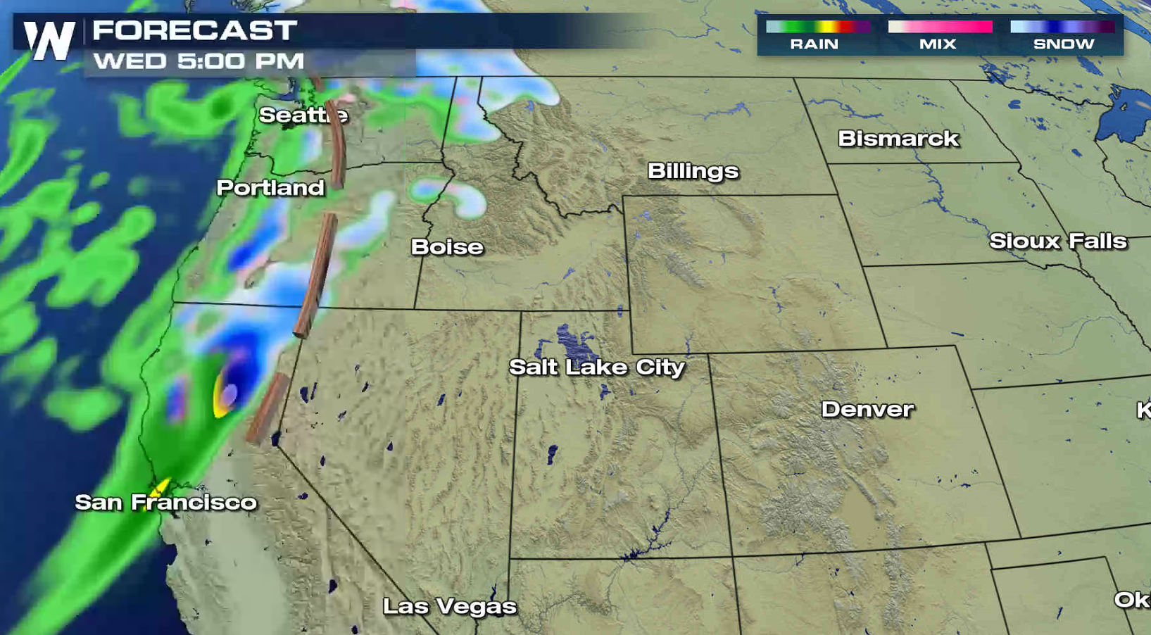
As a intense low dumps big snows and produces blizzard conditions in the Plains, another system is ready to move into the nation. Winter storm alerts have already been issued for the Cascades and Sierra Nevada. 1 to 2 feet of snow is possible in most of the higher elevations, with several feet possible over the highest peaks. Wind gusts of 40 to 60 mph are possible, which will create blowing and drifting snow and white out conditions.
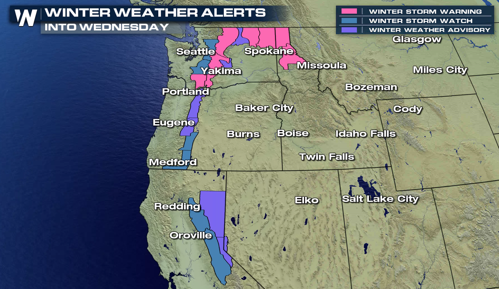
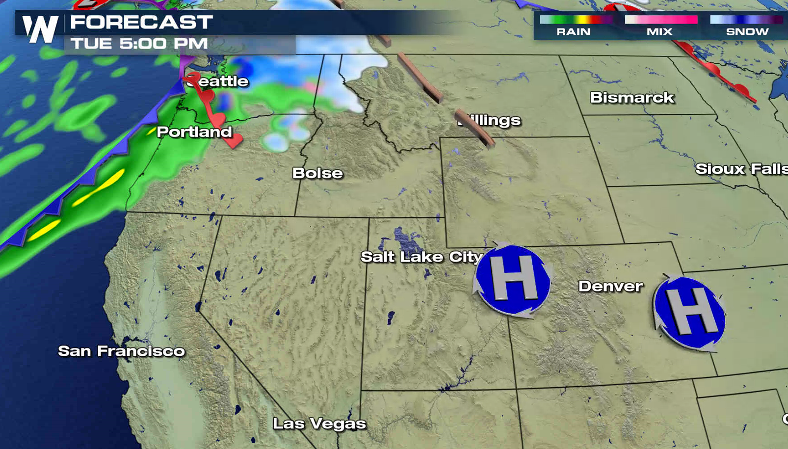
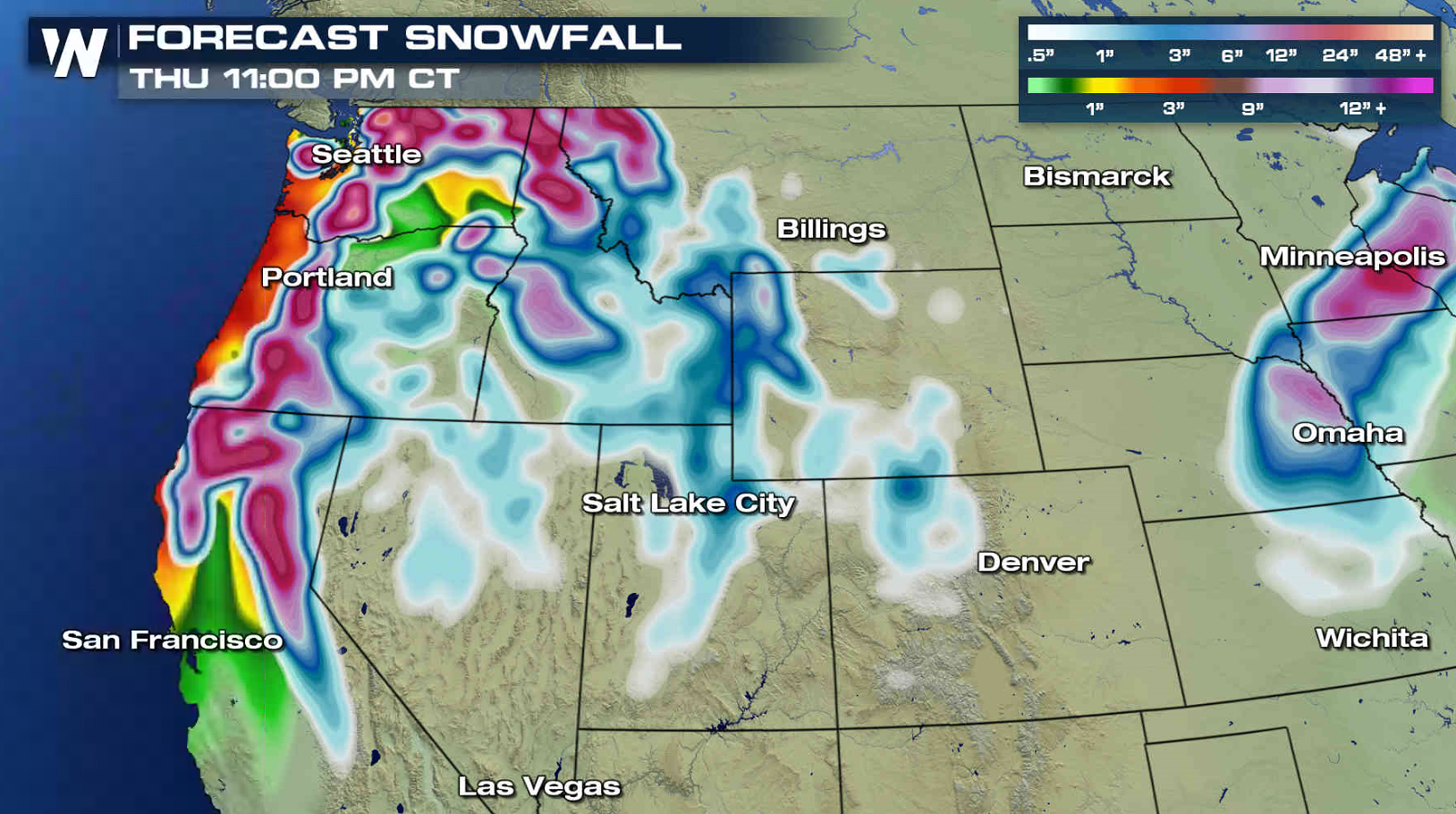 The storm system will slide into the Pacific Northwest on Tuesday, bringing the first wave of snow. The snow will spread into the southern Cascades and Sierra Nevada by Wednesday. Travel will be difficult as the snow becomes heavy.
 For WeatherNation: Meteorologist Mace Michaels
The storm system will slide into the Pacific Northwest on Tuesday, bringing the first wave of snow. The snow will spread into the southern Cascades and Sierra Nevada by Wednesday. Travel will be difficult as the snow becomes heavy.
For WeatherNation: Meteorologist Mace MichaelsAll Weather News
More
Wildfire Outbreak in the Pacific Northwest
SPOKANE, WA - On Saturday, August 1st, the Ol
3 Aug 2026 1:55 AM

More Storms for the East Through Monday
A low-pressure system that moved through the
3 Aug 2026 1:50 AM


After Reaching Category 5, Genevieve Weakens in the Pacific
PacificGenevieve formed last Friday south of
3 Aug 2026 12:30 AM

Flooding, Severe Storms Target the Midwest Again
After an active week of storms across the nor
1 Aug 2026 1:40 AM

Flooding Risk Increases as Heavy Rain Targets the Tri-State Area
Tuesday, heavy rainfall moved across the Nort
30 Jul 2026 12:25 AM

Severe Weather: Energy From the Midwest Now in the Southeast
UPPER MIDWEST - Through Monday, dangerous tor
29 Jul 2026 10:30 PM