Arctic Blast to Kick Off the Work Week
Special Stories
10 Dec 2019 9:30 AM
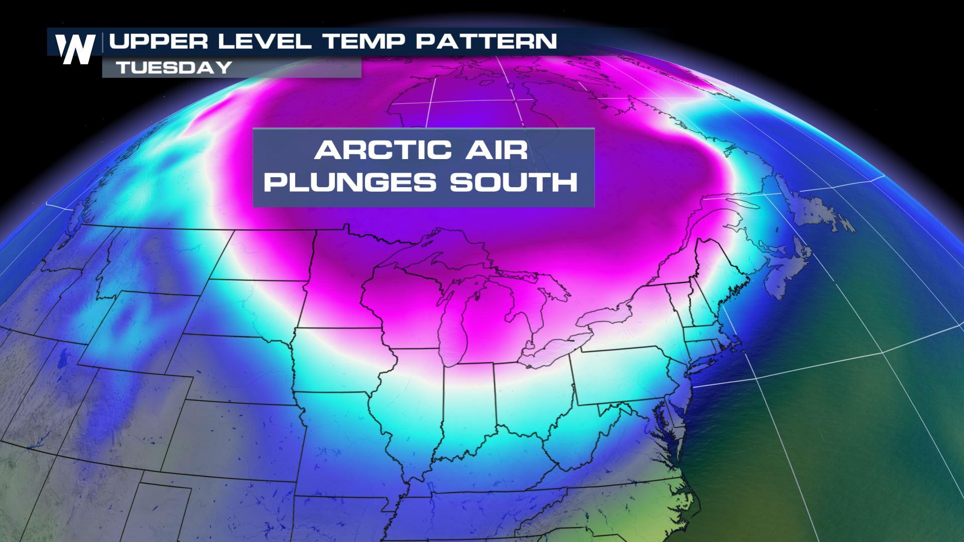
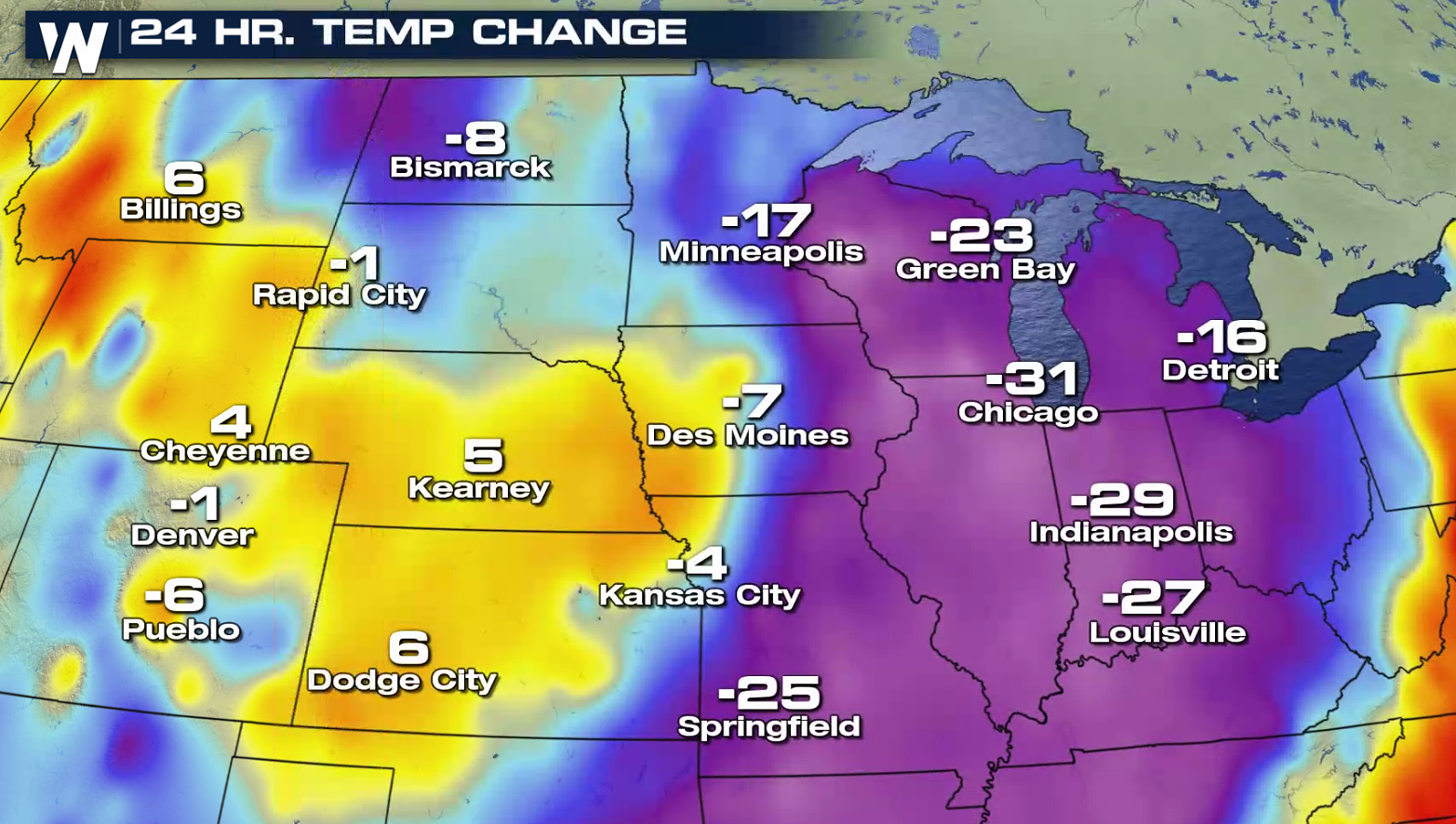
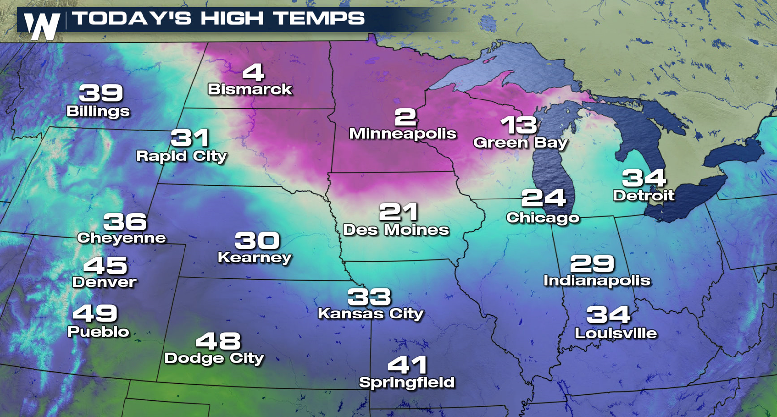
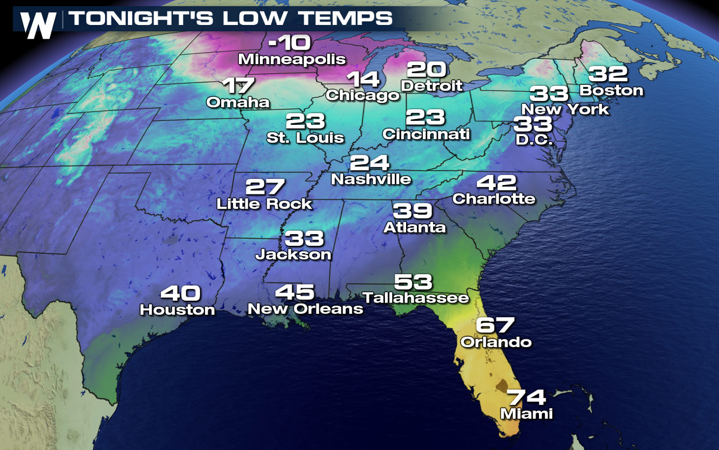
The northern United States is feeling quite a change this week! An exceptionally cold air mass will dip south, dropping temperatures well-below zero in many cases. The mercury this morning (Tuesday) is already 10 to 30 degrees colder in the Northern Plains than 24 hours ago.
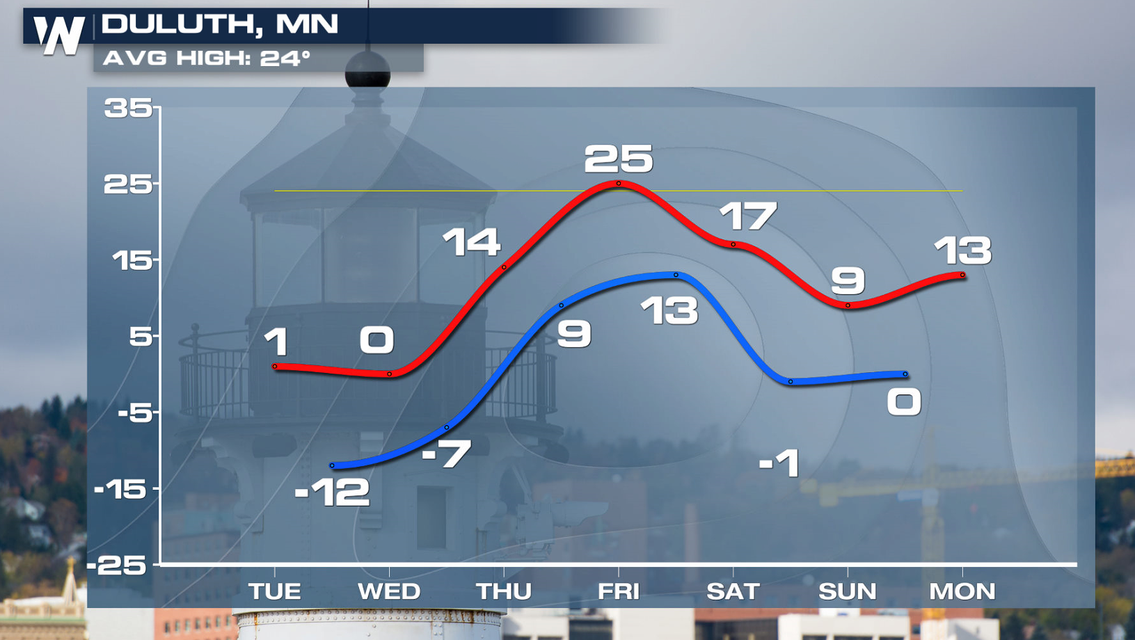
 Duluth is already feeling the cold air. Temperatures will continue to drop further into Wednesday, before a rebound later this week.
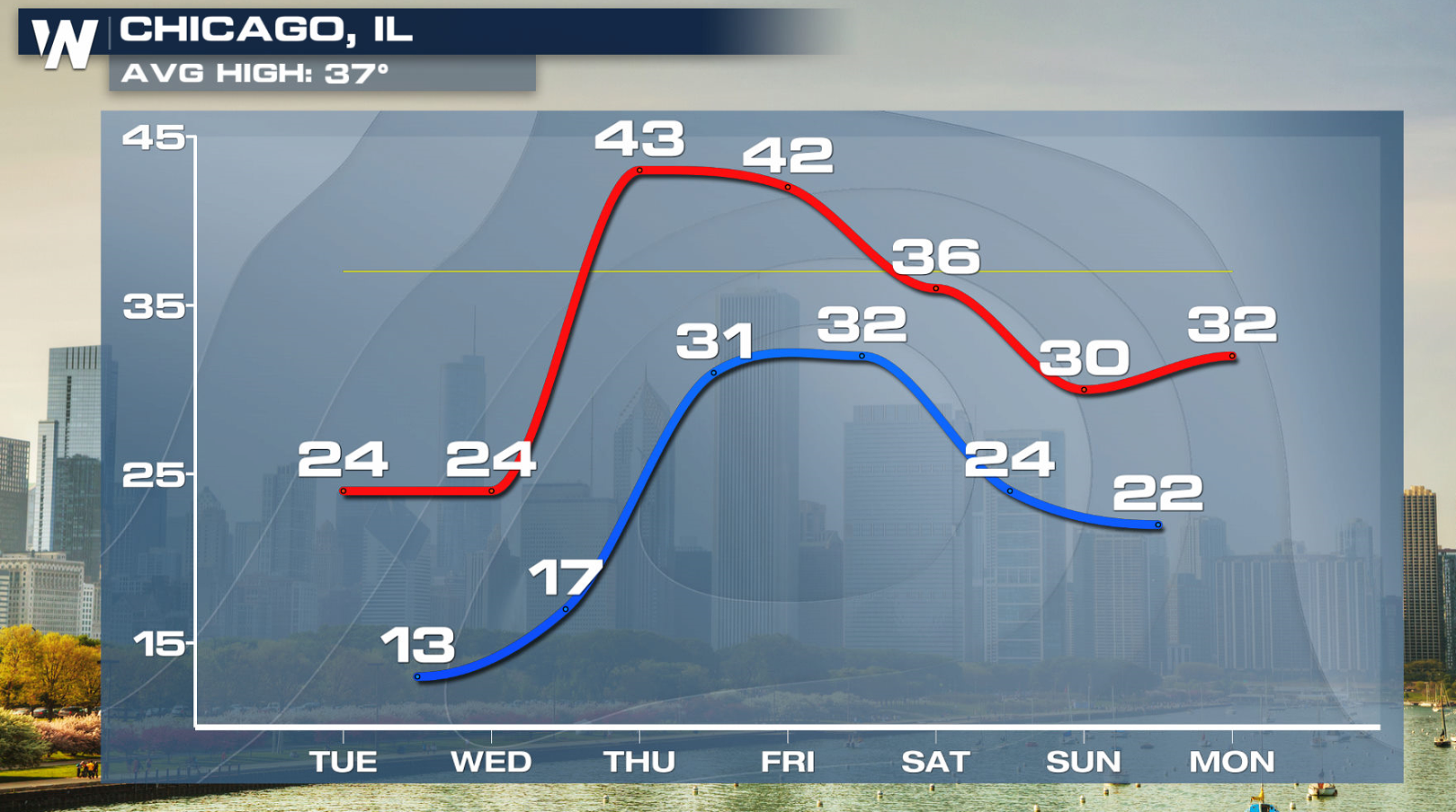
 Chicago has also seen temperatures tumble. After a high near 50 Monday, temperatures will only be in the 20s today (Tuesday). This doesn't even take into consideration the wind chill. Are you shivering yet?
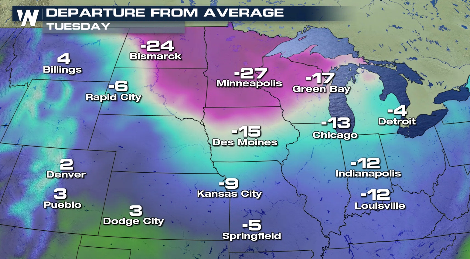
 The cold air won't stop there. Folks will feel the chill far and wide today (Tuesday). Temperatures are more than 20 degrees colder than average in parts of the Midwest.
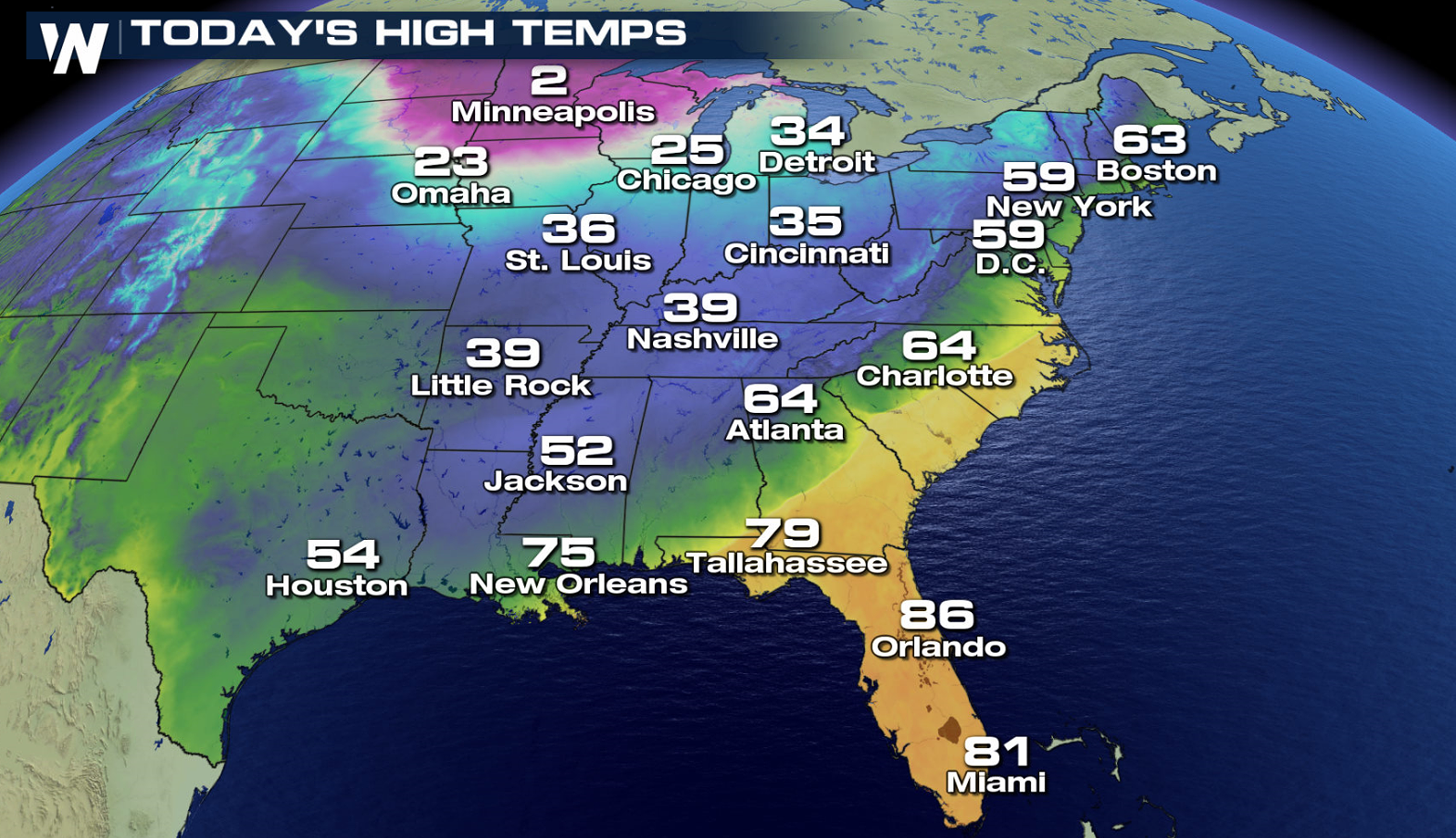 Lows by Wednesday morning will fall into the 20s all the way south into Arkansas and Tennessee.
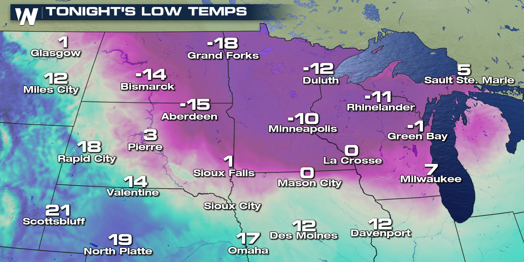
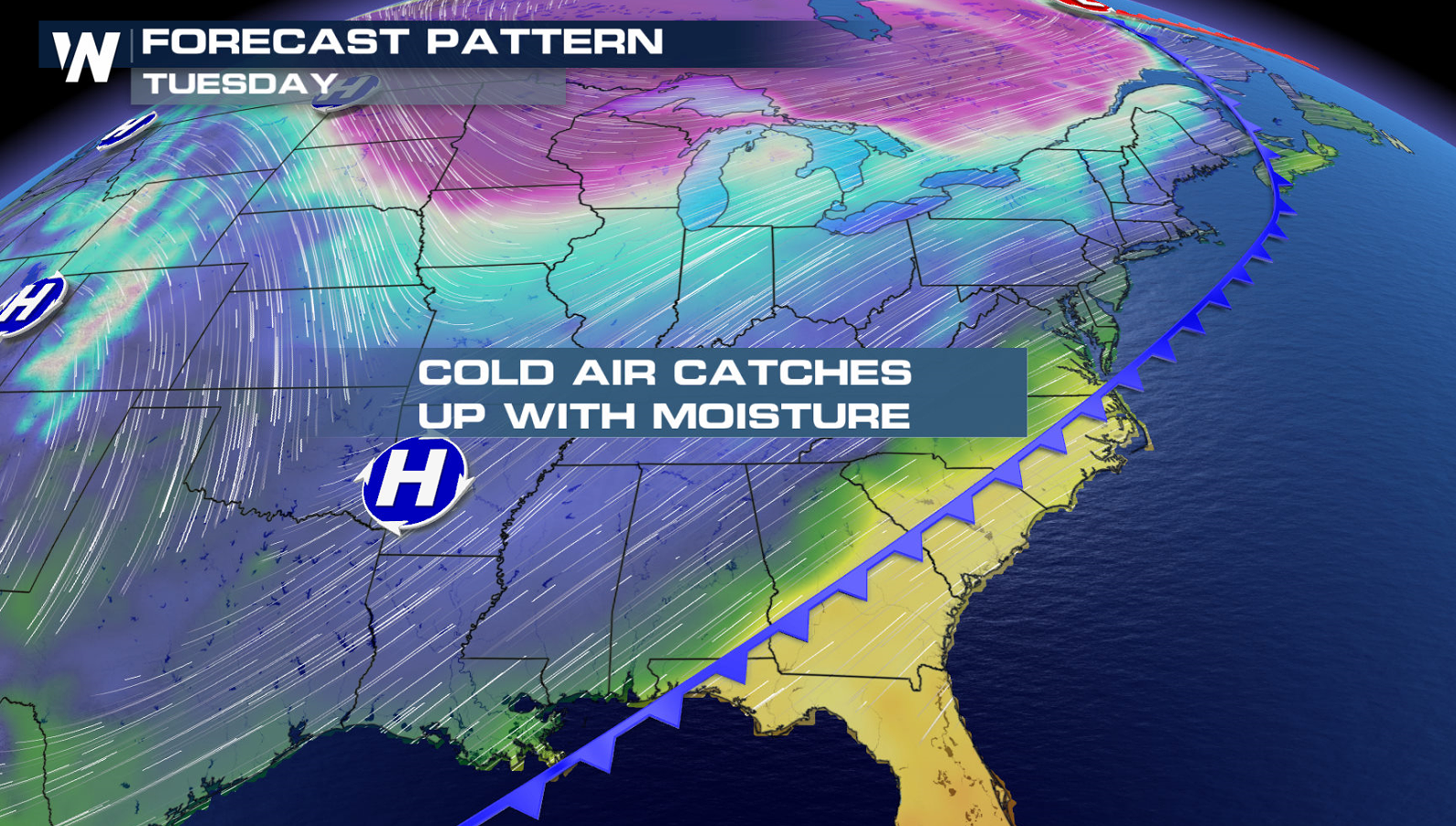
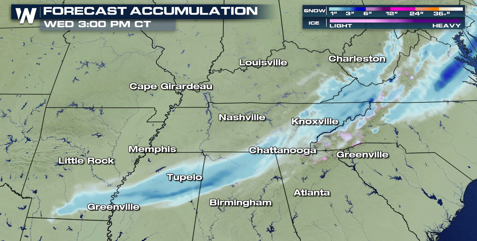
 This cold air will meet up with some moisture across the Southeast. That could support snow in some places into Wednesday morning.
 Stay warm! Be sure to download the WeatherNation app on your smart phone to get your local forecast on the go!
Duluth is already feeling the cold air. Temperatures will continue to drop further into Wednesday, before a rebound later this week.
Chicago has also seen temperatures tumble. After a high near 50 Monday, temperatures will only be in the 20s today (Tuesday). This doesn't even take into consideration the wind chill. Are you shivering yet?
The cold air won't stop there. Folks will feel the chill far and wide today (Tuesday). Temperatures are more than 20 degrees colder than average in parts of the Midwest.
Lows by Wednesday morning will fall into the 20s all the way south into Arkansas and Tennessee.
This cold air will meet up with some moisture across the Southeast. That could support snow in some places into Wednesday morning.
Stay warm! Be sure to download the WeatherNation app on your smart phone to get your local forecast on the go!
All Weather News
More

More Storms for the East Through Monday
A low-pressure system that moved through the
3 Aug 2026 12:20 PM


After Reaching Category 5, Genevieve Weakens in the Pacific
PacificGenevieve formed last Friday south of
3 Aug 2026 12:30 AM

Flooding, Severe Storms Target the Midwest Again
After an active week of storms across the nor
1 Aug 2026 1:40 AM

Flooding Risk Increases as Heavy Rain Targets the Tri-State Area
Tuesday, heavy rainfall moved across the Nort
30 Jul 2026 12:25 AM