An Area to Watch for the Atlantic
Top Stories
26 Jun 2018 11:11 AM
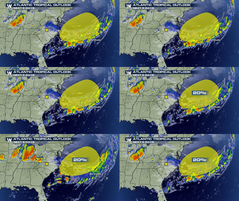
The National Hurricane Center is watching an area of low pressure that form along the coast of North Carolina.
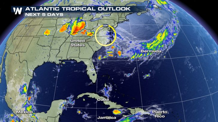 While this will be a non-tropical area of low pressure, it could develop some tropical characteristics. The low could move into a more favorable environment for acquiring tropical tendencies within the next few days as it moves eastward or northeastward away from the United States. This won't be a huge storm but it will have impacts across the coast for the end of the week. No matter what happens, if you are across coastal North or South Carolina, expect a lot of rain into the end of the week.
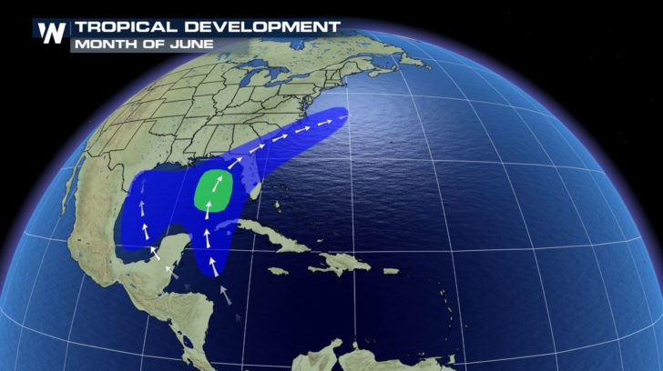
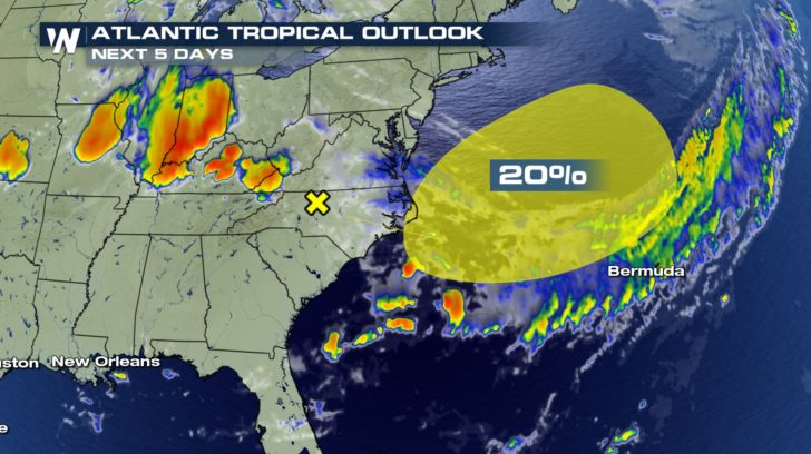 Typically, when it comes to tropical development in the month of June, we look towards the Gulf of Mexico or Western Caribbean. This is where sea surface temperatures are warmer and wind shear is less.
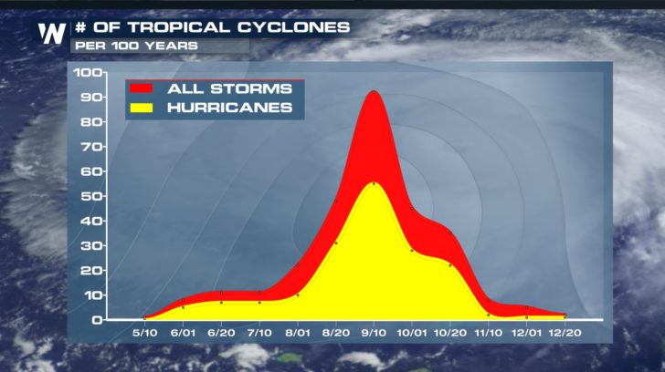
 Usually across the Atlantic basin, storm frequency starts to increase come late August into September and early October. That's when sea surface temperatures are the warmest and the jet stream is further north causing less wind shear.
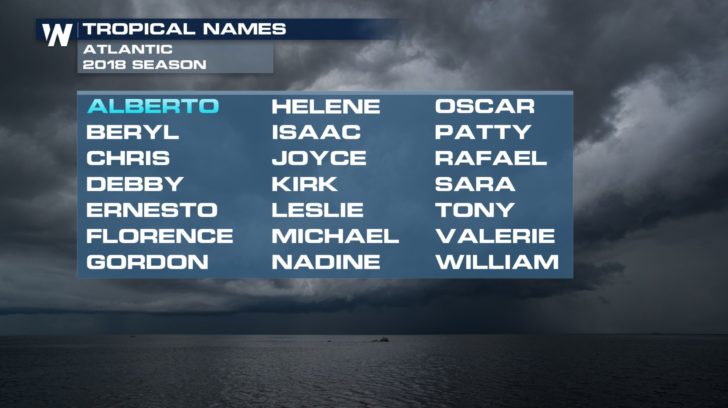
 If this system were to be named, it would be Beryl and the second named storm of the 2018 Atlantic Hurricane season.
 For WeatherNation, Meteorologist Kate Mantych
While this will be a non-tropical area of low pressure, it could develop some tropical characteristics. The low could move into a more favorable environment for acquiring tropical tendencies within the next few days as it moves eastward or northeastward away from the United States. This won't be a huge storm but it will have impacts across the coast for the end of the week. No matter what happens, if you are across coastal North or South Carolina, expect a lot of rain into the end of the week.
Typically, when it comes to tropical development in the month of June, we look towards the Gulf of Mexico or Western Caribbean. This is where sea surface temperatures are warmer and wind shear is less.
Usually across the Atlantic basin, storm frequency starts to increase come late August into September and early October. That's when sea surface temperatures are the warmest and the jet stream is further north causing less wind shear.
If this system were to be named, it would be Beryl and the second named storm of the 2018 Atlantic Hurricane season.
For WeatherNation, Meteorologist Kate MantychAll Weather News
More
Major River Flooding Causes Damage; Another Day of Storms in New Mexico
A powerful low pressure system has been movin
26 Oct 2026 1:00 AM

Mount Slushmore? Taking a look at Dakota Snow Chances
The cooler weather is finding places to go fi
26 Oct 2026 12:10 AM

Tropical Storm Vance Swirling in the Pacific, Olana Forms East of Hawaii
After becoming a hurricane Friday, Vance has
26 Oct 2026 12:00 AM

Sunny Day Flooding; King Tides Surge This Week
This week, the ocean is coming to low lying a
25 Oct 2026 8:55 PM

Warmer Than Average: Above-Normal Temperatures Across the Central U.S. This Week
WHAT TO EXPECTA ridge of high pressure linger
25 Oct 2026 10:15 AM


Several Fires Break Out in SoCal Last Week Amid Santa Ana Wind Event
Santa Ana winds helped several fires grow qui
19 Oct 2026 1:25 PM