Tropics: Watching Two Regions For Development, Rough Atlantic Surf

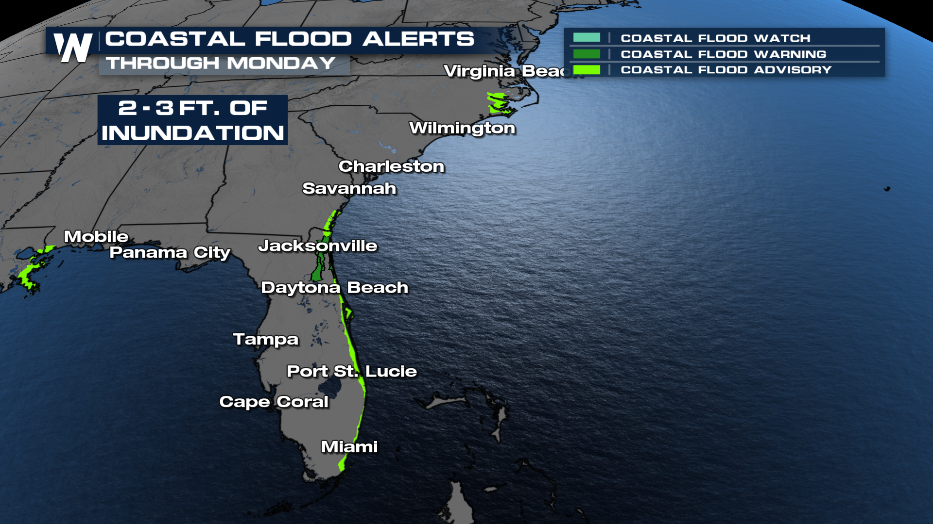
Although there are no named storms in the Atlantic, life-threatening rip currents remain possible, as well as coastal flooding with inundation of 1 to 3 feet above ground level. This flooding can move inland, impacting homes and businesses. Dangerous swim conditions will also be a concern. Please listen to local authorities and avoid swimming if possible, as rip currents can be deadly.
Waves & Rip Currents
The coastline from St. Simons Island, GA, to West Palm Beach, FL, is highlighted for high surf. Some wave heights could reach up to 10 feet!
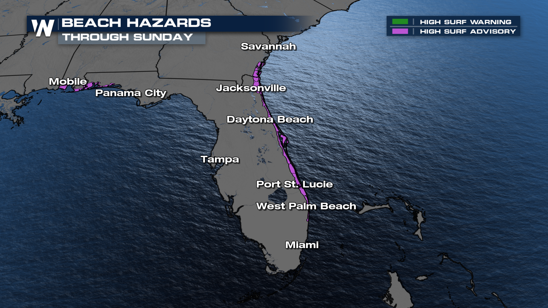 A high threat for rip currents remains likely over the next few days. Check the flags at the beaches to ensure the conditions are safe enough for you to get into the water, if you plan to do so.
What's Next For the Atlantic
The NHC is monitoring two areas in the Atlantic: a developing low near Florida and a tropical wave over the central tropical Atlantic, which is now moving off the coast of Africa. These systems have a low and medium chance of tropical formation. The low near Florida will have a small window to develop and gain tropical characteristics. Regardless, it is expected to bring heavy rain and gusty winds to the area.
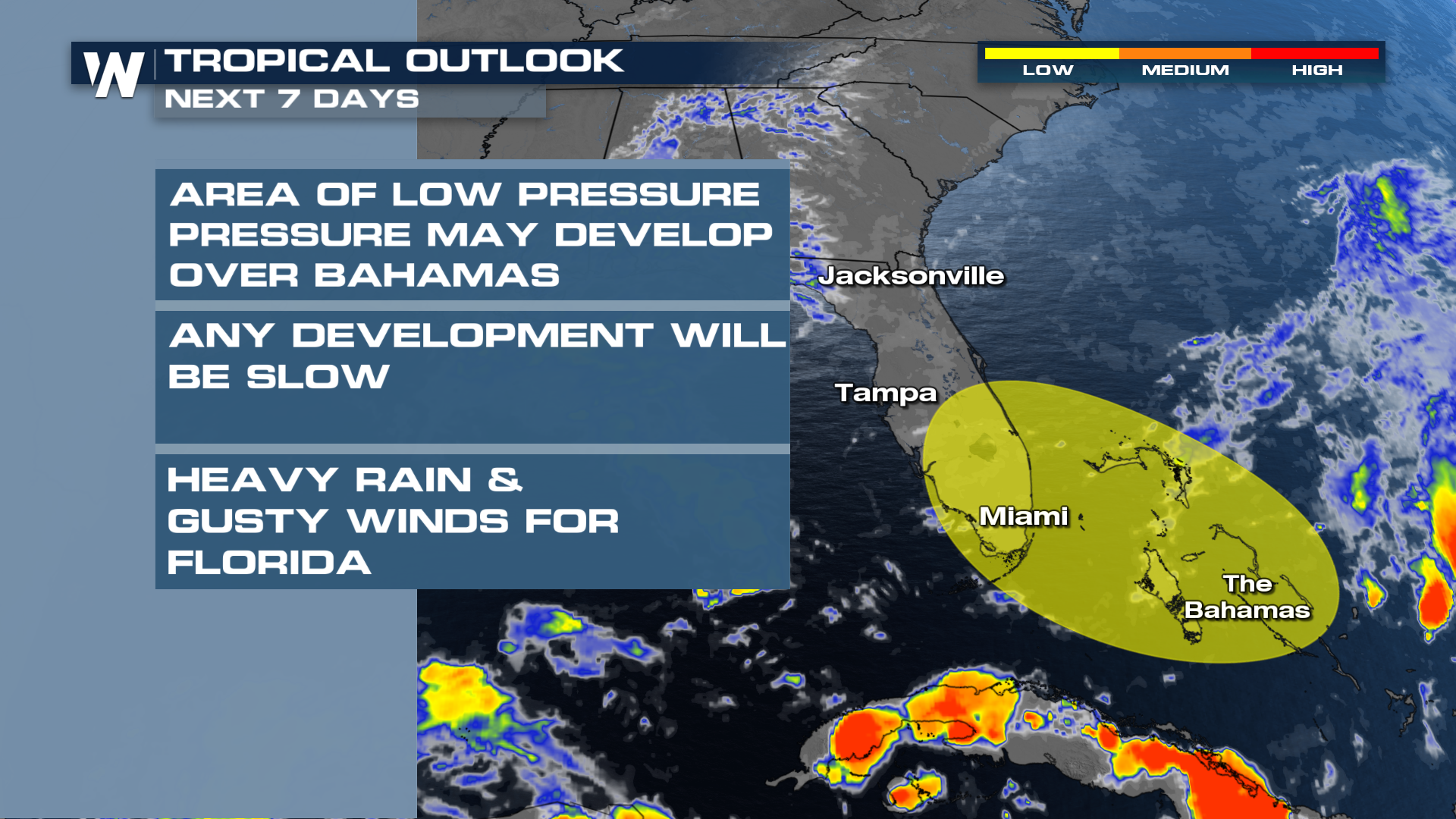 UPDATE: The National Hurricane Center has downgraded this area to a 0% chance for tropical development.
A tropical wave moving off the coast of Africa will have a better chance to develop next week as it moves across the MDR (main development region) in the Atlantic. It's a bit late in the season for tropical waves to develop from Africa, but models have supported this system becoming organized next week.
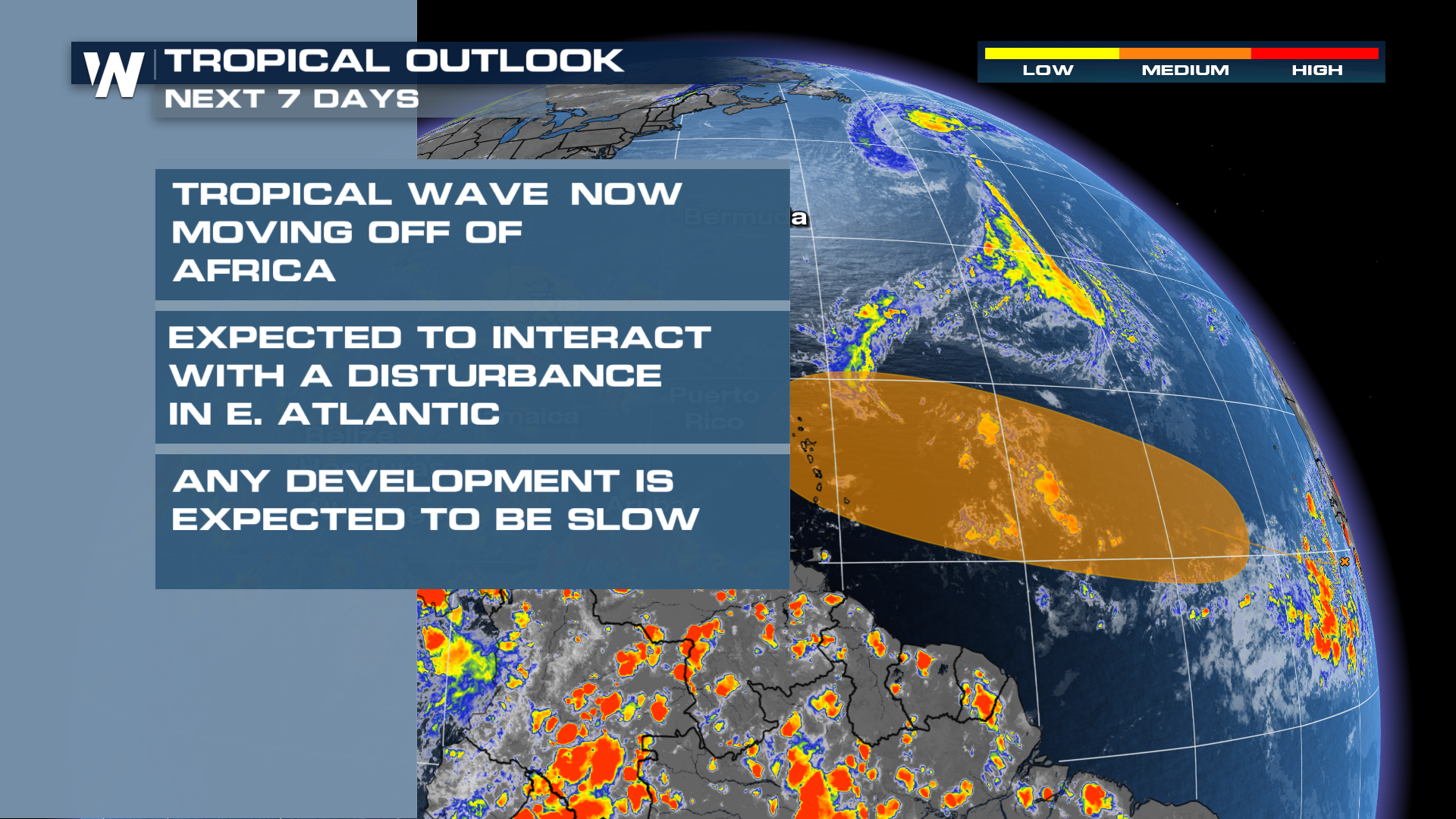
As the wave from Africa merges with another trough in the MDR, it is more likely to organize. This could bring tropical cyclone impacts to the Caribbean toward the end of next week if these trends hold.


