Fall turns to Winter Across the High Peaks of the West

Top Stories
5 Oct 2025 7:00 PM
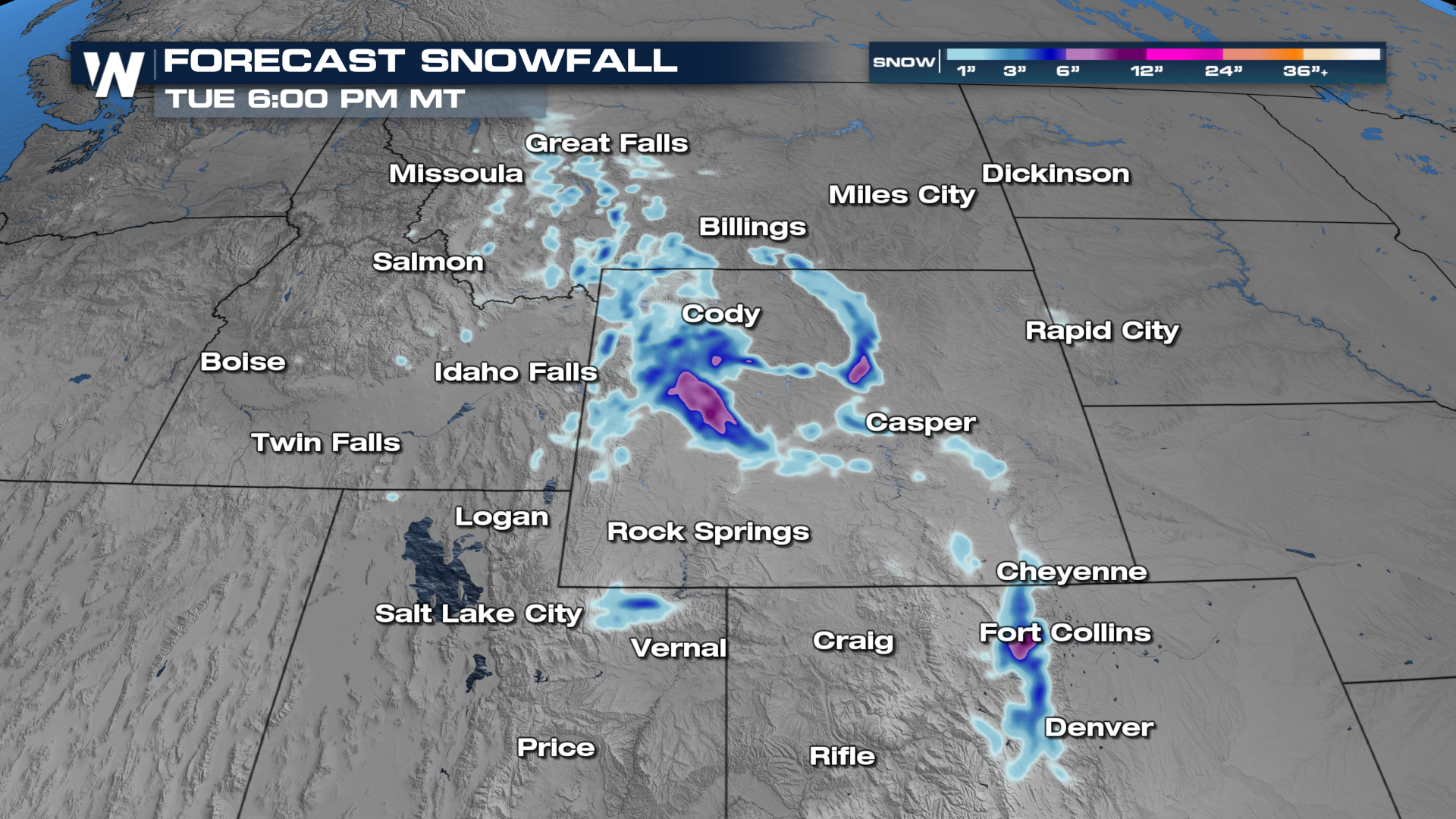
ROCKIES - A strong, upper-level low-pressure system is moving through the western United States, bringing heavy rain, thunderstorms, snow, and wind. Much cooler temperatures are moving in as well, particularly behind a trailing frontal system, which will help produce heavy mountain snow.
Cold air behind the front has started changing rain to snow from Montana into Wyoming with more heavy snow for mountain areas into Sunday night.
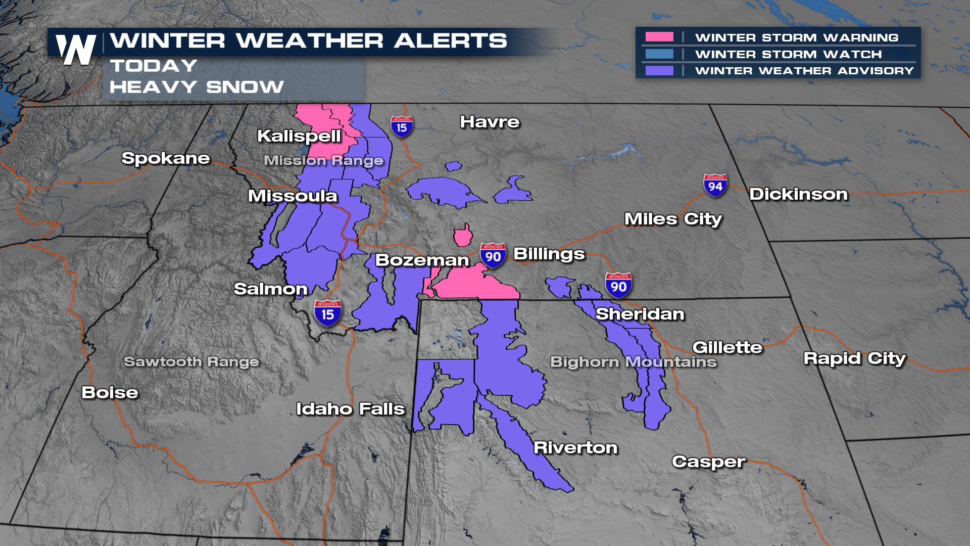 Winter weather alerts have been issued for some heavy snow that will be expected in the mountains, mostly above 5,500 feet.
 More details on your Western Regional Forecast can always be found :50 past the hour on WeatherNation.
All Weather News
More

Severe Storms, Flash Flooding Overnight In Midwest
WHAT TO EXPECTIt was a very active day across
22 Jun 2026 1:50 AM


Summer Solstice Kicks Off Father's Day Sunday
Fathers across the country will have to share
21 Jun 2026 5:20 PM

Flood Risk Continues This Weekend for the Gulf Coast States
Numerous flash flood warnings were issued as
21 Jun 2026 1:15 PM

Dry T-Storms & Fire Danger in the West
A weak low-pressure system moving through the
20 Jun 2026 1:40 PM

Tornadoes Tear Through The Midwest, Isolated Severe Storms in the South
EARLIER THIS WEEKMONTROSE, IL - A dangerous t
20 Jun 2026 1:30 AM