Fall Front Triggers Frost and Storm Threat

TEMPERATURES
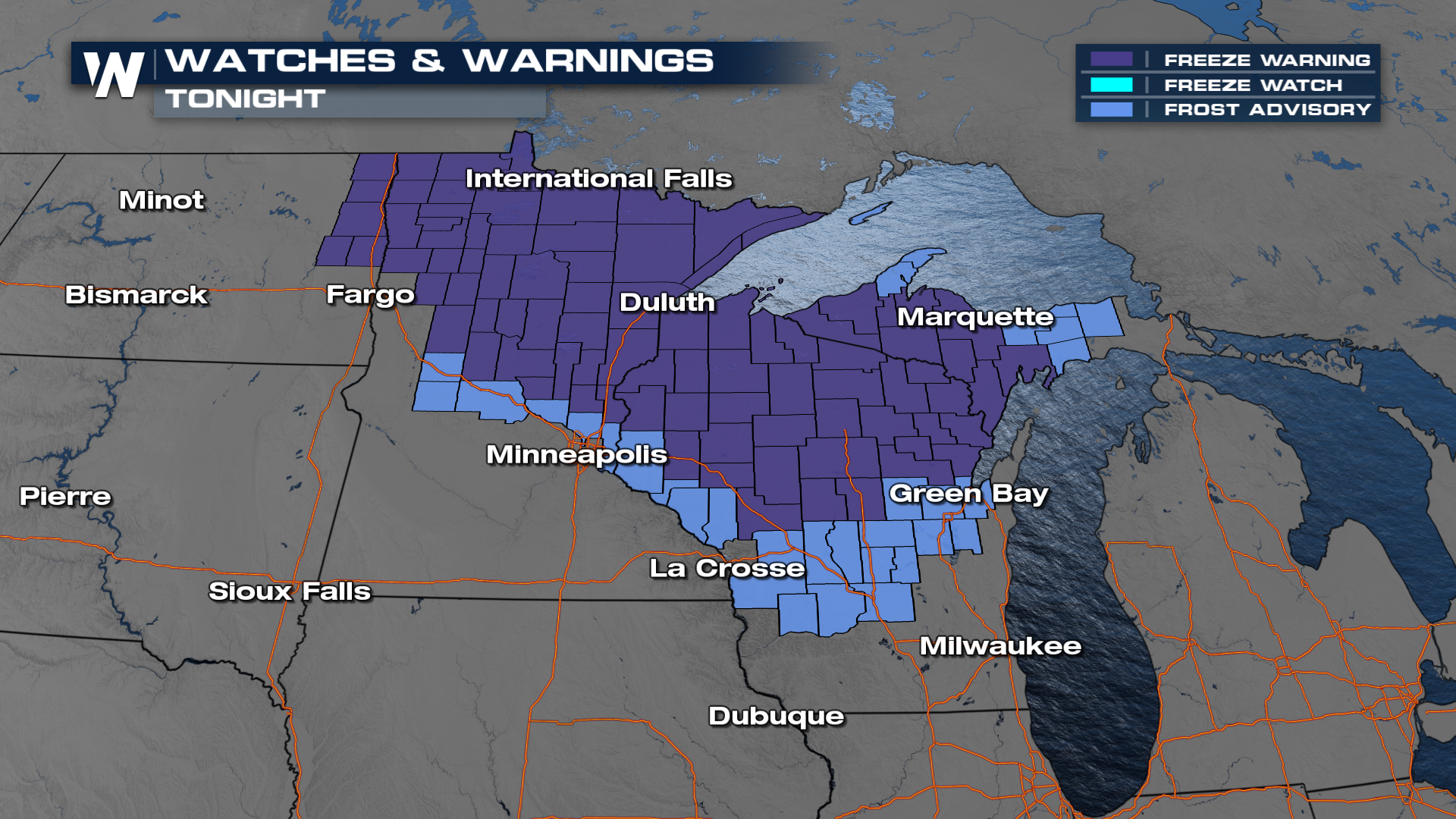
A cold front sweeping through the Plains has brought a noticeable temperature drop behind it. Widespread Frost Advisories and Freeze Warnings have now continued into Wednesday morning. Daytime highs are dropping 20+ degrees from where they were Sunday for cities where the cold front has crossed. As impressive as that is, we're only getting back to where seasonal avereges, which shows how warm it's been for a little while.
RAIN / STORMS
An upper-level trough is also contributing to this storm setup, supporting a surface cold front expected to move east and southeast through Wednesday. With dew points in the 60s, there’s plenty of moisture to fuel thunderstorms, but limited instability should keep most storms below severe thresholds.
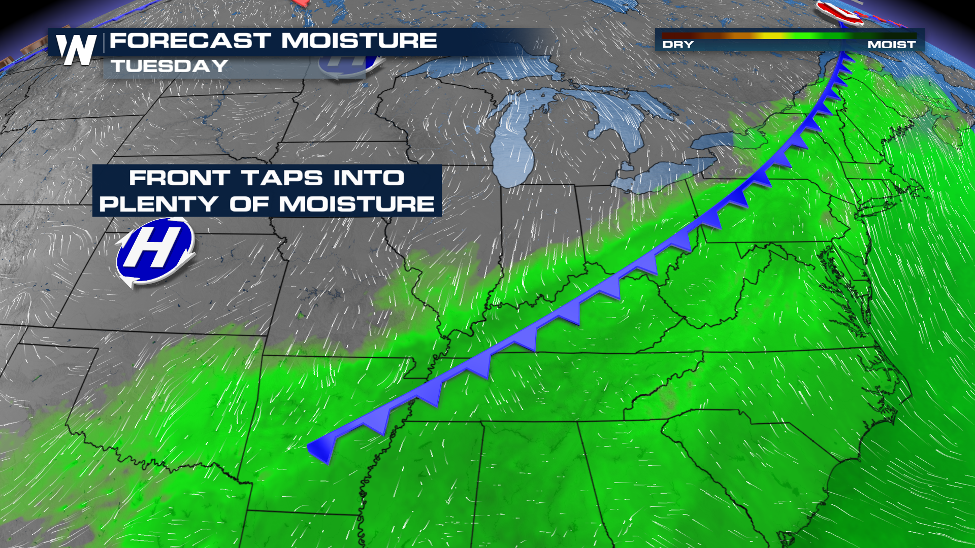
The frontal system will continue tapping into Gulf moisture as it moves through the Mid-South and Ohio Valley. The available moisture will spark a flash flooding threat, as several cities get hit for 2 days in rain as this system slows down.
The Weather Prediction Center has issued excessive rainfall outlooks through Tuesday across these regions. They have now been upgraded to slight (level 2 out of 4), but rain rates may get as heavy as 1-2" per hour.
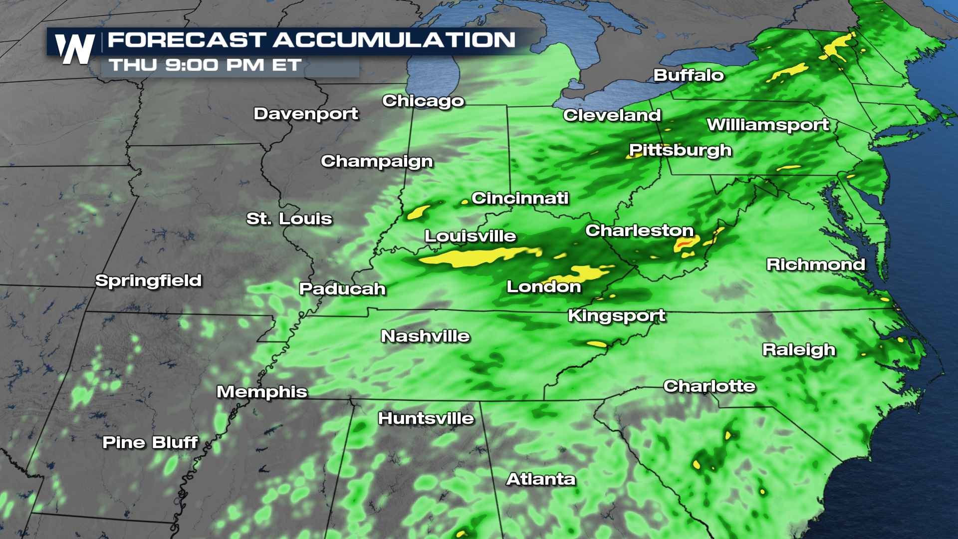
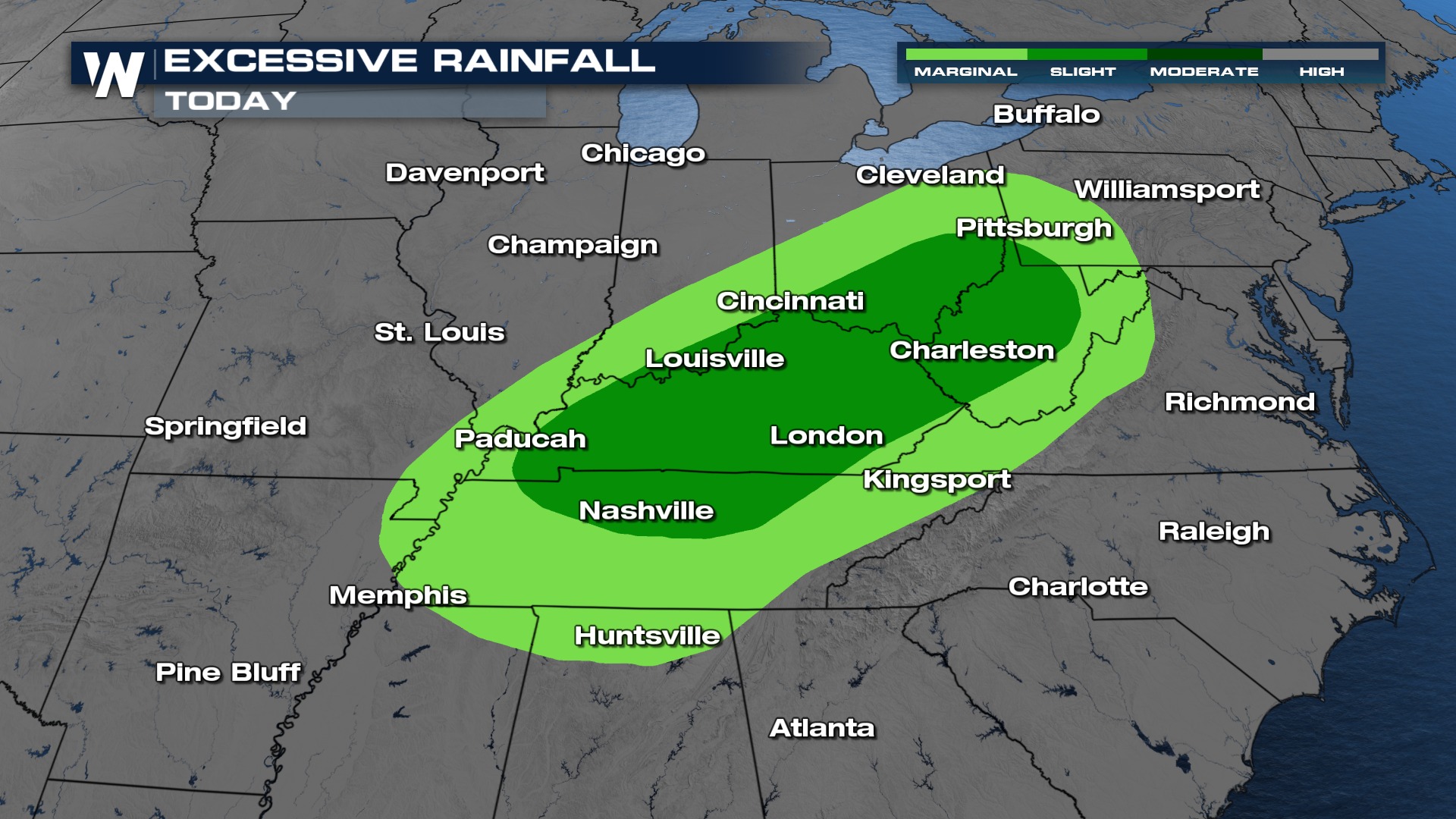 With high rain rates, rainfall totals between 2-4" are possible by the time it's all said and done. Many areas have already picked up a few inches of rain already, here's what more we could have in store
We’ll keep tracking this system as it shifts east through midweek. The good news is cooler, drier air settles in behind it, bringing a welcome taste of fall once the storms clear out.


