Big Boomer Storms for the Central Plains Today
Special Stories
18 Jun 2018 4:34 PM
Storms are firing along a frontal boundary across Kansas and Nebraska right now.
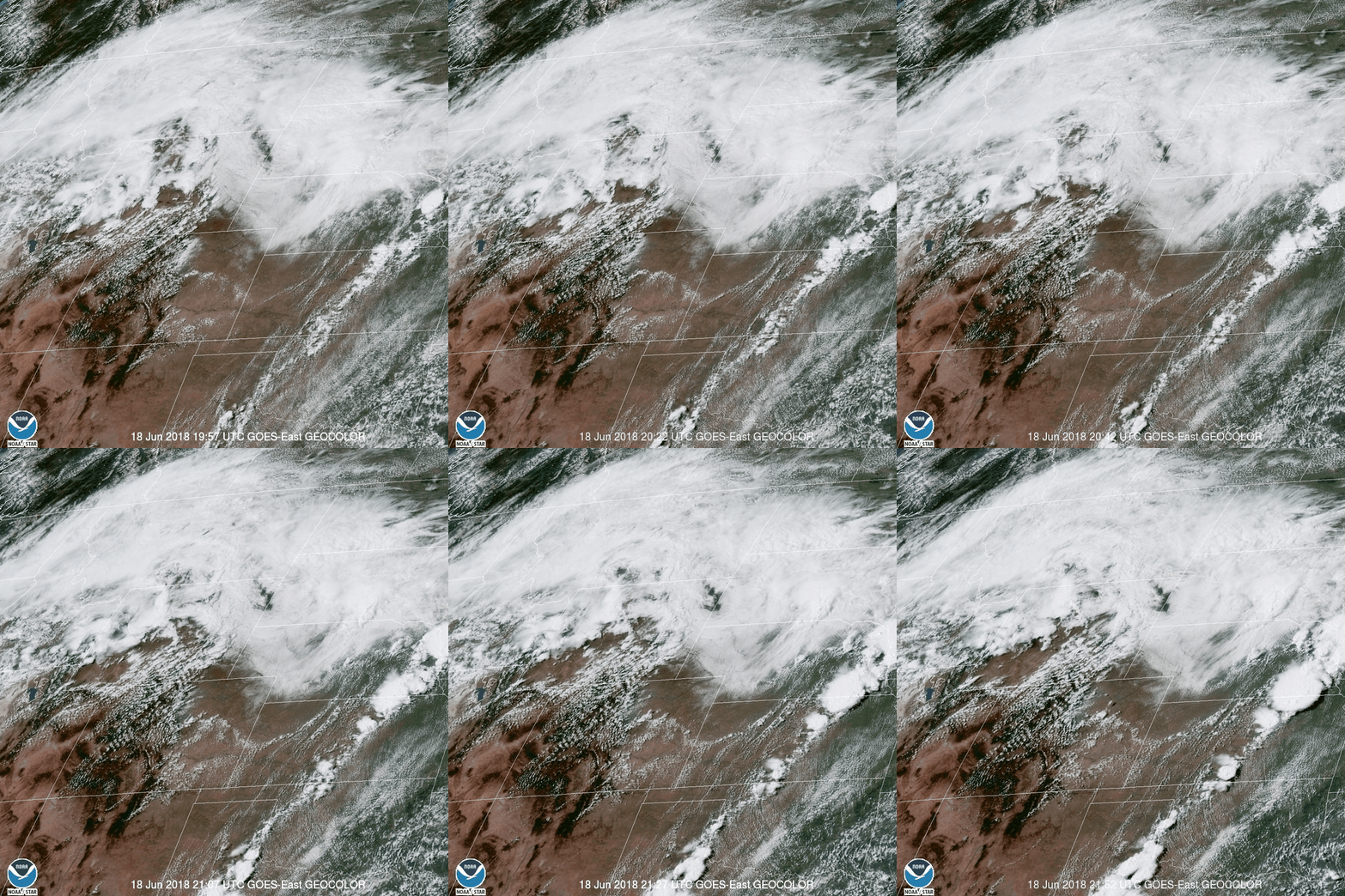
 The video above (as seen from Visible GOES East Satellite) shows those storms firing up from west Texas all the way to eastern Nebraska.
There is a Severe T-Storm Watch out for eastern Nebraska all the way to western Iowa until later this evening.
https://twitter.com/WeatherNation/status/1008803687659999232
Primary concern with the storms in the Plains and Midwest this afternoon remains to be damaging winds and hail;however, there is enough rotation/shear to allow some individual cells to begin to rotate which could spawn a few brief isolated tornadoes for Iowa and Nebraska. The concern for isolated tornadoes is only for this afternoon and early evening.
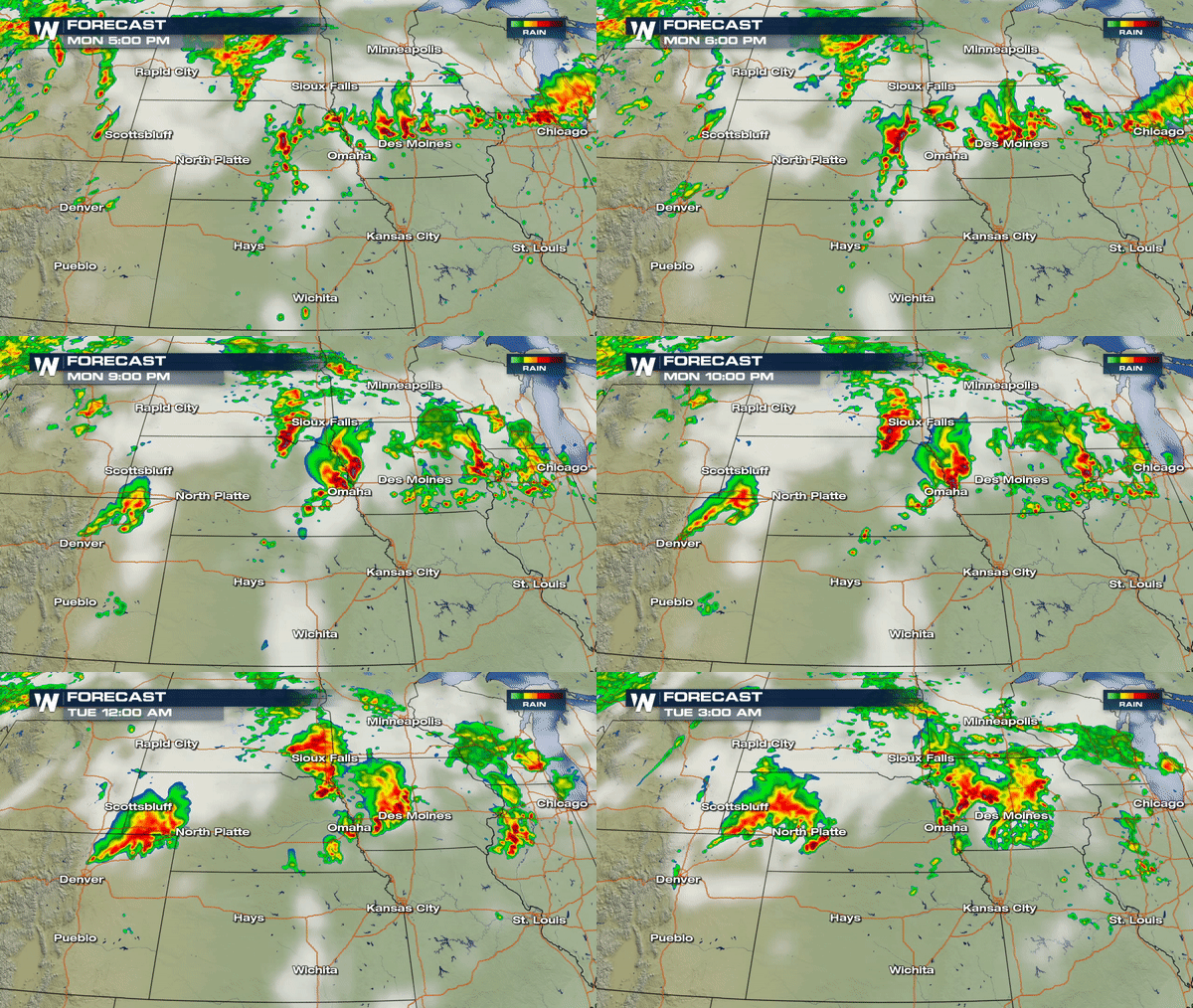
These storms exploding over the Plains will continue east northeast through the remainder of the day as shows in the forecast below. After sunset tonight, storms moving over eastern Nebraska and western Iowa will likely yield more of a damaging wind threat.
 Northeast Colorado is under an elevated risk for severe storms as well; however, a delay in surface heating due to a thick layer of late morning cloud cover may inhibit the overall severe storm development this afternoon. Still a few big boomers producing gusty winds across the Colorado plains looks to be the main concern at this time and timing would be between 6pm - 8pm this evening.
Stay alert! Meteorologist David Neal is tracking severe storms all across the country today. Tune in for the latest or find us on all streaming platform such as Amazon Fire TV, Roku or Sling.
Meteorologist Merry Matthews
 The video above (as seen from Visible GOES East Satellite) shows those storms firing up from west Texas all the way to eastern Nebraska.
There is a Severe T-Storm Watch out for eastern Nebraska all the way to western Iowa until later this evening.
https://twitter.com/WeatherNation/status/1008803687659999232
Primary concern with the storms in the Plains and Midwest this afternoon remains to be damaging winds and hail;however, there is enough rotation/shear to allow some individual cells to begin to rotate which could spawn a few brief isolated tornadoes for Iowa and Nebraska. The concern for isolated tornadoes is only for this afternoon and early evening.
These storms exploding over the Plains will continue east northeast through the remainder of the day as shows in the forecast below. After sunset tonight, storms moving over eastern Nebraska and western Iowa will likely yield more of a damaging wind threat.
 Northeast Colorado is under an elevated risk for severe storms as well; however, a delay in surface heating due to a thick layer of late morning cloud cover may inhibit the overall severe storm development this afternoon. Still a few big boomers producing gusty winds across the Colorado plains looks to be the main concern at this time and timing would be between 6pm - 8pm this evening.
Stay alert! Meteorologist David Neal is tracking severe storms all across the country today. Tune in for the latest or find us on all streaming platform such as Amazon Fire TV, Roku or Sling.
Meteorologist Merry Matthews
All Weather News
More