Big Trough Brings Snow North, Rain South

The coldest air of the season is on its way. This arctic outbreak will be wide-reaching, with bitterly cold temperatures heading to the East Coast and the South.
SETUP
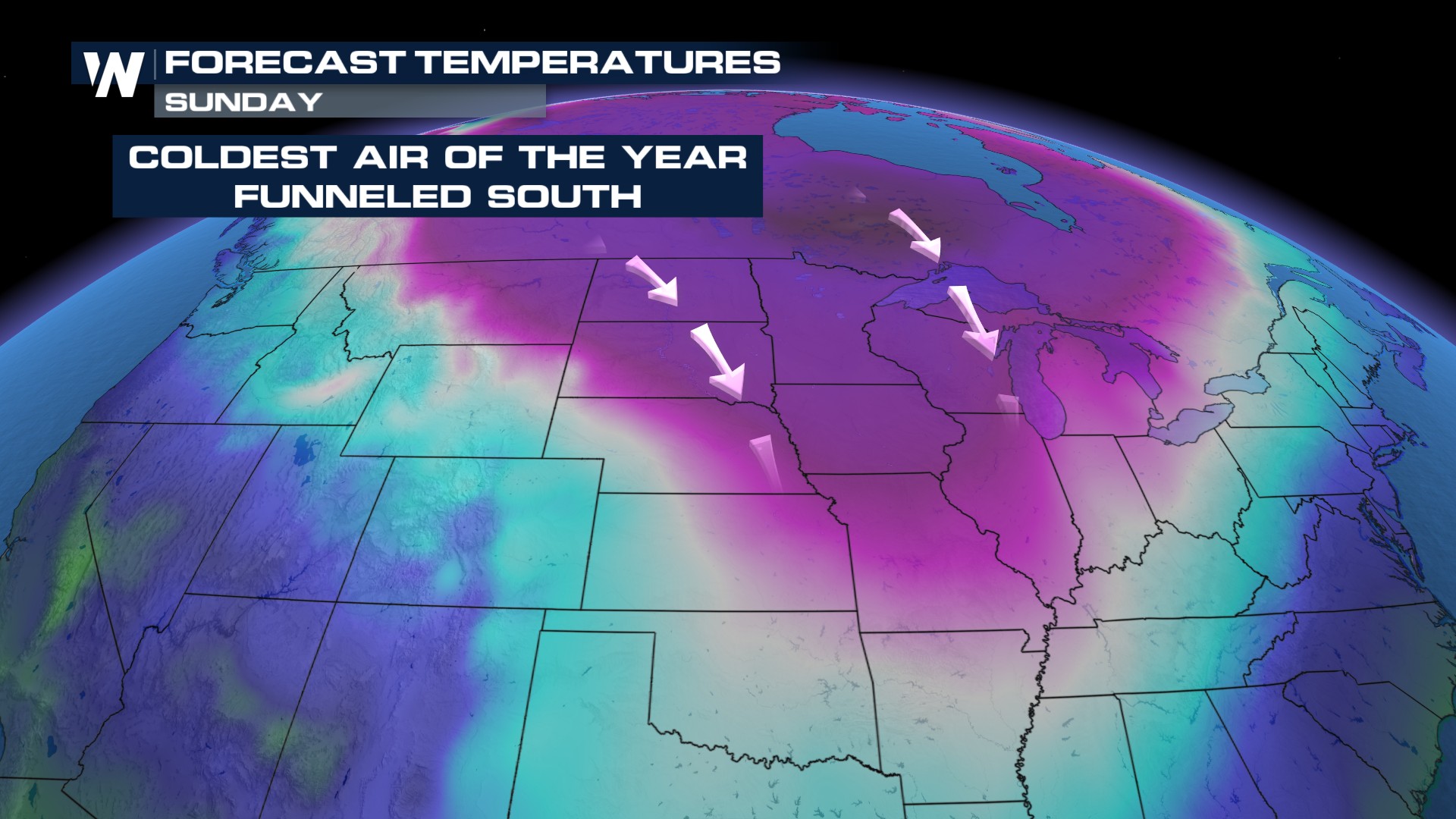
A cut-off low and a large upper-level trough will allow cold air from northern latitudes to move south through the weekend.
COLD
Temperatures will be well below average, as most models show jaw-dropping possibilities (Think 40° colder than average!). There will be locations dipping into -20°s to -30°s, before even factoring in the windchill! The Climate Prediction Center has much of the lower 48 below average January 21-25.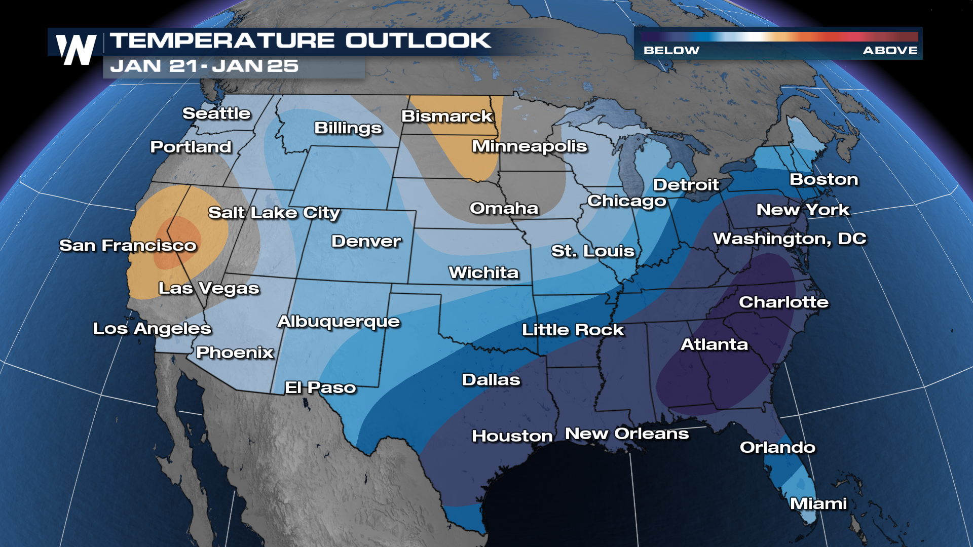
While it is extremely cold, it does not appear to be threatening any record lows at the moment. However, these temperatures are going to take a drastic fall this week. Denver, CO drops 60° in 60 hours...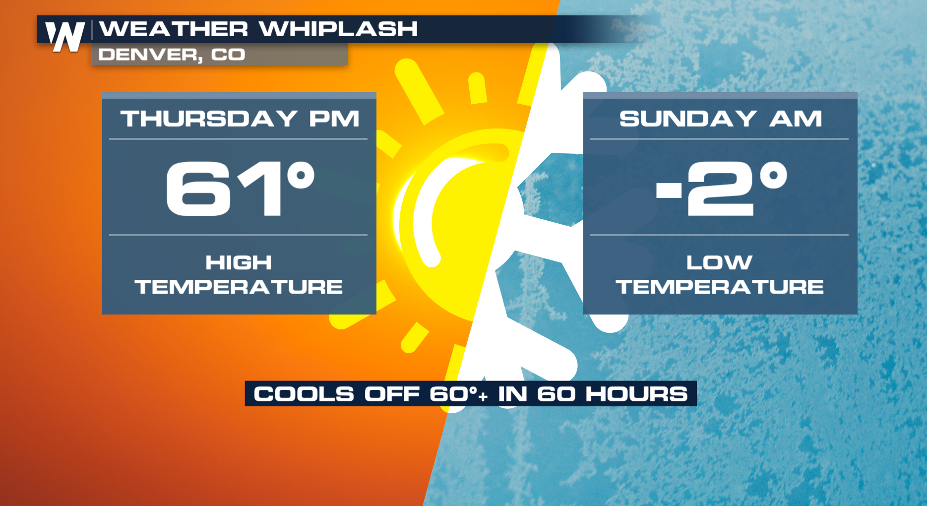
PRECIPITATION
As a front moves south and east, moisture will combine with cold air. The Rockies can see snow Friday into Sunday, with snow moving into New Mexico and Texas Sunday morning. The Midwest and Northeast can see some snow, the south will be cold with rain, but most of the snow should stick further north.
As always, check back with us throughout the week. Often times what looks like a dramatic cooldown can soften as we get closer to the event. Disturbances slow down and phase with better ingredients.


