Blizzard Warnings in the Upper Midwest to End 2018
Special Stories
31 Dec 2019 9:48 AM
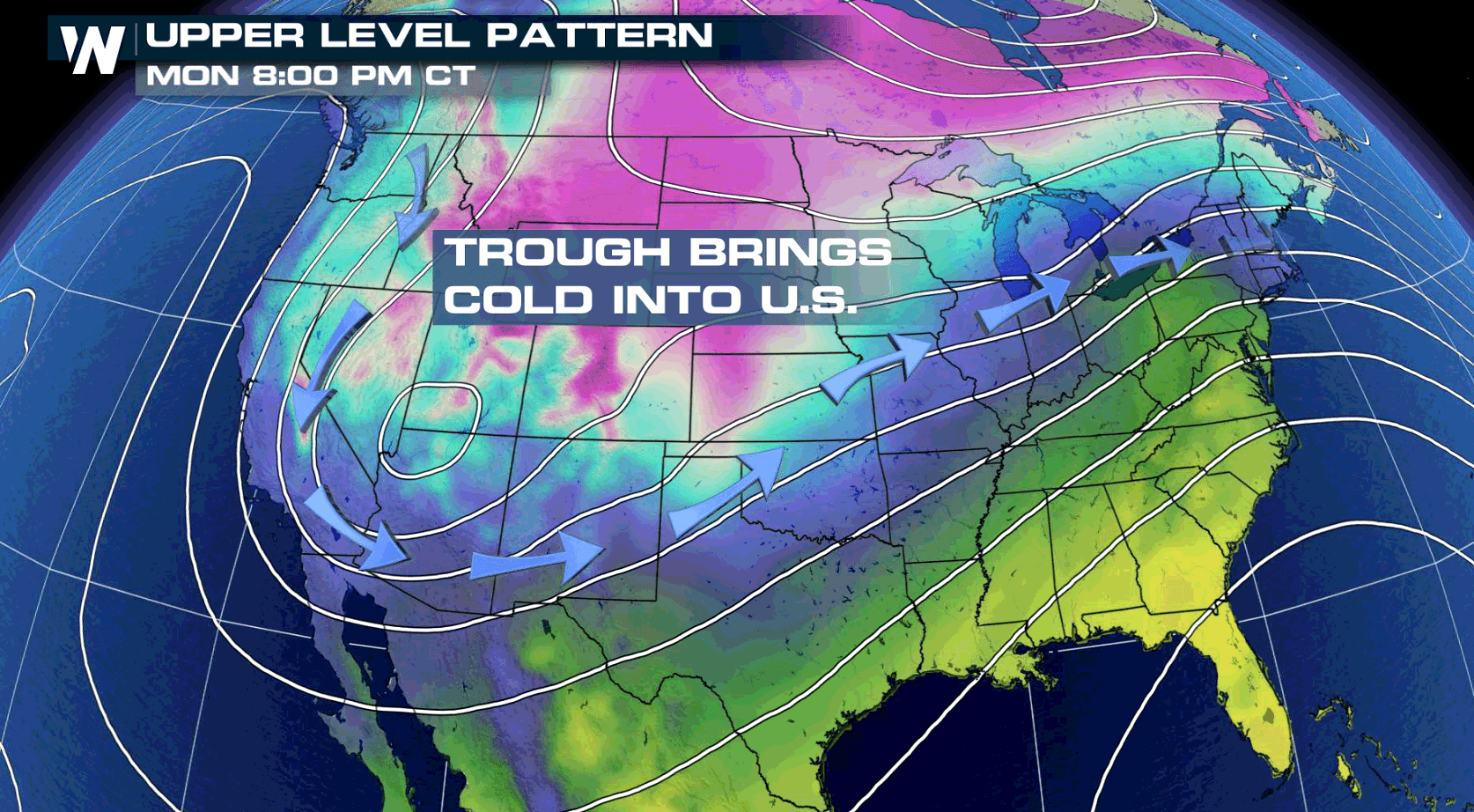
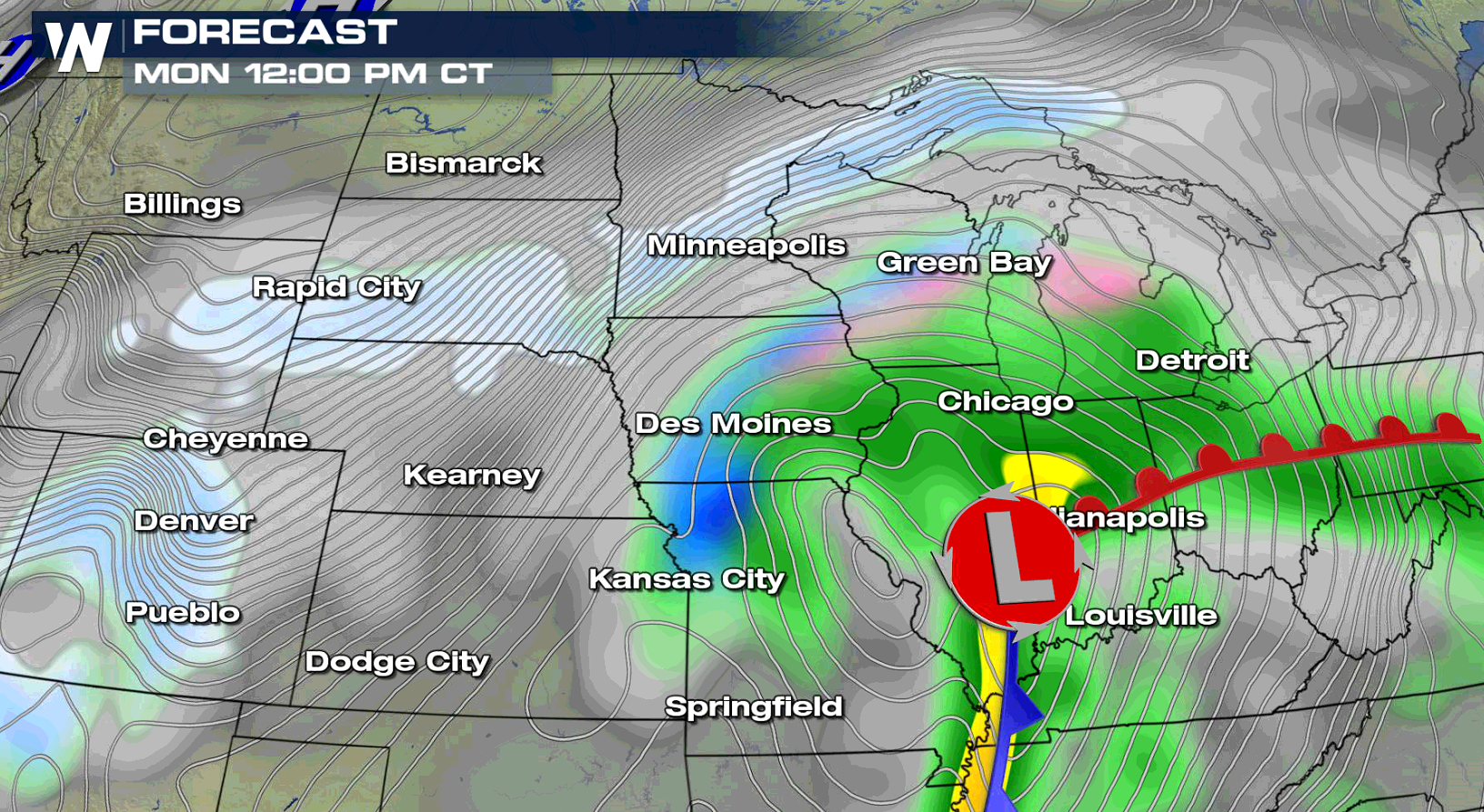
Minor snowfall accumulations but strong winds will make for hazardous travel in portions of the Upper Midwest into New Years Day. Blizzard Warnings have been issued in the Red River Valley and Black Hills, with winter weather alerts from the Front Range to Lake Huron.
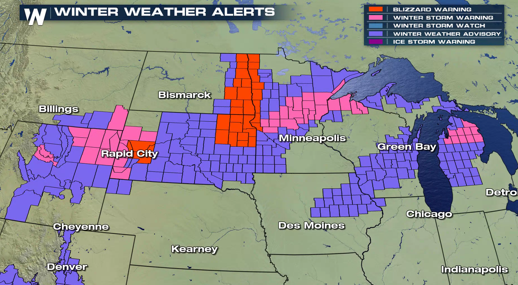
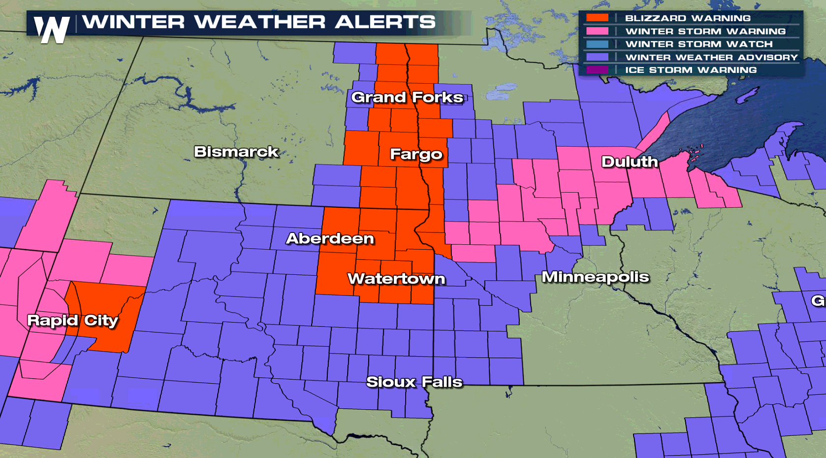
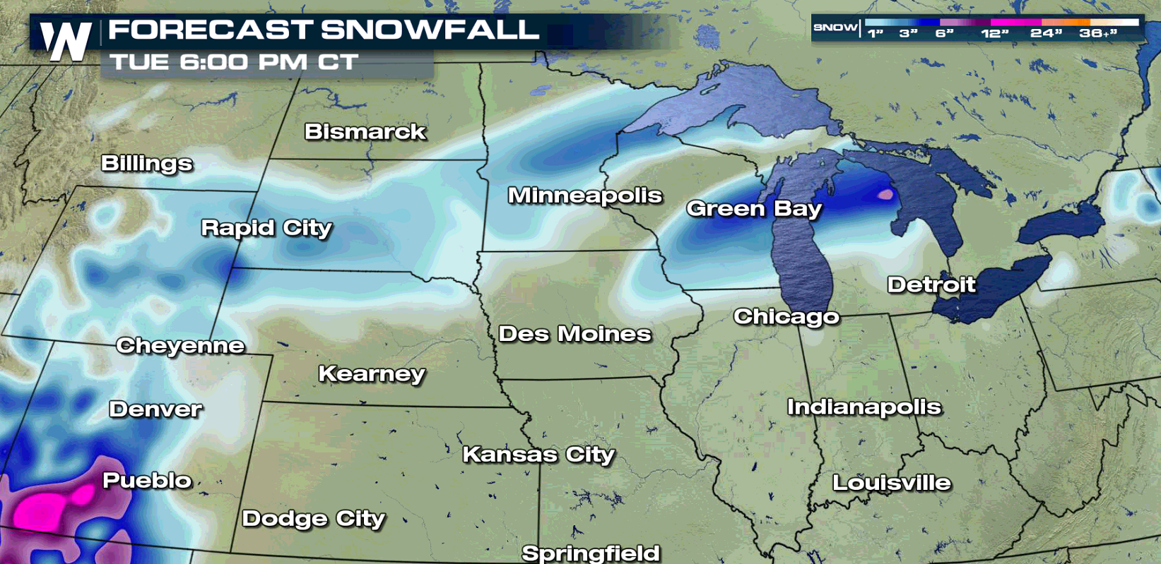 A stripe of 4" to 8" of snow will fall from on the north side of a low pressure center riding through the Corn Belt states. Far lesser amounts will fall further north, an inch at most. A strong Jet Stream will help to deepen the low, increasing winds across the region. This will create significant blowing and drifting snow, reducing visibility. White out conditions are possible in the Blizzard Warning areas with travel becoming nearly impossible at times.
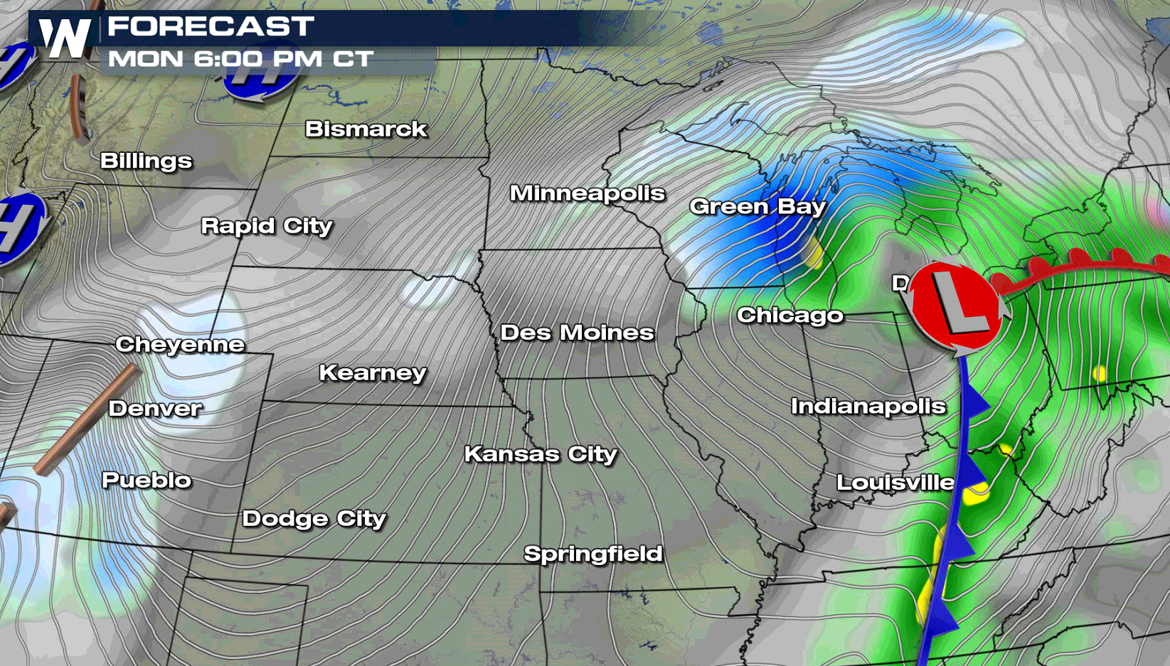
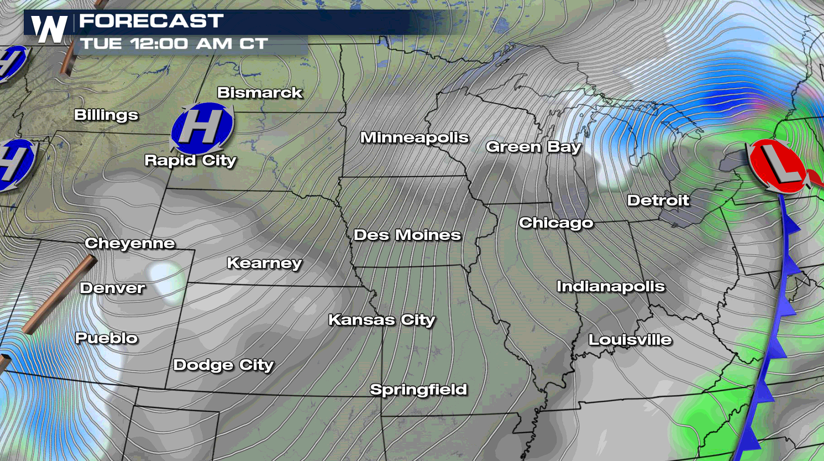 The wind will remain brisk on New Years Day, but the snow will come to an end as the low pushes eastward through the Ohio Valley.
For WeatherNation: Meteorologist Mace Michaels
The wind will remain brisk on New Years Day, but the snow will come to an end as the low pushes eastward through the Ohio Valley.
For WeatherNation: Meteorologist Mace Michaels
A stripe of 4" to 8" of snow will fall from on the north side of a low pressure center riding through the Corn Belt states. Far lesser amounts will fall further north, an inch at most. A strong Jet Stream will help to deepen the low, increasing winds across the region. This will create significant blowing and drifting snow, reducing visibility. White out conditions are possible in the Blizzard Warning areas with travel becoming nearly impossible at times.
The wind will remain brisk on New Years Day, but the snow will come to an end as the low pushes eastward through the Ohio Valley.
For WeatherNation: Meteorologist Mace MichaelsAll Weather News
More
Wildfire Outbreak in the Pacific Northwest
SPOKANE, WA - On Saturday, August 1st, the Ol
3 Aug 2026 1:55 AM

More Storms for the East Through Monday
A low-pressure system that moved through the
3 Aug 2026 1:50 AM


After Reaching Category 5, Genevieve Weakens in the Pacific
PacificGenevieve formed last Friday south of
3 Aug 2026 12:30 AM

Flooding, Severe Storms Target the Midwest Again
After an active week of storms across the nor
1 Aug 2026 1:40 AM

Flooding Risk Increases as Heavy Rain Targets the Tri-State Area
Tuesday, heavy rainfall moved across the Nort
30 Jul 2026 12:25 AM

Severe Weather: Energy From the Midwest Now in the Southeast
UPPER MIDWEST - Through Monday, dangerous tor
29 Jul 2026 10:30 PM