Blizzard Warnings in the Great Lakes with Lake Effect Snow
Special Stories
8 Feb 2019 9:20 AM
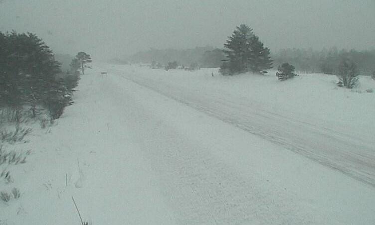
[M-28 near Seney Rest Area in the Upper Peninsula of Michigan from this morning (Friday). From MDOT]
Strong wind and pockets of heavy snow is producing white out conditions along the Great Lakes this morning (Friday). Visibility has been near zero at times in blowing and drifting snow, especially in Michigan.
https://twitter.com/NWSGaylord/status/1093869056208355329
https://twitter.com/NWSGrandRapids/status/1093886662453743617
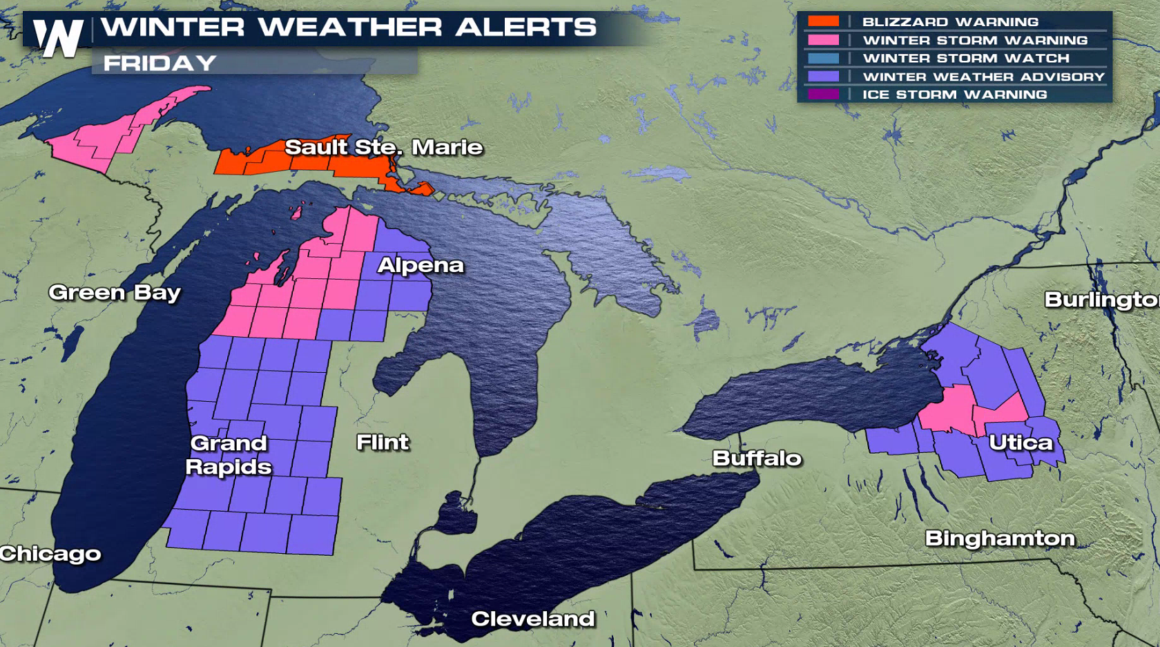
Blizzard Warnings remain in effect from Sault Ste. Marie to Marquette in the Upper Peninsula of Michigan. A couple inches of snow along with wind gusts to 40 mph will create difficult travel. Roads have been closed at times already. Additional winter weather alerts have been issued along Lake Superior, Lake Michigan and Lake Ontario. The heaviest snow totals will be seen in New York, with up to a foot possible in the heaviest squalls.
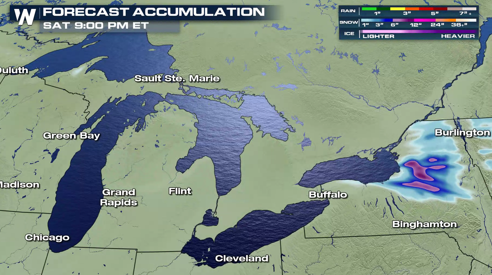 The worst travel conditions will likely be found in Michigan. Snowfall totals will range from a couple inches in the U.P. to 6" in southwest Lower Michigan, but strong winds will produce blowing and drifting snow.
https://twitter.com/NWSMarquette/status/1093816410374094848
https://twitter.com/NWSGaylord/status/1093826968599048193
https://twitter.com/NWSGrandRapids/status/1093593908804763649
Lake Ontario will produce some intense snow bands, with potentially up to a foot of snow. Wind gusts to 50 mph will create difficult travel conditions.
https://twitter.com/NWSBinghamton/status/1093824570300223489
For WeatherNation: Meteorologist Mace Michaels
The worst travel conditions will likely be found in Michigan. Snowfall totals will range from a couple inches in the U.P. to 6" in southwest Lower Michigan, but strong winds will produce blowing and drifting snow.
https://twitter.com/NWSMarquette/status/1093816410374094848
https://twitter.com/NWSGaylord/status/1093826968599048193
https://twitter.com/NWSGrandRapids/status/1093593908804763649
Lake Ontario will produce some intense snow bands, with potentially up to a foot of snow. Wind gusts to 50 mph will create difficult travel conditions.
https://twitter.com/NWSBinghamton/status/1093824570300223489
For WeatherNation: Meteorologist Mace MichaelsAll Weather News
More

Flooding, Severe Storms Target the Midwest Again
After an active week of storms across the nor
1 Aug 2026 1:40 AM


After Reaching Category 5, Genevieve Weakens in the Pacific
PacificFausto is now a post-tropical cyclone.
31 Jul 2026 1:30 AM

Flooding Risk Increases as Heavy Rain Targets the Tri-State Area
Tuesday, heavy rainfall moved across the Nort
30 Jul 2026 12:25 AM

Severe Weather: Energy From the Midwest Now in the Southeast
UPPER MIDWEST - Through Monday, dangerous tor
29 Jul 2026 10:30 PM