Powerful Nor’easter Slams East Coast over the Weekend

A Nor'easter...in September? While most people think of winter when it comes to these intense coastal storms, they can happen in the fall. The impacts will only be a little different, mainly with heavy rain instead of snow, but coastal flooding, huge surf, and strong winds will continue to create significant hazards.
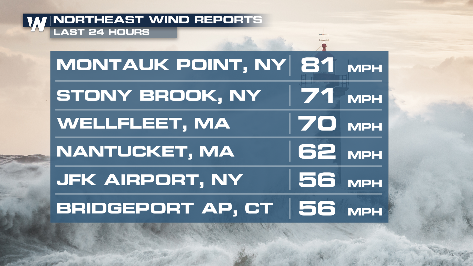
Winds across the northeast have reached over 60 mph in some areas.
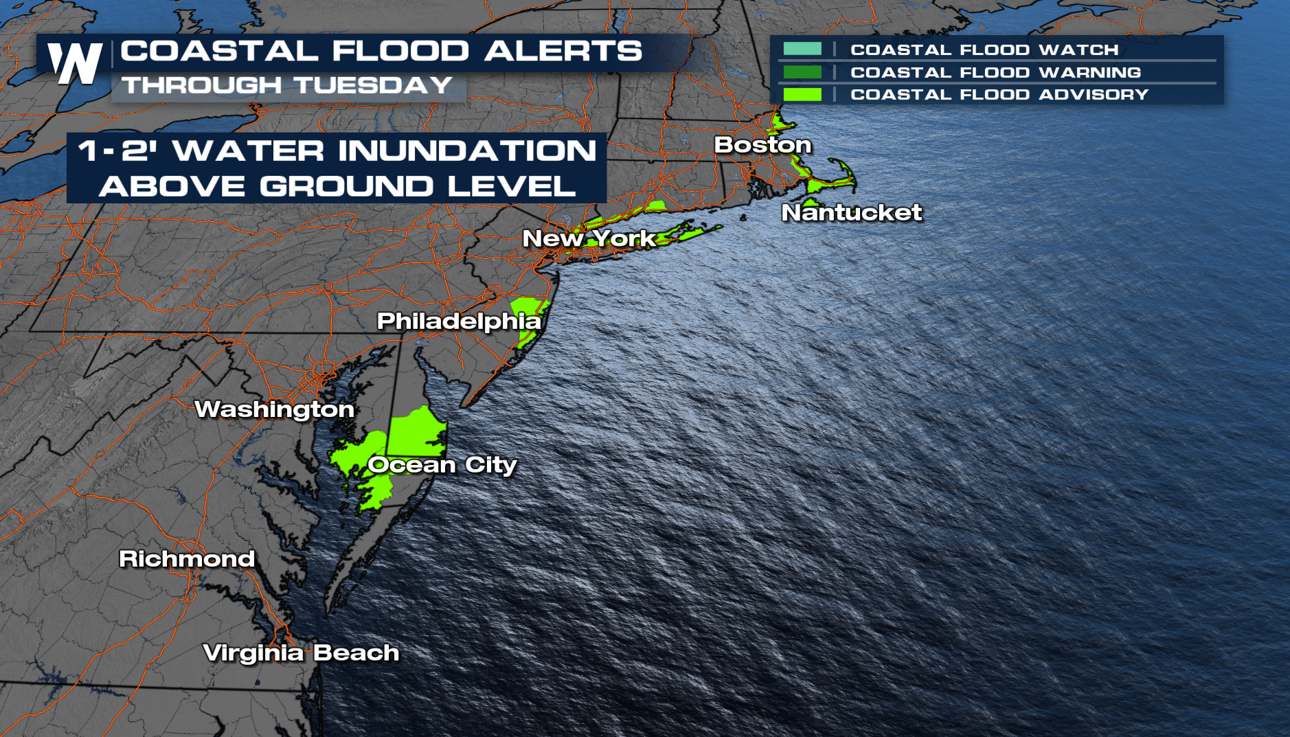
 Some of the greatest concerns were along the Mid-Atlantic coastline, where repeated high-tide cycles sent water into neighborhoods and businesses and washed out roadways. Communities that frequently experience tidal flooding like Bethany Beach saw conditions worsen as the storm churned offshore.
The impacts of this nor'easter will be winding down today, but Coastal Flood Warnings and Advisories do remain in effect through the day, some through early Tuesday.
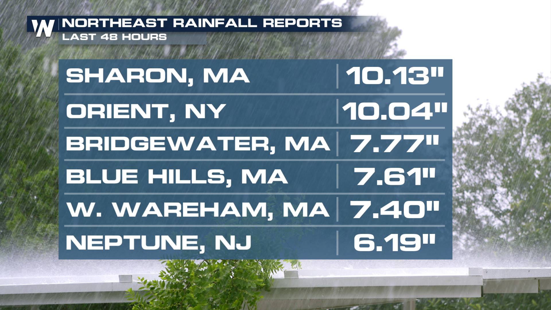
 The immediate coastal flooding was quickly made worse as heavy rain dumped along the Northeast coast by the weekend.
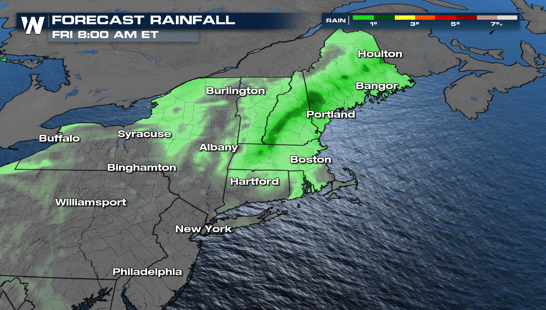 As the low weakens and stalls, the rain should break up and become less heavy through today. Lingering gusty winds, light rain, and strong surf are expected to last into early Tuesday as the low moves out of New England.
Conditions should gradually improve as the storm weakens and moves away from the coast Monday, and more so Tuesday. However, dangerous surf and lingering coastal flooding could remain concerns even after the heaviest rainfall and strongest winds subside. Residents and travelers along the East Coast are encouraged to monitor local weather alerts, avoid flooded roadways, and use caution near beaches and other coastal areas as the storm continues to impact the region. Tune into WeatherNation TV for the latest.


