Cold Blast Prompts Frost and Freeze Alerts

WHAT TO EXPECT
A blast of cold air has brought freeze warnings across portions of the Great Lakes, Midwest, and East. Temperatures will drop sub-freezing for Tuesday morning. These temps can impact crops and sensitive vegetation with the potential to damage unprotected outdoor plumbing.
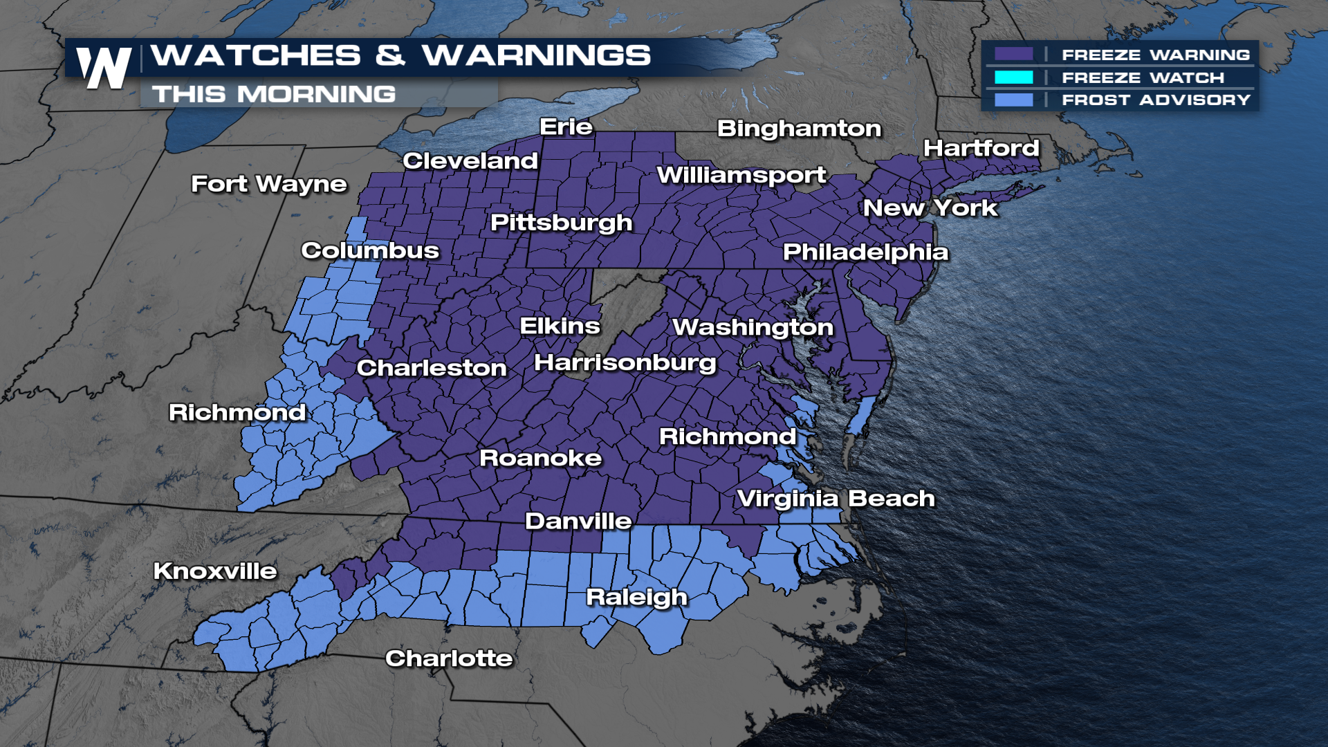
Lows will be cold overnight! Tuesday morning starts out with temperatures in the 20s and 30s for some.
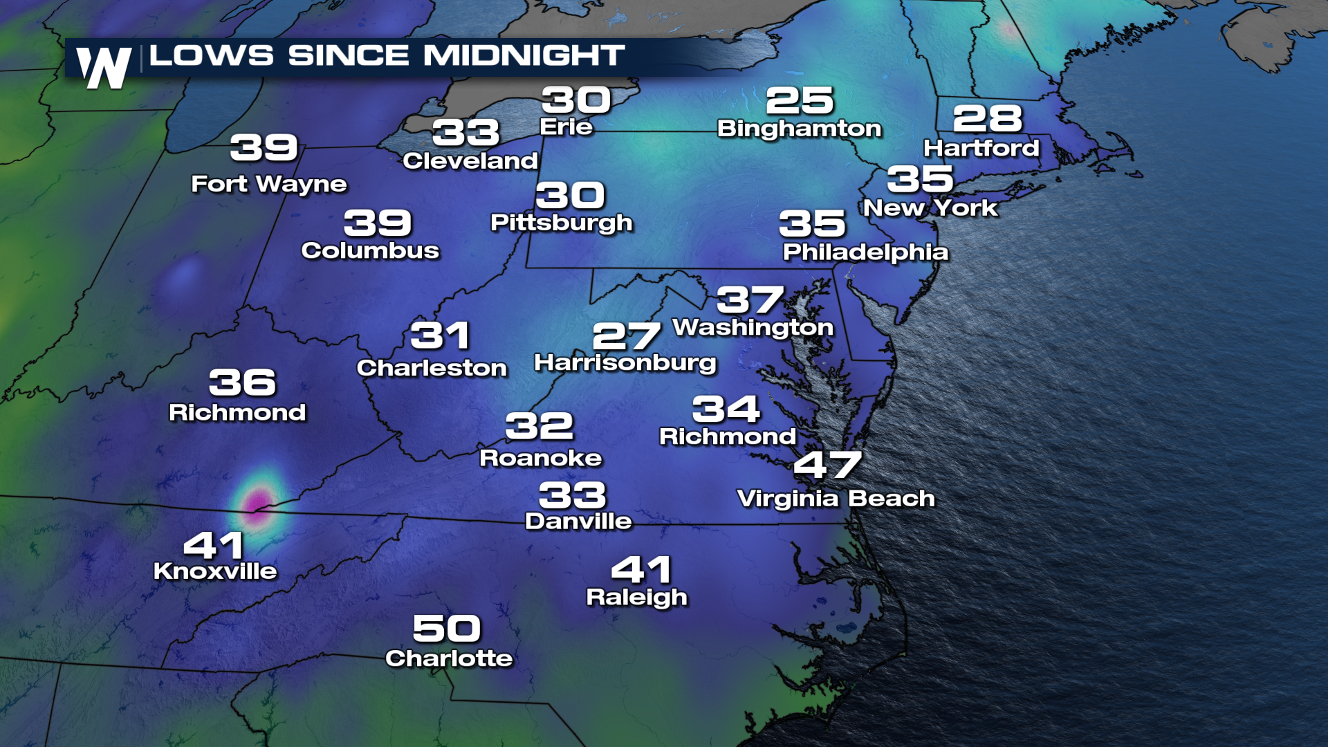
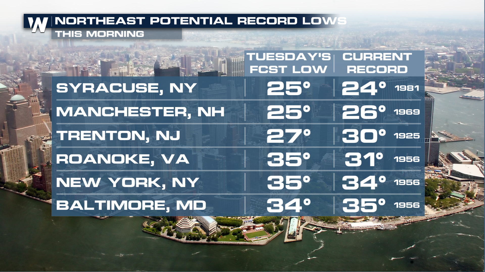
There is even the potential for record lows to break on Tuesday morning with sub-freezing temperatures. The dots on the map are cities that could tie or break record lows.
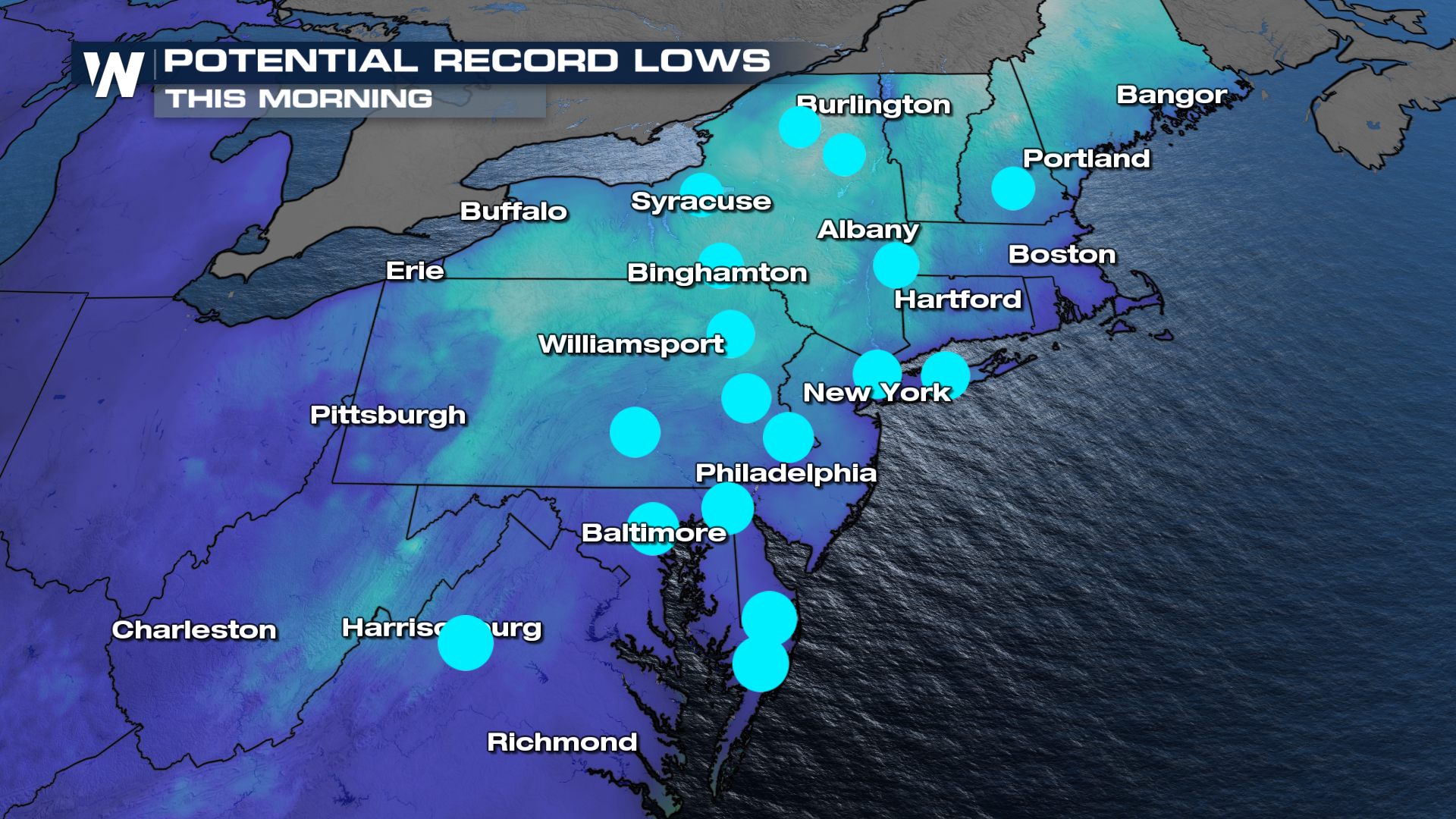
Some of these temperatures include the 20s for cities like Syracuse, NY which may break a record Tuesday morning.
The cold snap won't last long, as by Wednesday temperatures will rebound back to above average.