One More Brutally Cold Morning on the High Plains

NORTHERN PLAINS
A blast of arctic air remains in portions of the northern plains. Extreme cold alerts are in place through Thursday morning. Dangerous wind chills can occur with values as low as 50 below zero. In these conditions, frostbite can occur in as little as 10 minutes, so dress in layers if you have to be outside.
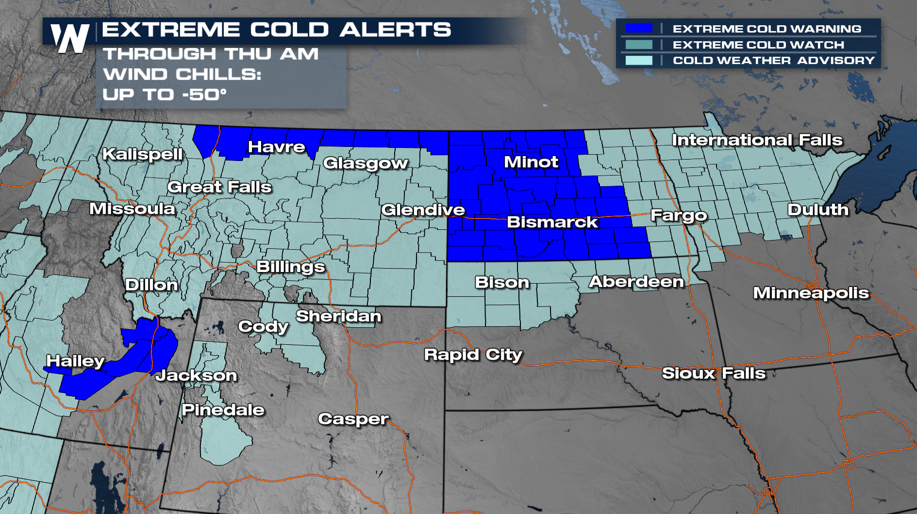 As this frigid air dominates the Northern plains, temps will remain below average and COLD! Temperatures will be below average across the board. Bismarck normally has an already cold average of 5° for this time of year, but will be waking up to extreme cold and temperatures below zero through Friday.
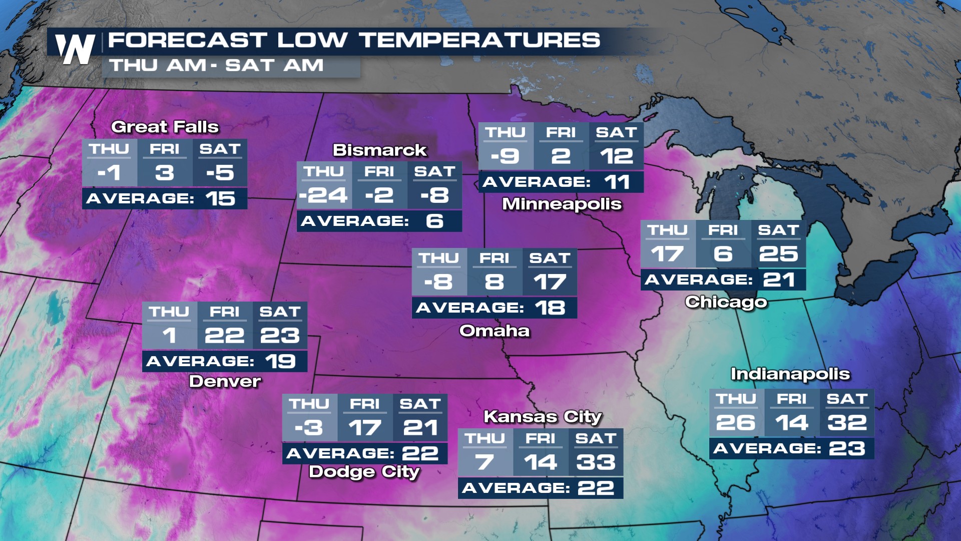 The cold air remains in place over the next few days! The wind chills will again dig into the -20s, -30s, and -40s. Some spots can see wind chills up to -50° below zero! This weather is extremely dangerous, so layer up and use caution if you have to go outdoors.
NORTHWEST
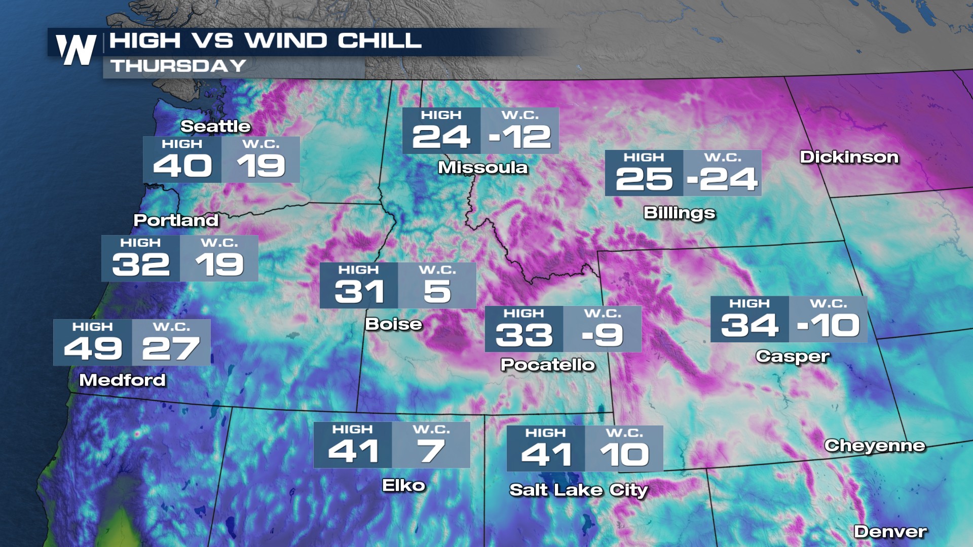
A shot of dry arctic air will bring extremely cold temps across the Northwest. Extreme cold alerts are in place through Thursday morning. Northerly winds will create wind chills below zero.
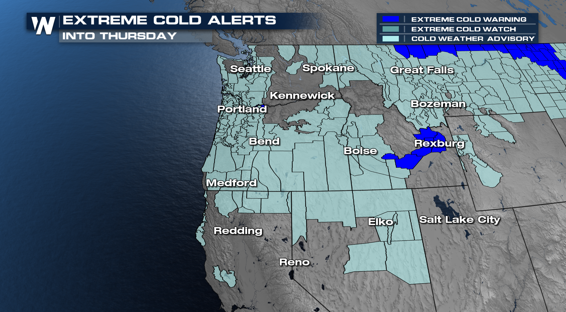 Forecast lows will be below average and cold! Seattle and Portland normally see temps in the upper 30s, and you will wake up to the low 20s. Medford will start Wednesday in the teens. Spokane, Missoula, and Boise will see temps below zero and single digits for Wednesday and Thursday morning.
Tune into WeatherNation :30 and :50 past the hour for the latest on the North Central and Northwest Forecasts.


