Plains Blizzard To Bring Snow to Appalachian Mountains

A Colorado low has moved from the Plains and Upper Midwest now into the Great Lakes and Ohio Valley. This system was responsible for causing blizzard conditions. Winter weather alerts remain in effect within these winter weather alerts, we have Blizzard Warnings (in red).
As the low-pressure center is moving eastward, the snow is winding down from west to east. In Minnesota, the snowstorm dumped over a foot of snow in some locations.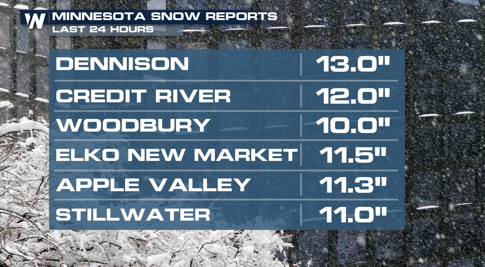 For the rest of Wednesday into the early hours of Thursday morning, the heaviest snow will fall across the Great Lakes region. However, we could see some light snow in the Ohio Valley and Appalachian mountains as the upper-level low passes east.
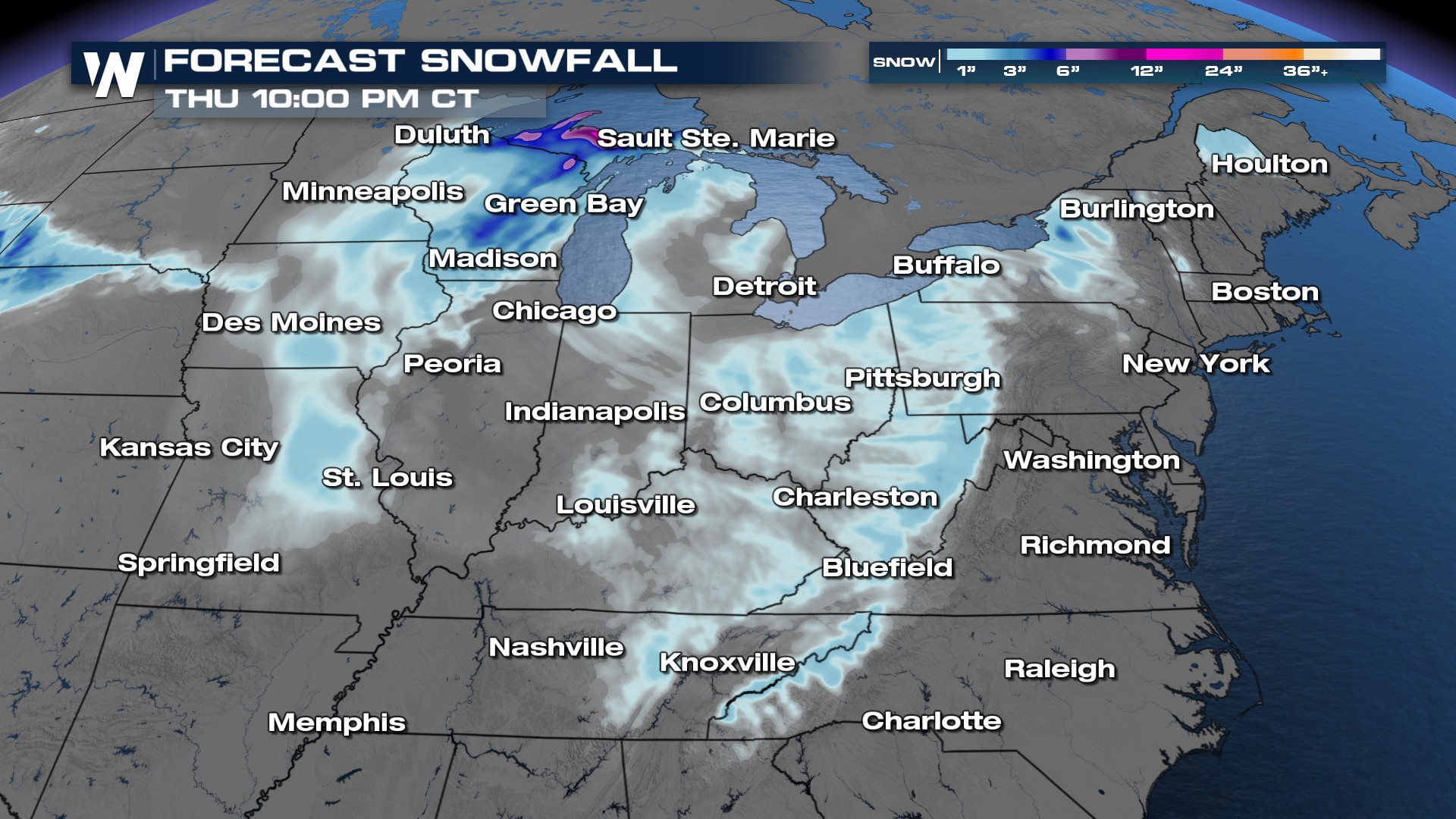
Forecast Timing
The strong winds, snow, and rain keep pushing east throughout the day from the Great Lakes into the Northeast. The strong low-pressure system will exit off the coast by Thursday morning with some light lake-effect snow over Lake Erie and Ontario.
Next System
Another Colorado low is expected to move back into the north-central United States on Thursday to bring us our next chance of snowfall. So if you missed out on snow from the blizzard on Tuesday and Wednesday, there's another chance for snow.
There are still some uncertainties on snowfall totals with this next system.


