Severe Thunderstorms Ramp Back Up Next Week

While the severe thunderstorm risk ends with the latest system pushing off the Atlantic Coast, another potent upper trough will move into the middle states by the middle of next week. The Storm Prediction Center has already highlighted an area of potential severe weather on Thursday, across central Oklahoma and Kansas (above).
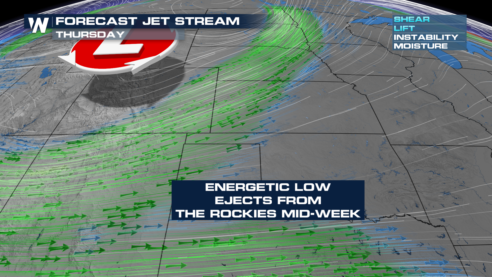
This upper-level low will bring strong winds aloft, enhancing shear for any storms that are able to form in the environment.
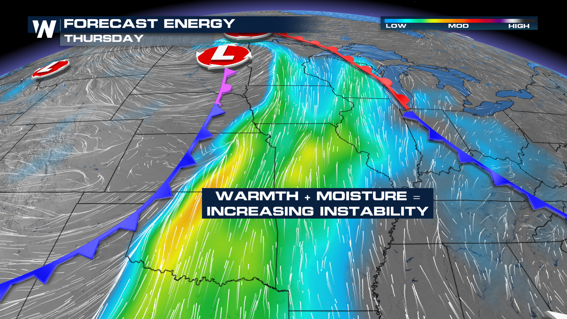
Meanwhile, at the surface, heat and humidity will build during the afternoons, creating an unstable atmosphere. Storms that form will strengthen quickly!
Longer range, less resolute models depict thunderstorms erupting each afternoon, beginning Wednesday. In addition, the models depict heavy rainfall during these events.
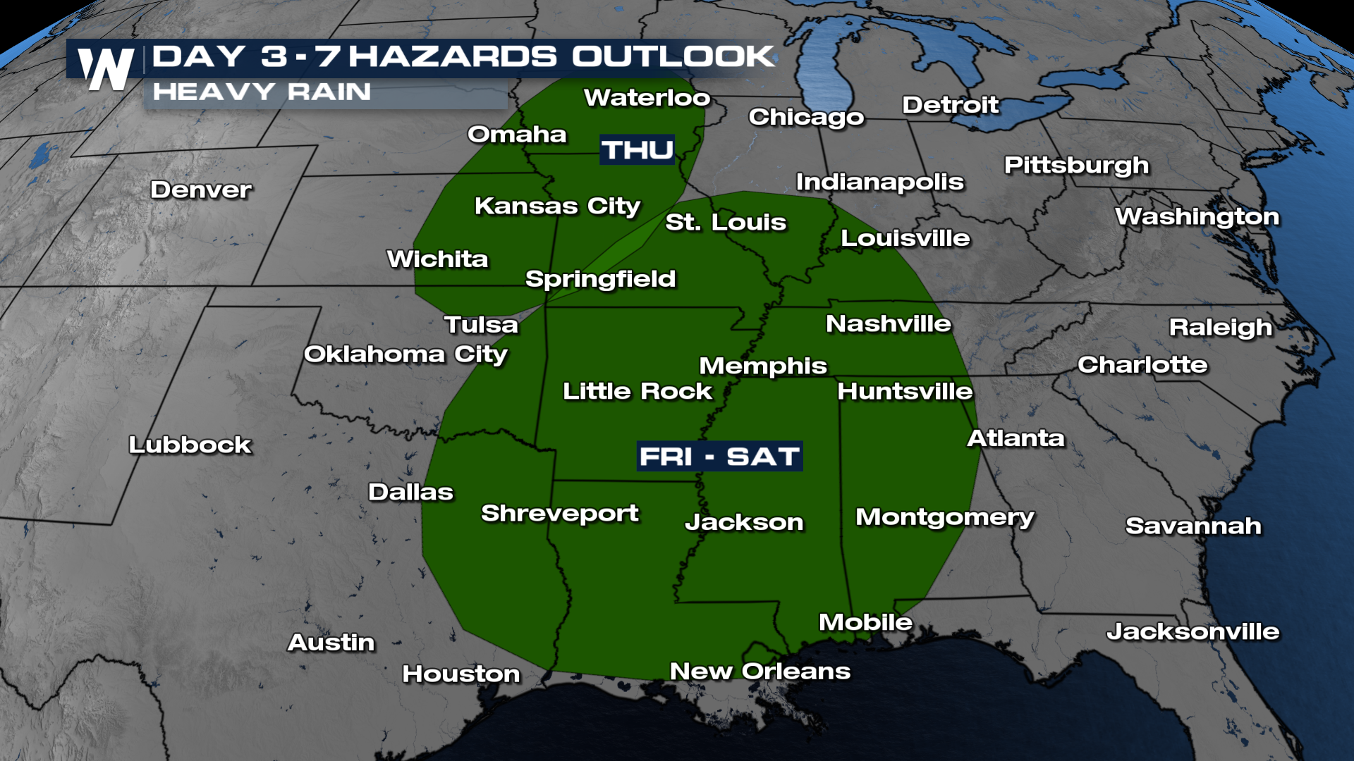
The WPC 3-7 Day Outlook has highlighted the threat of heavy rain from the Central Plains to the Gulf Coast from Thursday to Saturday, respectively.


