Severe Storms Leave a Mark on the Great Lakes

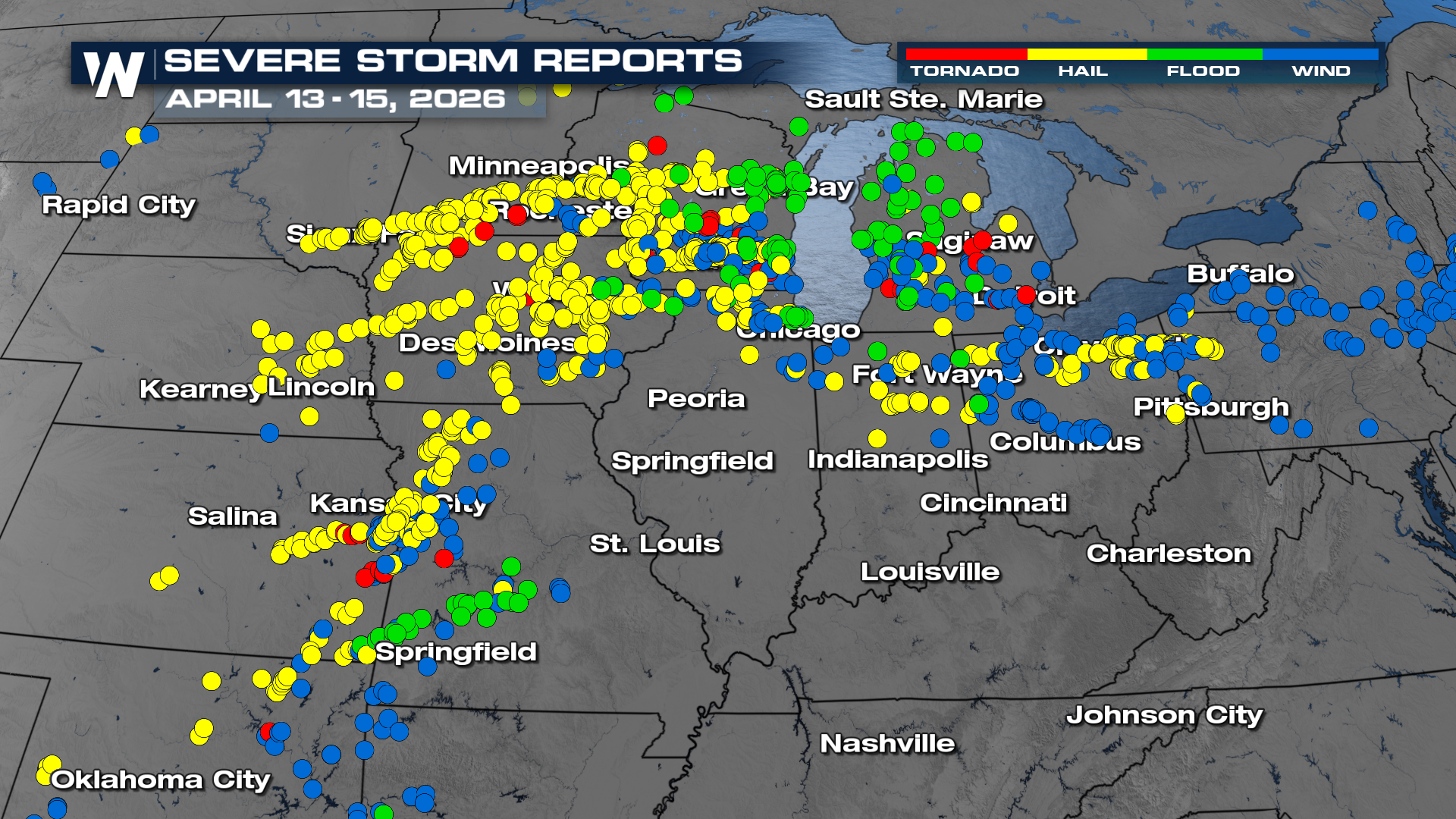
UPPER MIDWEST and GREAT LAKES - Three straight days of destructive severe storms moved through Iowa, Minnesota and Wisconsin. Wednesday, NWS Kansas City confirmed two EF-0 and EF-1 tornadoes that hit the city of Clinton, MO. Check out the video below of the tornado knocking over a fuel tanks.
Overnight
Storms are expected to continue to weaken as we have lost daytime heating. Some rough storms still remain possible across Arkansas and Tennessee that could produce some damaging winds and hail. An isolated severe storm or two is also possible for New England.
Timing
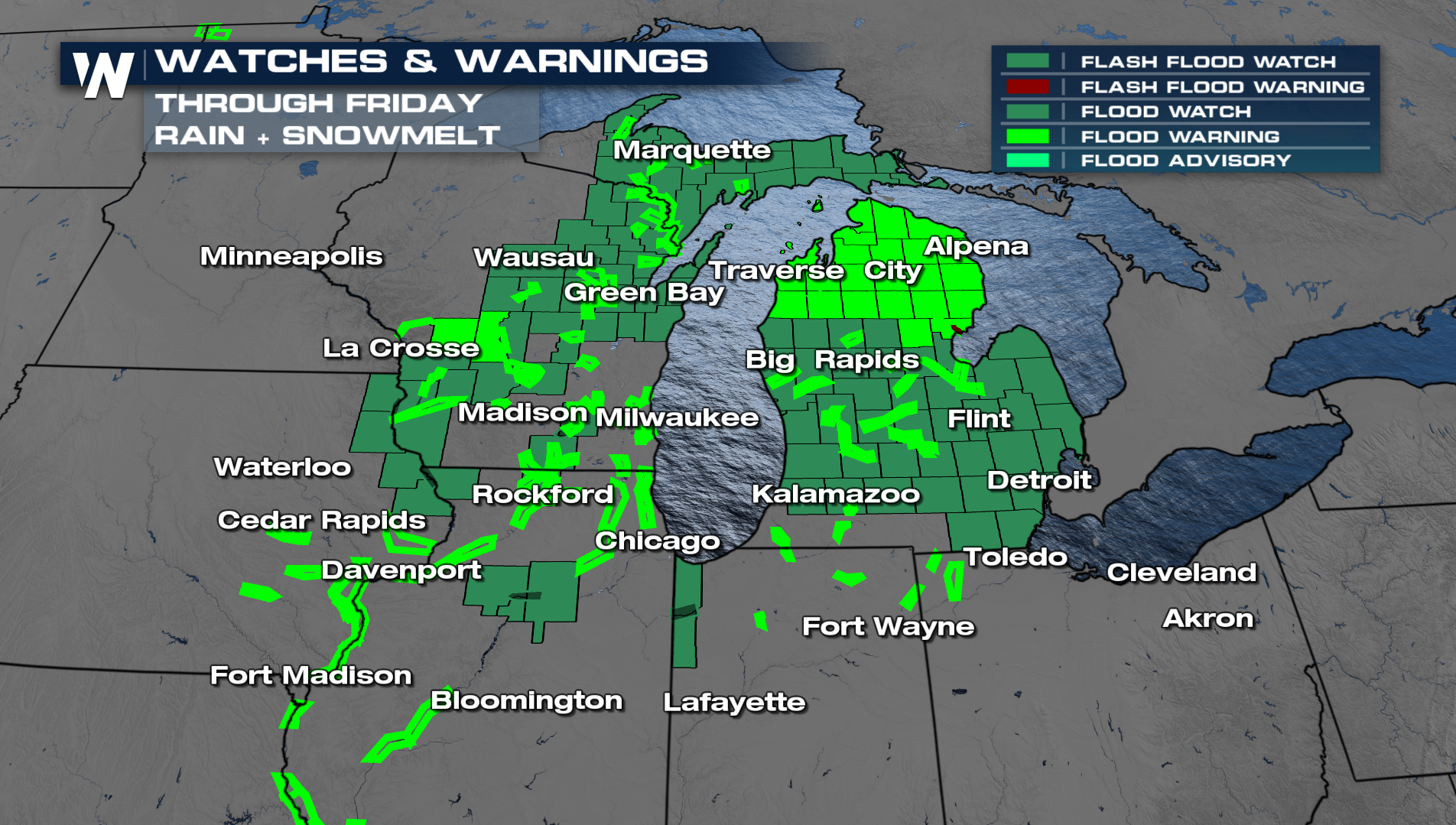
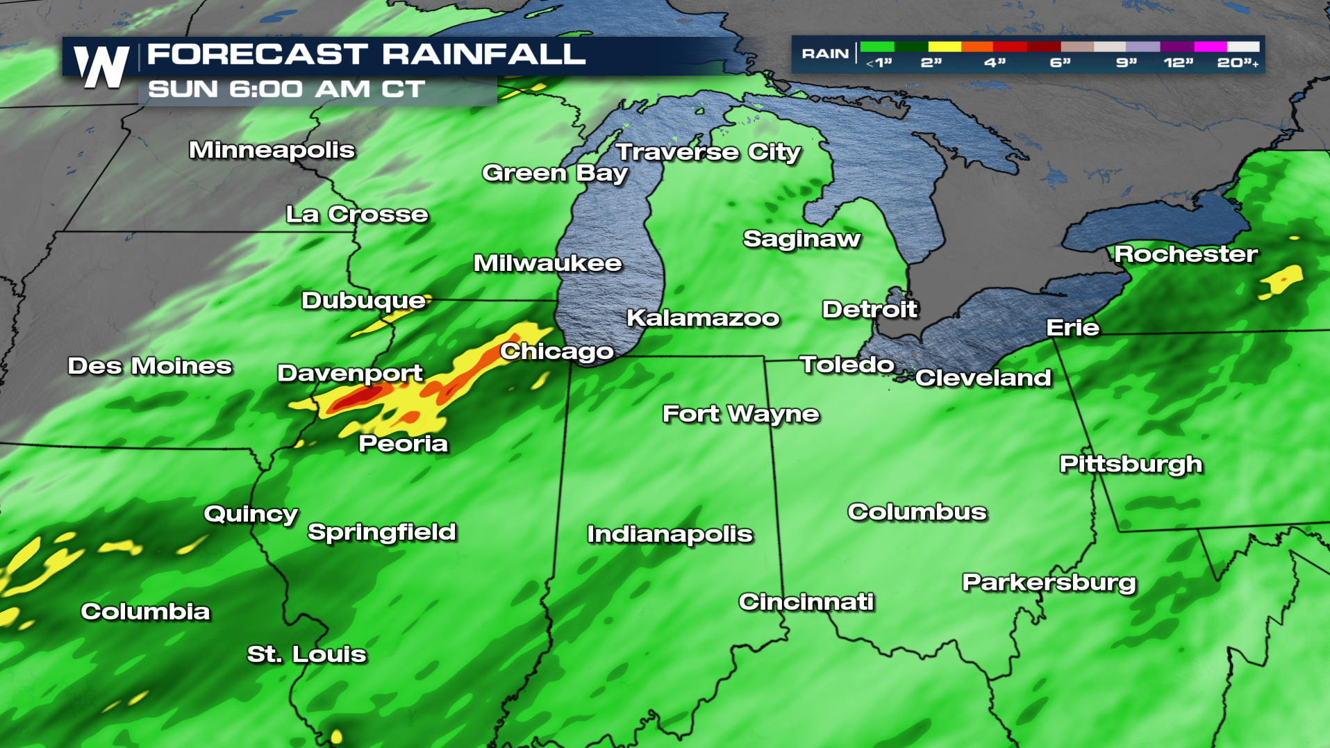
With multiple rounds of strong to severe thunderstorms in the same areas, this may lead to an isolated to scattered flooding risk across the Great Lakes region. Be prepared for flooding, especially if you still have some snow on the ground; frozen ground can take longer to absorb flood waters compared to unfrozen ground. Flood alerts continue into Friday with the next round of severe storms in the forecast.