Colorado I-70 Pileup on Tuesday, More Snow Late Week

COLORADO - An estimated 70+ car pileup happened on Colorado's I-70 near the Eisenhower-Johnson Tunnel earlier on Tuesday, April 14th. Light snow was being reported throughout the day. I-70 was closed well into Tuesday evening, but has since been reopened.
A frontal boundary is moving across the Northern Rockies. As a result, widespread winter weather alerts are in place for higher elevations across the Northwest.
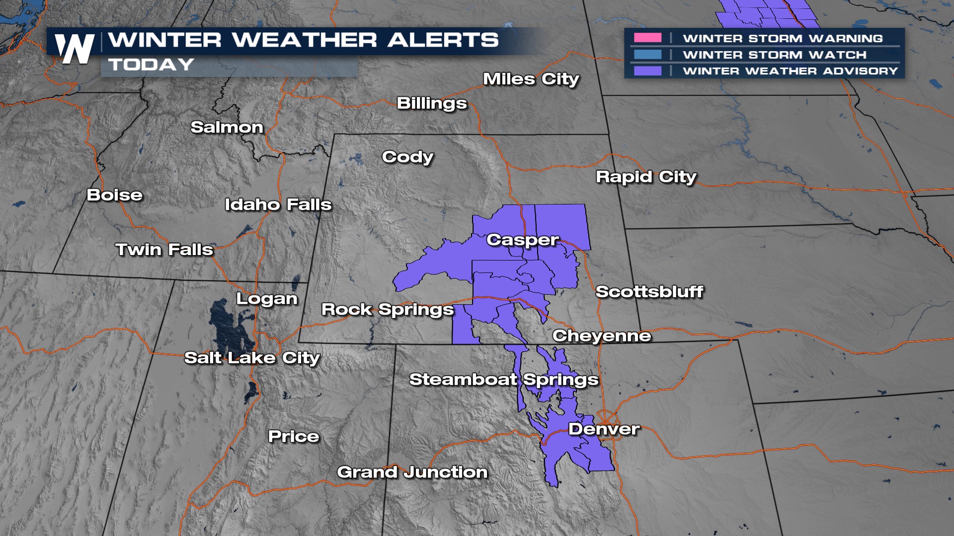
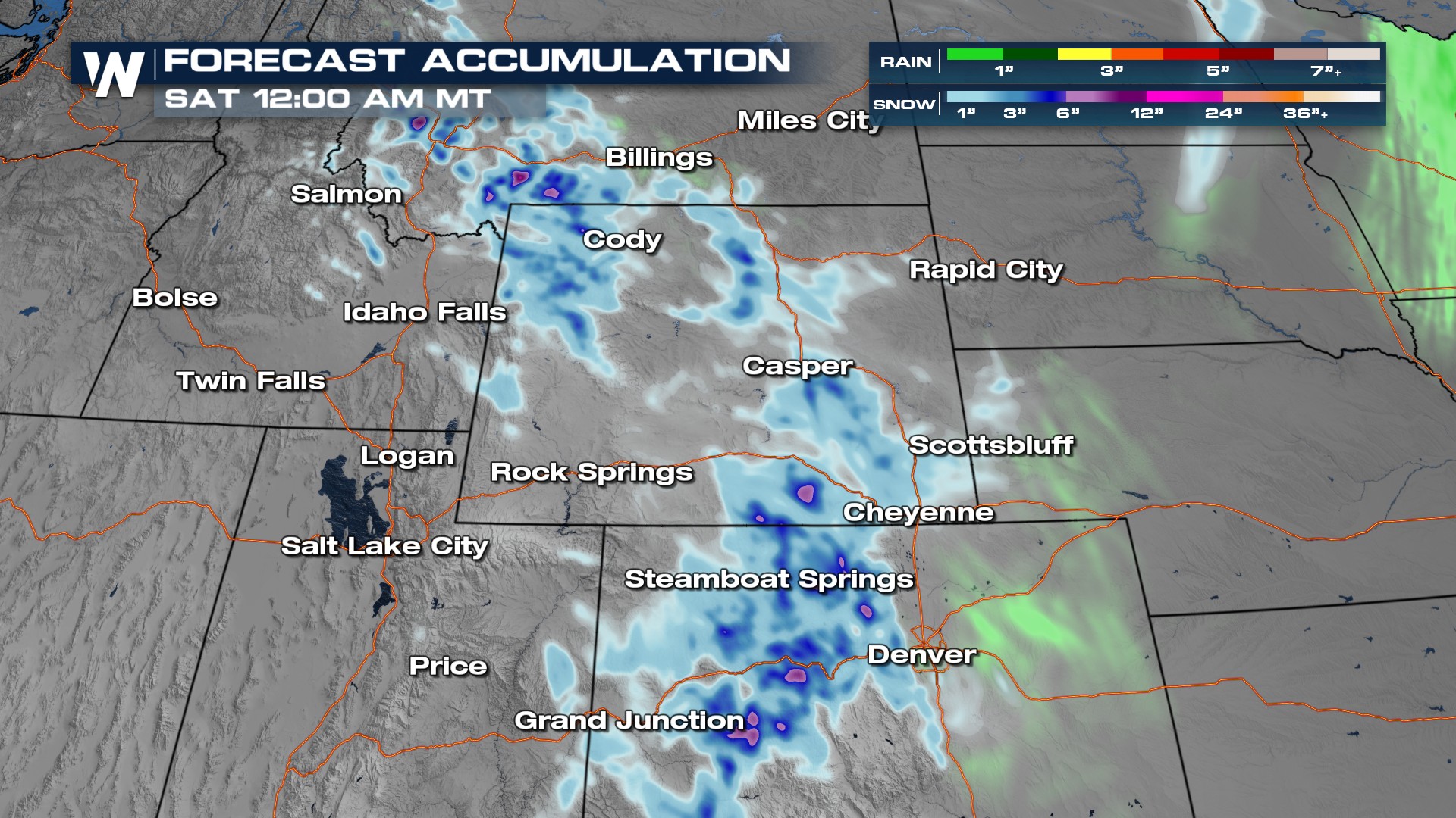
This system is expected to reach Utah by tonight and much of Colorado by Friday. This next round of snow for Colorado looks to bring snow levels lower, down to the I-25 corridor.
Snowfall totals will vary by elevation, but mountainous areas could pick up a foot of snow.
The air will feel much cooler over the next few days. Numerous areas are under frost and freeze alerts.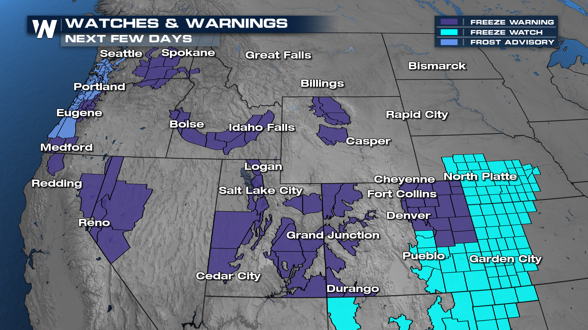
In true Colorado fashion, Denver's nighttime lows will drop into the 20s and 30s after a mild start on Thursday morning.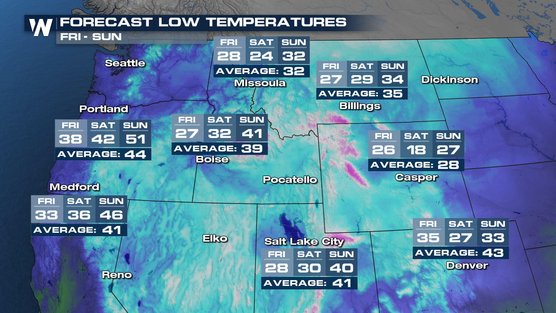
More details on this forecast can be found :50 past the hour on WeatherNation.


