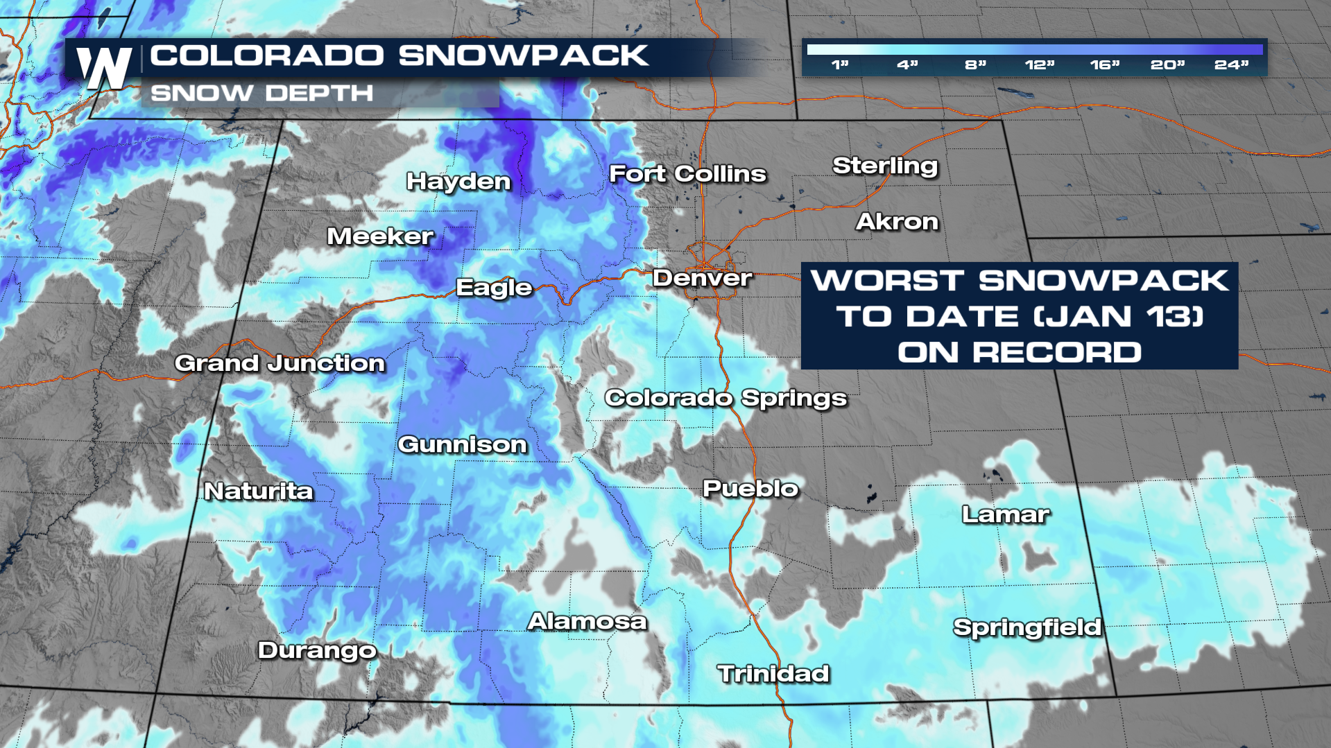
Colorado Snowpack Hits Record Low for Mid-January

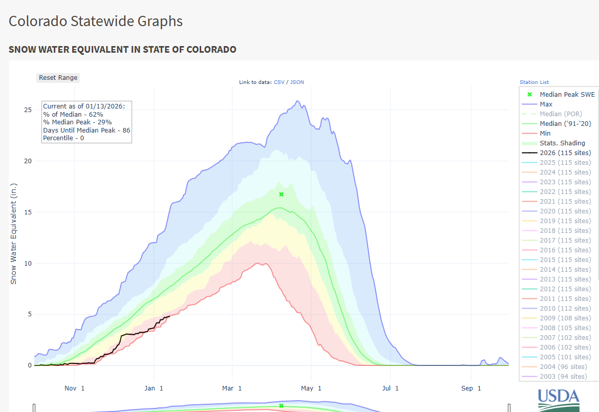
COLORADO - As of January 13, 2026, the season-to-date snowpack, measured as snow water equivalent (SWE), is at its lowest level ever recorded. Records date back to 1987 for the snowpack. Snowpack records for the state date back to 1987, and no other January 13 has seen a lower SWE. Unfortunately, the long-range forecast doesn’t offer much help, with little to no snowfall expected this week.
Why Is Snowpack Important?
Snowpack runoff is essential for filling up Colorado's reservoirs that supply drinking water to communities along the Rocky Mountains, while also supporting agriculture, vegetation, and wildlife. A healthy snowpack also helps reduce drought impacts later in the year, making winter snowfall vital for the state’s long-term water supply.
Is There Hope for This Winter?
In short, yes! According to the USDS, Colorado’s snowpack typically doesn’t peak until April, meaning there is still time for impactful winter storms. Climatologically, the median peak SWE for the state occurs around April 8. According to the Climate Prediction Center, there's about a 75% chance of transitioning to ENSO-neutral during January to March 2026. This shift can be more favorable for mountain snowfall, leaving the door open for some recovery later this winter.
For the latest information on how the forecast is looking for these areas that need precipitation, be sure to join us at :50 past the hour for your west regional forecast.


