Drenching Downpours Soak Central US
Special Stories
30 Jul 2020 3:38 AM
A slow-moving stationary front will keep the chance for showers and thunderstorms through the end of the week for a large section of the United States. Several low pressure systems will "ride" along the front, bringing not only the chance for flooding rainfall, but also severe weather.
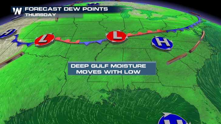 As is often the case during the summer, ample moisture from the Gulf of Mexico will help to "fuel" these thunderstorm chances. Incredibly heavy rainfall rates and several rounds of storms over the same territory is a concern. Flash flooding and river flooding is likely.
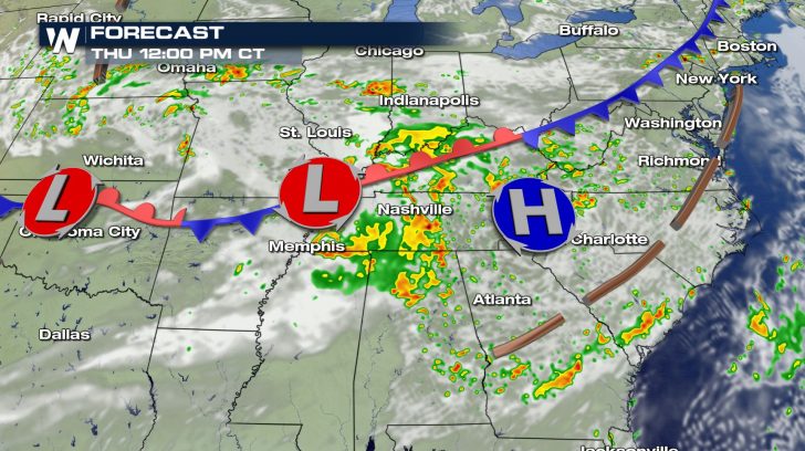
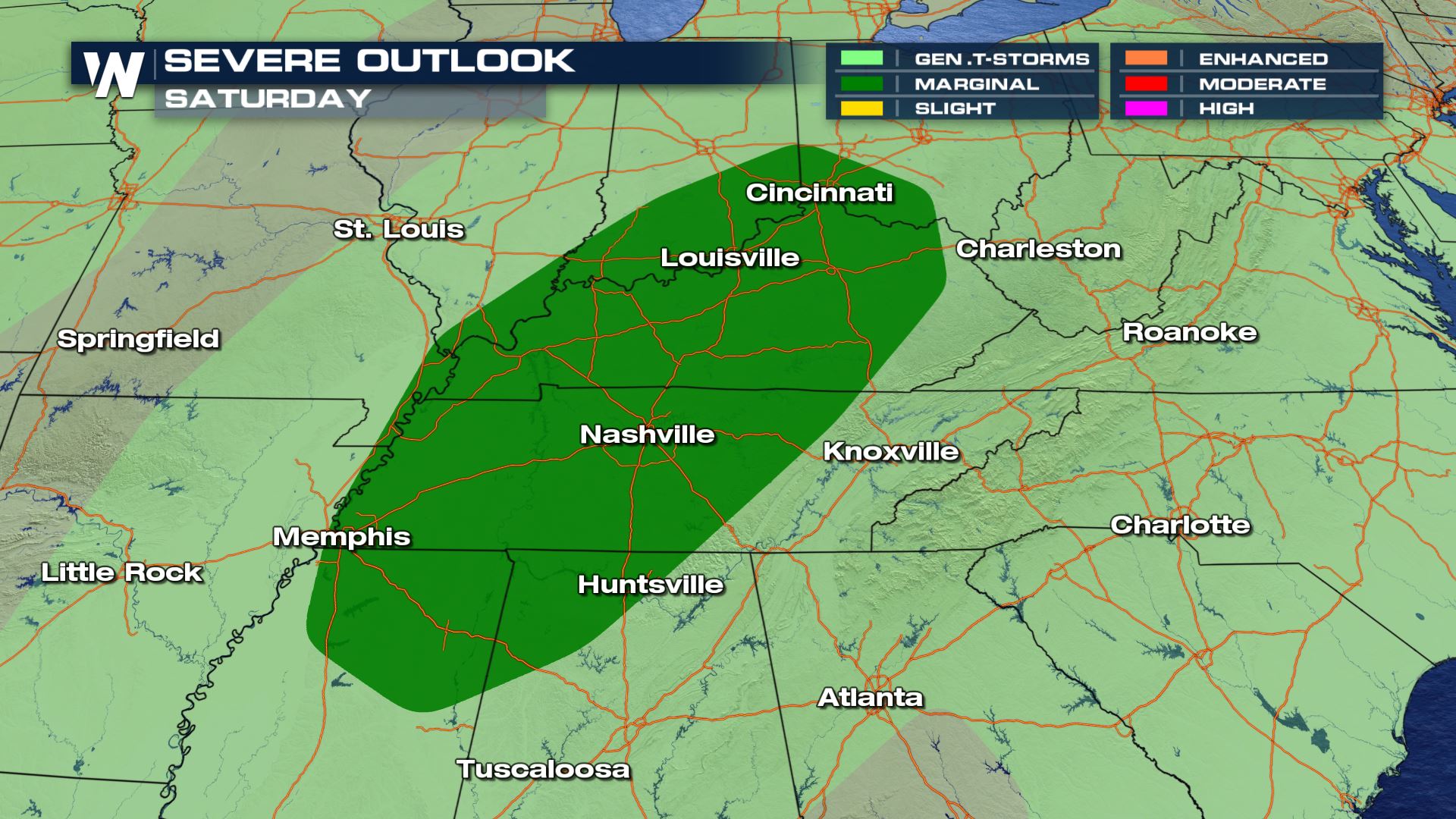
 On Thursday, the risk for severe thunderstorms will impact several states. From New Mexico eastward to North Carolina, thunderstorms may include gusty winds and small hail. Cities such as Lubbock, Oklahoma City, Memphis, and Nashville should stay "Weather Aware."
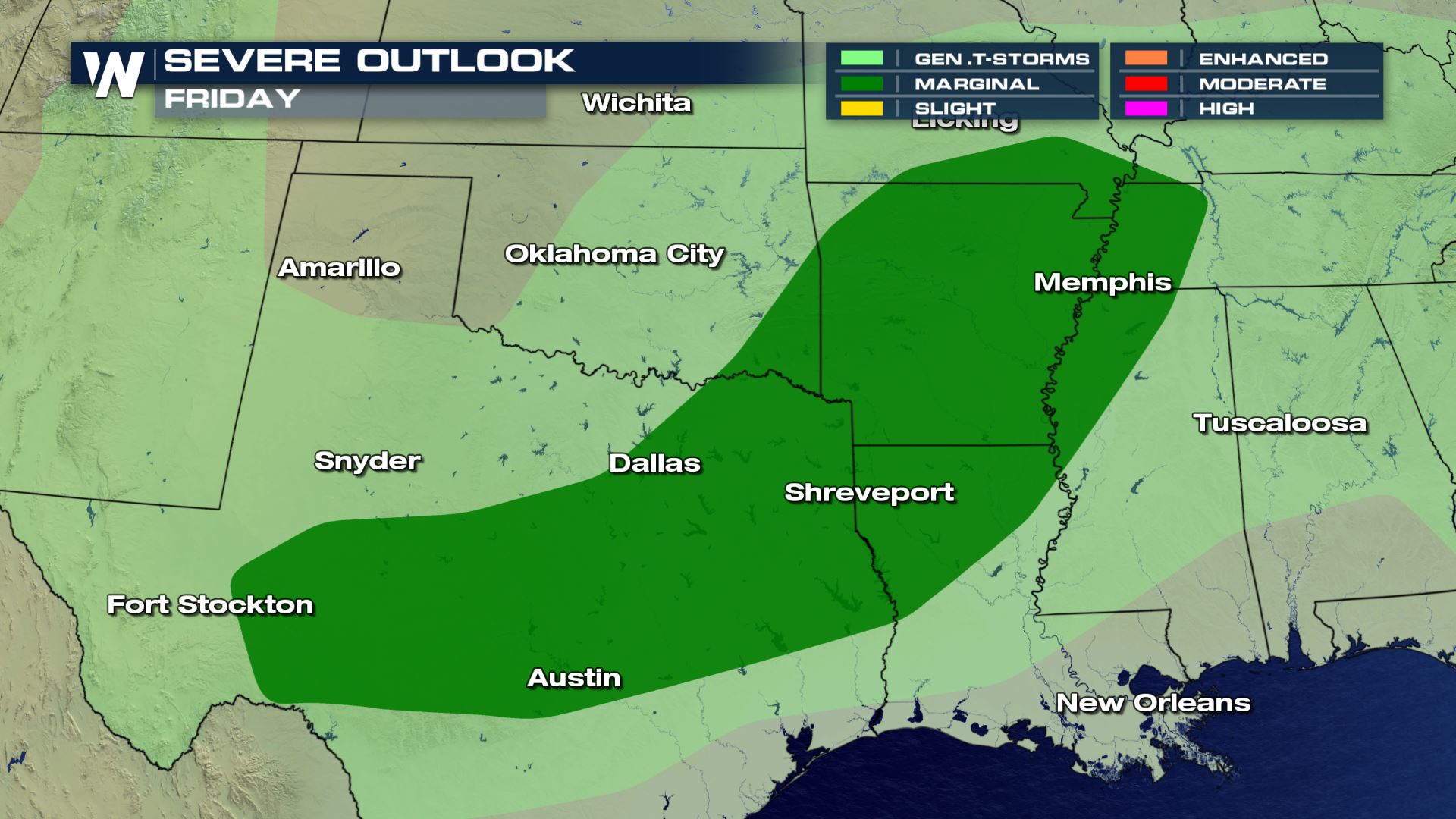
 On Friday, a few more strong storms will be possible, especially from Dallas to Memphis.
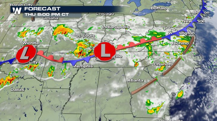
 With numerous clusters of thunderstorms expected from the Great Plains all the way to the Mid-Atlantic, the threat of flooding rain is wide-reaching through the end of the work week.
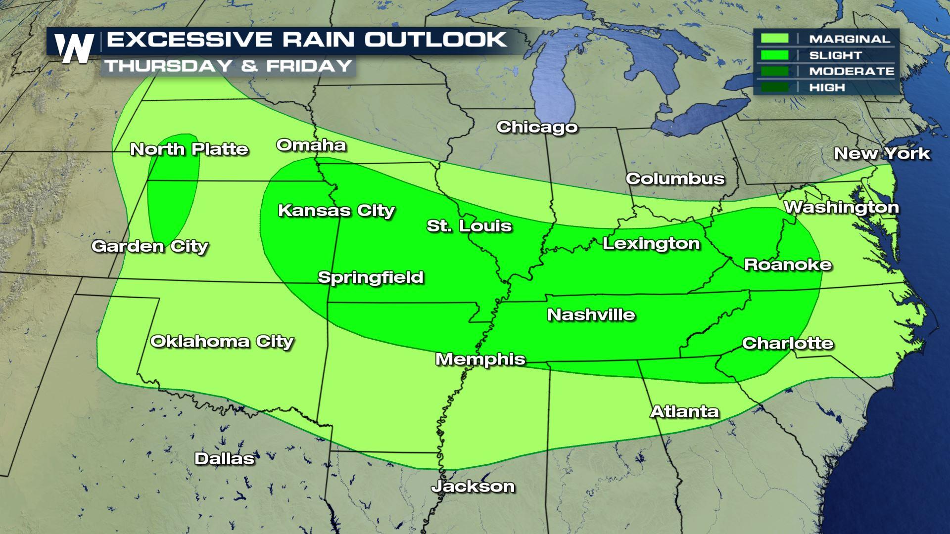
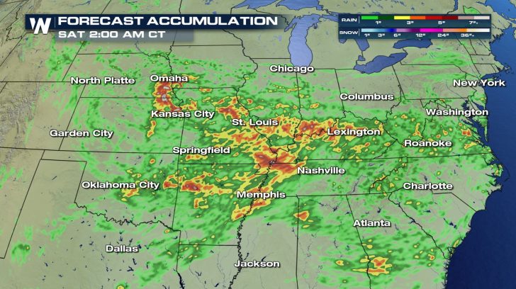
 Weather models indicate that some of the highest rainfall totals will occur in the Missouri, Mississippi, and Ohio River Valleys. Widespread totals of 3 to 5 inches will be possible.
 Flood Watches and Flash Flood Watches will likely be issued off-and-on throughout this period. As of Thursday, a Flash Flood Watch is in effect for parts of Kansas, Nebraska, Missouri, Illinois, Indiana, and Kentucky.
Join WeatherNation on air and online as we track these thunderstorms and all top weather headlines throughout the week.
Flood Watches and Flash Flood Watches will likely be issued off-and-on throughout this period. As of Thursday, a Flash Flood Watch is in effect for parts of Kansas, Nebraska, Missouri, Illinois, Indiana, and Kentucky.
Join WeatherNation on air and online as we track these thunderstorms and all top weather headlines throughout the week.
As is often the case during the summer, ample moisture from the Gulf of Mexico will help to "fuel" these thunderstorm chances. Incredibly heavy rainfall rates and several rounds of storms over the same territory is a concern. Flash flooding and river flooding is likely.
On Thursday, the risk for severe thunderstorms will impact several states. From New Mexico eastward to North Carolina, thunderstorms may include gusty winds and small hail. Cities such as Lubbock, Oklahoma City, Memphis, and Nashville should stay "Weather Aware."
On Friday, a few more strong storms will be possible, especially from Dallas to Memphis.
With numerous clusters of thunderstorms expected from the Great Plains all the way to the Mid-Atlantic, the threat of flooding rain is wide-reaching through the end of the work week.
Weather models indicate that some of the highest rainfall totals will occur in the Missouri, Mississippi, and Ohio River Valleys. Widespread totals of 3 to 5 inches will be possible.
Flood Watches and Flash Flood Watches will likely be issued off-and-on throughout this period. As of Thursday, a Flash Flood Watch is in effect for parts of Kansas, Nebraska, Missouri, Illinois, Indiana, and Kentucky.
Join WeatherNation on air and online as we track these thunderstorms and all top weather headlines throughout the week.All Weather News
More
Severe Storm Threat Returns to the Midwest
After several tornadoes ripped through the Mi
30 Jul 2026 4:37 PM


After Reaching Category 5, Genevieve Weakens in the Pacific
PacificFausto is now a post-tropical cyclone.
30 Jul 2026 12:00 PM

Flooding Risk Increases as Heavy Rain Targets the Tri-State Area
Tuesday, heavy rainfall moved across the Nort
30 Jul 2026 12:25 AM

Severe Weather: Energy From the Midwest Now in the Southeast
UPPER MIDWEST - Through Monday, dangerous tor
29 Jul 2026 10:30 PM

Southeast Flood Risk Lingers Near Stalled Front
A stalled boundary over the Southeast will ke
25 Jul 2026 10:55 AM