Coast to Coast Heat With Some Relief & Storms

The long-range temperature trend towards the end of August shows higher confidence that temperatures will remain above average. Even this week, temperatures are feeling the summertime heat. But, there's a sharp cold front moving through with a 20 degree temperature drop for parts of the Pacific Northwest.
Relief!
A sharp cold front delivered cooler air to the PNW on Wednesday. That will drop temperatures substantially from the low 90's in Seattle on Tuesday to the 70's. Another reinforcing shot of cooler air moves in this weekend, but that one has some rain chances with it. I think we'll take it give how the first part of the week was shaping up.
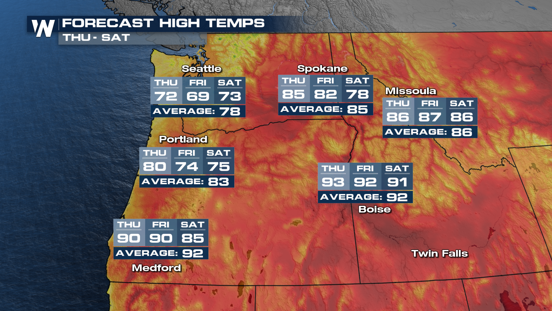 Although this front in the Northwest won't bring rain to the region, there will be rain in the forecast later in the week with another incoming system.
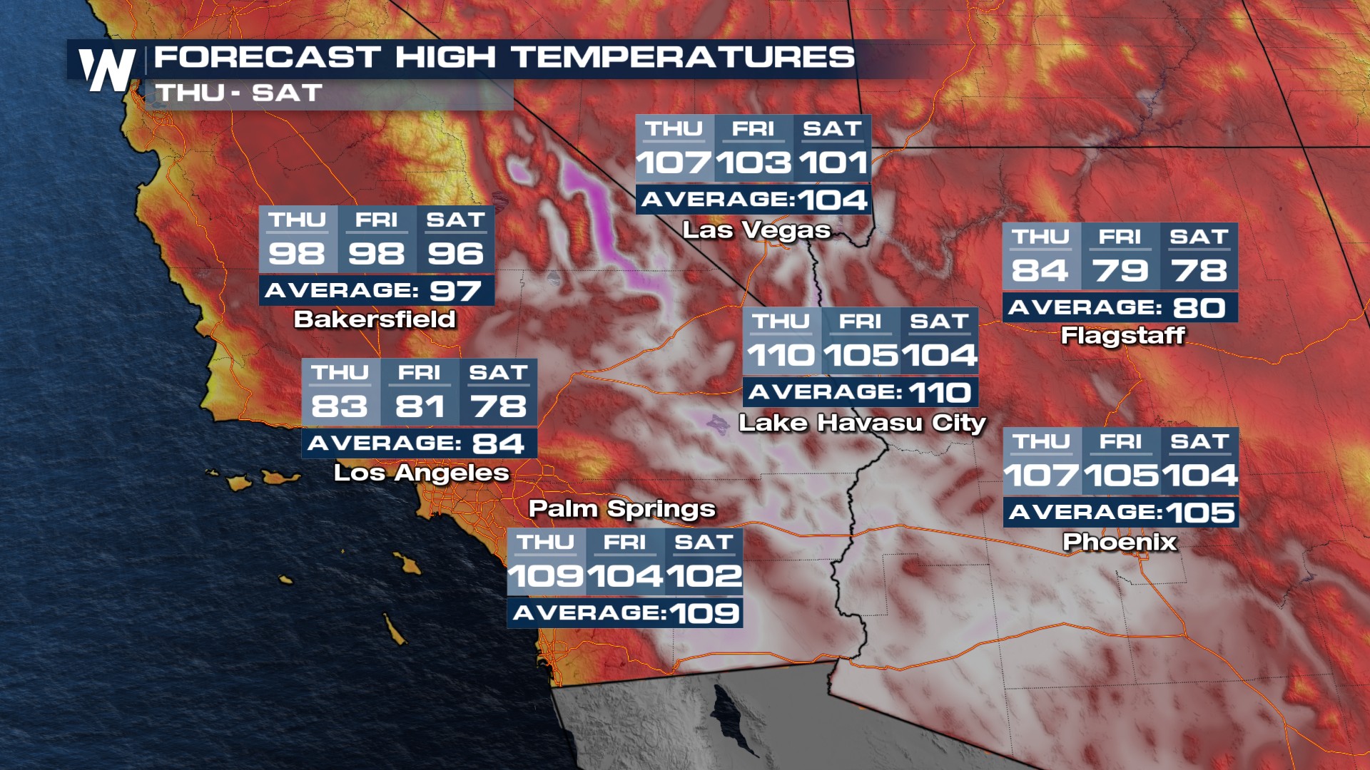
In the Southwest, we had a few record highs on Wednesday. A small cooldown is anticipated for the rest of the week. Although for the desert areas, a small cooldown drop highs to near normal which is still above 100 degrees.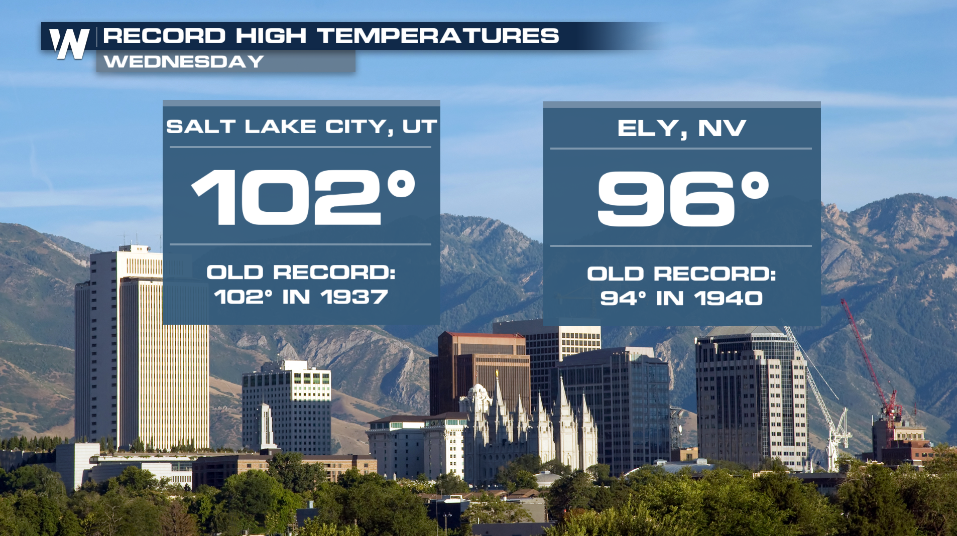
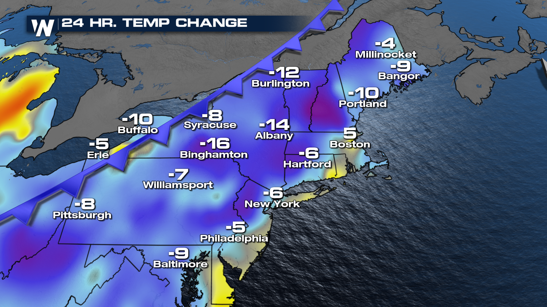
Northeast
The heat continues (ahead of a cold front) on Wednesday with additional record highs in Maine.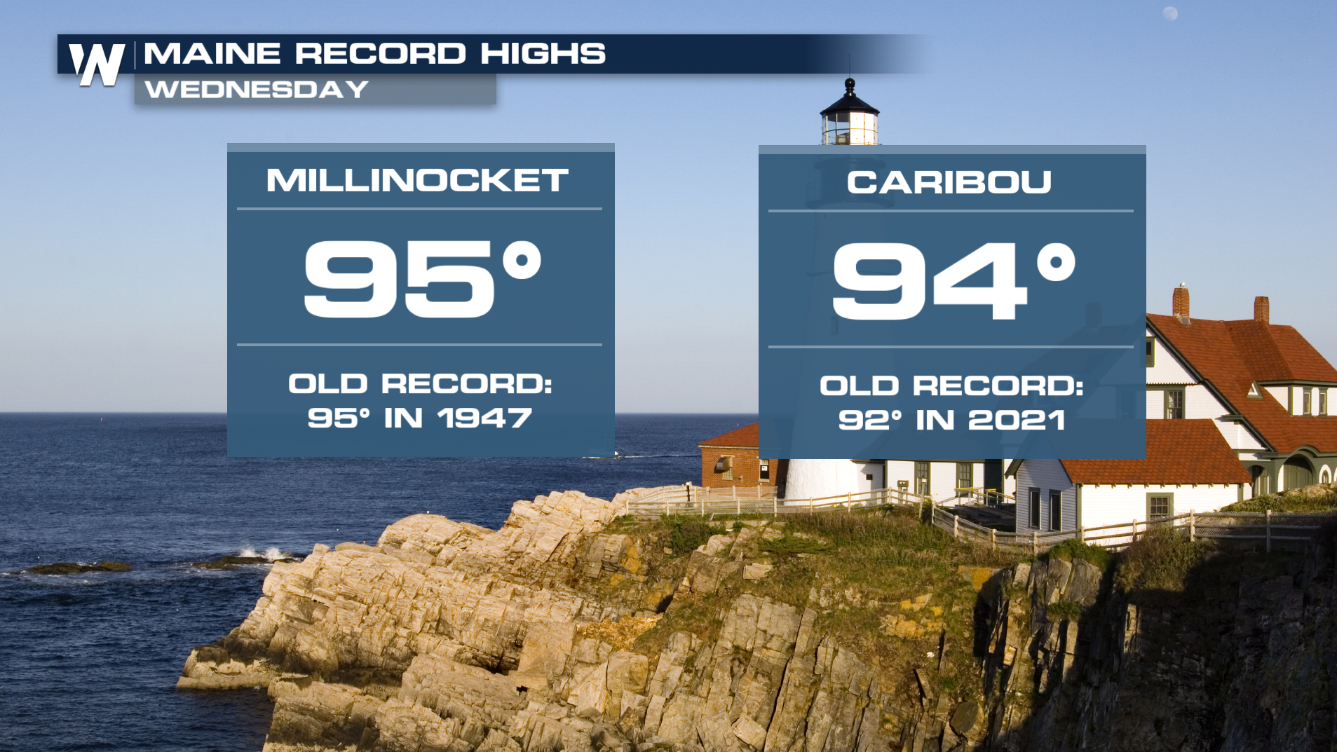
Temperatures have cooled significantly since Tuesday with some areas 15° cooler compared to the last 24 hours.
 Stay with WeatherNation for the latest.


