Front Brings Storms to the Midwest and Front Range

Top Stories
25 Aug 2025 2:30 AM
A strong cold front is pushing across the Front Range and Midwest. It is dropping temperatures and bringing strong storms and heavy rainfall. Through Monday morning, there will still be strong storms possible with a marginal to slight risk of severe weather.
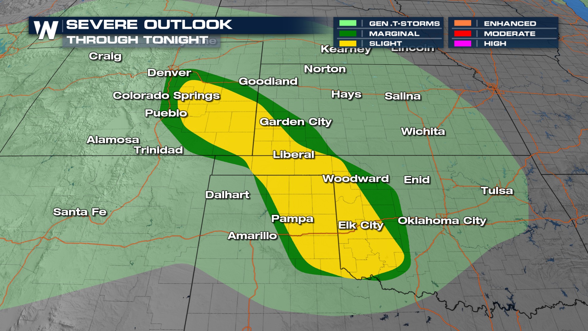 These storms will linger through parts of Oklahoma through the morning on Monday.
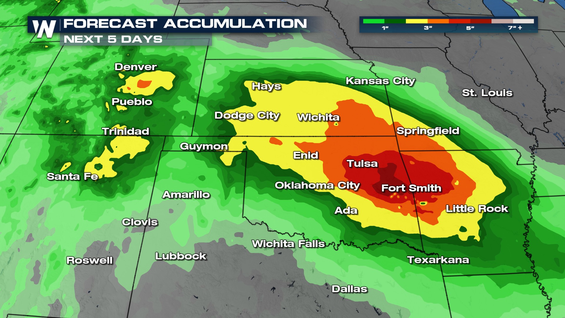
The next 5 days will remain active with heavy rain and flooding threats.
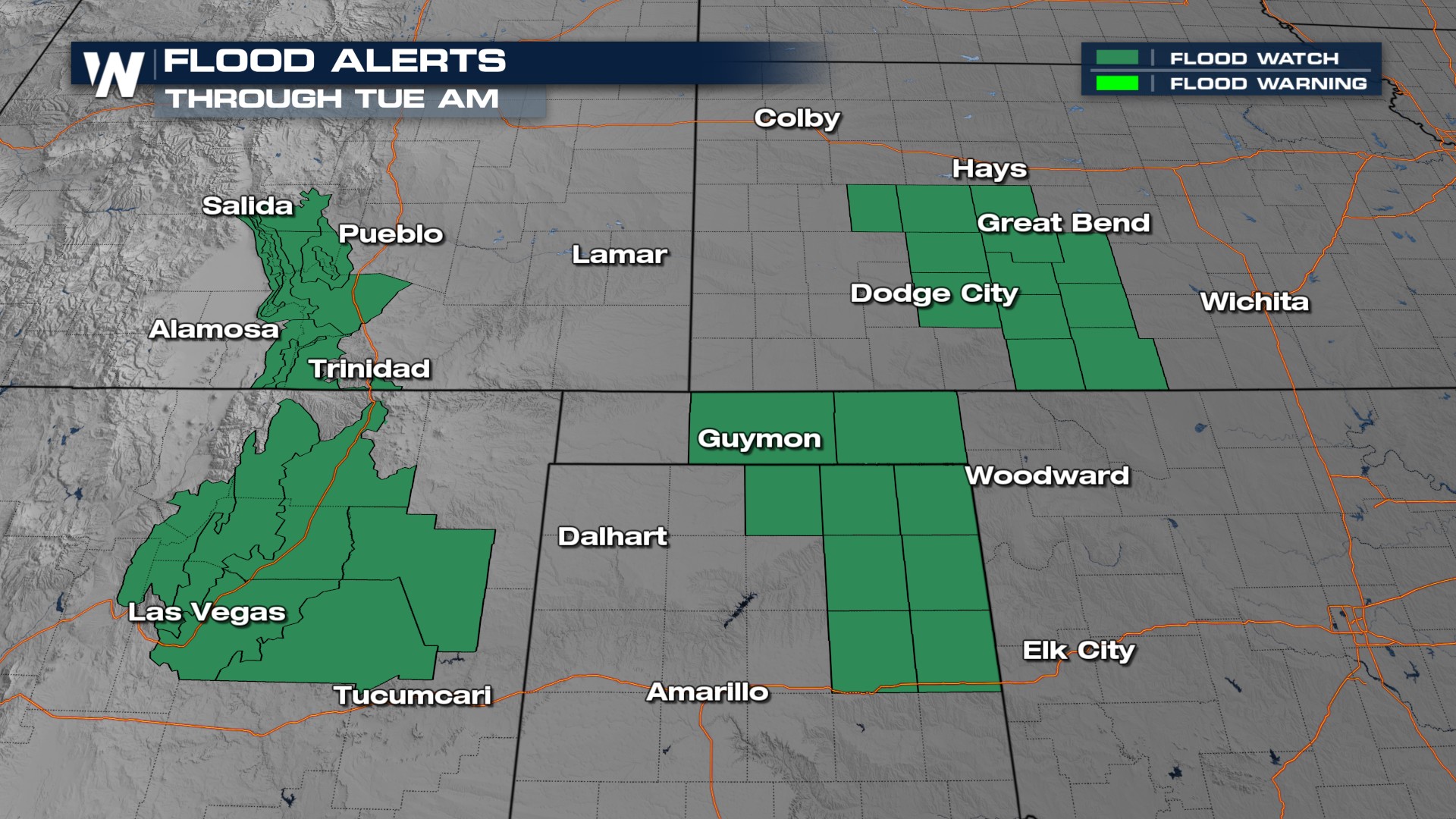
 There are flood watches in place in anticipation of heavy rain and flooding.
 Stay with WeatherNation for the latest updates on the forecast. You can always find your full Central Regional Forecast:30 past the hour.
All Weather News
More
Pacific Northwest Fires Bringing Down the Air Quality
Conditions have been real dry out west. We've
21 Jul 2026 11:05 AM

Flash Flooding and Severe Weather for the Carolinas This Week
Another stalled front in the Carolinas is for
21 Jul 2026 10:40 AM

Another Round of Storms Targets the Northeast
Another cold front is dropping east and will
21 Jul 2026 10:25 AM

Tropics: Tropical Storm Bertha Forms In the Atlantic, Eastern Pacific Active
In the Atlantic basin, we are keeping a very
21 Jul 2026 10:00 AM

Another Round of Severe Weather for the Upper Midwest and Great Lakes
The upper-level low train continues to keep t
21 Jul 2026 1:45 AM

Air Quality Improvements in the Forecast
Wildfires burning in Northwestern Ontario, Ca
20 Jul 2026 7:20 PM

Monsoon Moisture Brings Weekend Flood Threat
The monsoon has returned to the southwestern
19 Jul 2026 1:30 AM