Overnight Storms Slow for Texas and Oklahoma

Top Stories
16 Apr 2026 1:00 AM
SW PLAINS - Portions of Texas and Oklahoma are at risk of severe thunderstorms through Thursday morning. The threat for severe storms is expected to slow into the overnight hours but is still non-zero. Wind reports earlier on Wednesday gusted up to 84 mph in Elk City, Oklahoma.
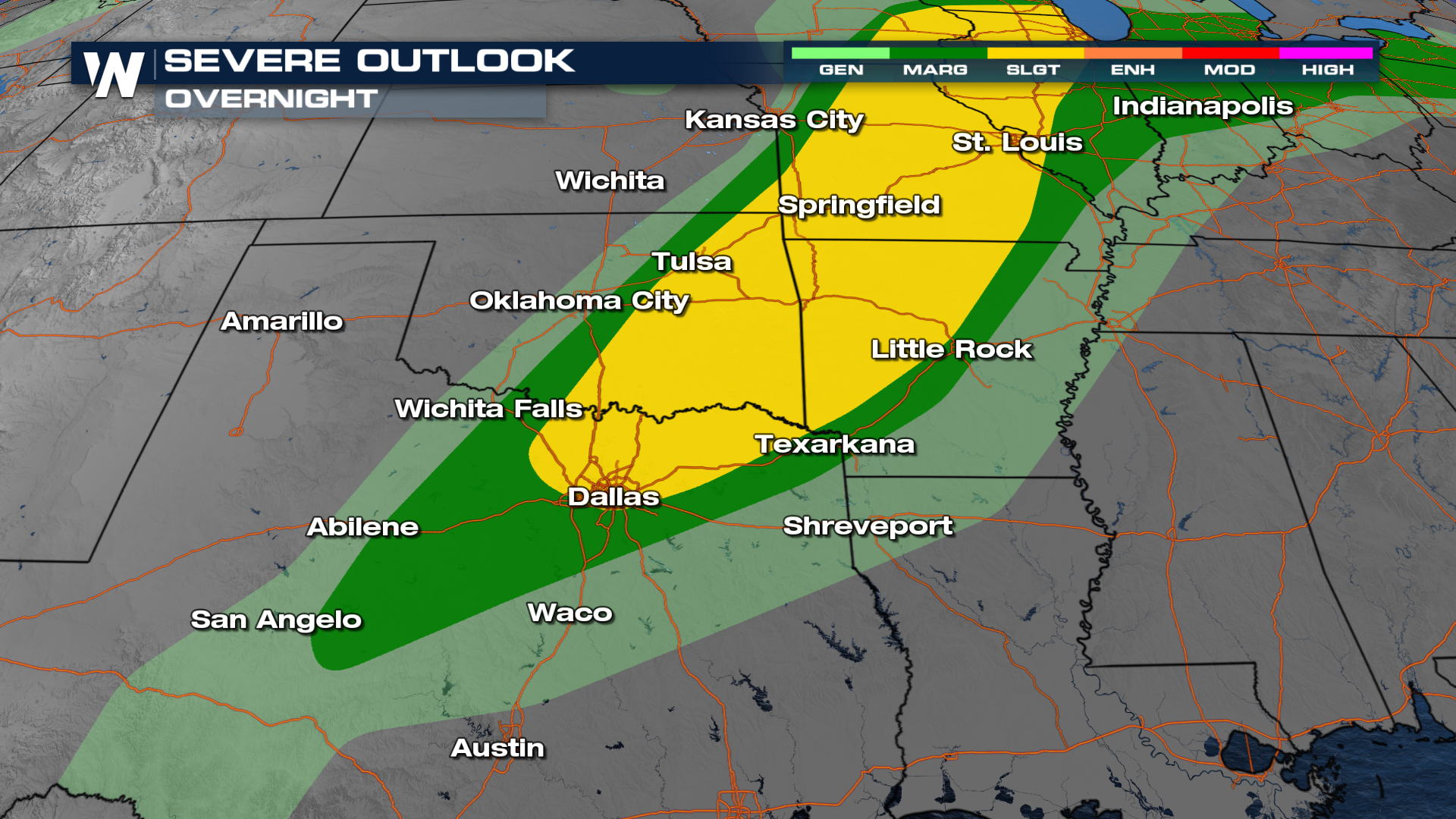
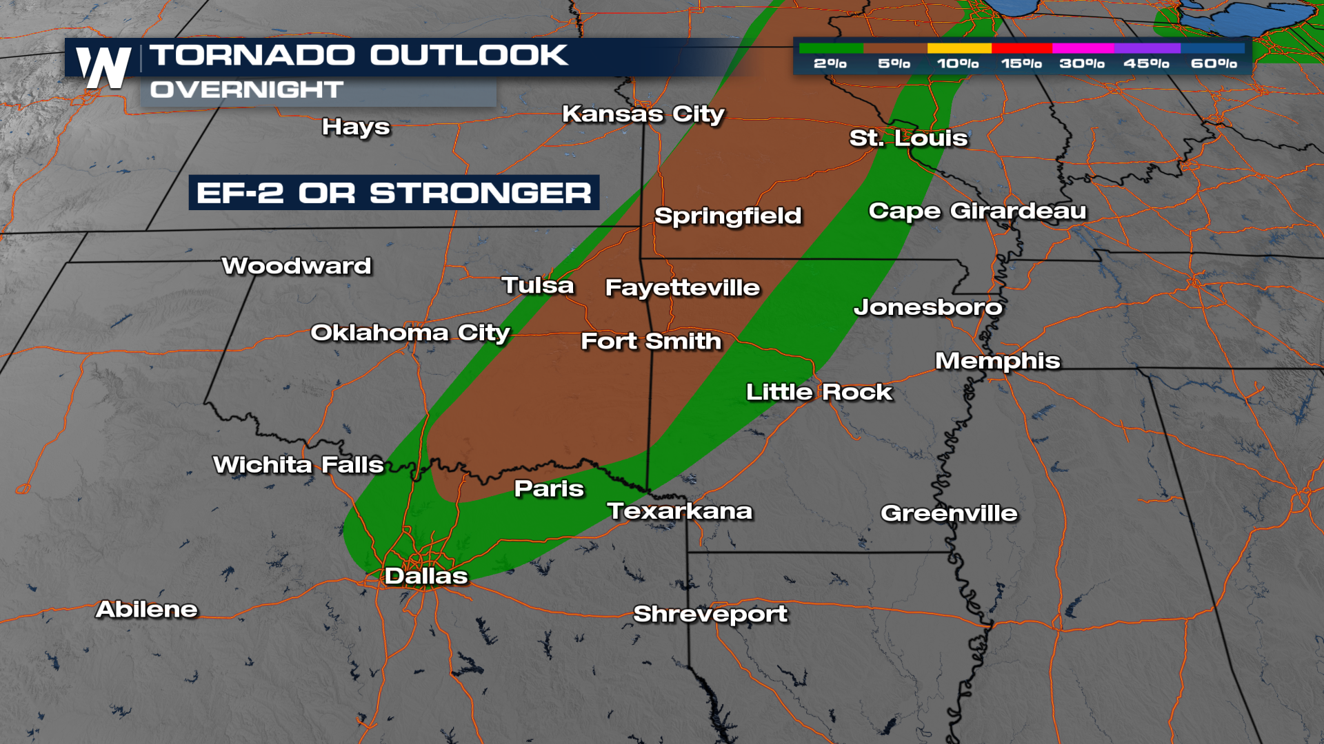
In addition to this significant hail risk, there is also a risk of tornadoes with these supercells.
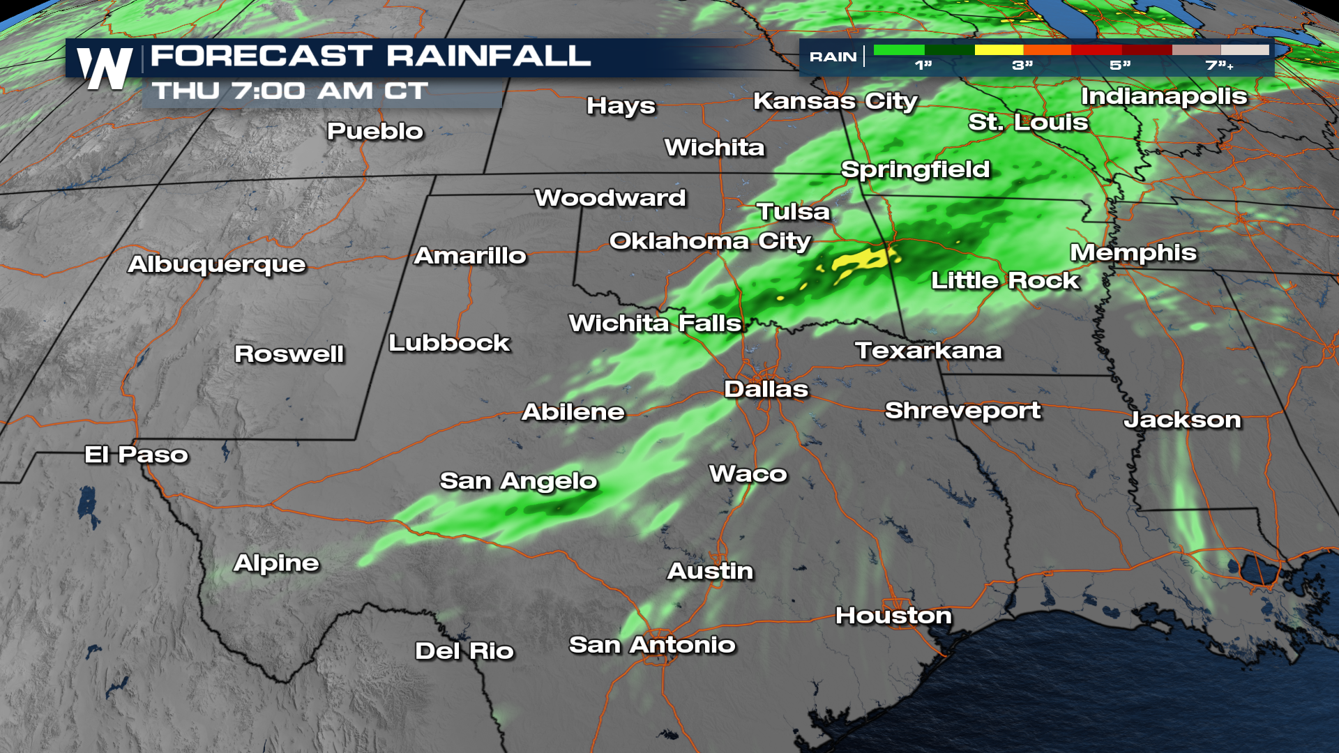
 The risk for flooding is fairly minimal in these areas, but models do have a few localized, heavier downpours through the next couple of days in these areas.
All Weather News
More

Severe Storms, Flash Flooding Overnight In Midwest
WHAT TO EXPECTIt was a very active day across
22 Jun 2026 1:50 AM


Summer Solstice Kicks Off Father's Day Sunday
Fathers across the country will have to share
21 Jun 2026 5:20 PM

Flood Risk Continues This Weekend for the Gulf Coast States
Numerous flash flood warnings were issued as
21 Jun 2026 1:15 PM

Dry T-Storms & Fire Danger in the West
A weak low-pressure system moving through the
20 Jun 2026 1:40 PM

Tornadoes Tear Through The Midwest, Isolated Severe Storms in the South
EARLIER THIS WEEKMONTROSE, IL - A dangerous t
20 Jun 2026 1:30 AM