Eastern Pacific: Where All of the Activity Has Been Recently

The hits just keep on coming in the Eastern Pacific basin. While Kiko gave us something to monitor and made a close call with the Hawaiian Islands, our next system has a better chance of impacting a landmass.
OUTLOOK
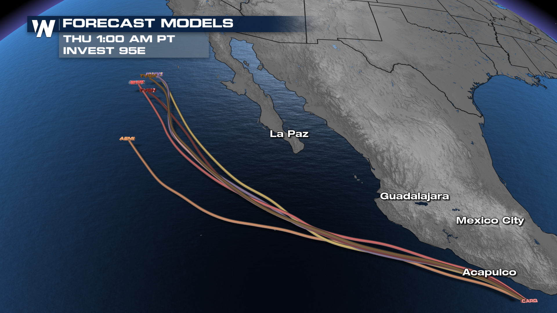
We're at the point of waiting on a name with this system. With almost a guarantee that we see something achieve that level of organization, Mario will be the next name on the list. What it does from there? Still a little up in the air.
WHAT WE KNOW
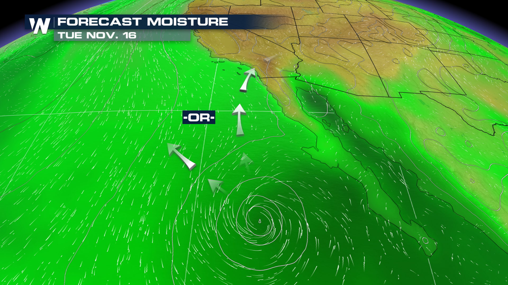
This system will hug the southern and southwestern coast of Mexico, but isn't expected to make a turn inland. How strong it gets is a little bit of a different story. Most suite of data suggests it tops out as a tropical storm, but until a closed low forms, models often struggle with intensity at this phase of its life. Given the angle of approach, the remnant moisture might be something to watch more than the intensity...
WHAT WE DON'T KNOW
Will any of the moisture get ciphoned off, like Lorena's did? The general idea of a track helps, but long-range modeling isn't. Typically, you need a trough to swing in just north of the system to either pull it ashore, or pull the moisture off of the top. That doesn't appear to happen, as the system looks like it could just drift northward before eventually dissipating.