Blocking Pattern Warms Up the Midsection

Surprisingly, this isn't about football. Or at least not how you would think.
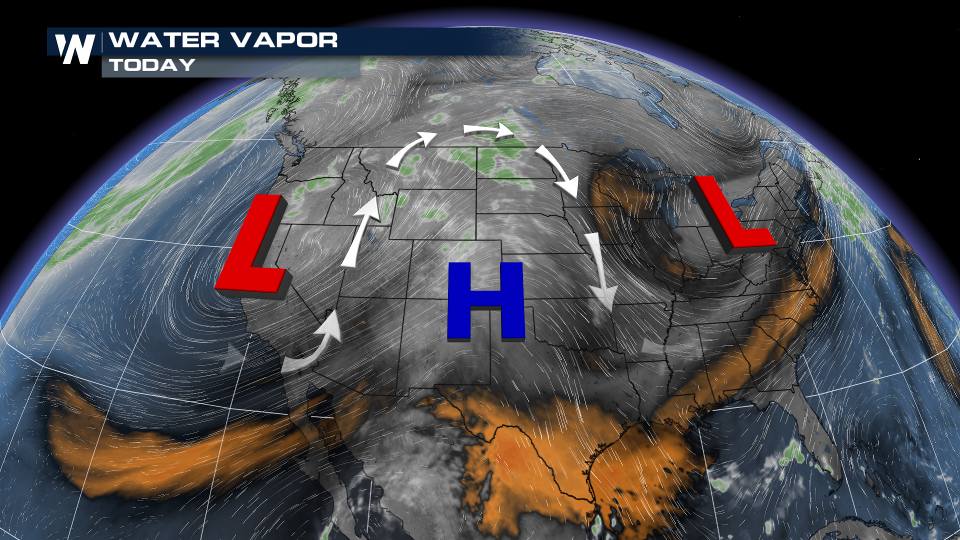
OMEGA BLOCK
In meteorology, the dog wags the tail, not the other way around. Meaning the upper levels have more influence on the day-to-day weather. When we look at the upper atmosphere, an important shape forms: the Greek letter omega! An Omega Block is a type of stagnant flow that isn't in a hurry to change.
READ MORE: What is an Omega Block?
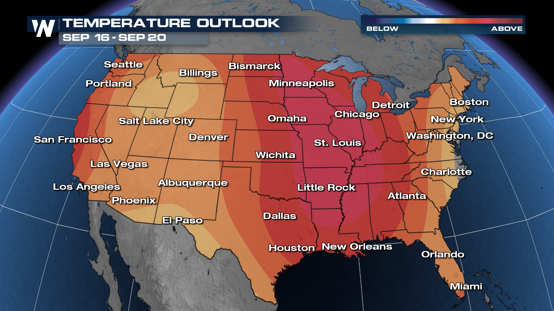
WHAT DOES THIS MEAN
The two dips in the overall flow will harbor low pressure: one on each side of the lower 48. That will keep the stormy skies nearby and for the East Coast, the cooler weather as well! But what about anyone under the high? Here comes some late Summer heat! St. Louis started off the month on a cooler note, but lately the thermometer has been rising.
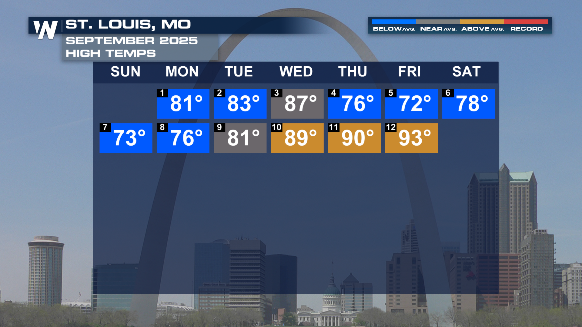
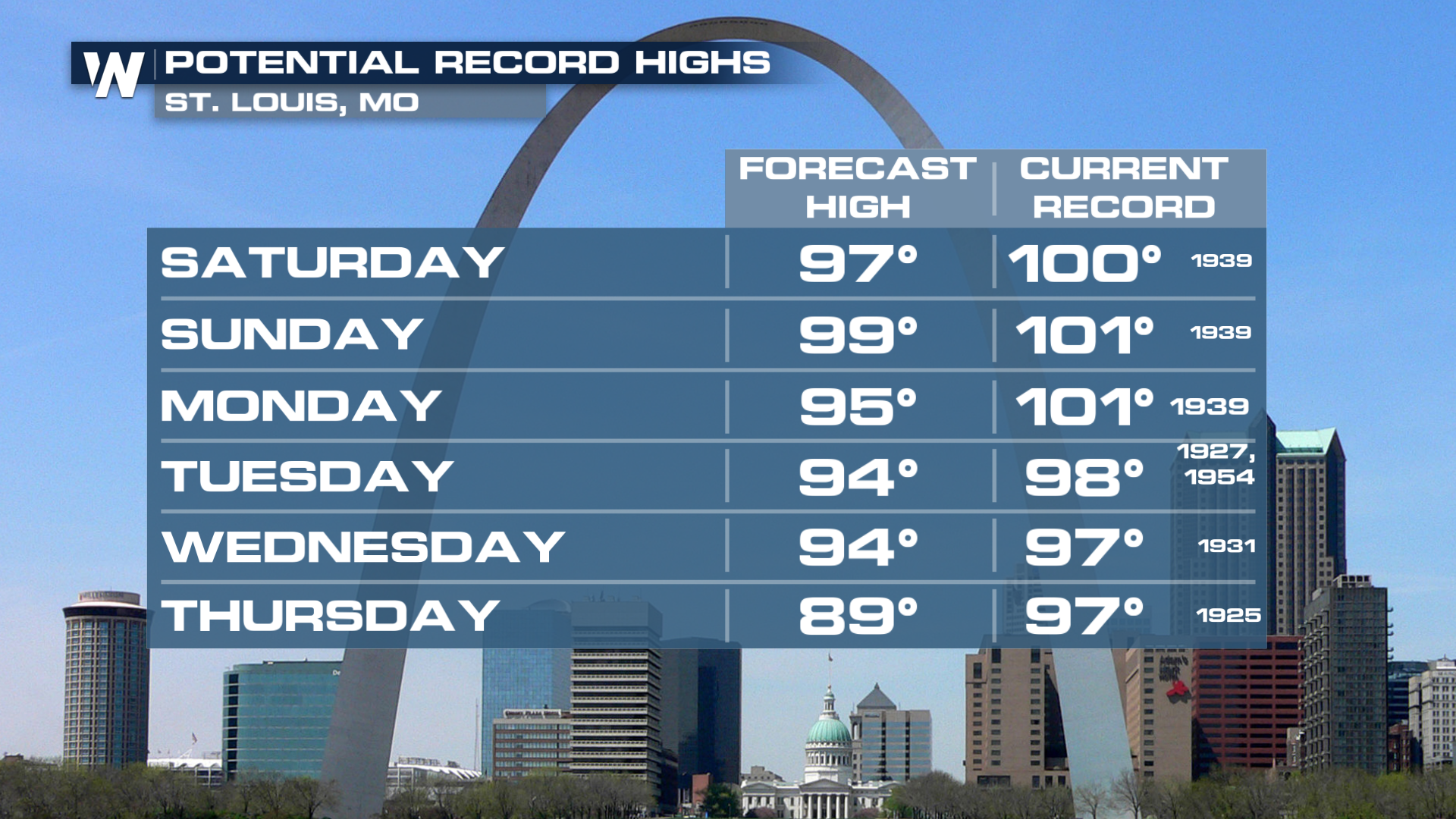
Temperatures are expected to continue to climb Sunday, eventually entering record territory in places like St. Louis.
I'M HERE FOR FOOTBALL
Well, here's your tie-in: football practices could become a little more dangerous over the coming week. This might become a recurring theme throughout September, despite the comfortable start we had. The Climate Prediction Center is leaning toward above-average temperatures well into September.