Florida Rainfall: Nuisance or Beneficial?

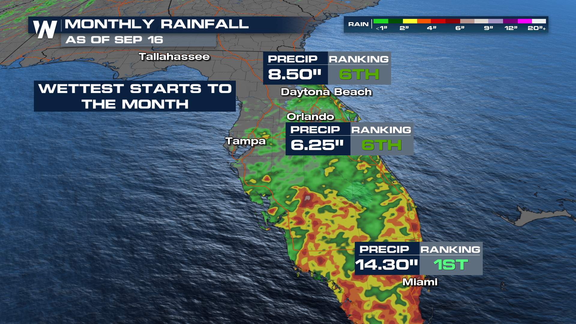
The dry time has been a little hard to enjoy the last week or two in South Florida. While this is the rainy season, and we're making up for a slow start to it, you can still roll your eyes at what the extended forecasts have looked like recently. In fact, some spots in South Florida have already had their wettest start to September, including Miami.
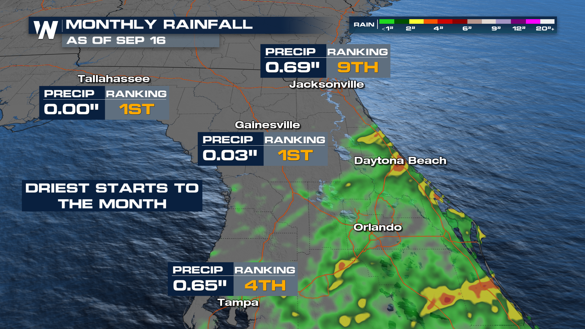
 On the other end of the spectrum, some northern Florida spots have really missed out, making it the driest start to September in areas such as Gainesville and Tallahassee.
So why? Just because Florida likes to have the most fun? Well, actually, a frontal boundary keeps these storms coming for days. While we've had a couple of days of relief, more moisture is in the forecast for South Florida.
That, along with a TON of moisture to work with, is attempting to catch up some drought-stricken areas of the Sunshine State. The Drought Monitor updated on Thursday and had some pretty sizeable improvements in South Florida.
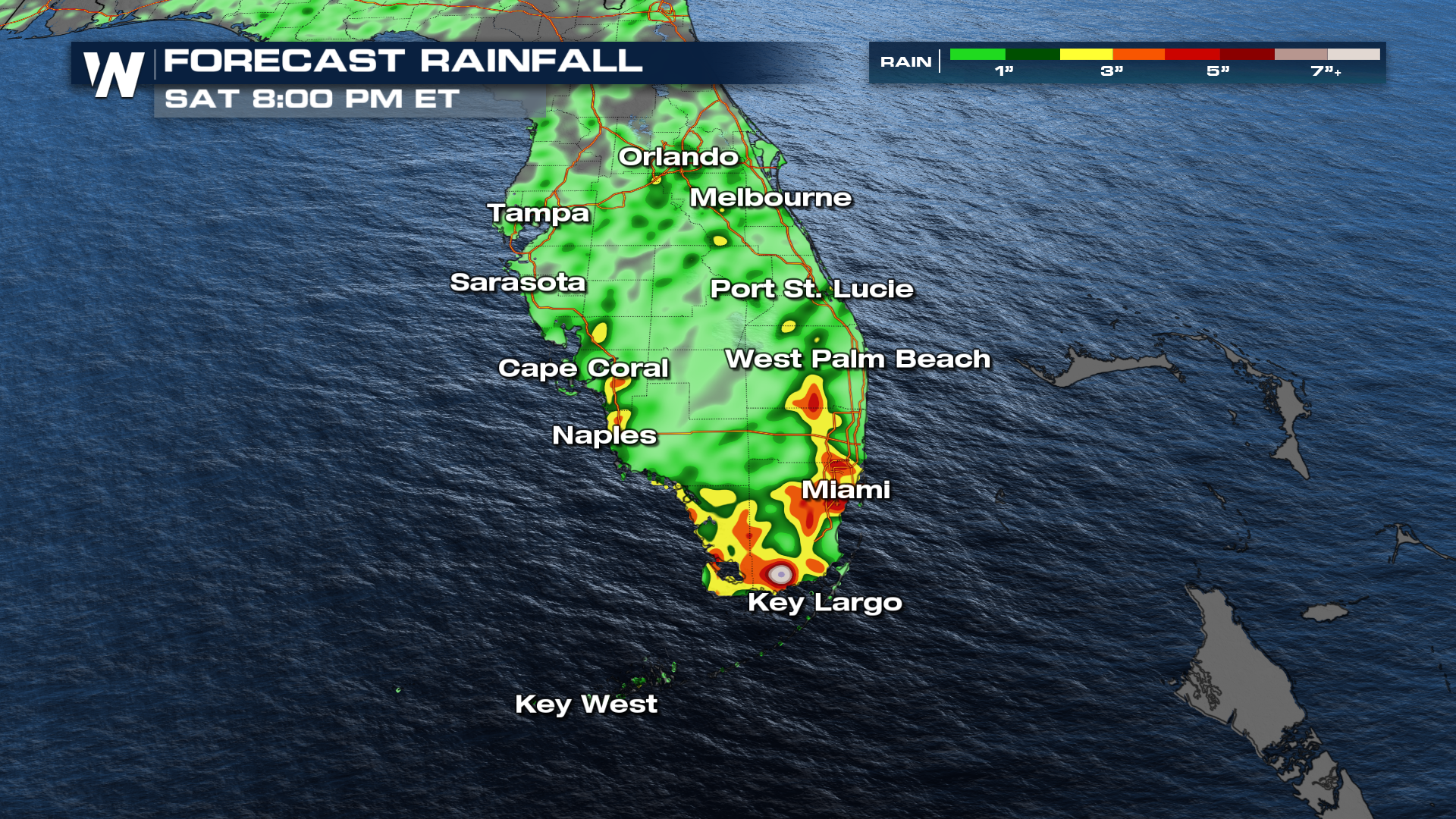
So while it might be easy to complain about beach plans constantly getting ruined, it has its benefits. Our biggest concern is the lightning threat associated with any Florida thunderstorm, but especially this time of year, with people outdoors. Anytime it rains this heavily, of course, the flash flooding threat will be there as well. Some areas could receive another 3-5 inches, or even more, before the rain chances start to back off next week.