Some Relief Ahead from the Heat in the Central U.S.

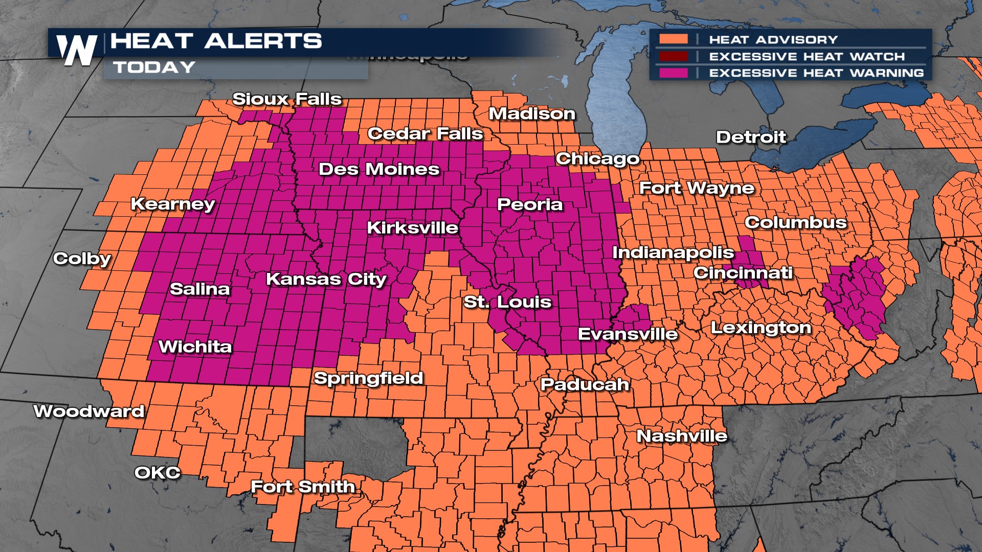
This week has been brutally hot in the central U.S. with highs in the 90s and 100s, and dew points in the 70s. For parts of Iowa, the "corn sweat" contributed to dew points close to 80° in some locations - that is down right disgusting! Today is our last day of serious heat for many of the Great Plains states as a cold front moves in and the area of high pressure responsible for the heat starts to back off this weekend. Still, heat alerts continue from the Great Plains to the Ohio Valley for temperatures in the 90s and heat index values much beyond that.
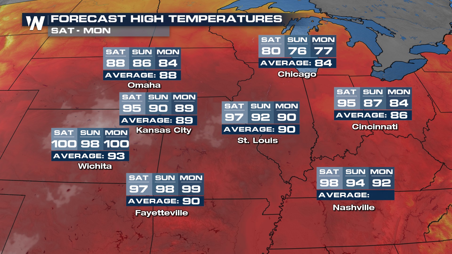
 A cool down is coming though ... a cold front slides through the Midwest today and will drop temperatures for many north of I-80 this weekend! Check out that "cooler" more "average" air for Minneapolis and Omaha! The cool down arrives for Indy, St. Louis and KC by Sunday! While the heat backs off through the weekend, it doesn't for the southern U.S. and in facts builds back for the next week.
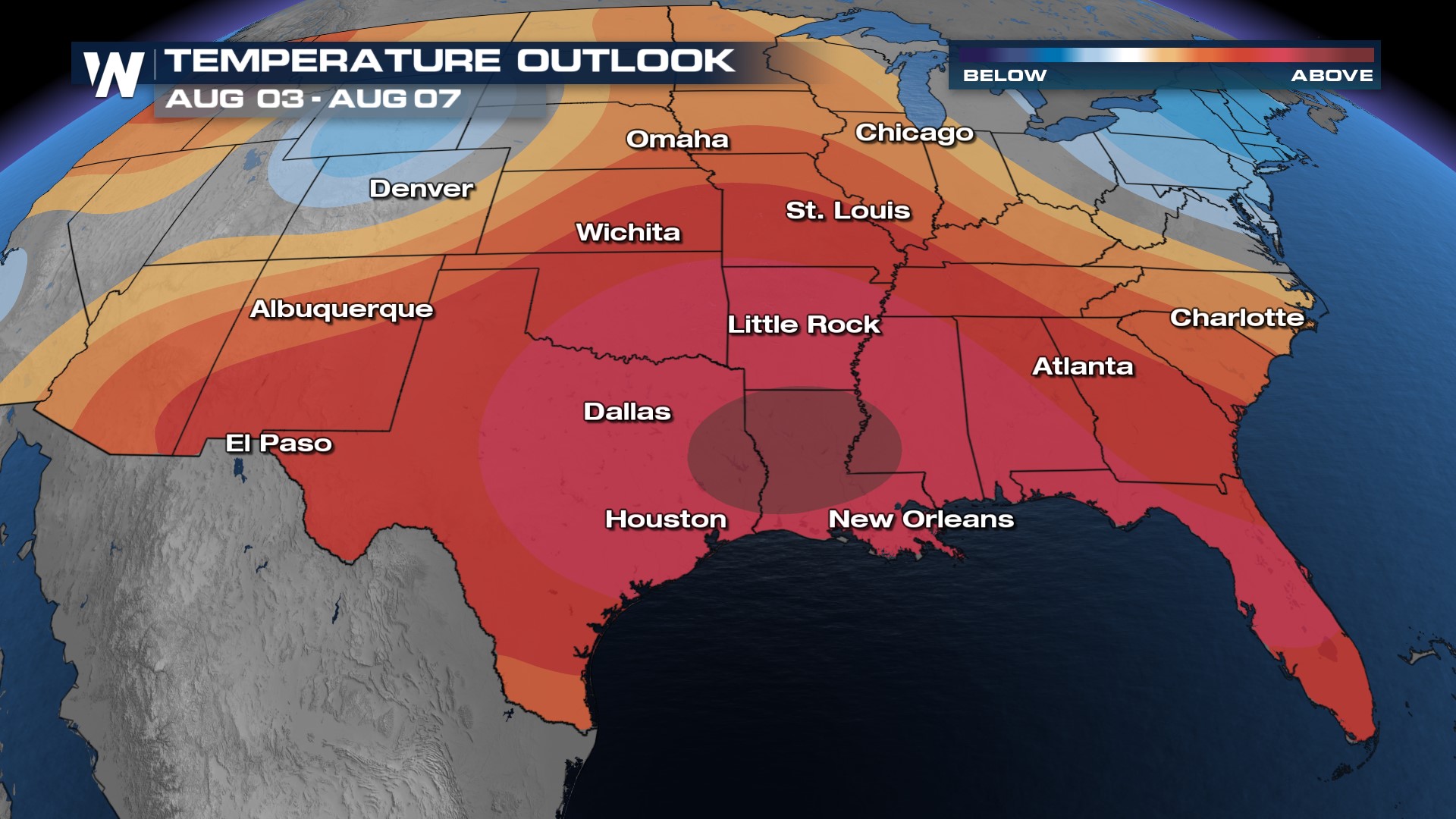
 The extended forecast calls for much of the same with heat remaining in the central and southern U.S.. We understand this is late July, so heat is normal, but temperatures will run much above average region-wide. The trend continues through the first week of August. With the extended heat outlook, please make sure you're taking care of yourself and others. Heat is the number one weather-related killer. It is essential you seek shade, A/C, and limit time in the conditions.
Stay with WeatherNation for the latest on the heat & humidity impacting the central U.S. We have your central regional forecast always :30 past the hour!


