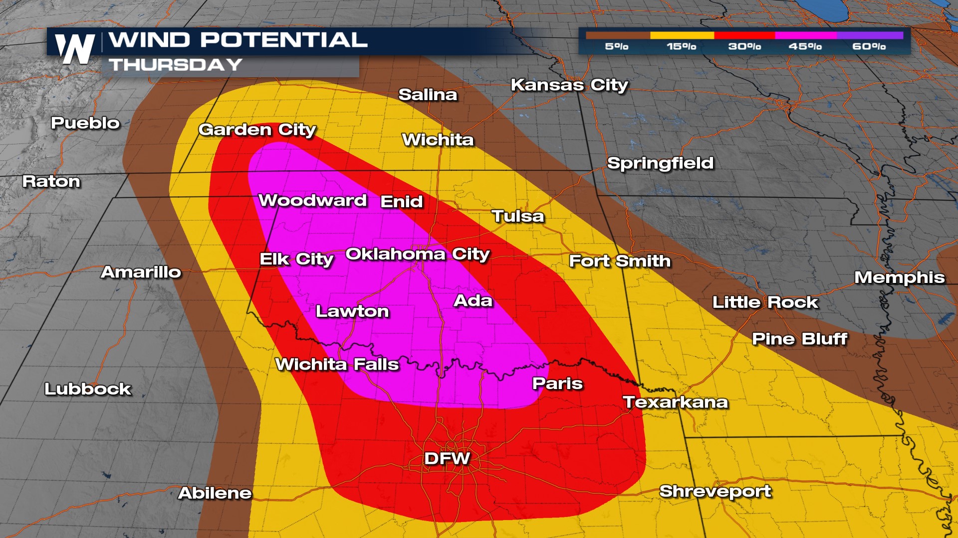
Over 630k Without Power in the South After Wind & Tornadoes Blast Through

Over 630k people are without power in the South today from Texas to Florida following widespread severe weather on Thursday night and Friday morning. A powerful wind storm blasted through the southern States, while tornadoes and large hail impacted Texas and Oklahoma on Thursday evening. This could potentially be a "derecho" which is a long duration wind event that is defined by "a swath of wind damage extends at least 400 miles (about 650 kilometers), is at least 60 miles (about 100 km) wide, includes wind gusts of at least 58 mph (93 km/h) along most of its length, and also includes several, well-separated 75 mph (121 km/h) or greater gusts" by NOAA. This is a radar loop of the storm from Thursday night through Friday morning as it swept across the southern U.S..
Before the storms organized into a wind event, they were individual supercells that produced tornadoes through western Oklahoma and Texas. A destructive tornado moved through Perryton, TX, Thursday afternoon, and our field correspondents were on the ground. They reported widespread, catastrophic damage throughout the town. Unfortunately, there have been at least 3 confirmed deaths from this tornado, according to local fire officials.
Every dot below represents a severe storm report in the last 24 hours. The blue dots are representative of the wind damage seen overnight Thursday into Friday in the South while the yellow and red are from the hail and tornadoes that were produced by individual supercells.
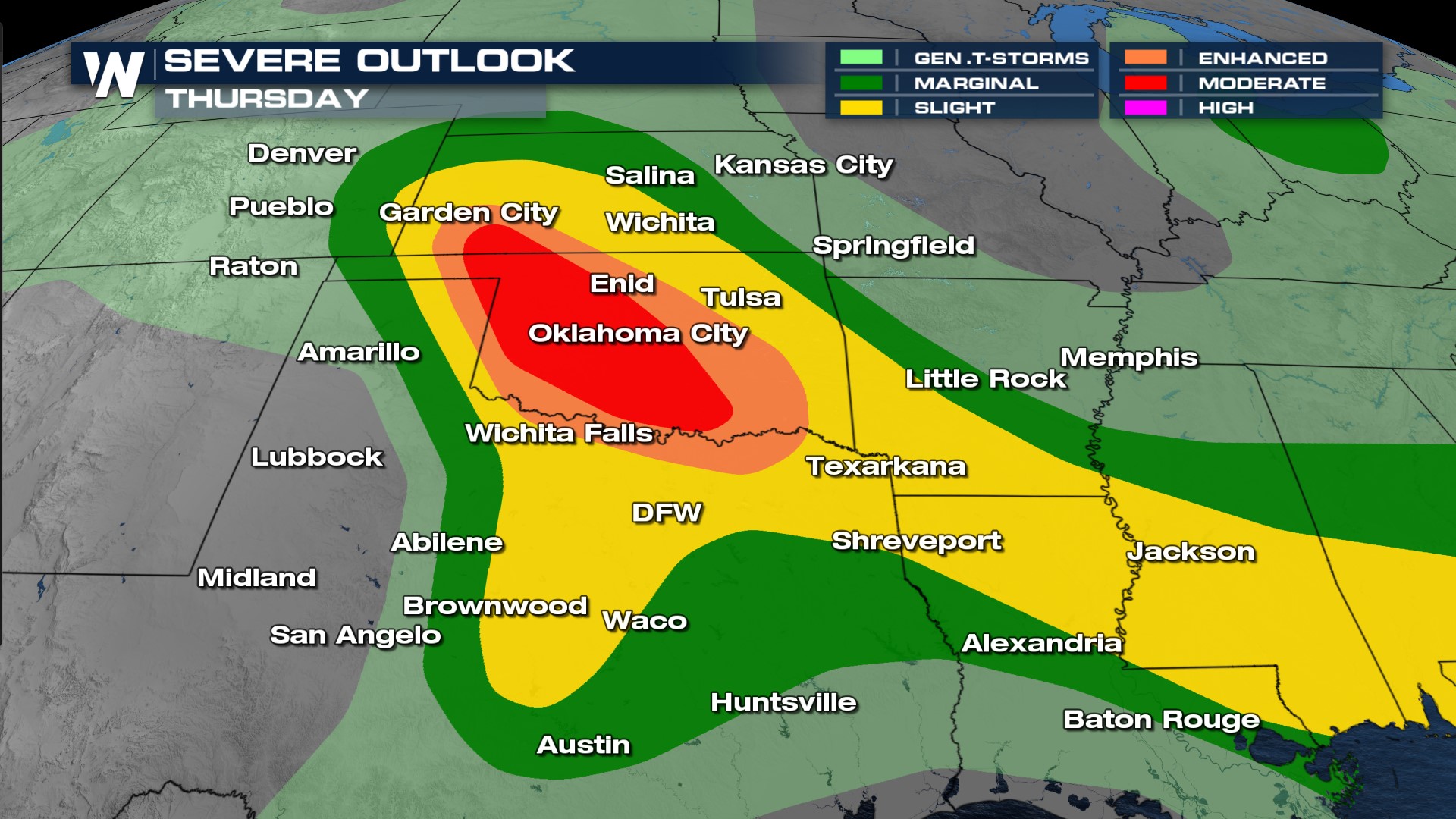
 A MODERATE (level 4 out of 5) risk severe weather was in effect for the day on Thursday through central Oklahoma and the Red River Valley. There was the risk of 2" hail threat through much of the I-35 and tornadoes too. However, hail reports were even larger than 2".
 We will have the latest on the recovery from severe weather forecast all week on WeatherNation - join us at :30 past the hour for your Central Regional Forecast.


